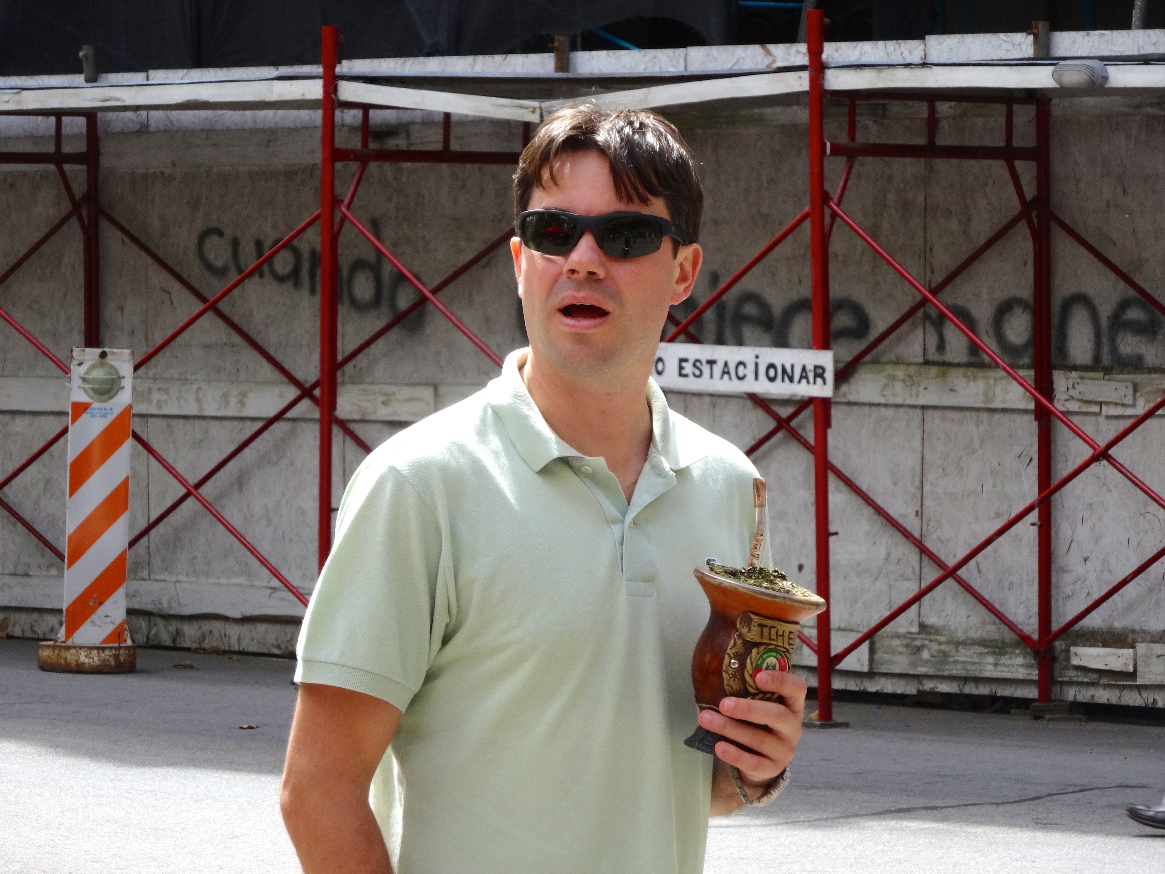
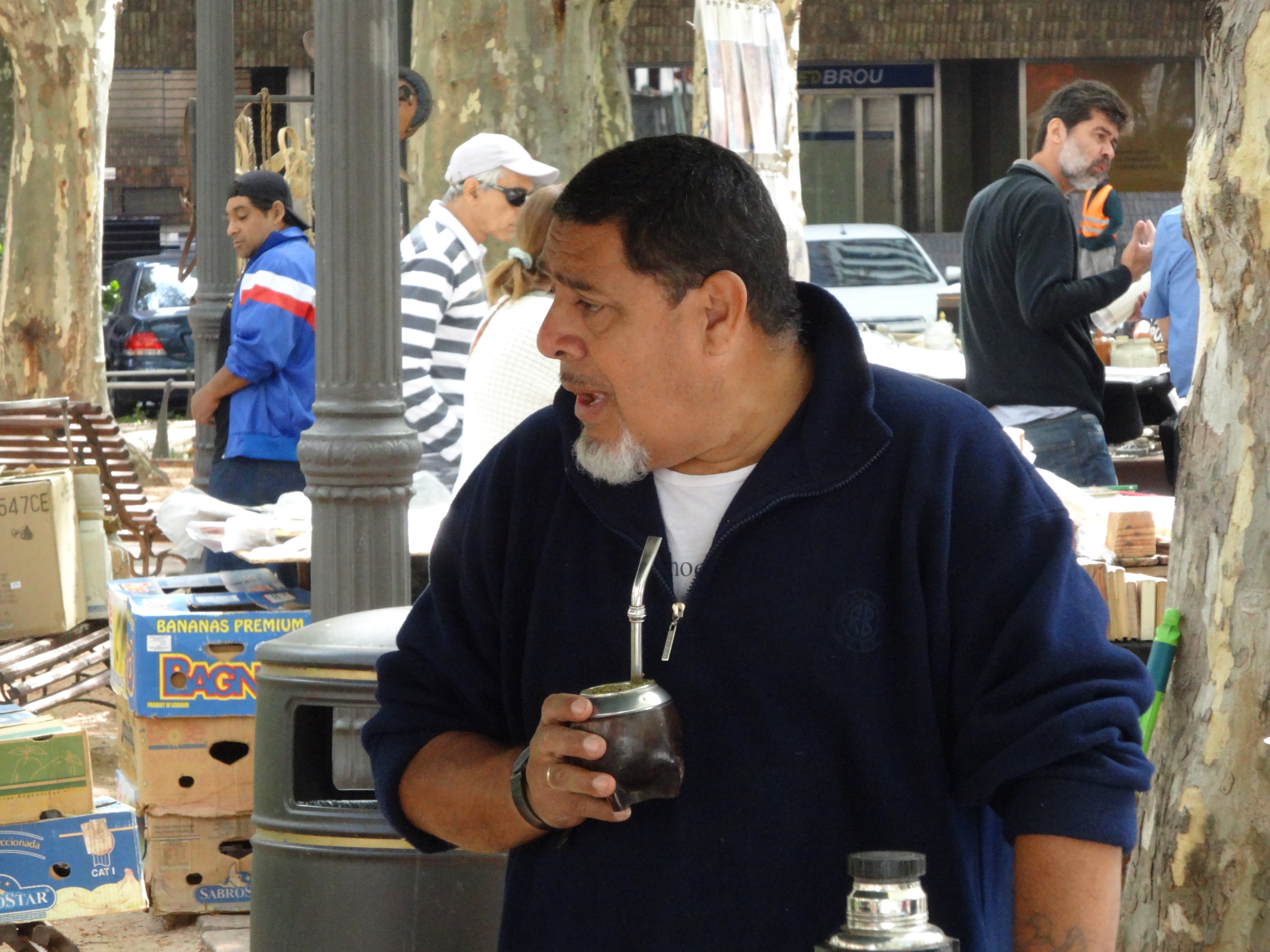
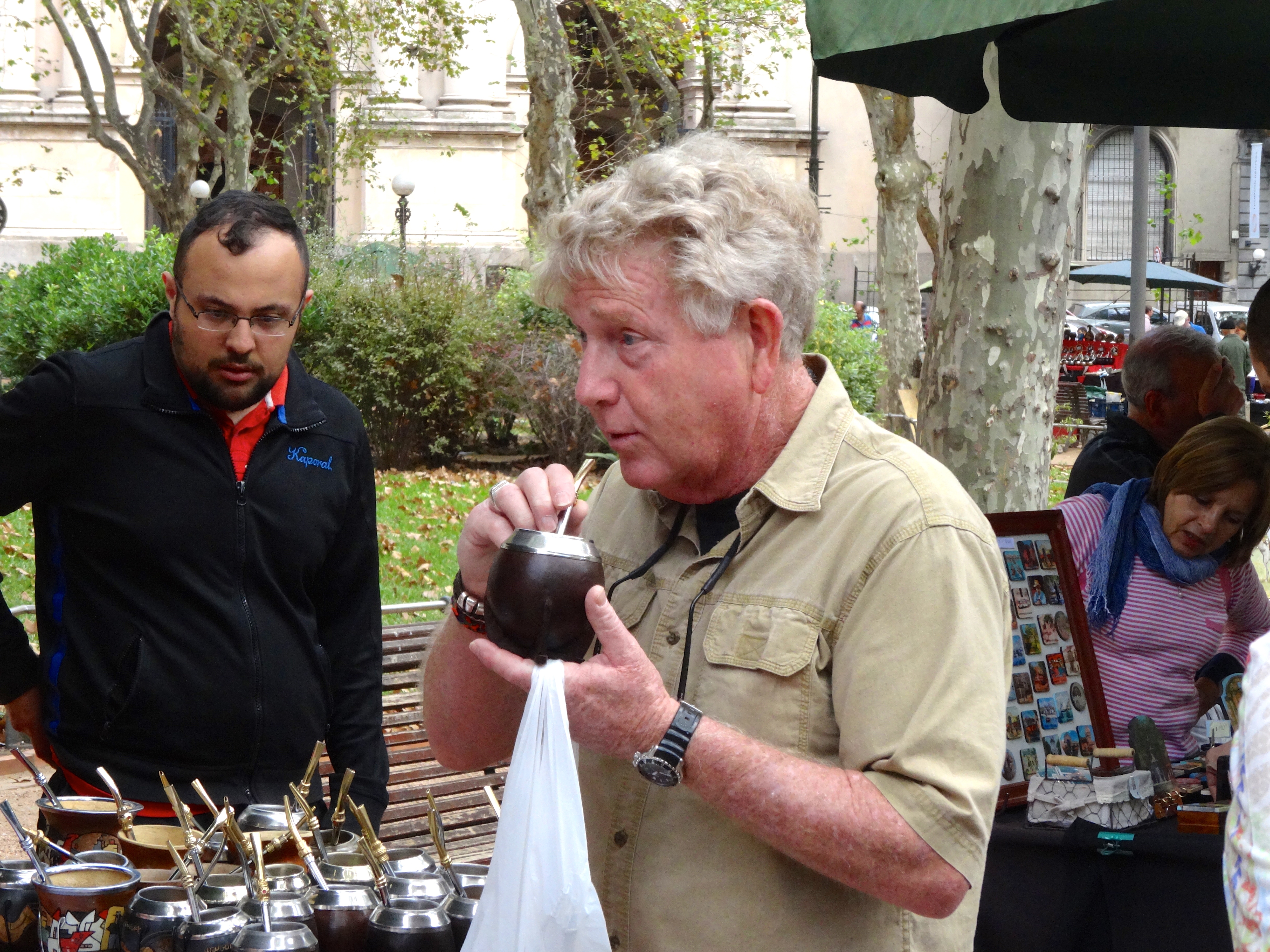
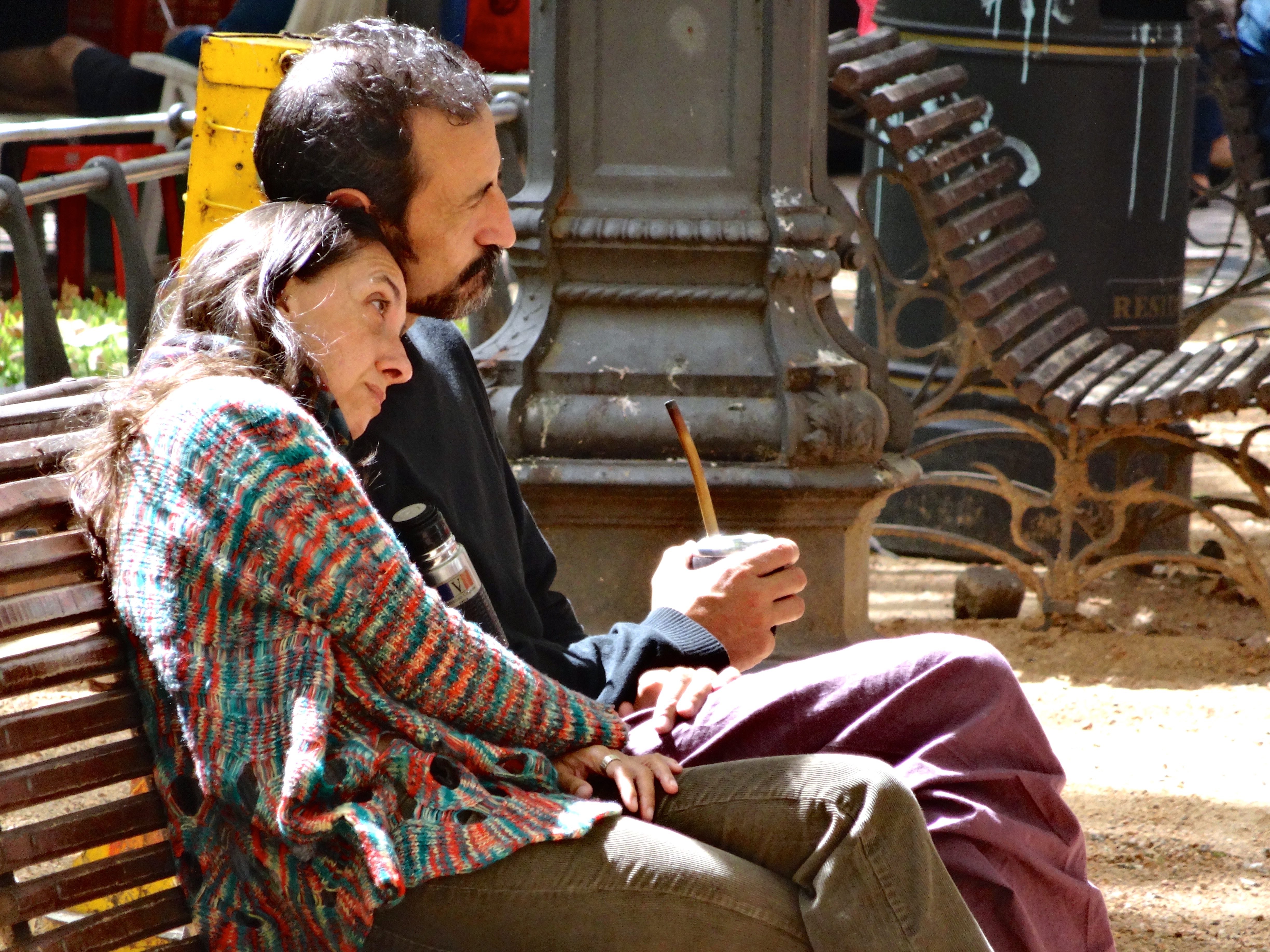
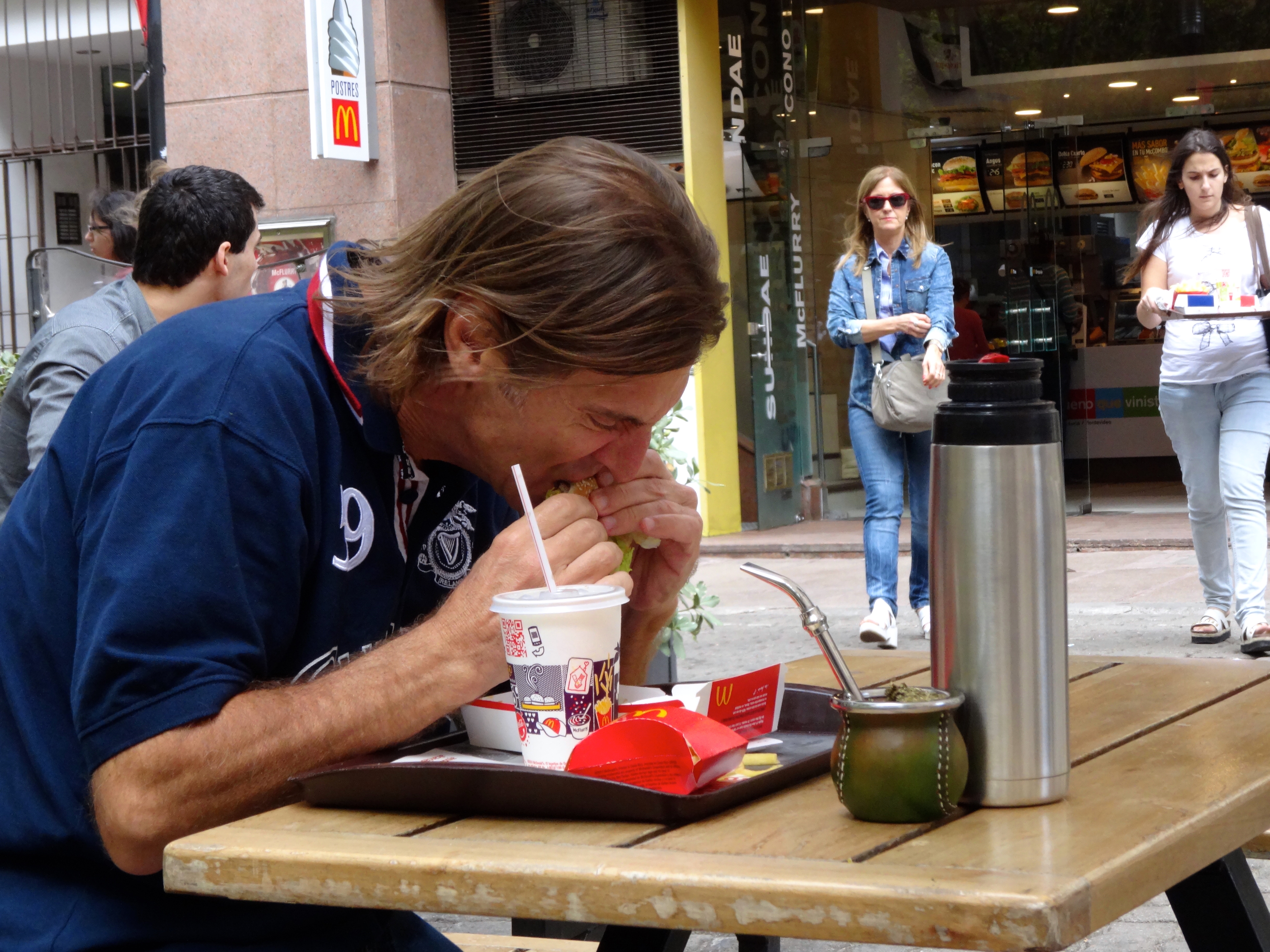
This town is awesome. Really walk friendly too. What rhymes with latte but is obviously way more addicting for some? If you answered mate’ (pronounced Mah-tAA) you are correct. When walking about in this place I happened to notice an abundant number of folks enjoying this hot tea-like beverage. There are three pieces of equipment needed to partake. First a special mate’ cup and filtered straw, and also a thermos. The thermos is necessary because once addicted you can’t let go. Once the liquid is consumed you will find in the bottom of the cup or mug a sludgy greenish-brown paste; much like long chewing tobacco which has been thoroughly enjoyed. See the many images that a snapped surreptitiously. People of all ages seem to be enjoying this stuff. In America mate’ exists, however like the original Coke Cola of 1906, it does not contain the addictive ingredient.
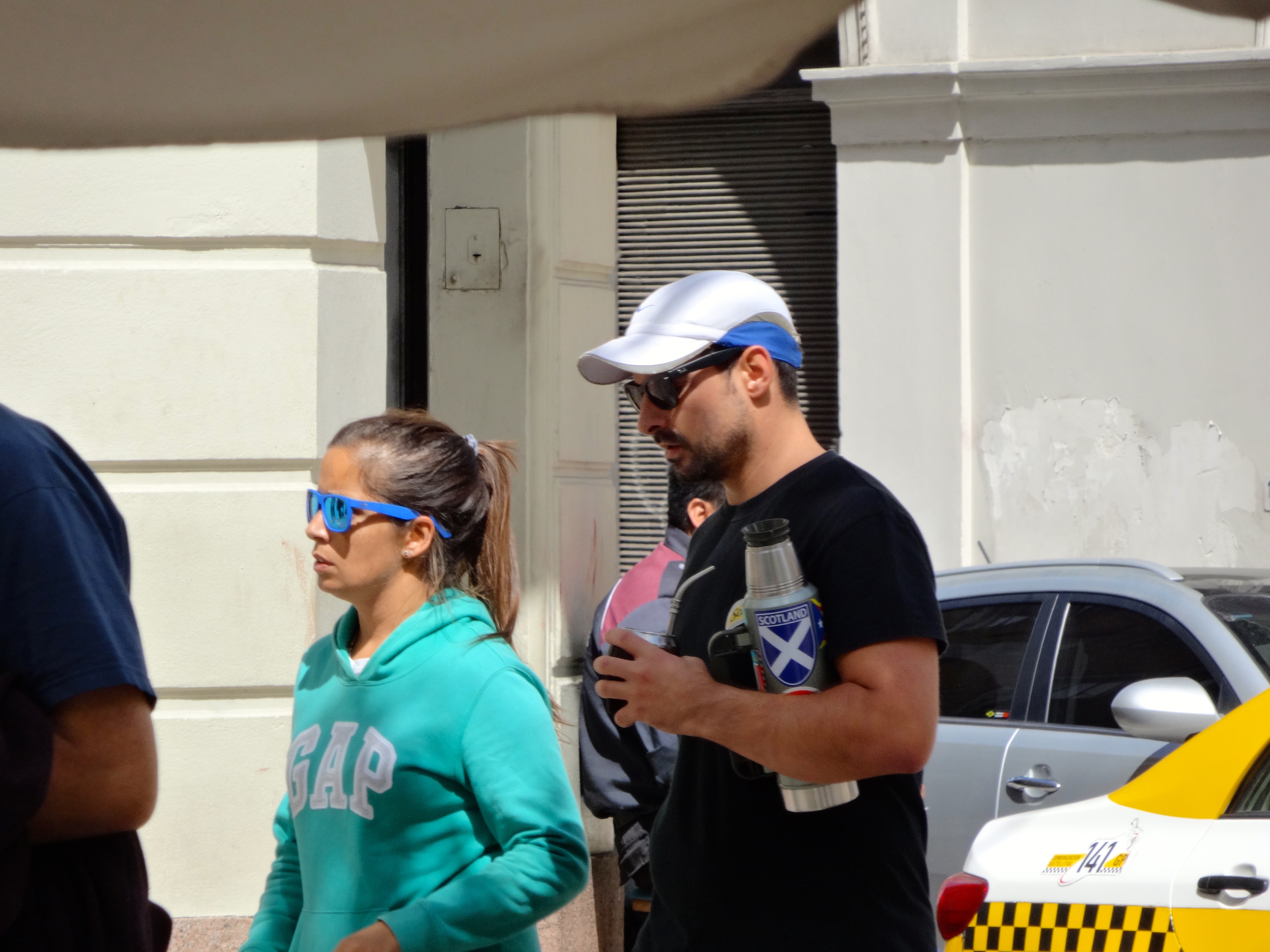
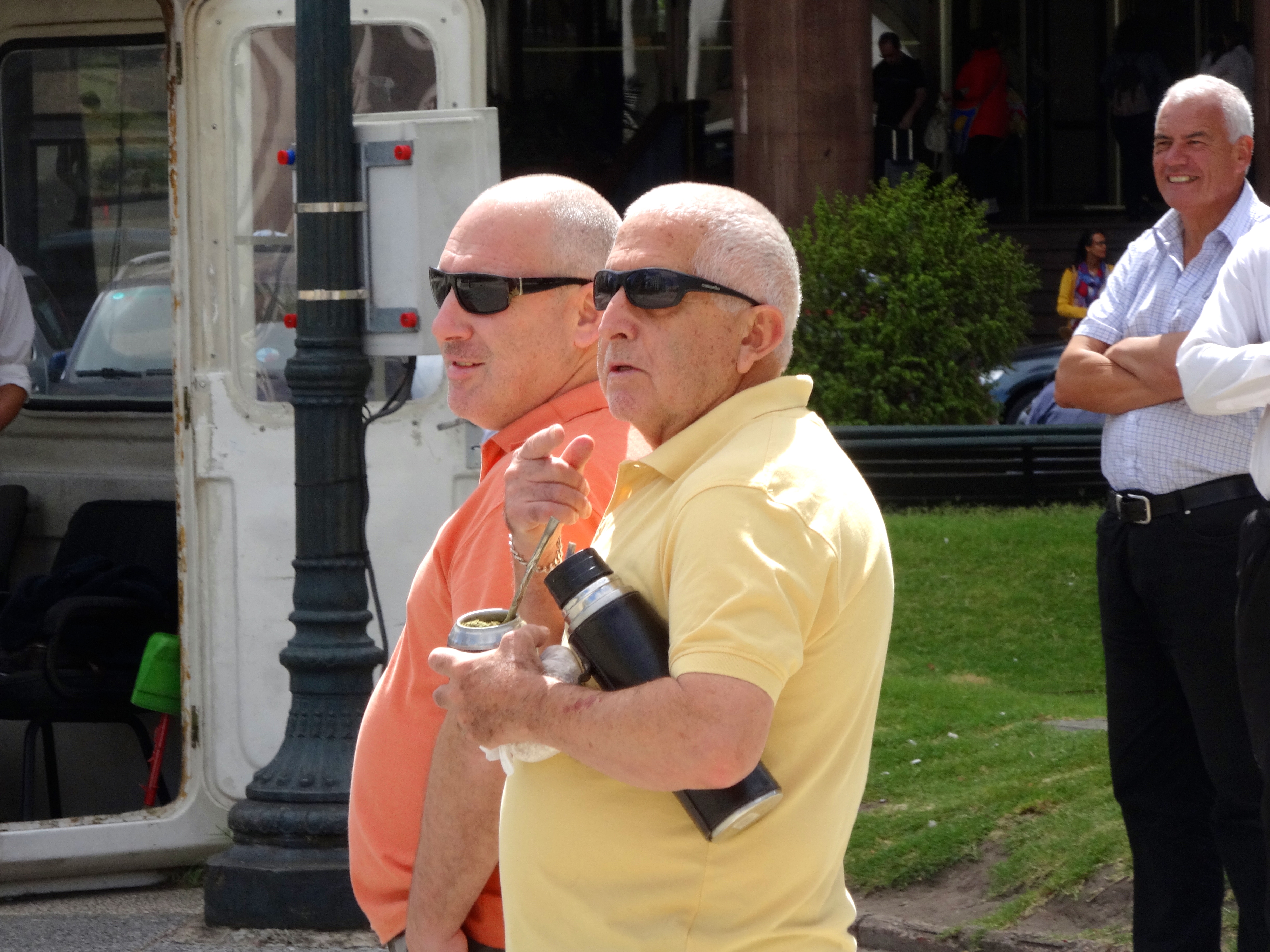
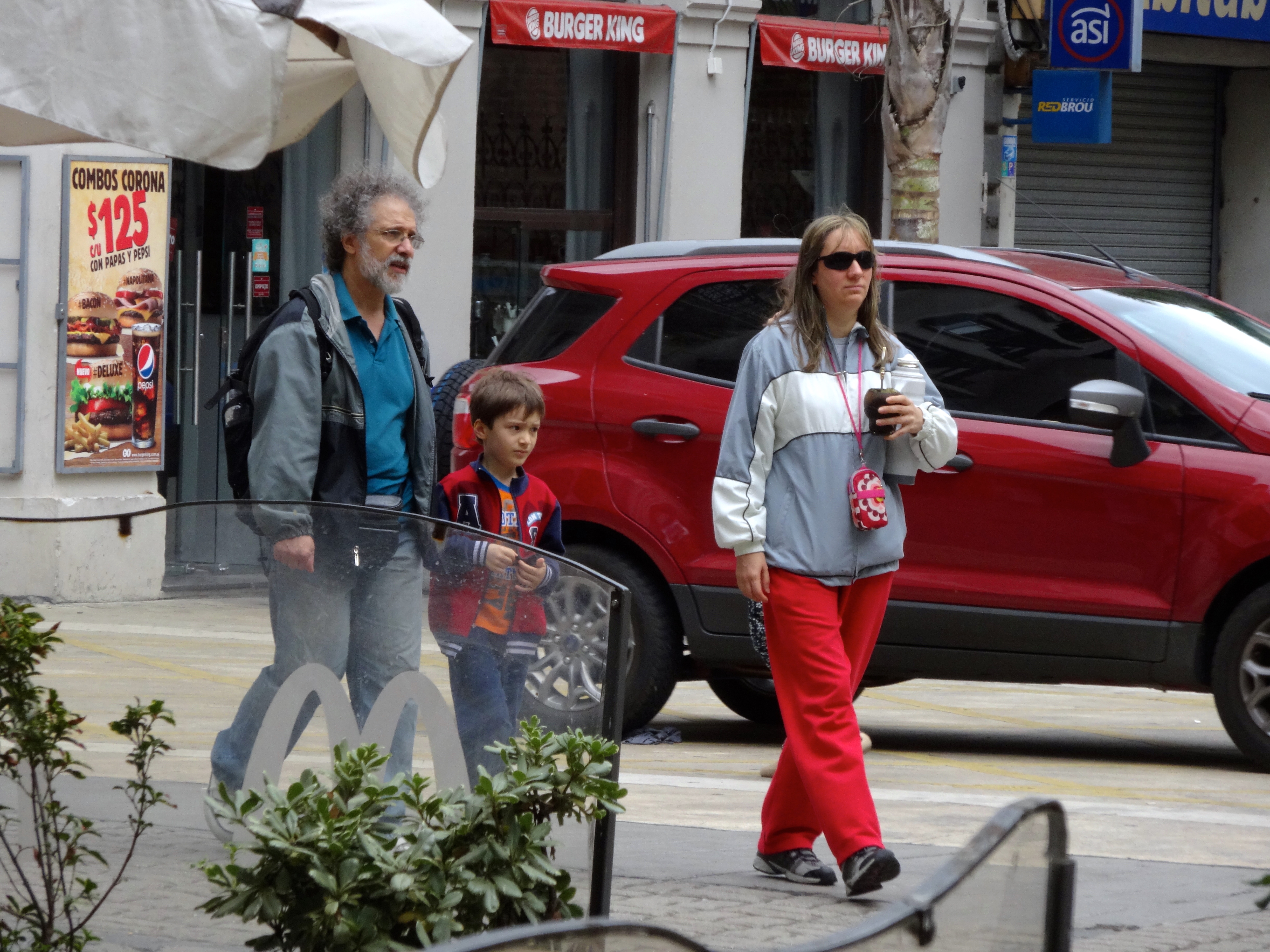
This dude is the only person I saw without a thermos reservoir.His thermos is sitting on a table. You can see the silver top.This consumer drinks and holds with the same arm. This grasp is know as the one-arm.This apparent tourist seems to be mug testing in order to get into the game.Lovers on a park bench enjoy too.Old folks seem to have the bug as well.This guy is taking some time away from his mate’ (seen just in front of him) to enjoy a Big Mac.Seems one-arming it is the hold of choice.These guys too. Mate’ knows no sexual orientation. Everyone seems to enjoy them.Again the one-arm hold is seen here.Another one-arm demonstration.
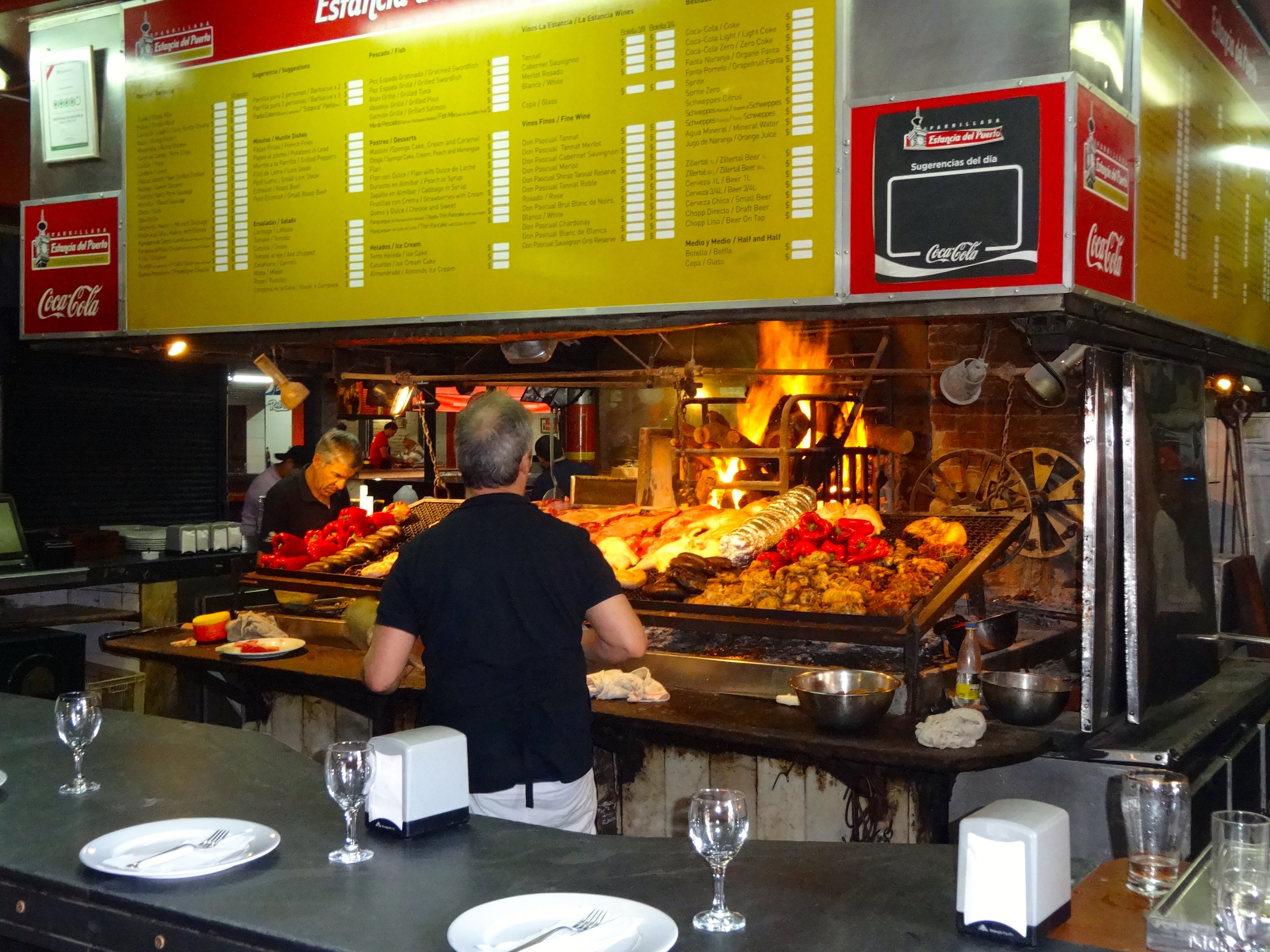
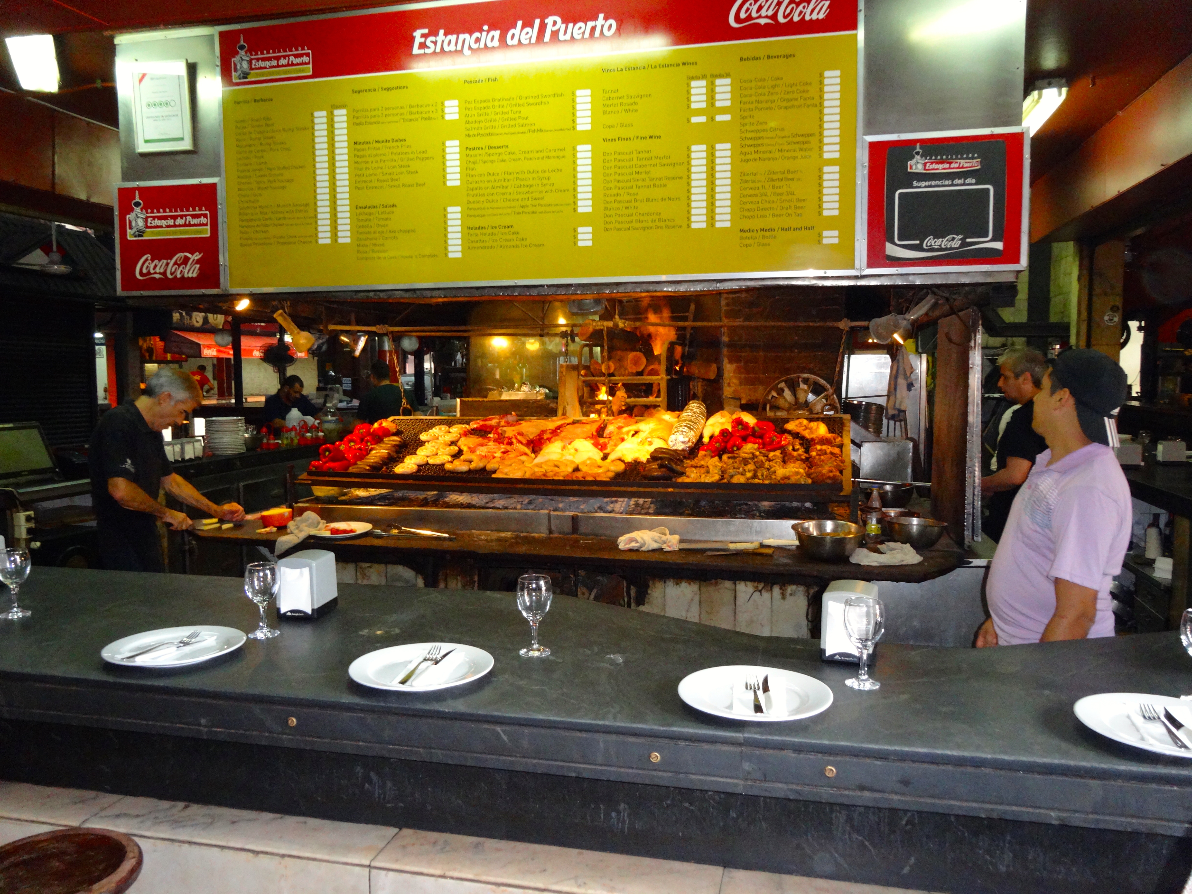
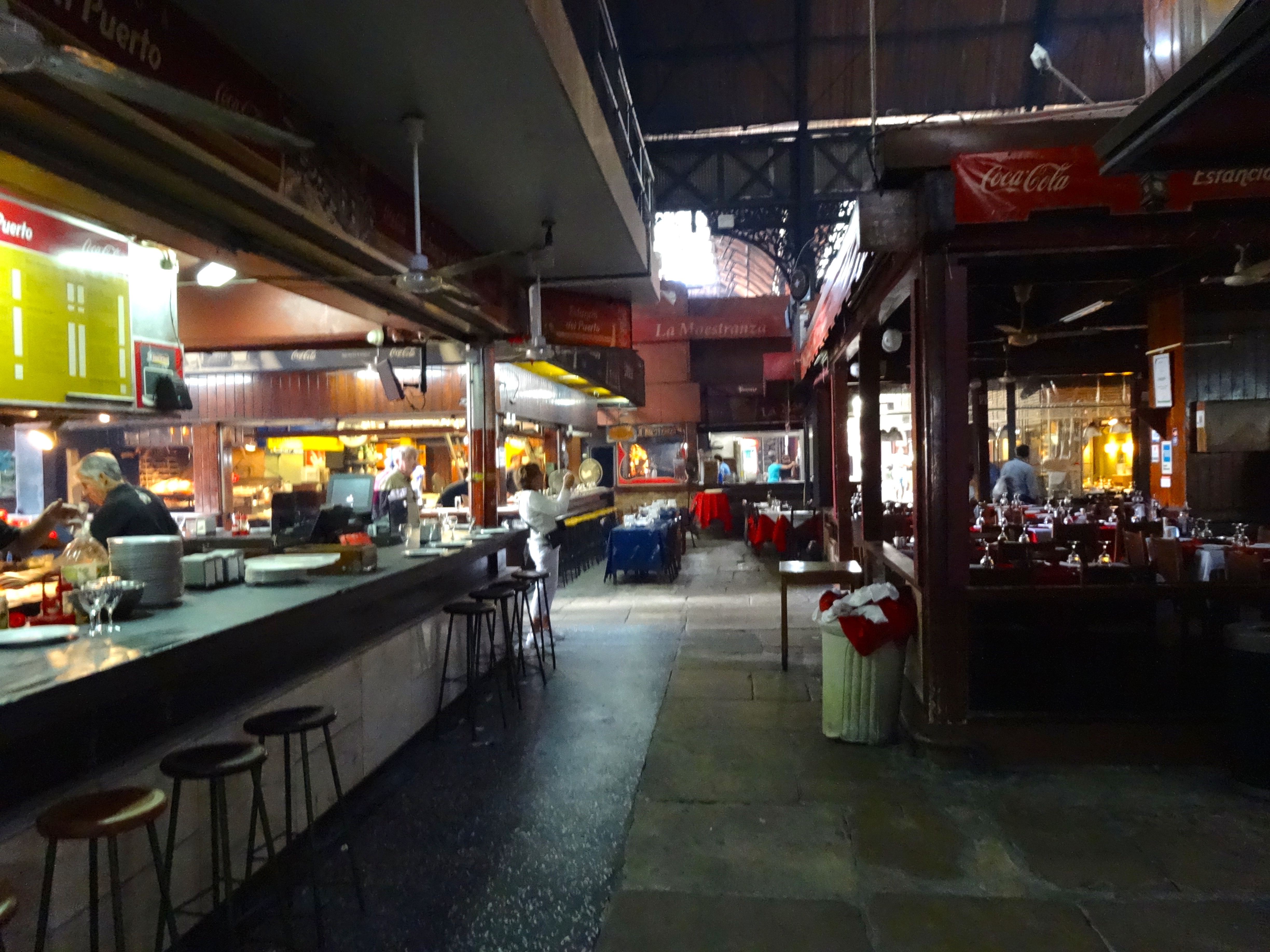
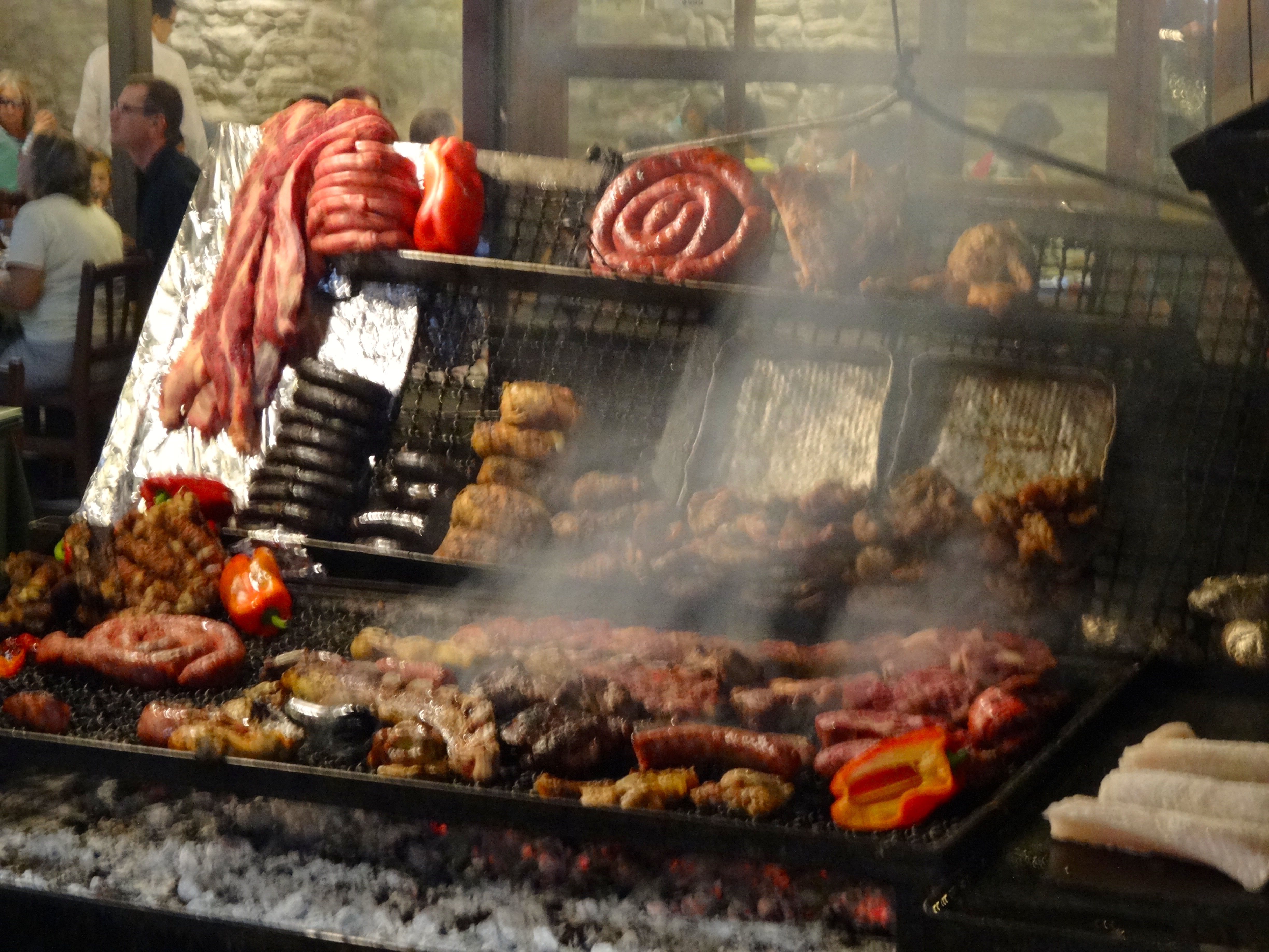
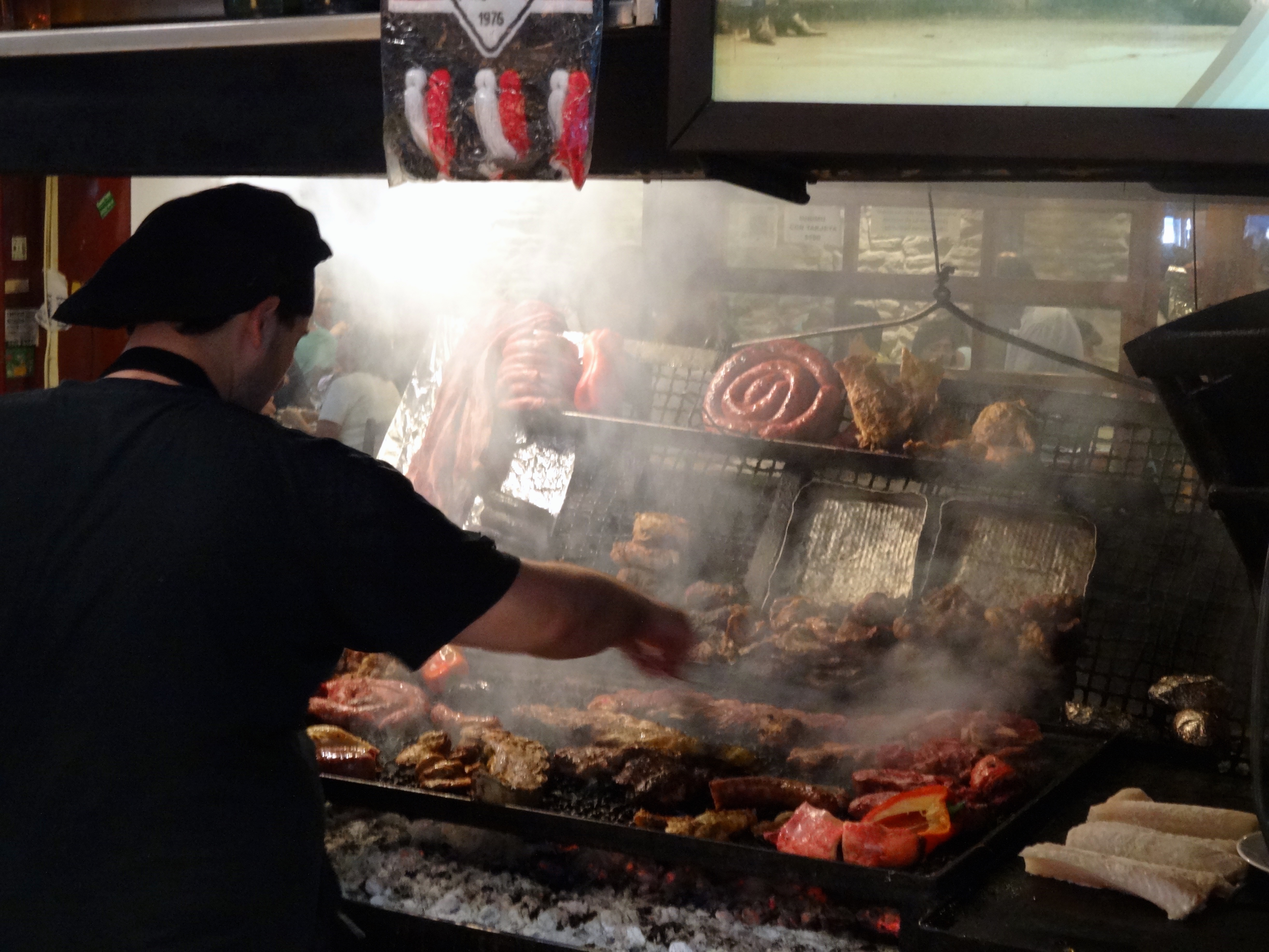
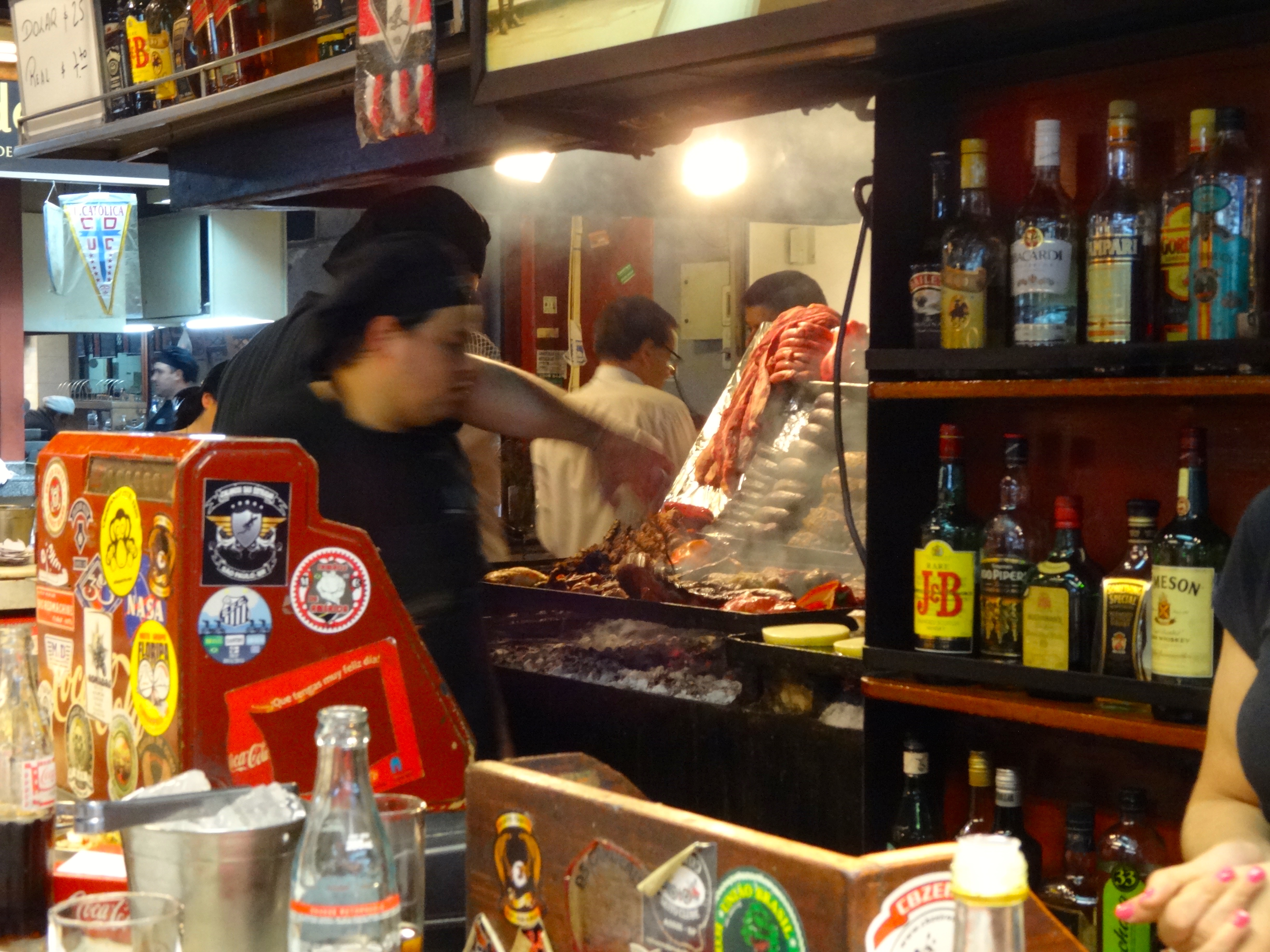
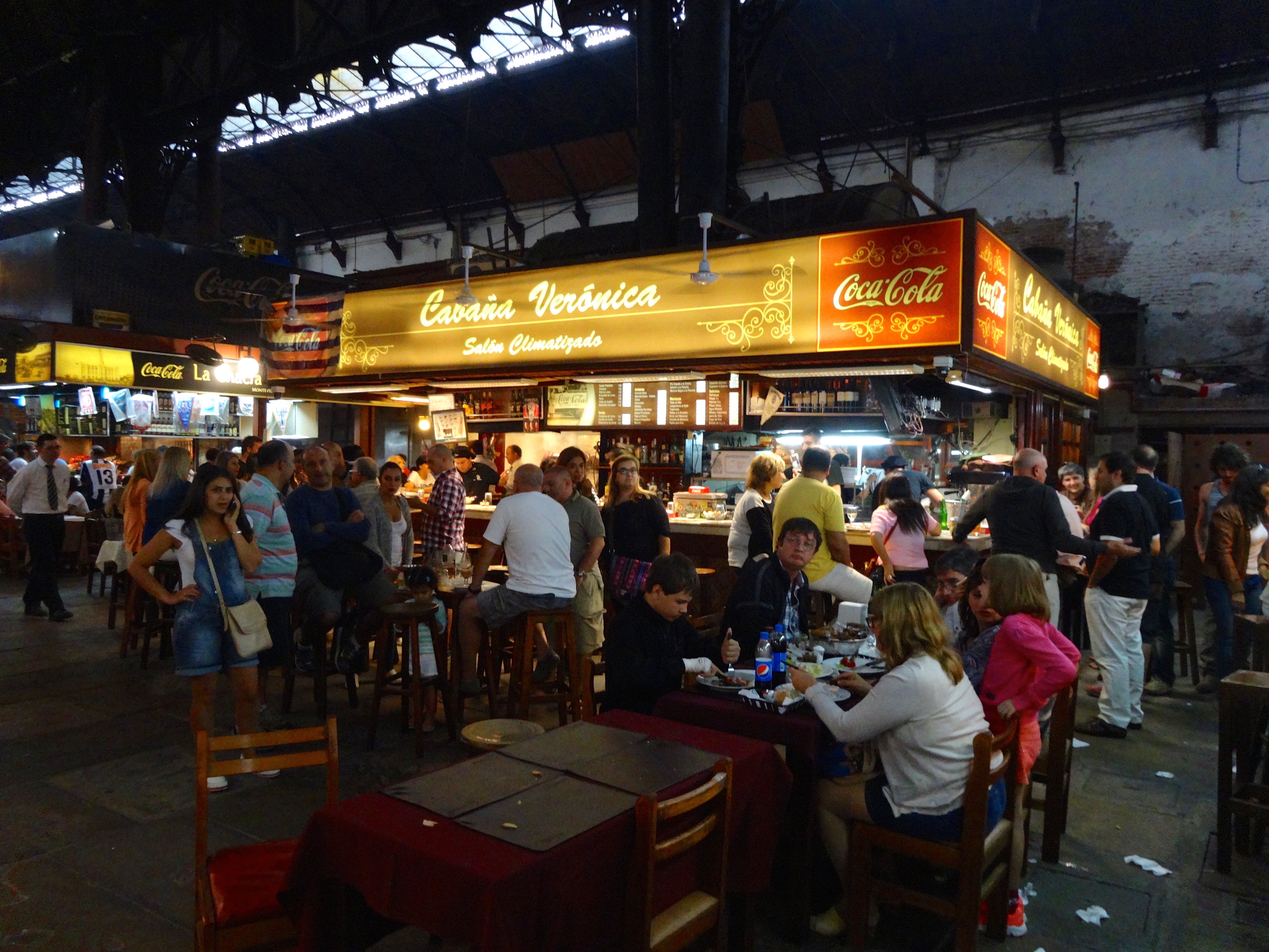
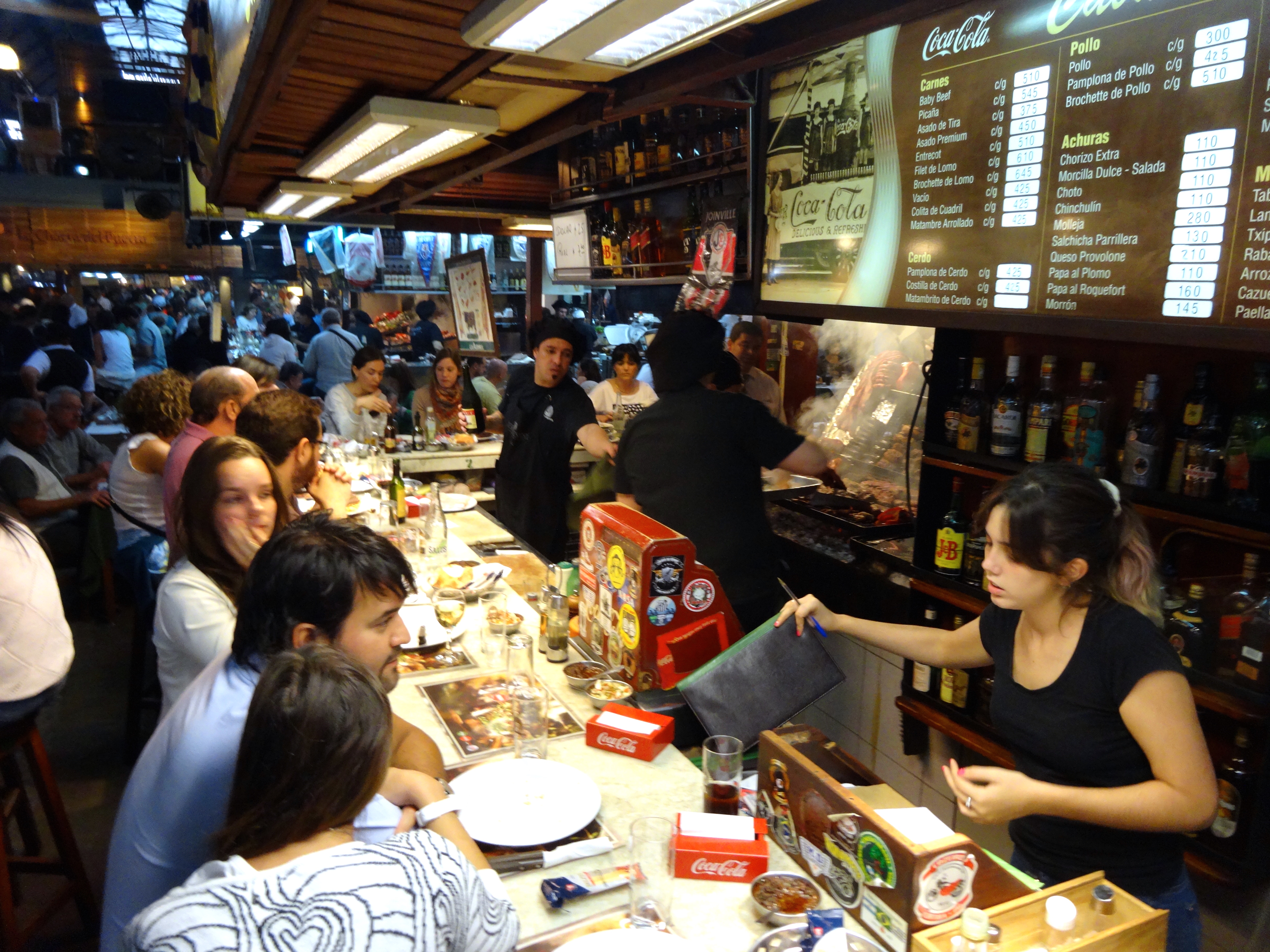
After a lengthy walk in order to get these candid shots I developed a powerful appetite. Consequently I dropped into the most amazing assembly of BBQ restaurants I have ever seen. The place was called Mercado del Puerto. Translating to “market at the port.” It was a huge market at one time. Now it plays home to about 20 or so BBQ joints. They start cranking up the grill at about 10 AM by burning special varieties of logs. The fire burns from behind the actual grill and then the hot coals are shoveled forward under the grills as needed. I happen to enjoy an amazing slab of beef tenderloin from Argentina. The aromas in the place could even make a vegan eat meat.
Grill setup pre-opening. Here you can really see what’s gonna be cooking.Close up of the fair.Pre-opening scene is peaceful. Wait till you see below pics during the food assault.Here’s a typical grill. Look what’s cooking here.Here’s the grillmaster at work.Just another perspective of the energy in this place.These folks seem to be enjoying the old Beatles drink of Scotch and Coke. Check out the otherwise chaotic scene. Looks like a BBQ feeding frenzy.Here’s the place I eat at.Eat right here at the bar. Best place to experience the true vibe of any place.
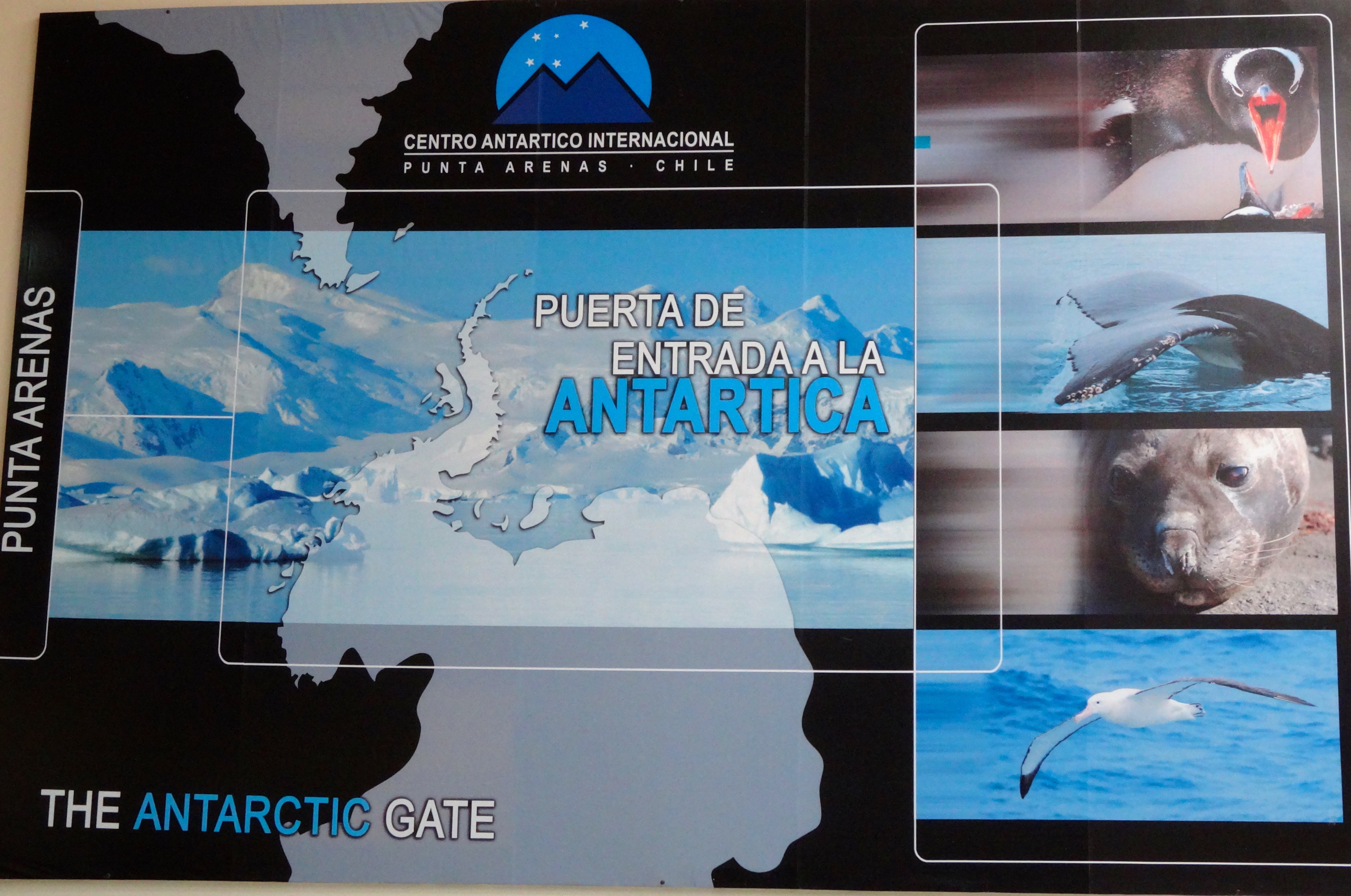
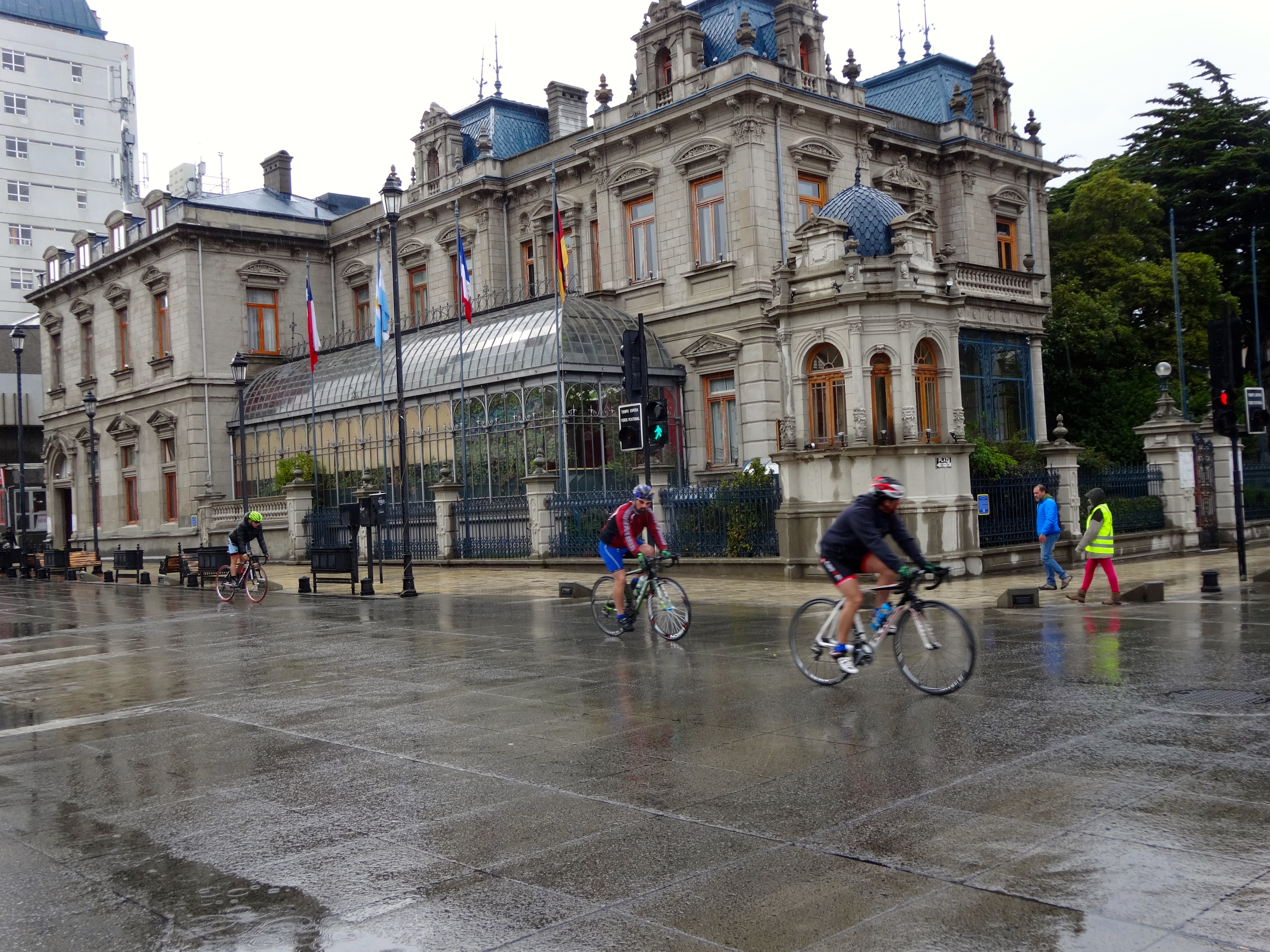
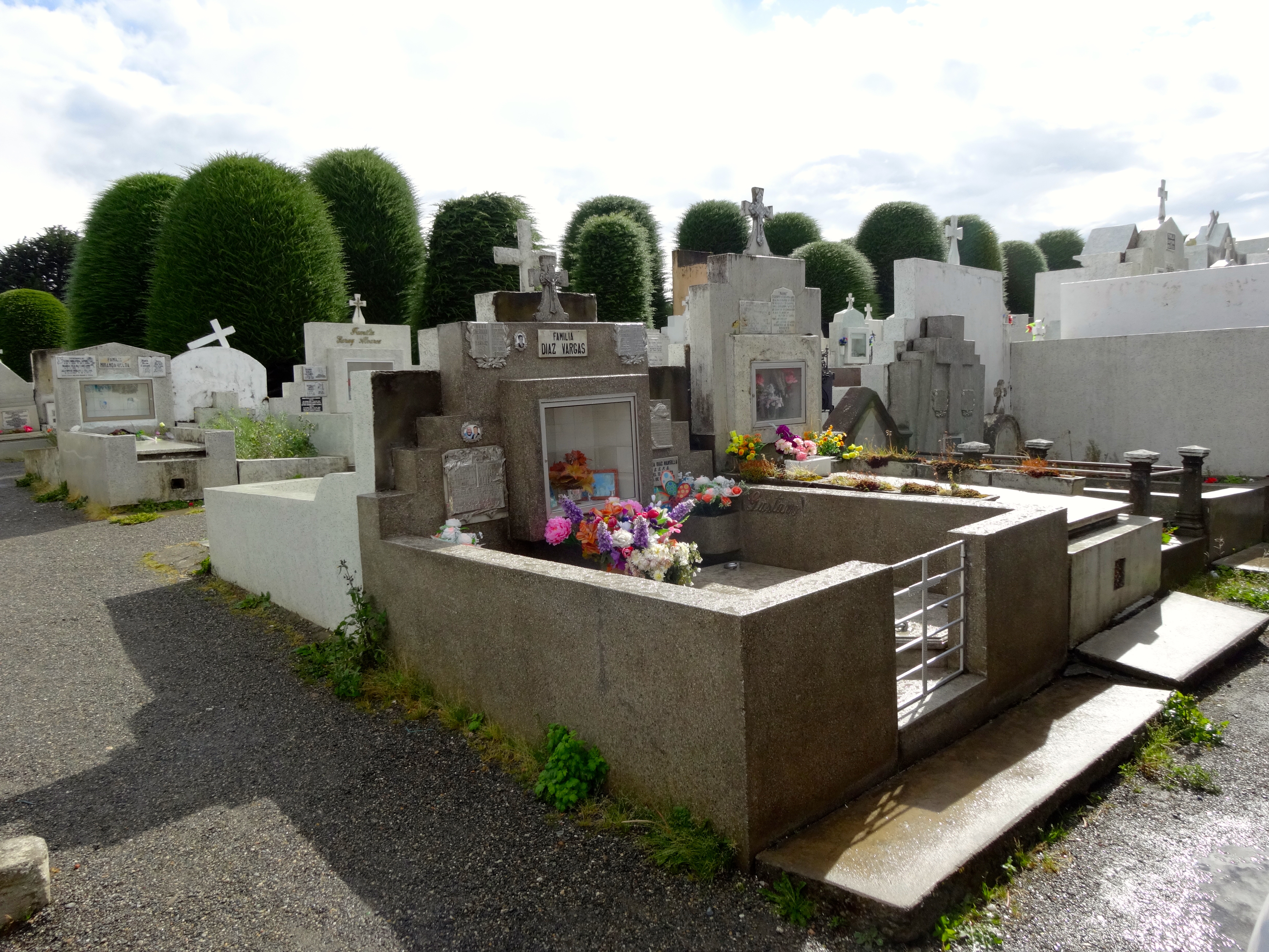
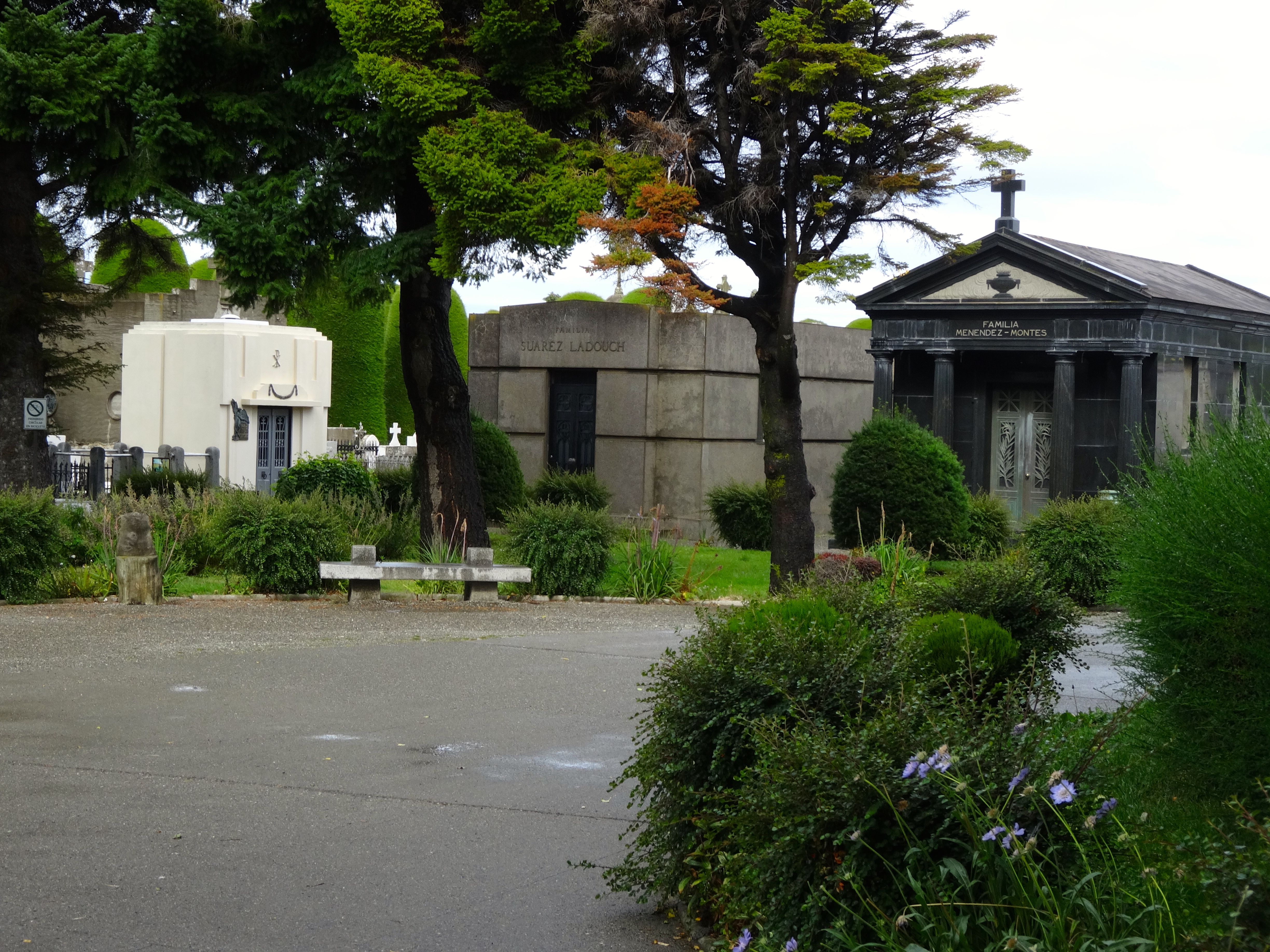
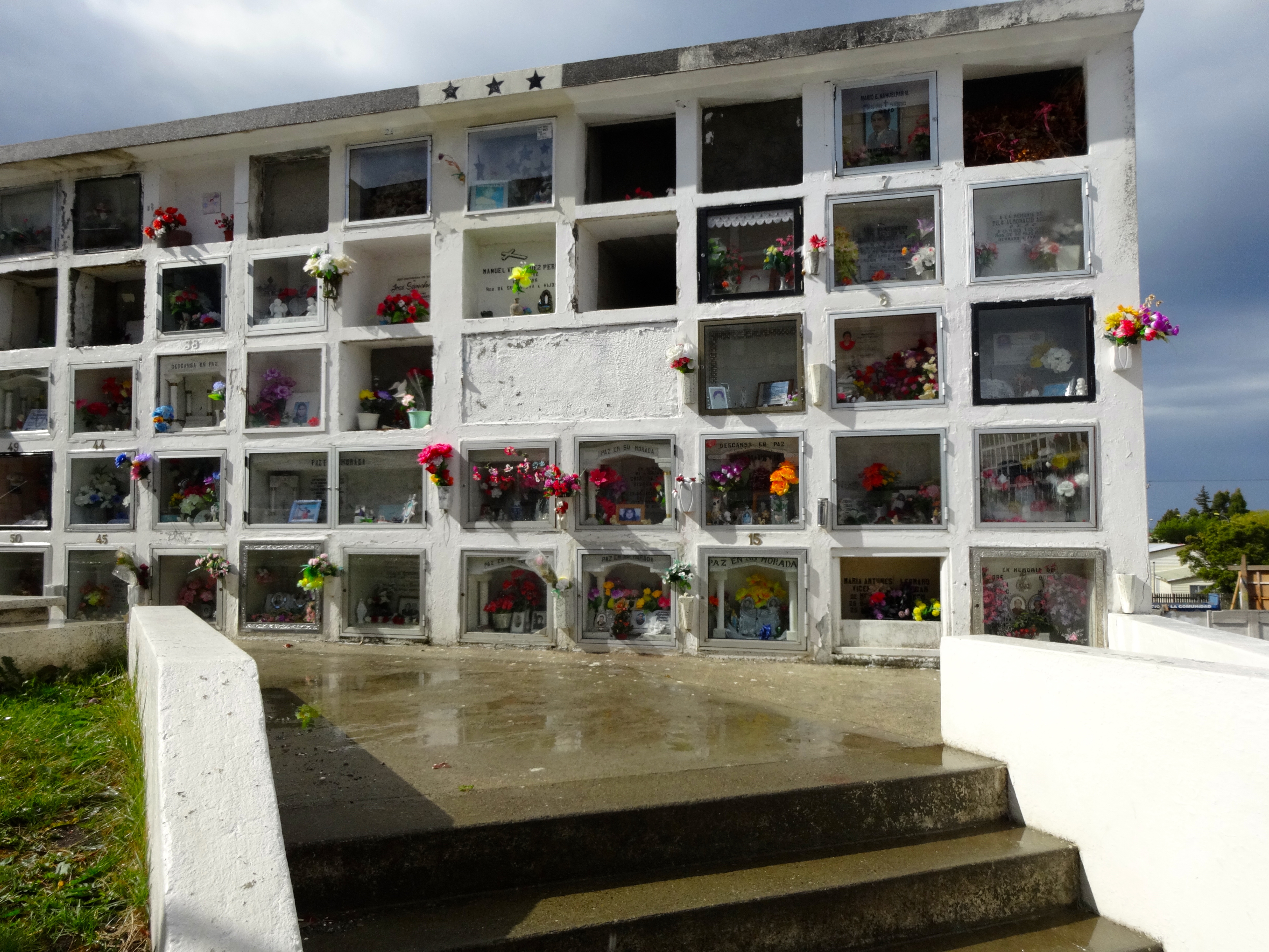
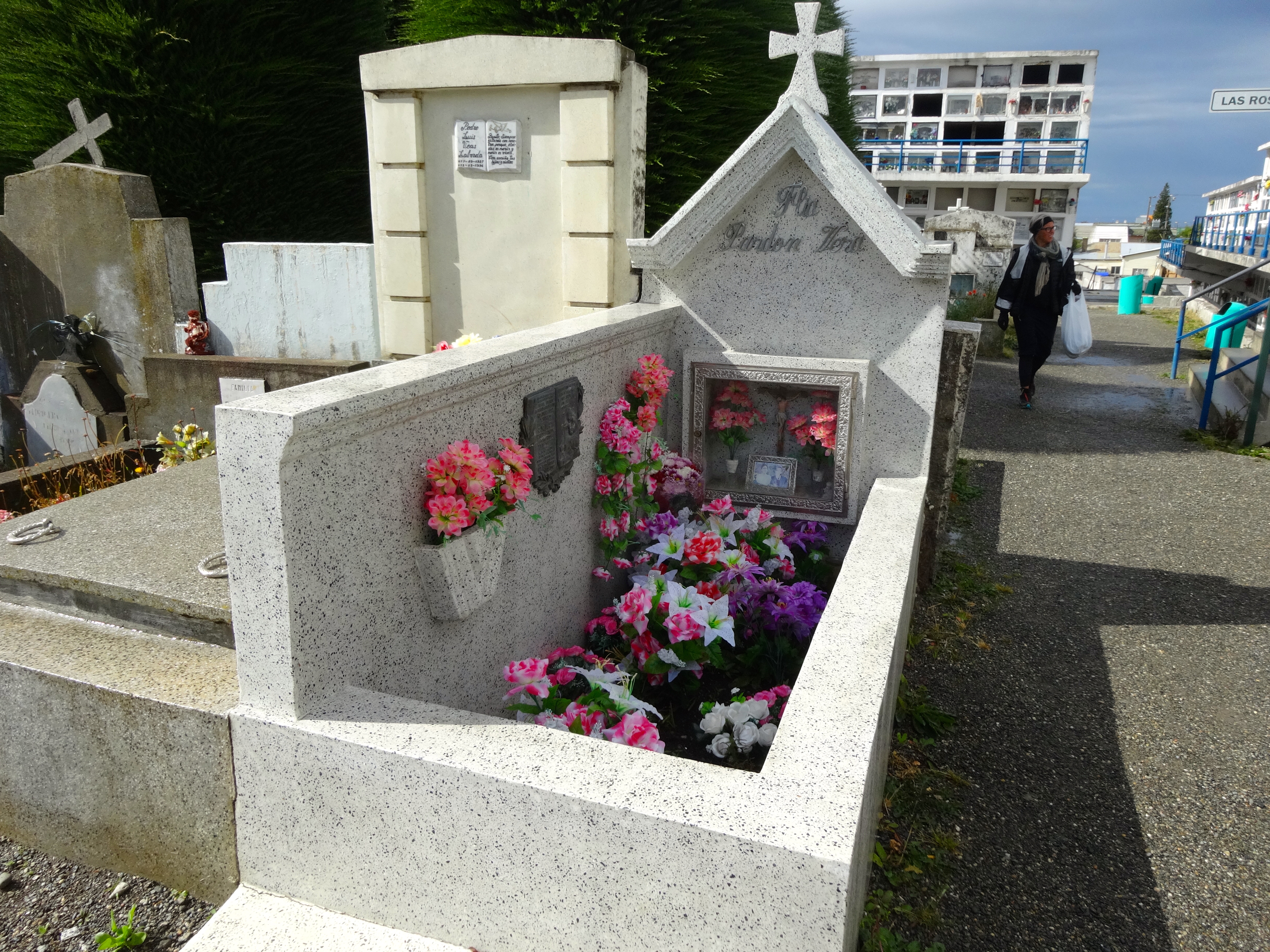
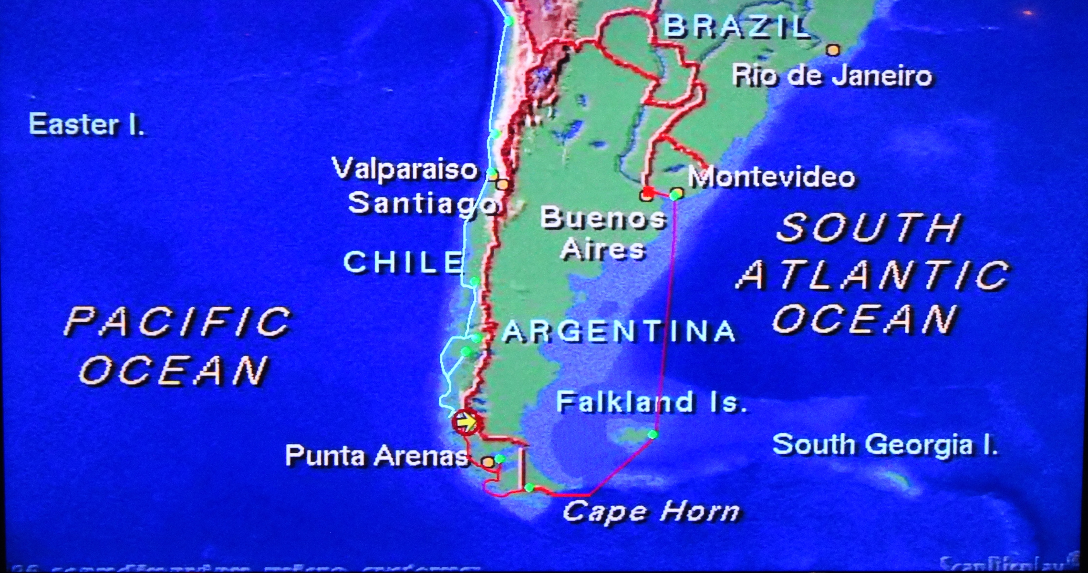
Punta Arenas is on the edge of the Strait of Magellan. It defies an easy definition, as it is a combination of both grand, as well as ruddy. Prosperity during the wool-boom allowed people to built some fairly impressive homes and mansions. It is a relaxed and friendly place. This tiny city is also known as the entry to Antartica. It is surrounded by almost impenetrable forests, impassable mountains, and endless fields of ice. It also happens to have one of the most unique cemeteries I’ve ever seen. Looks at the pics and see if you don’t agree.
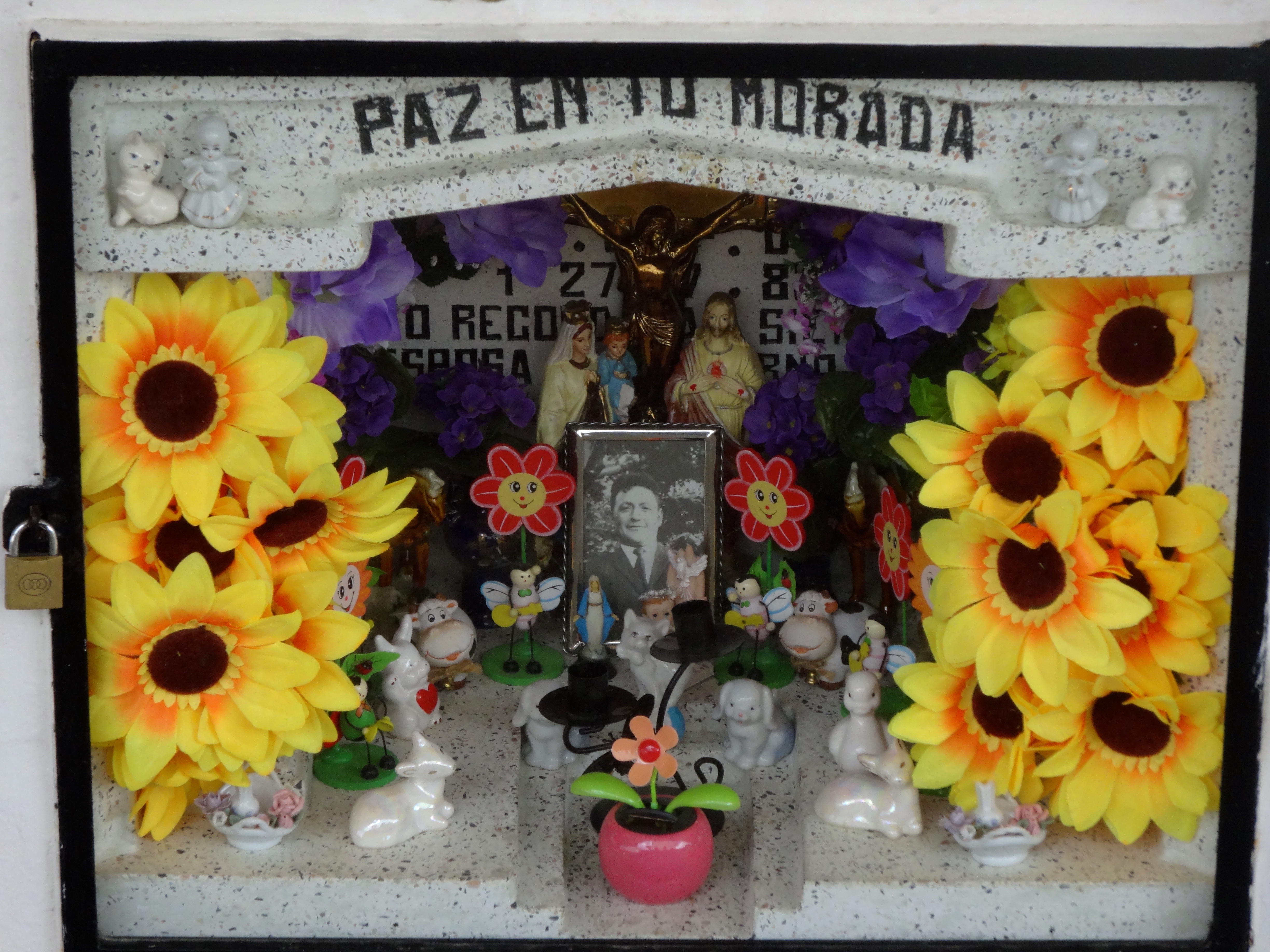
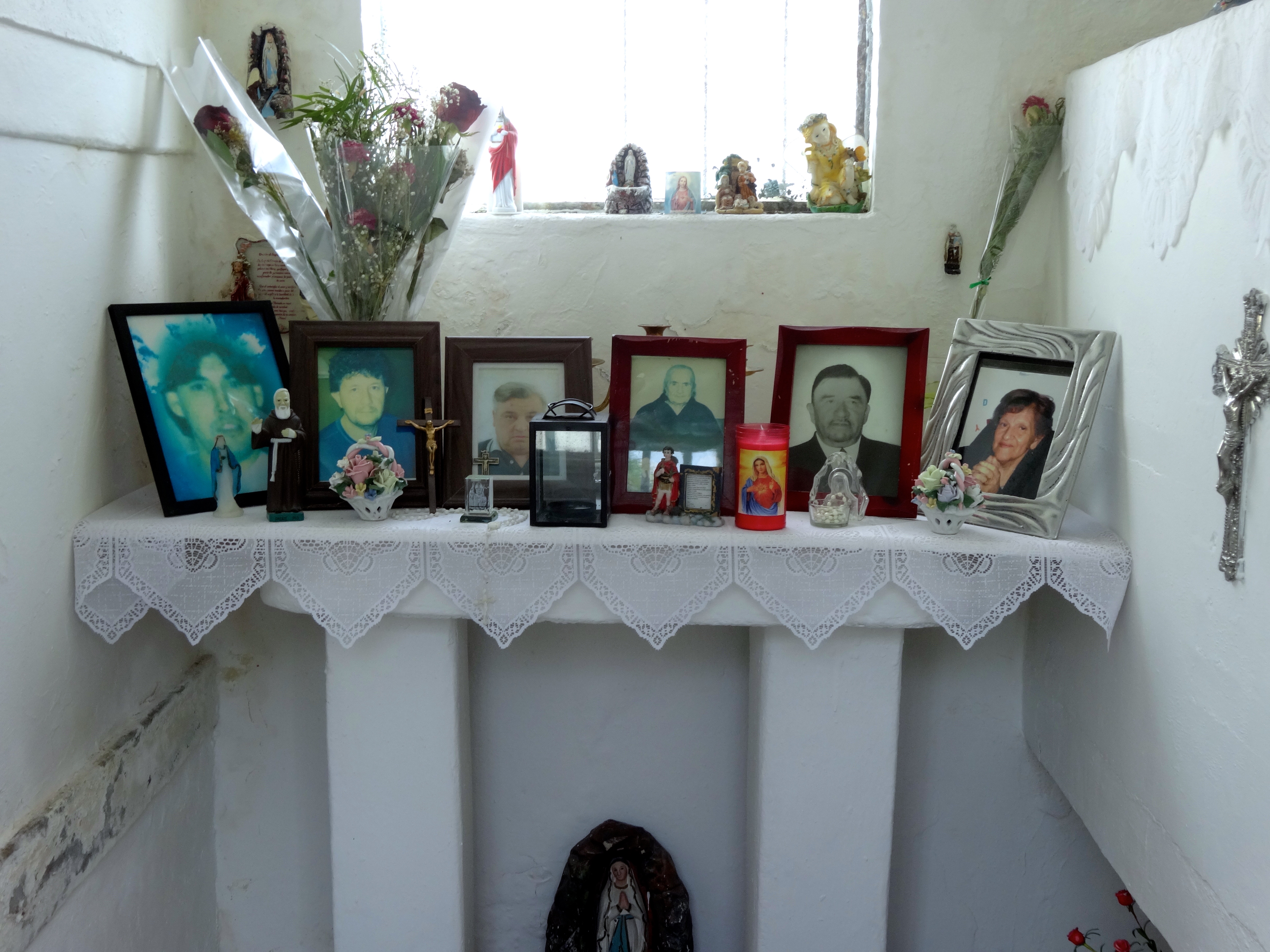
Like the sign says, Door to Antartica.Street scene near a city square.Love the use of flora hereNow gander at these impressive cryptsThese are for sure the cheaper seats. More like high density graving.How could anyone cry looking at this when you consider the occupant of this grave lived to be 80 years. I personally loved the use of tiny ceramic hippos, bunnies, and doggies. In fact it is quire whimsical. They definitely add a degree of lightness to an otherwise heavy scene. But I believe the picture of the deceased was taken at his confirmation.Again, great use of flora here. What appears to be high rise living in the background, is actually the opposite.
The gang’s all here. This is a shot through the sealed plexiglass door. The occupants are buried in the walls, while the central area is smartly equipped with various shelves and areas for display. Almost as though it were a sealed time capsule.
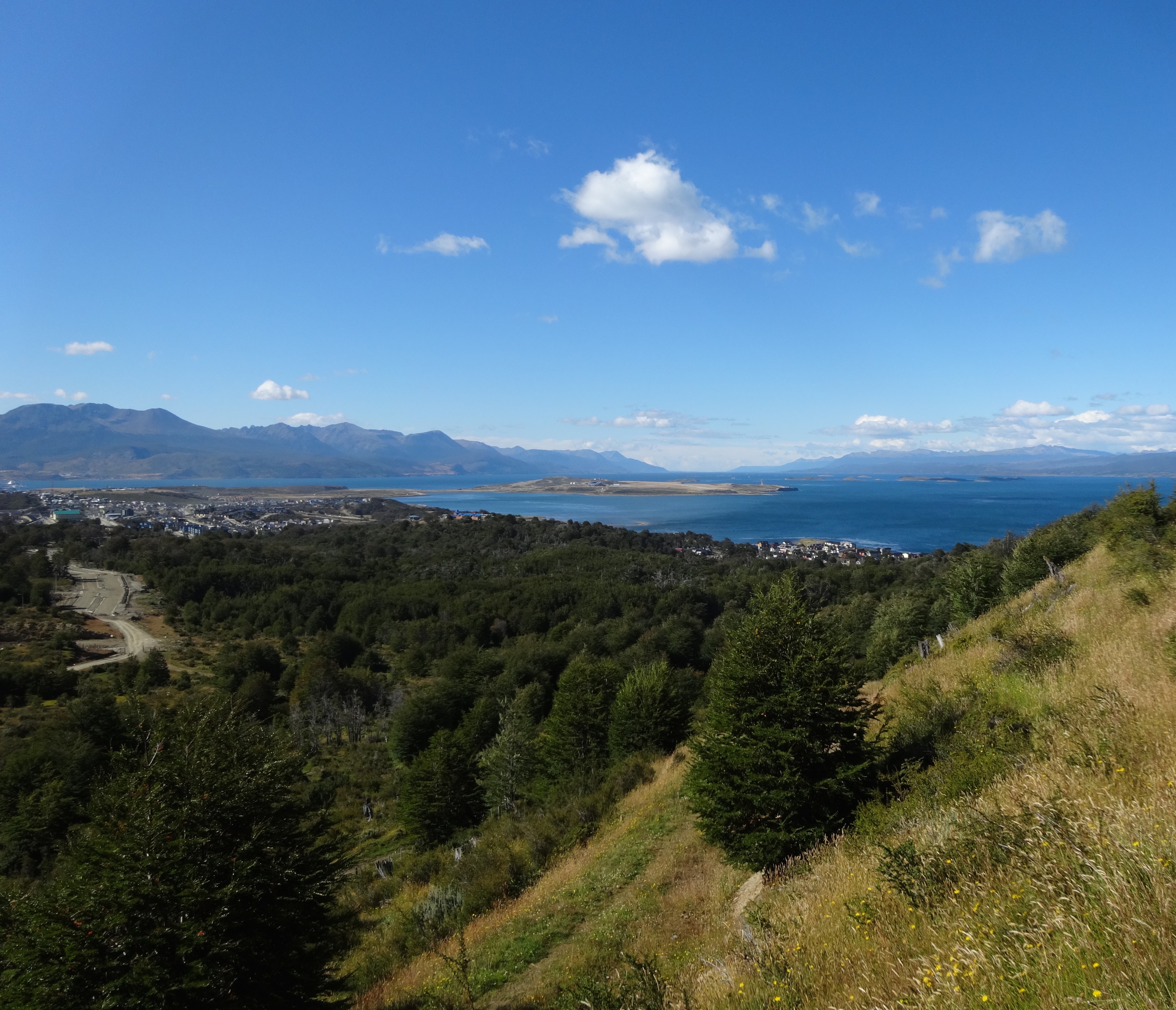
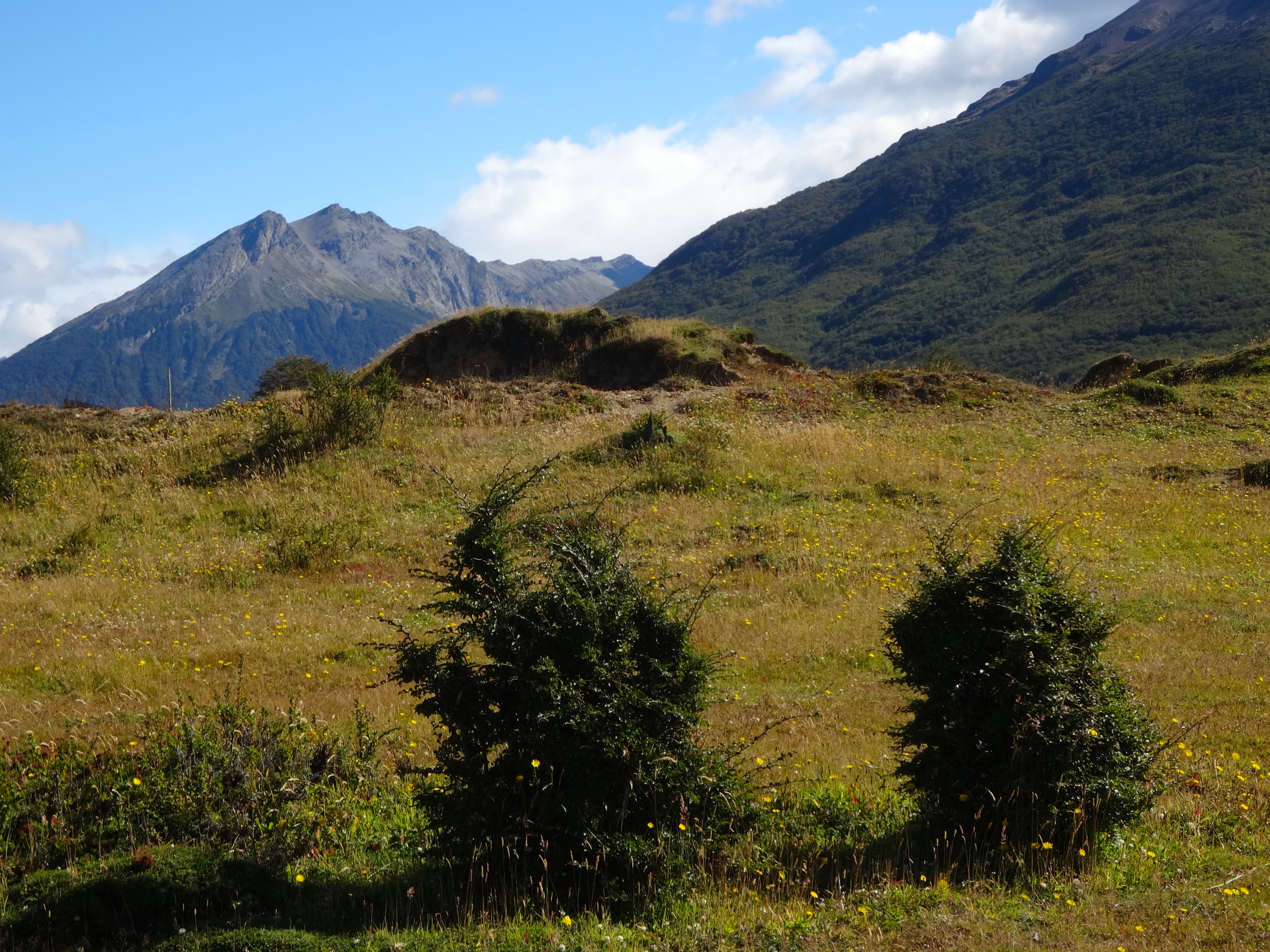
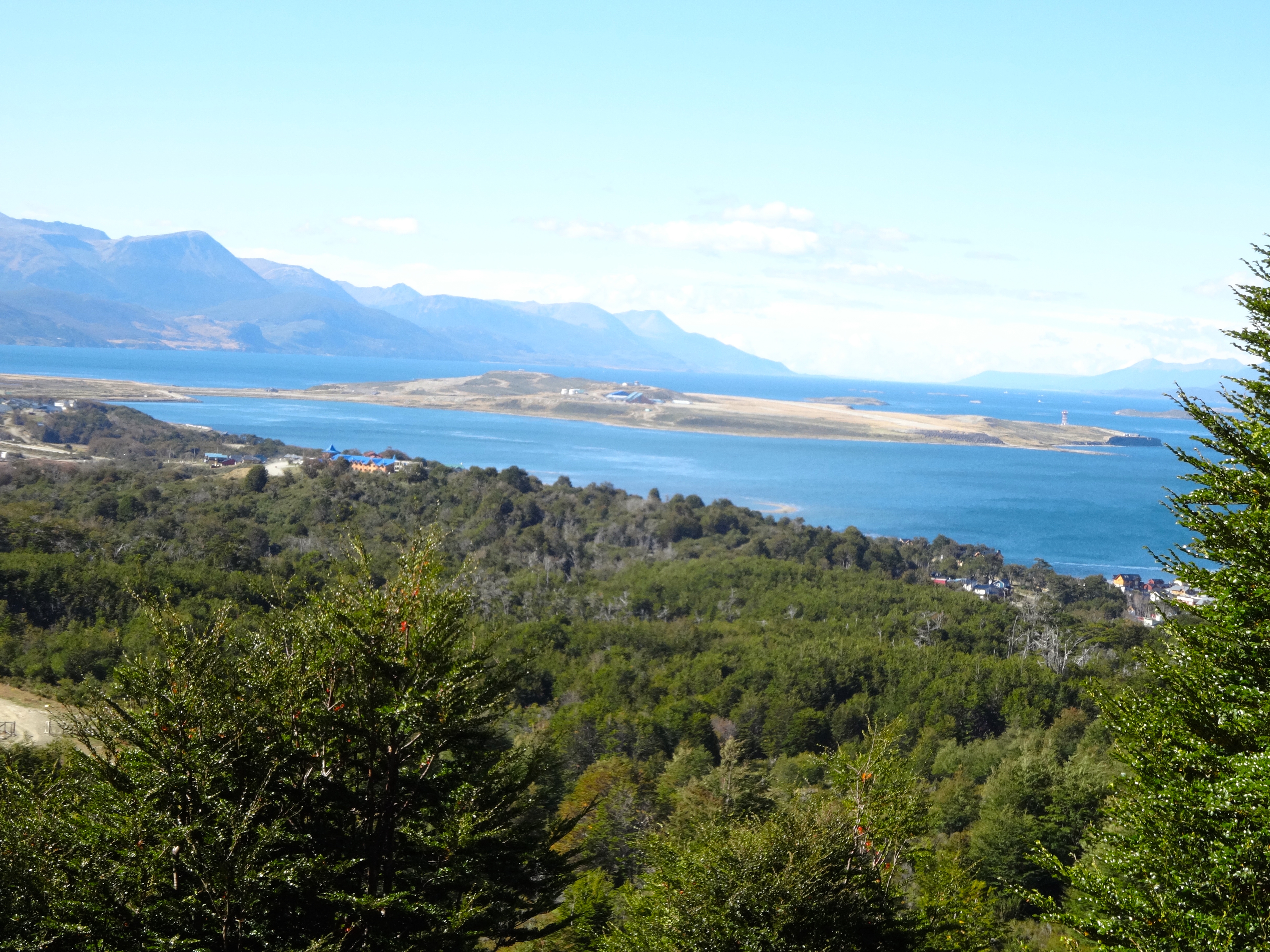
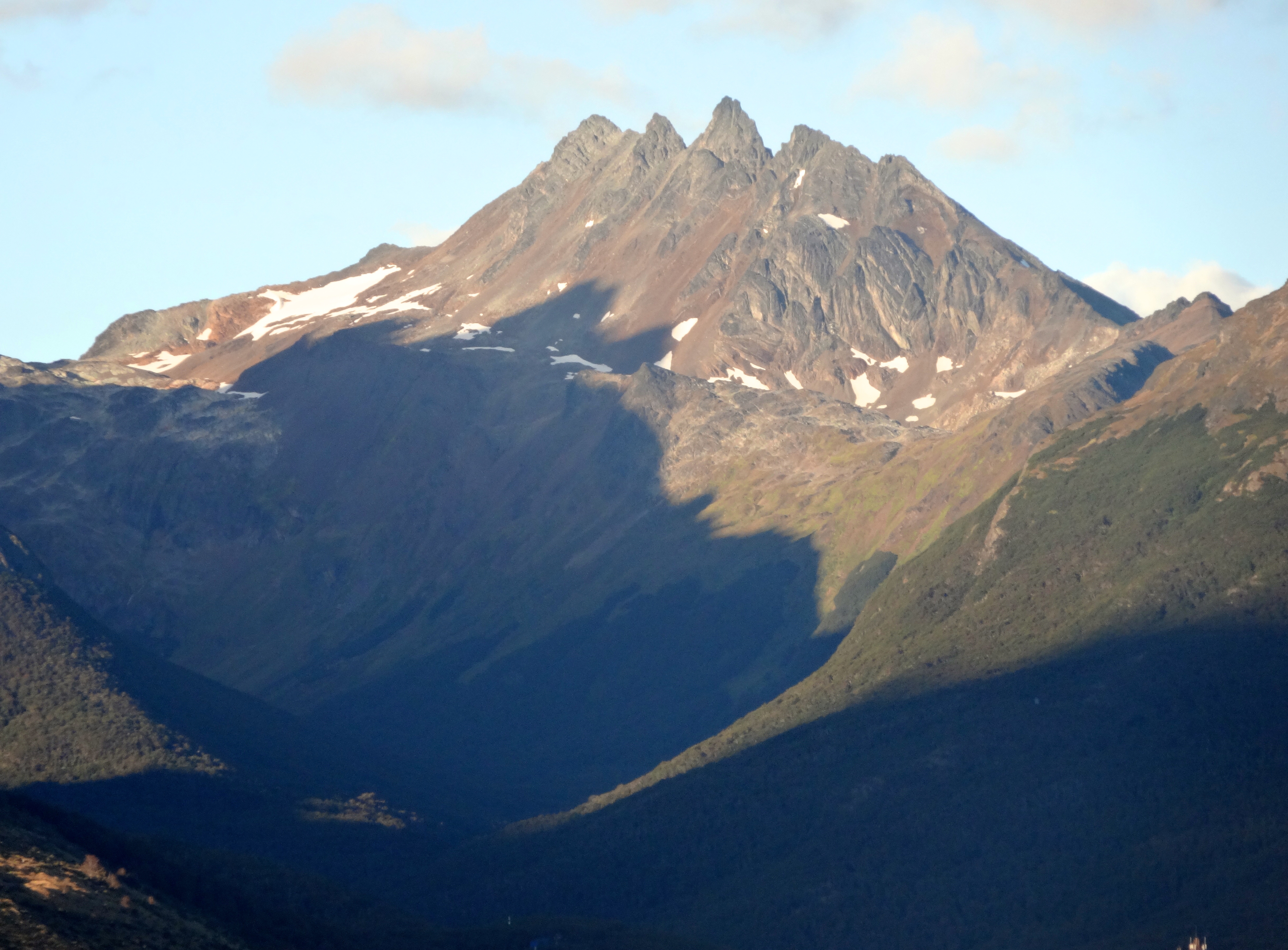
Took another break today to horseback ride in what began as a very scenic ride through this beautiful land. At a latitude of 50.8 degrees south, Ushuaia is The most southern city on Earth. This city of 50,000 is the staging point for most of the Antarctic expeditions. It is one of the fastest growing cities in Argentina.
The town is rustic and natural, but many of the homes are painted in pastel colors in order to brighten things a bit. In winter the temps are well below zero and the sun rises only briefly. The towering mountains surrounding this city rise to an altitude of 6,500 feet from sea level quite dramatically. The city is very clean and crisp.
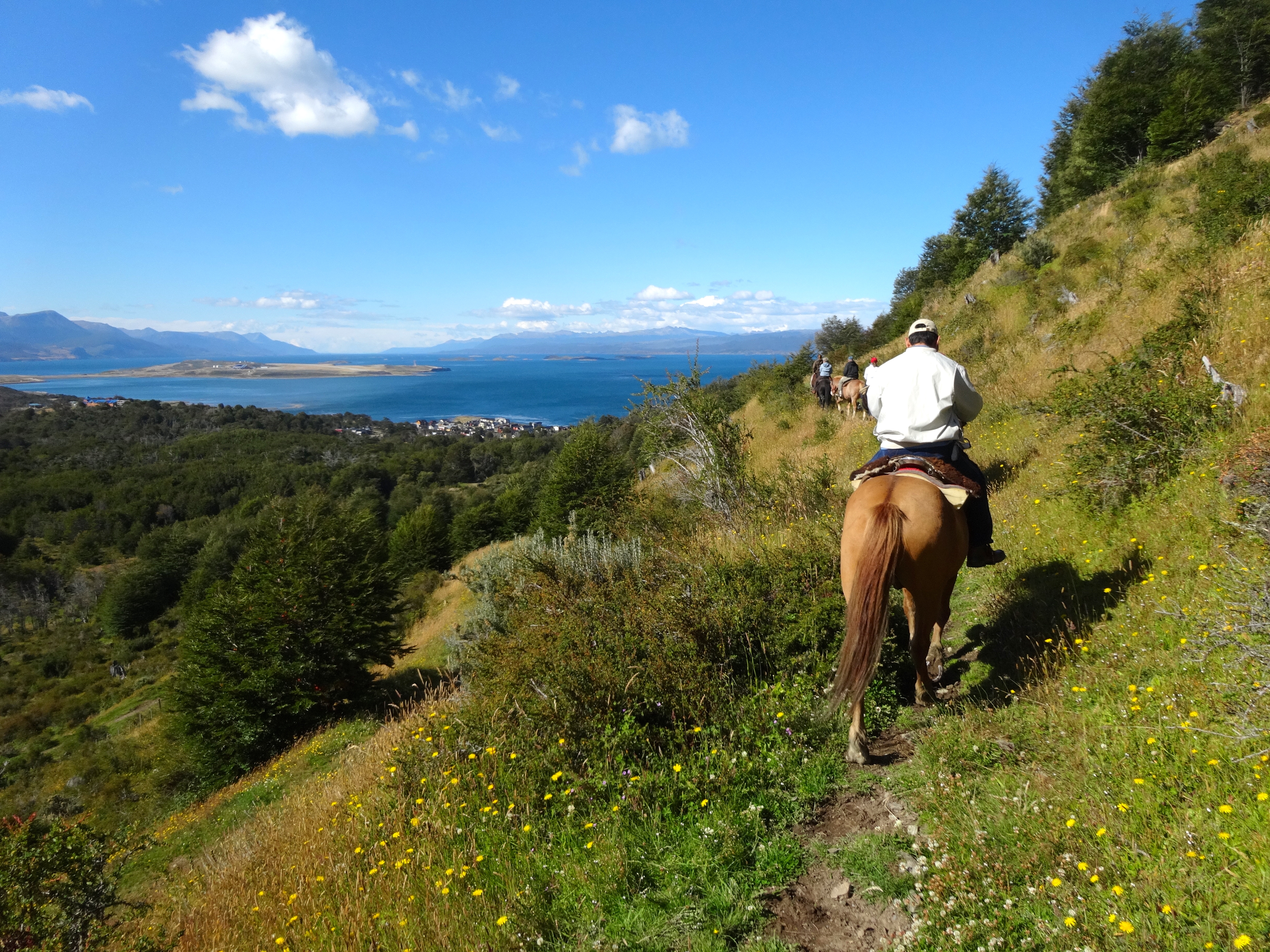
Now back to the horseback ride. It began with a steep climb along a narrow path to what was a great vantage point for panoramic photos. The shots taken (see below) show the harbor town and the surrounding majestic mountain peaks, as well as the pitch of the slope. Unfortunately for one rider in our group (who was a very experienced equestrian) it ended shortly after those majestic views. He was one rider ahead of me when his horse became spooked. The horse jerked unexpectedly throwing the rider off. It happened so quickly that I had difficulty processing it for a moment. He flew up in the air and dropped like an anchor to the ground. His body at first appeared lifeless. Another rider, who had prior experience as a medic came to his aid. As it turns out the unlucky rider suffered a minor concussion, some neck trauma, and a severely broken wrist. His hand swelled almost instantly to the size of a small balloon. On a selfish note, needless to say, it was a major buzzkill. I held on much tighter after that. I also decided that this would most likely be my last ride on a horse. So in this city, the southernmost on earth, a few firsts and lasts for me took place. See pics below.
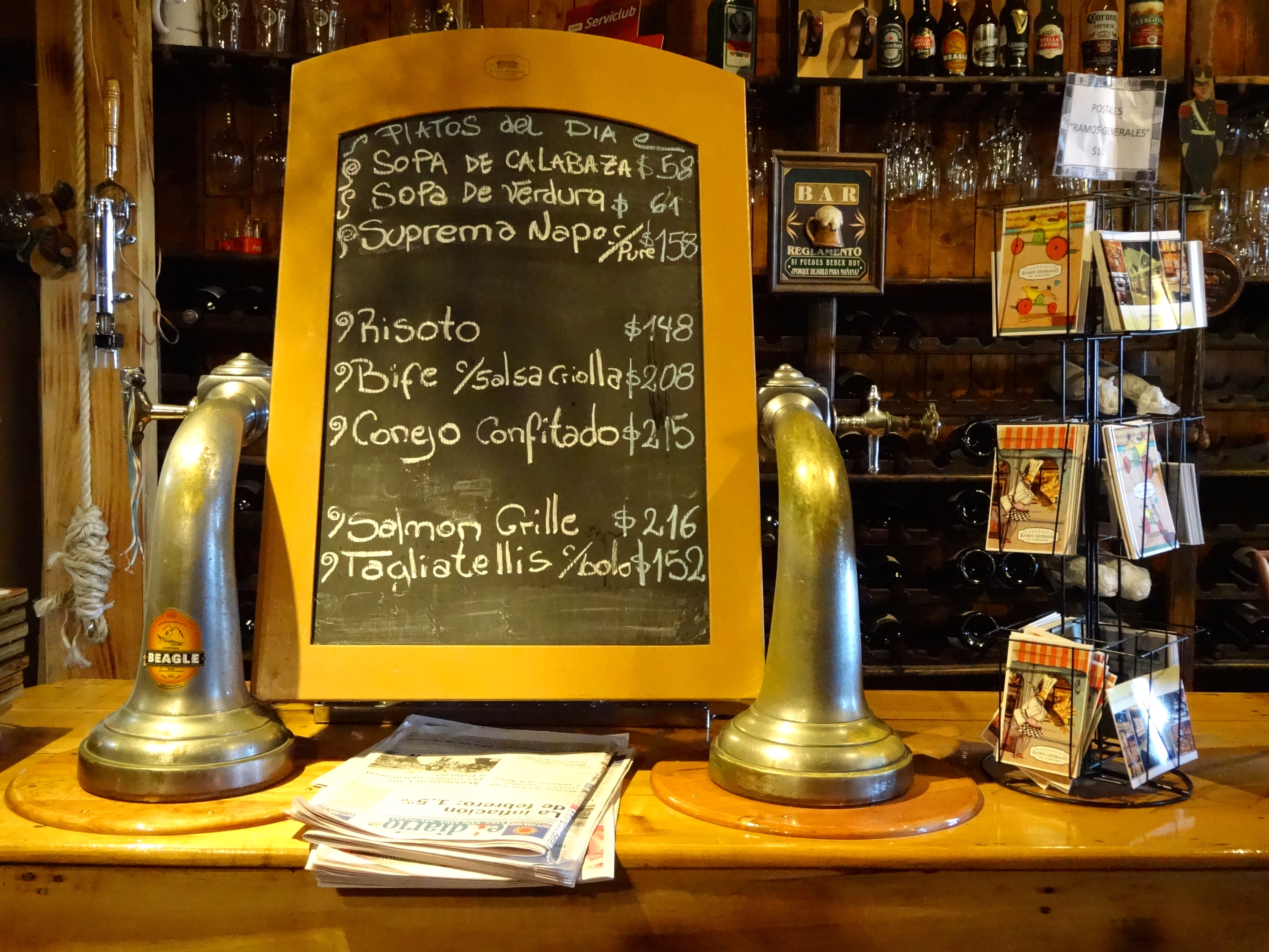
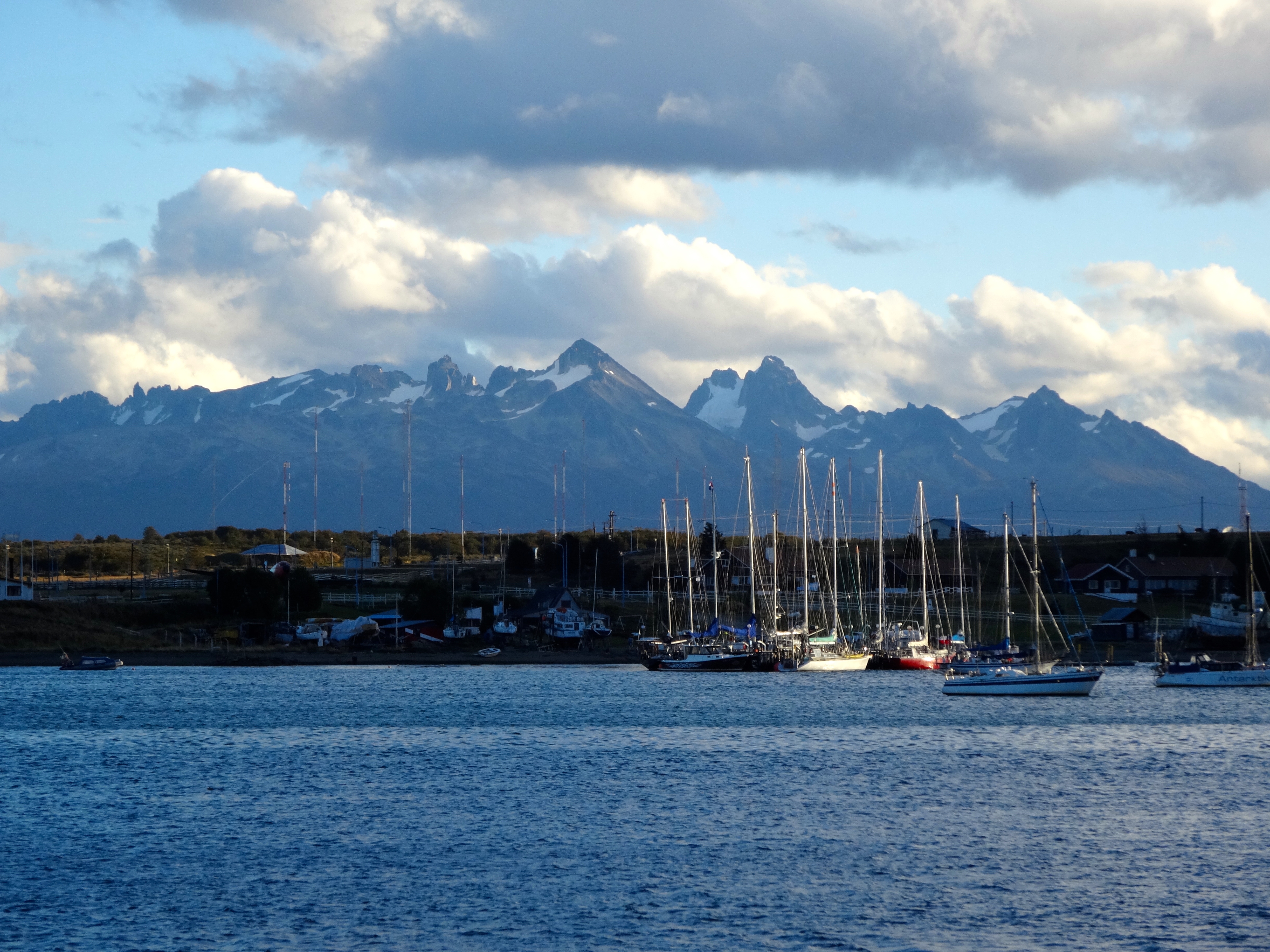
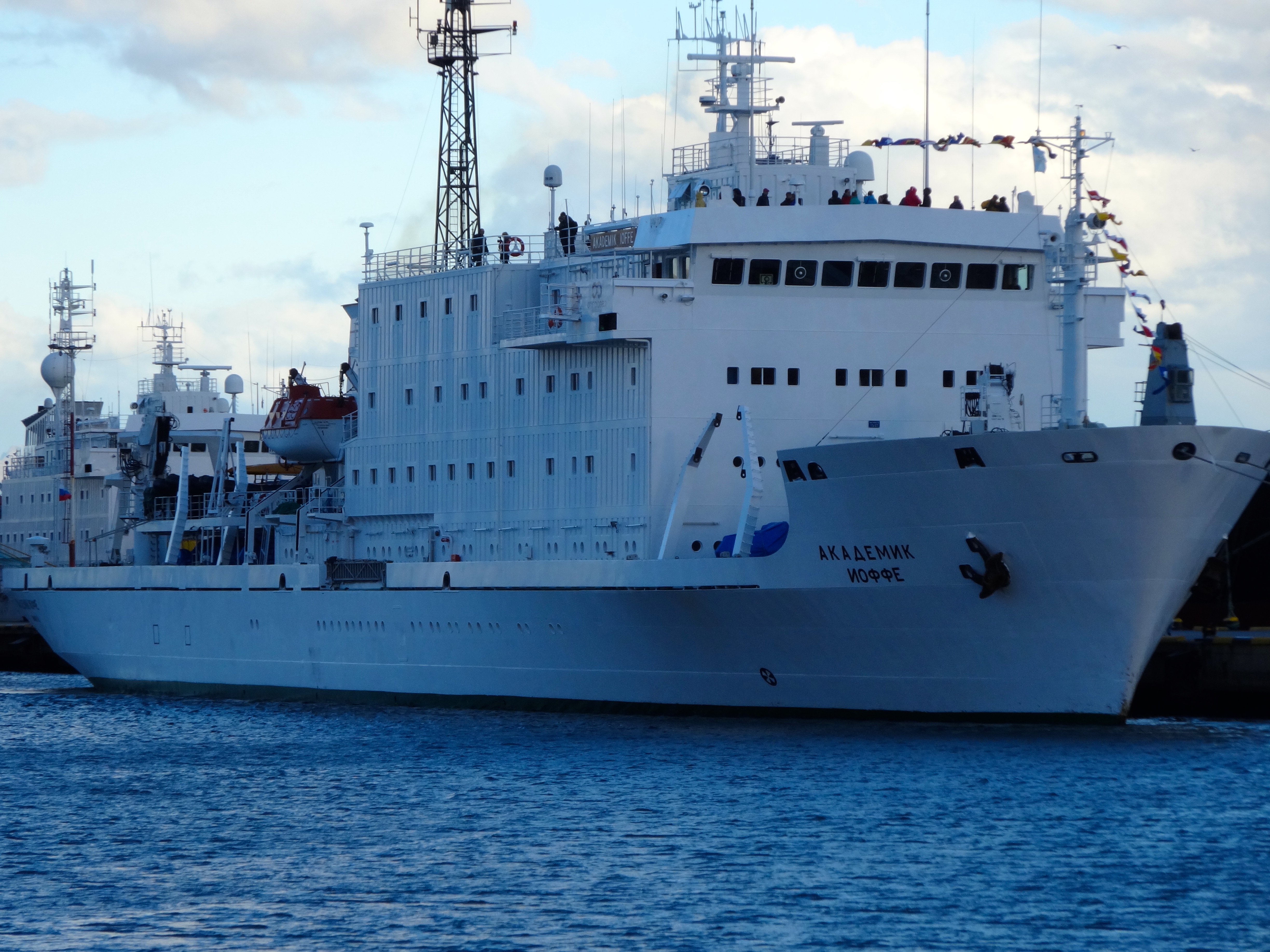
Nice steep slope for those horses on the assent. One mis-step by the horse and you are dead (or worse yet, wish that you were).This is the back of our ill-fated rider on the way up. Little did he know here that in about 20 minutes time he would be so very f*^ked. (Blogger’s note: I subsequently learned that he had to abort the rest of his trip and fly out to receive surgery. It would take him 3 days to get to his home in Honolulu. Interestingly, his wife stayed on. I’d divorce the bitch when she finally gets home.)A view from the topand another image from above.A view to the sea from horseback. This was my last shot from the saddle, as after the incident I thought it was better to hold on tight. Jews and horses rarely mix.Setting sun on the surrounding mountains.So I was able to enjoy my very first bunny rabbit here. Very impressive dish. They should serve it more in the U.S.of A. For all the hopping around this thing must have done it was surprisingly tender. Great mustard preparation too. It was called “Conejo Confitado.”Been away for so long now a had too stop into a local salon and get a tune up. My cameraman took this without my knowing.. The stylist was funny, even in spanish. No clue what he was saying.Harbor shot with the Andes in background.Russian expedition ship bound for Antartica which is about to embark. See all the happy passengers on top. This vessel looks like a total bucket and is likely captained by drunken Russians. You’d never find me on it.
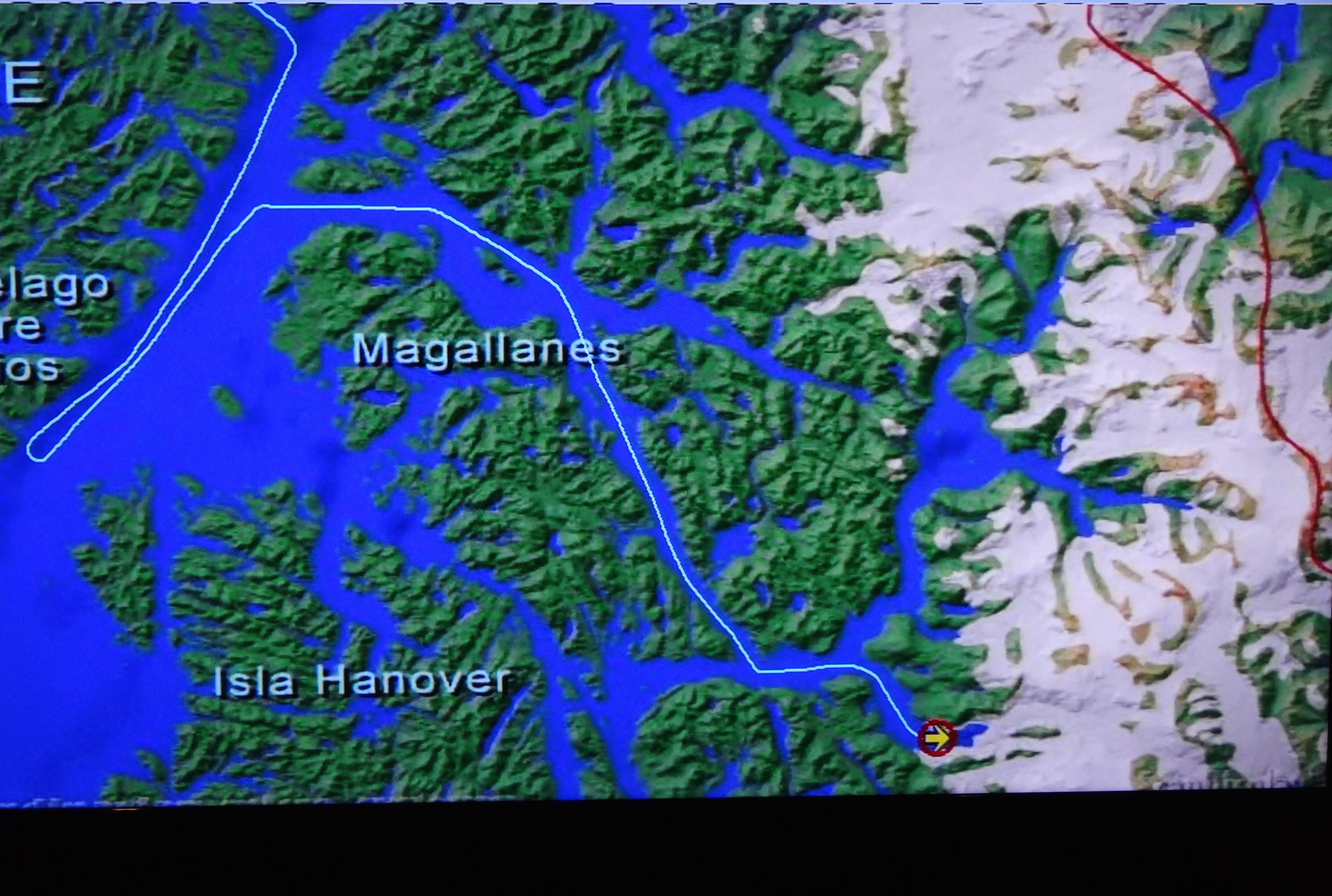
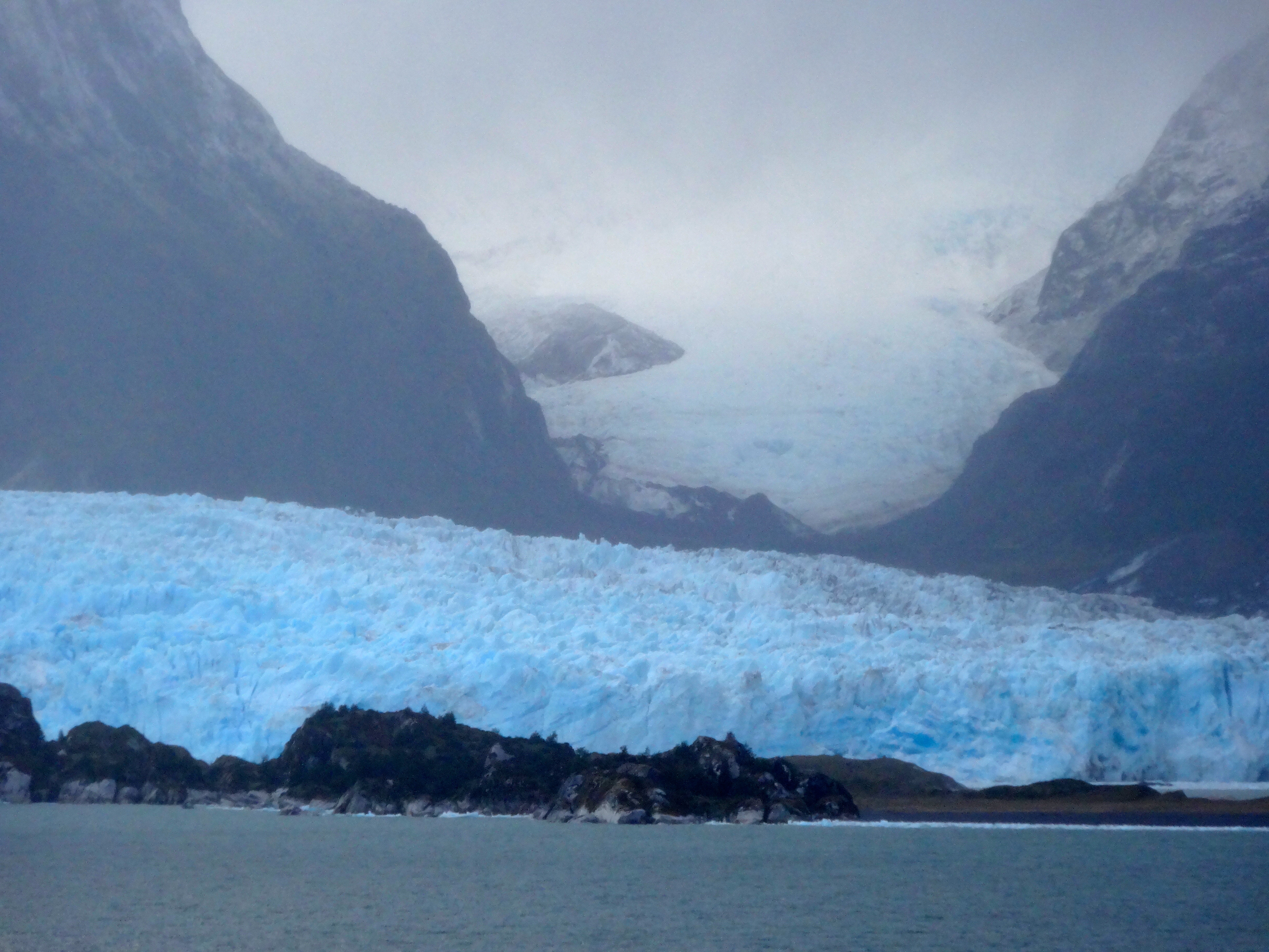
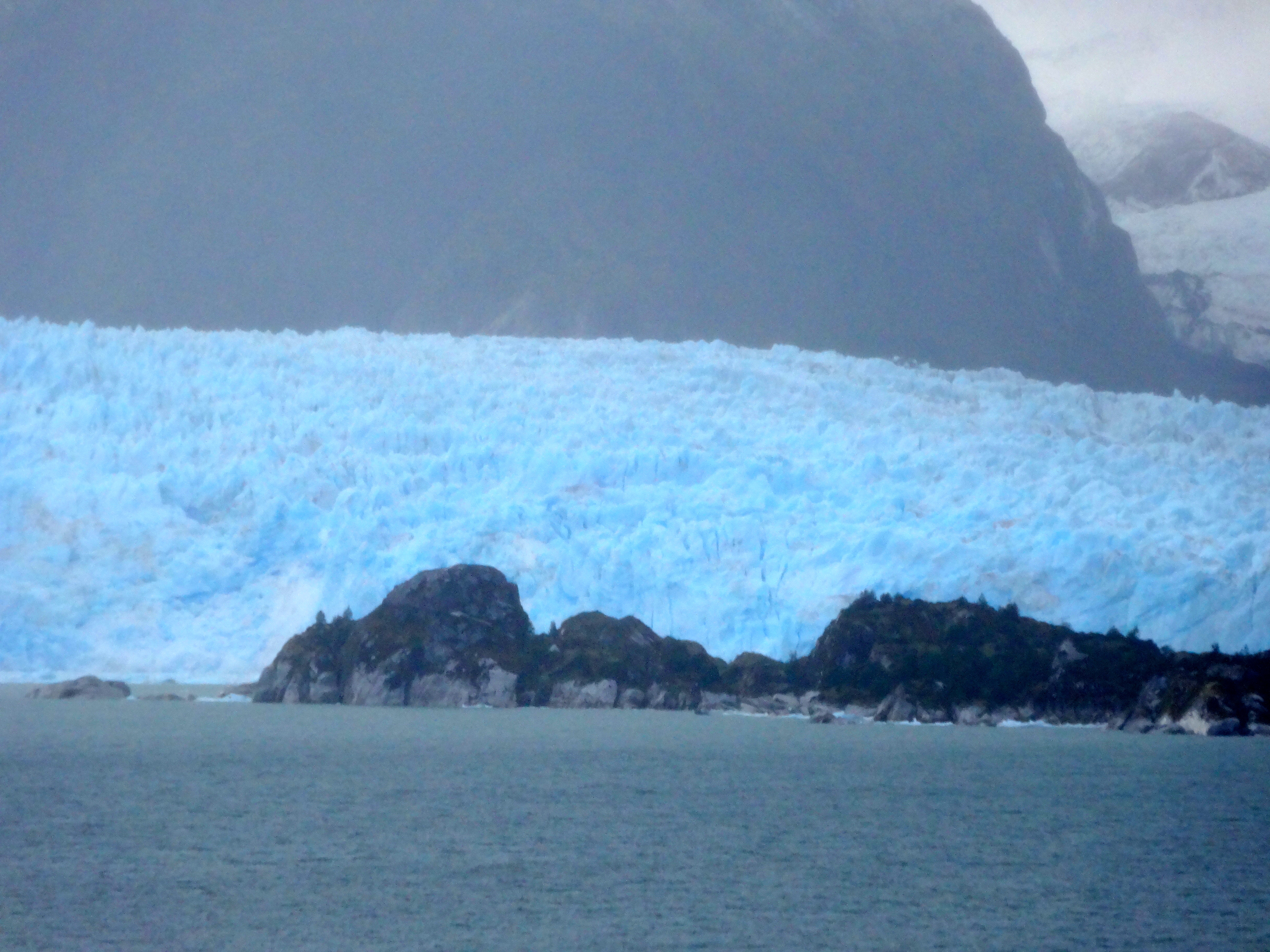
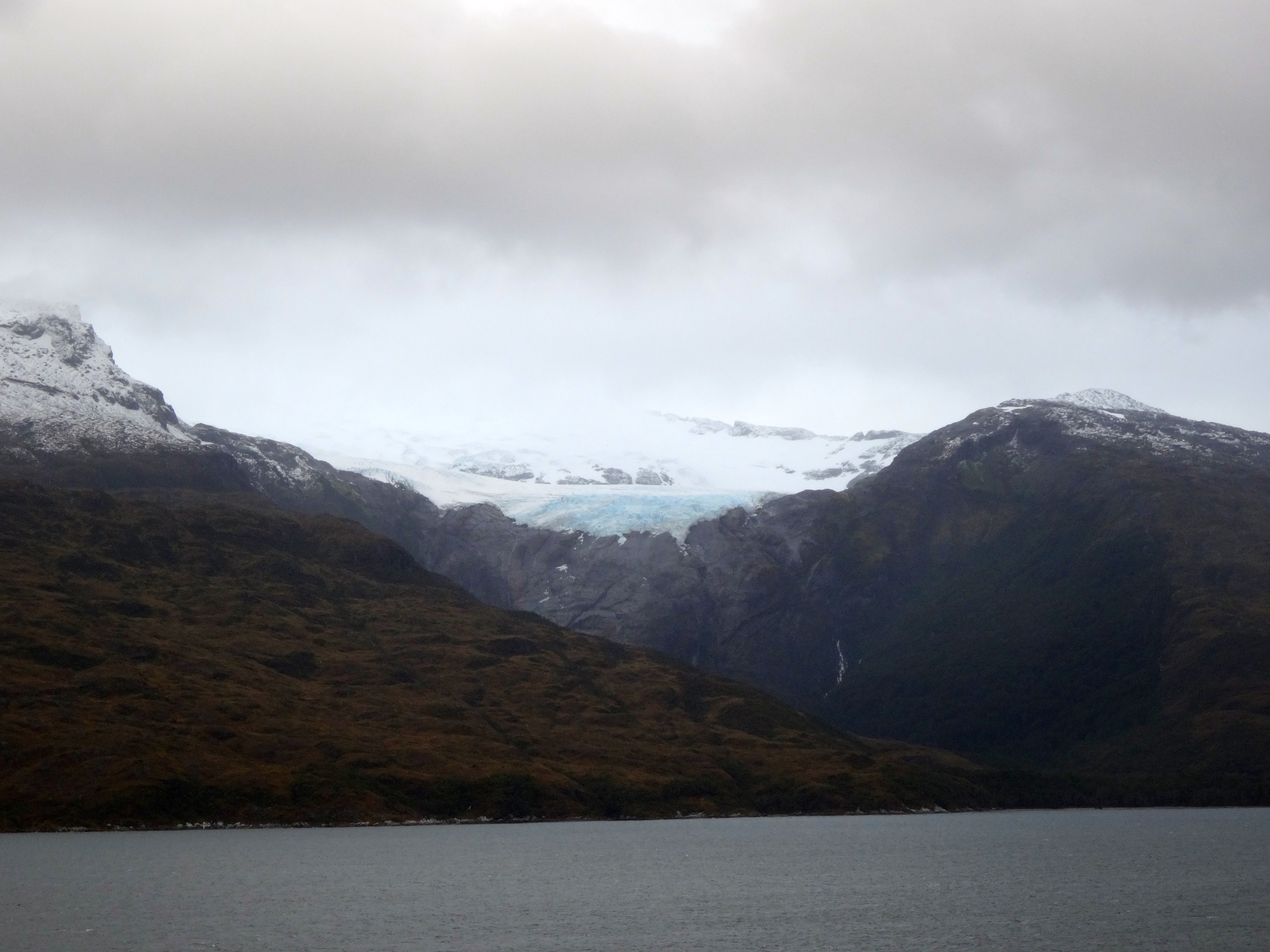
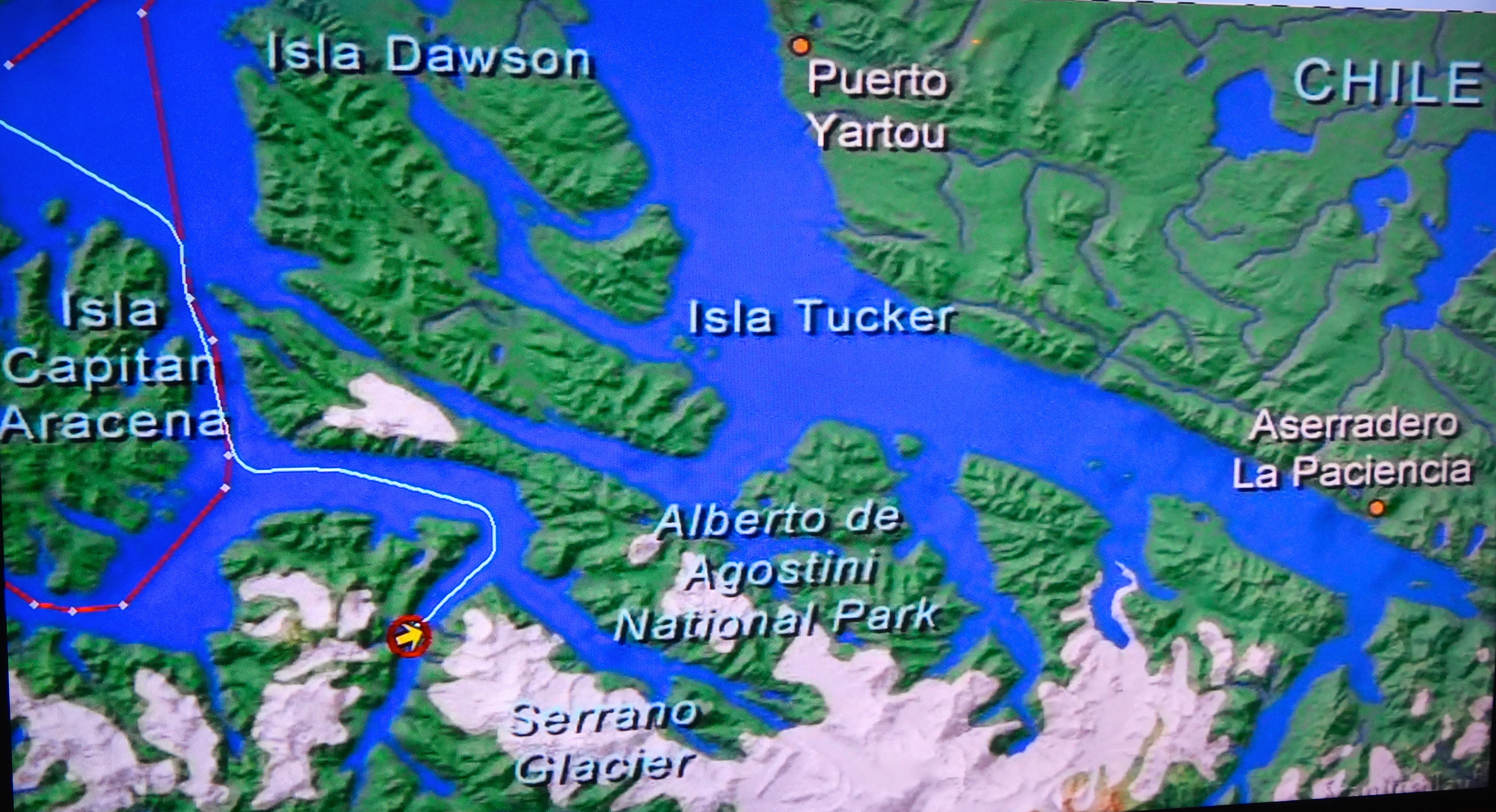
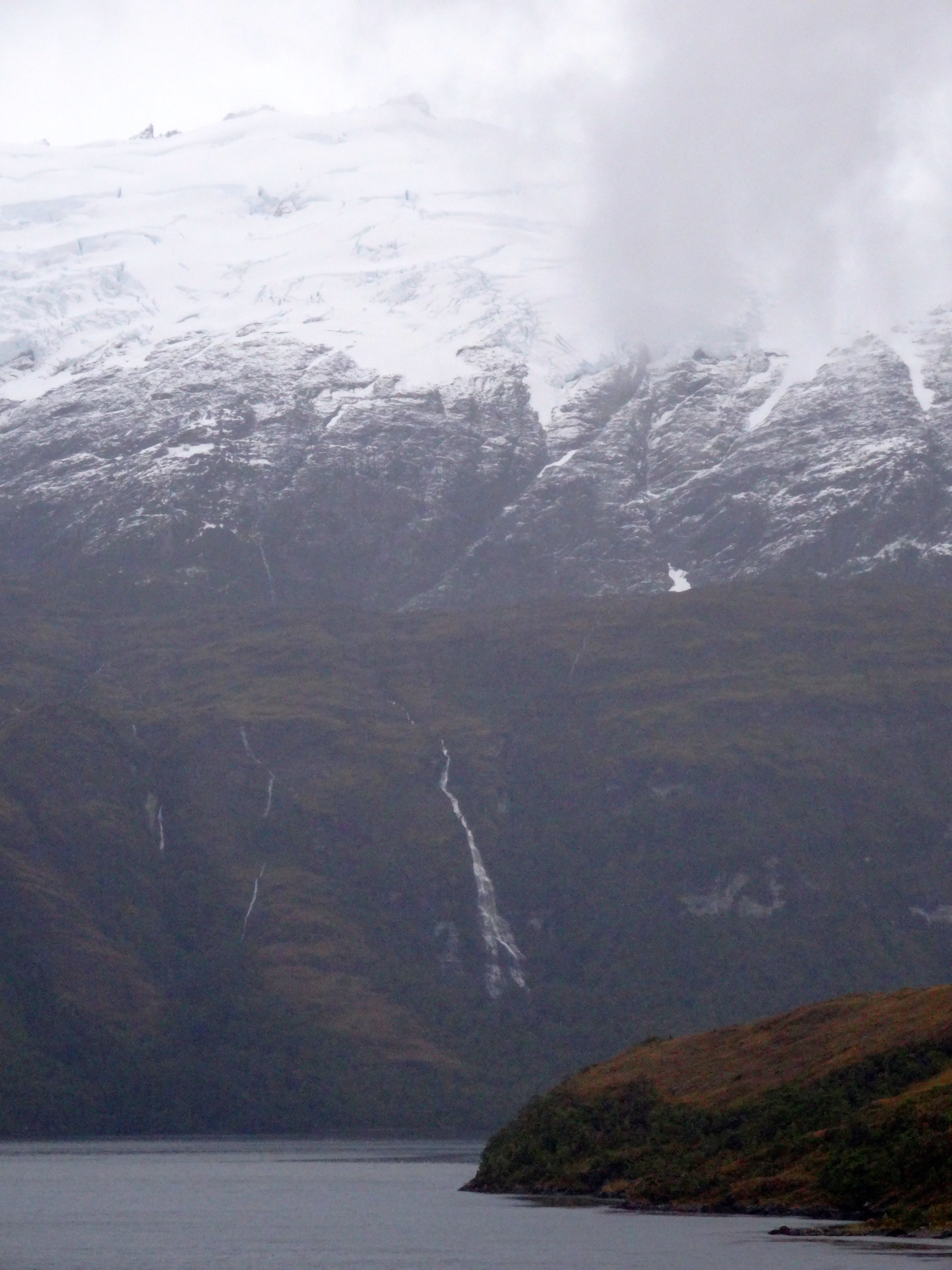
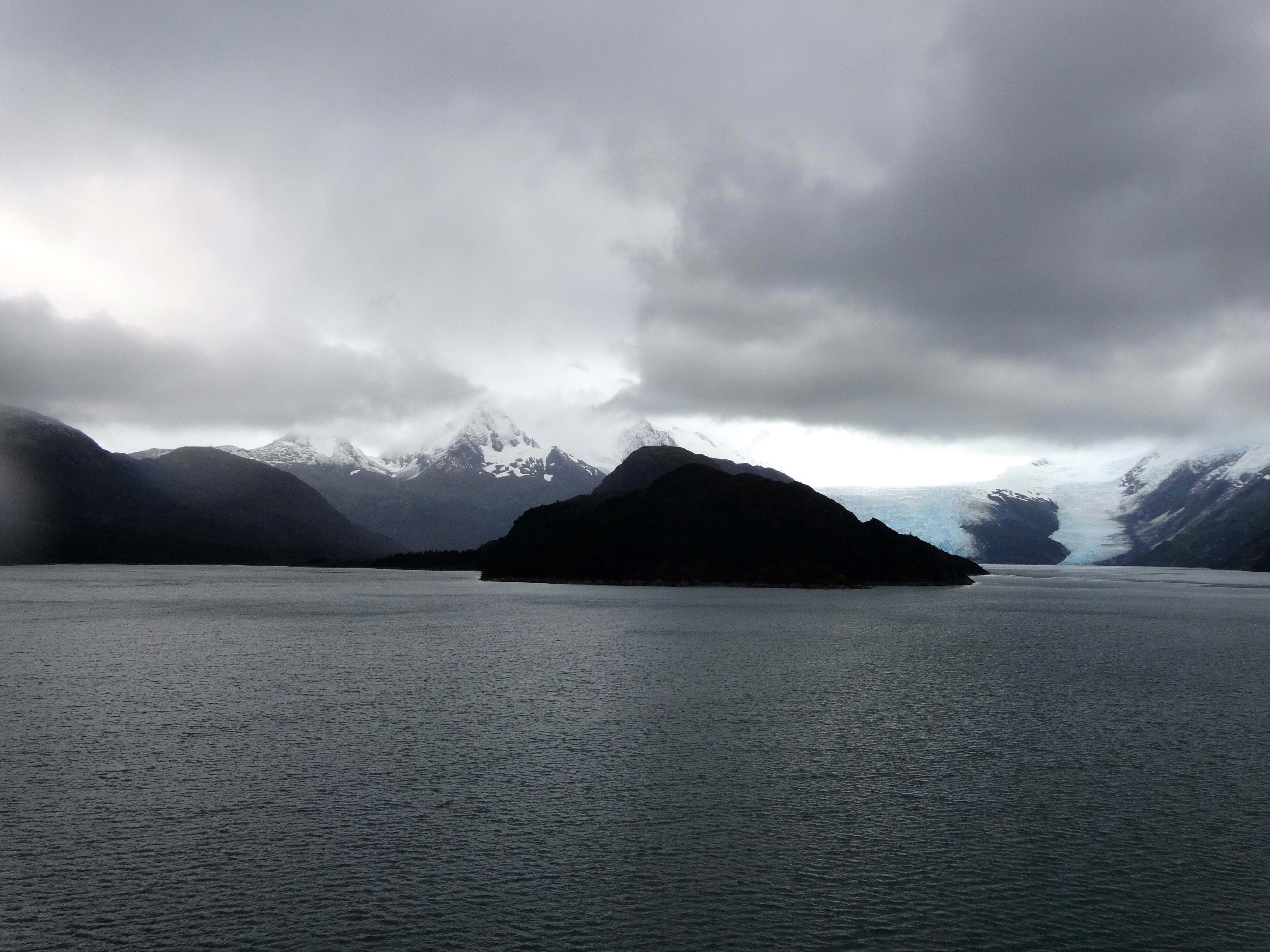
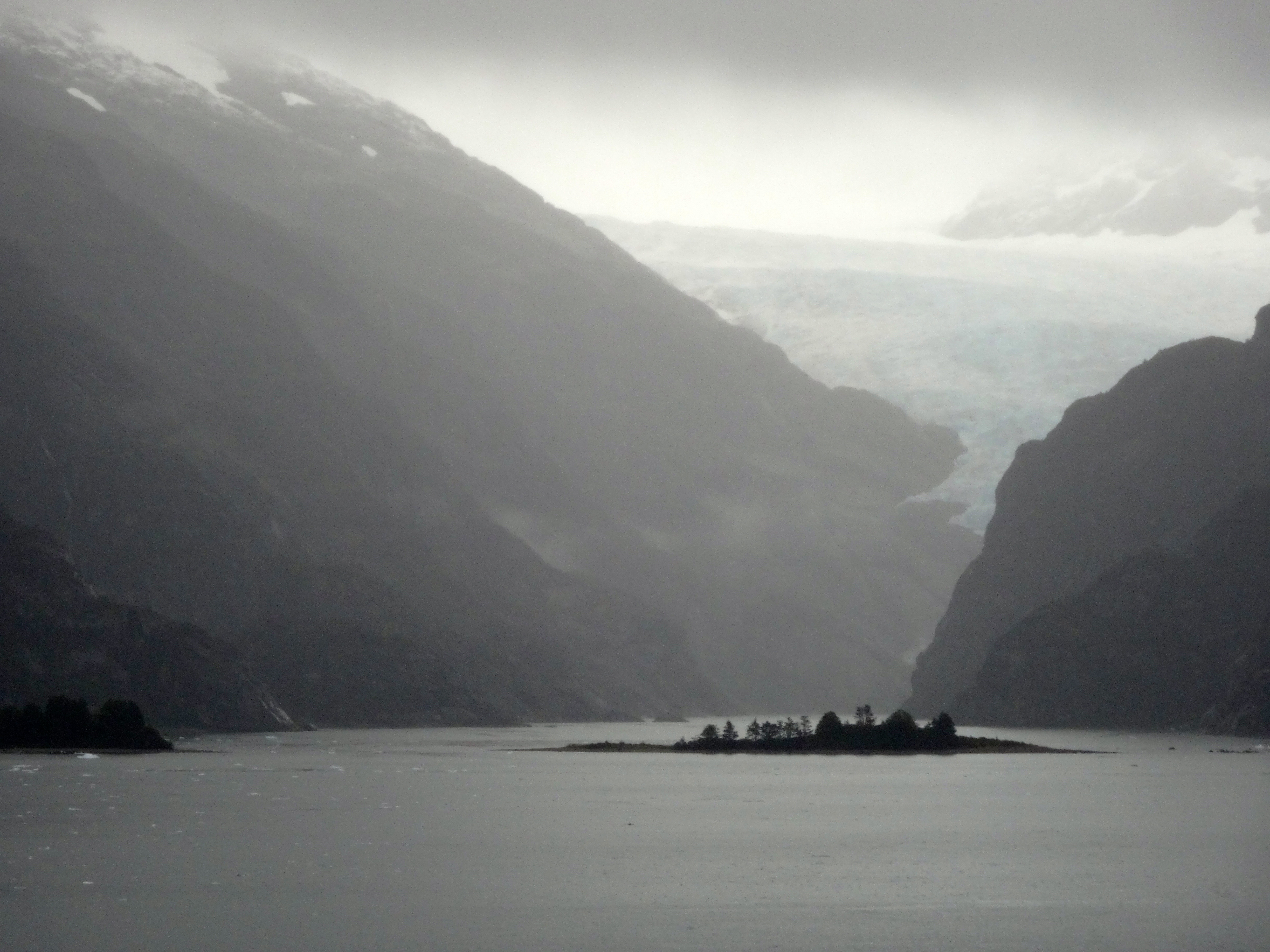
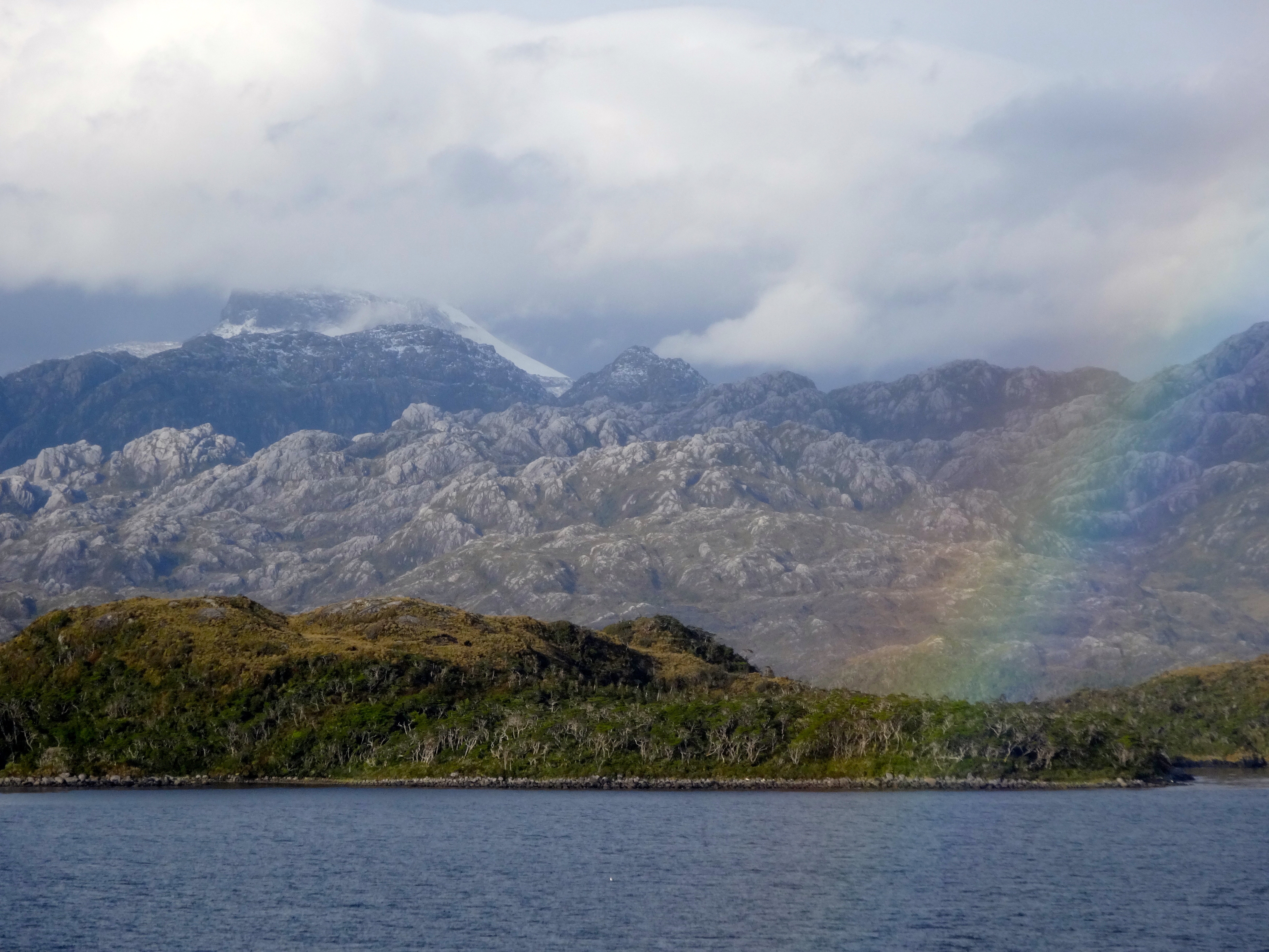
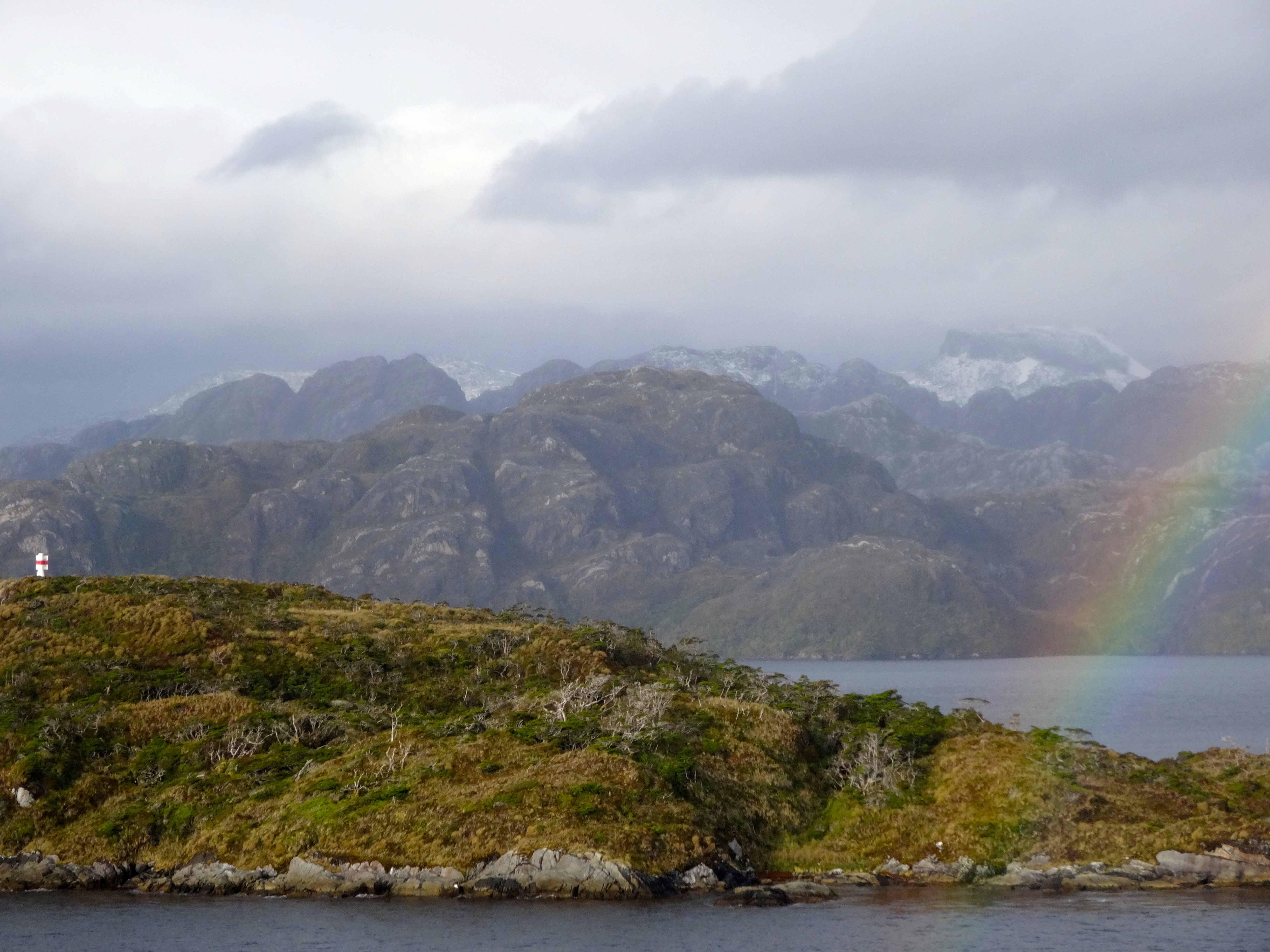
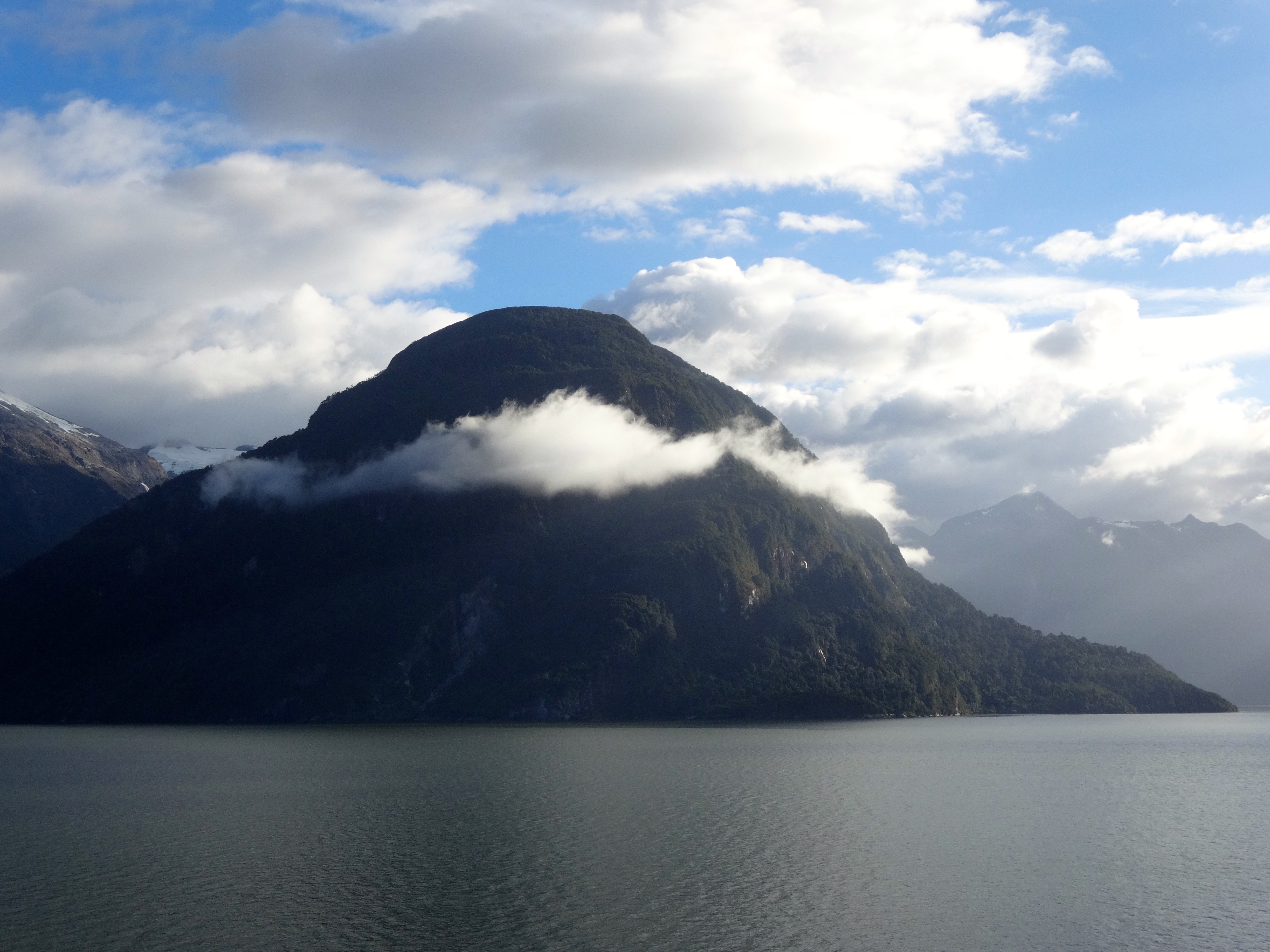
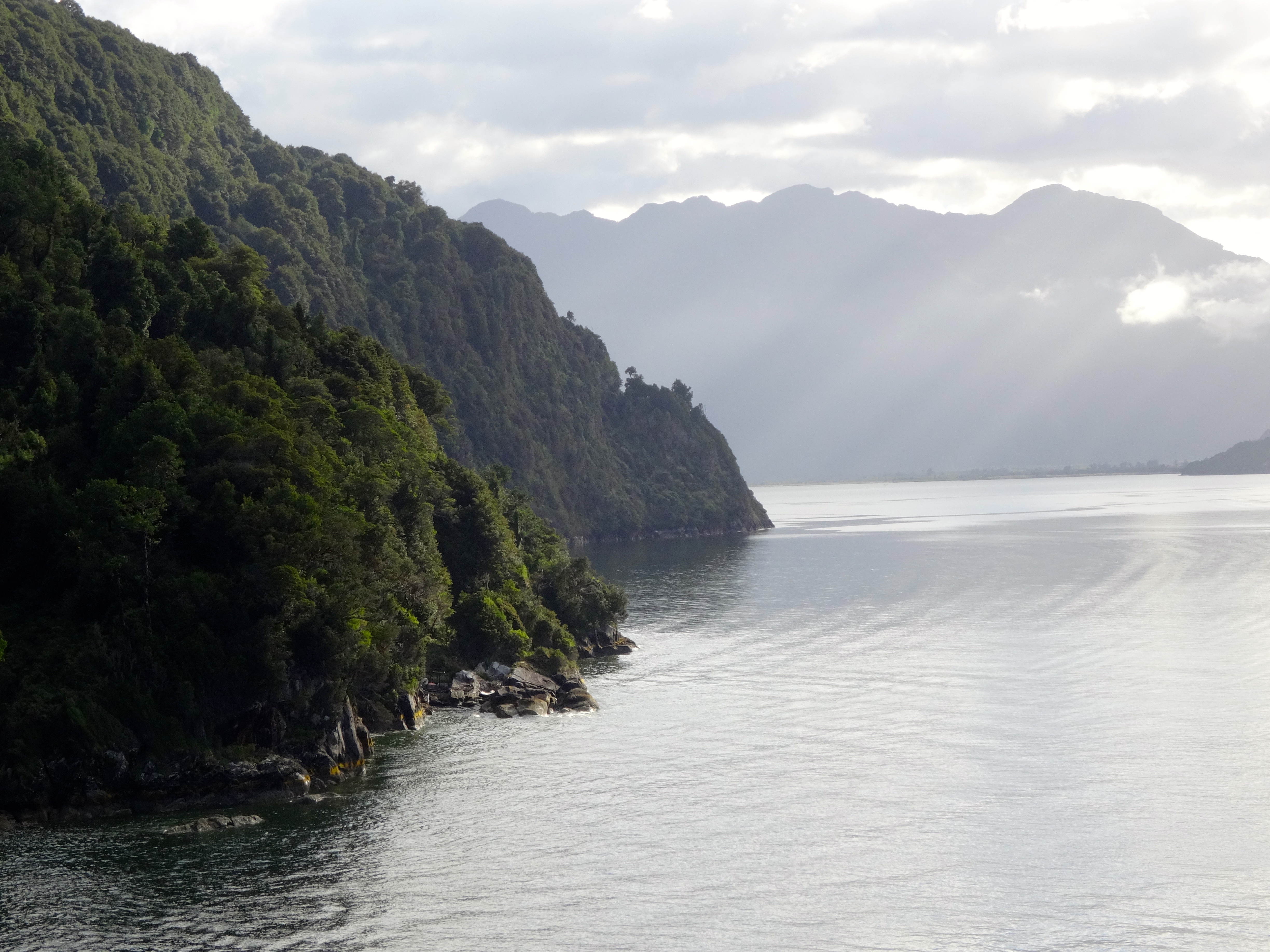
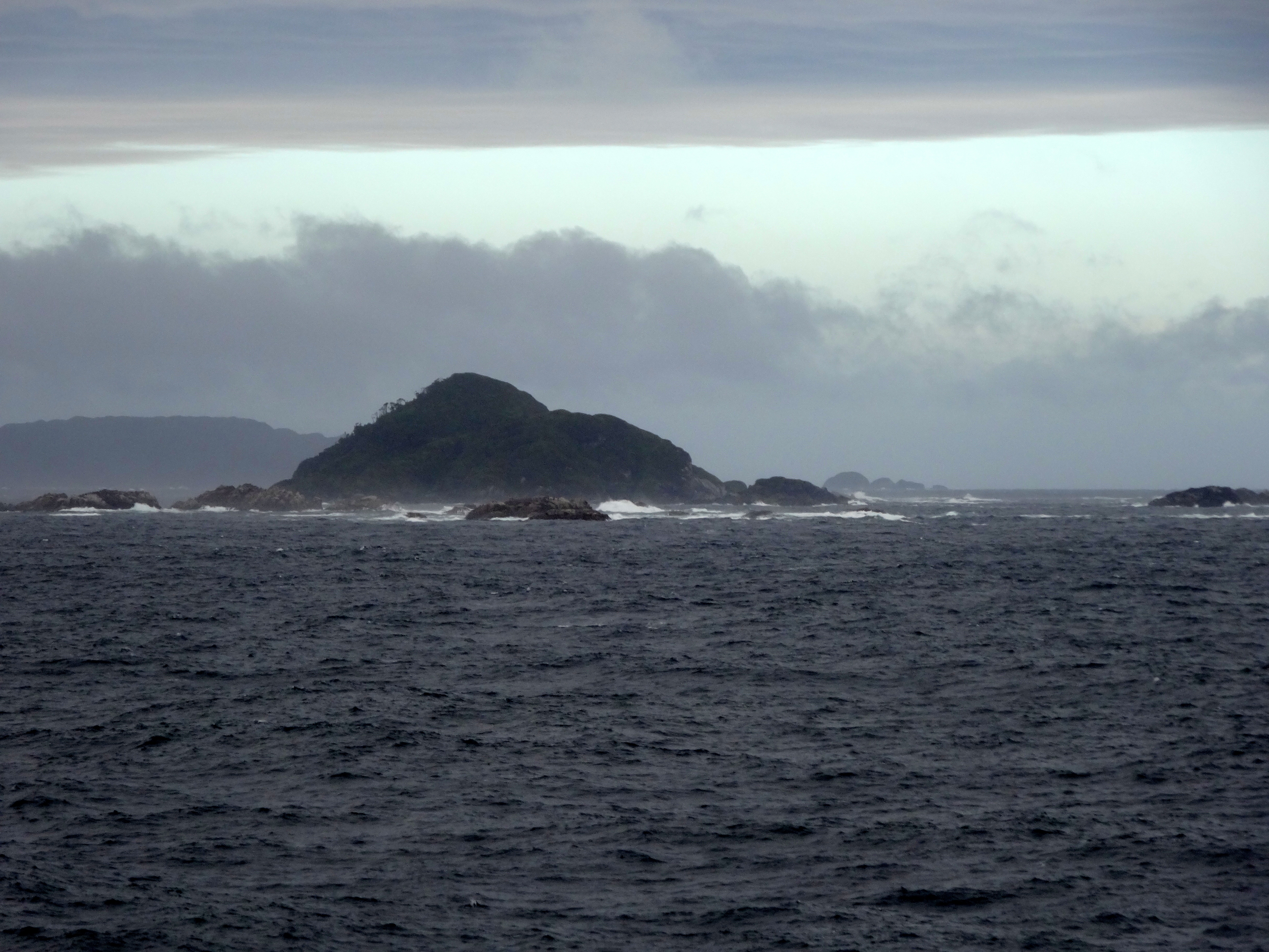
I have now spent more than four days in these fjords. Absolutely breathtaking views and scenery. It has been over two days without seeing any other human life or evidence thereof. Sandwiched between the tranquil valleys of the Lake District and the ice fields of Patagonia, Chile’s southern coast consists largely of heavily forested mountains, some of which rise dramatically (6,000 feet) from sea level. This area is assessable only by sea. The weather has been everything from great to really wet and always cold. Air temps have ranged from 35F to 45F. The glaciers are just spectacular. These glaciers have been dated to be approximately 30 million years old. Glacial ice is the largest reservoir of freshwater on earth. The last glacial period lasted 15,000 years. Interestingly, computer models are able to forecast that the next ice age will occur in 50,000 years. The major caveat in this forecast is the effects of global climate change.
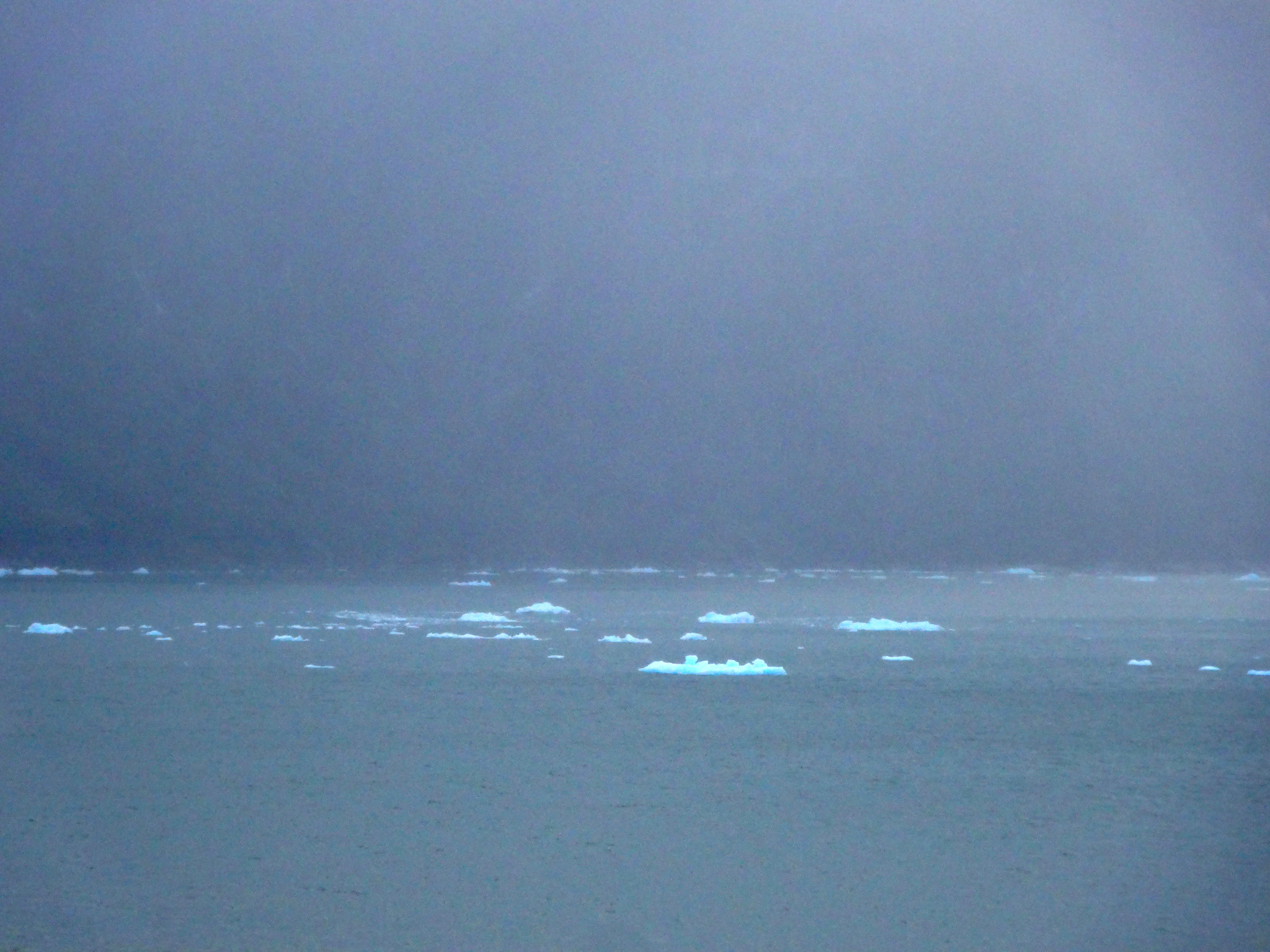
View from space of my current position in the Chilean Fjords.Closer image pinpointing my first position where the glacier images below were taken.This is a perfect example of a retreating glacier. Glaciers retreat when their terminus does not extend downvalley as it previously did. Glaciers retreat when their ice melts or ablates more quickly than snowfall can accumulate at higher elevations and form new glacial ice.A closer image of the very same glacier. This photo has not been retouched by software. The blue hue is similar to any large body of water appearing blue. All the colors of the spectrum (excepting blue) are absorbed and only the blue is refracted. Making this more pronounced is that because of the immense pressure to this ice during formation, most of the air is squeezed out. This air is what gives normal ice its white color.A perfect example of a hanging glacier. As all glacial ice, because of the immense pressure under which it is formed, it is much more dense than regular ice.Floating glacial ice which has calved from the retreating glaciers. Notice the distinct blue hue.My final location of the glaciers pictured.One of hundreds of waterfalls.Just a panoramic shot.
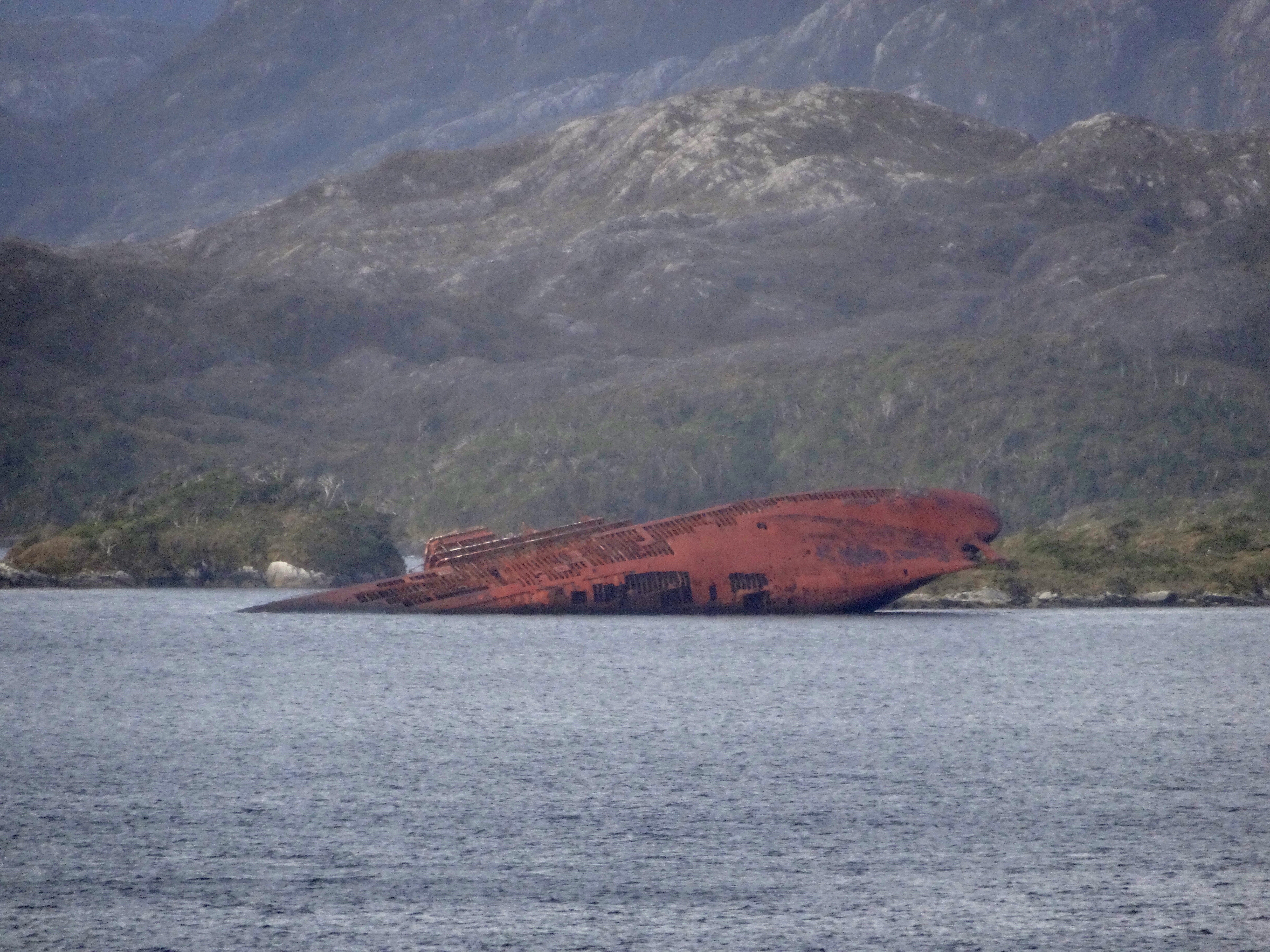
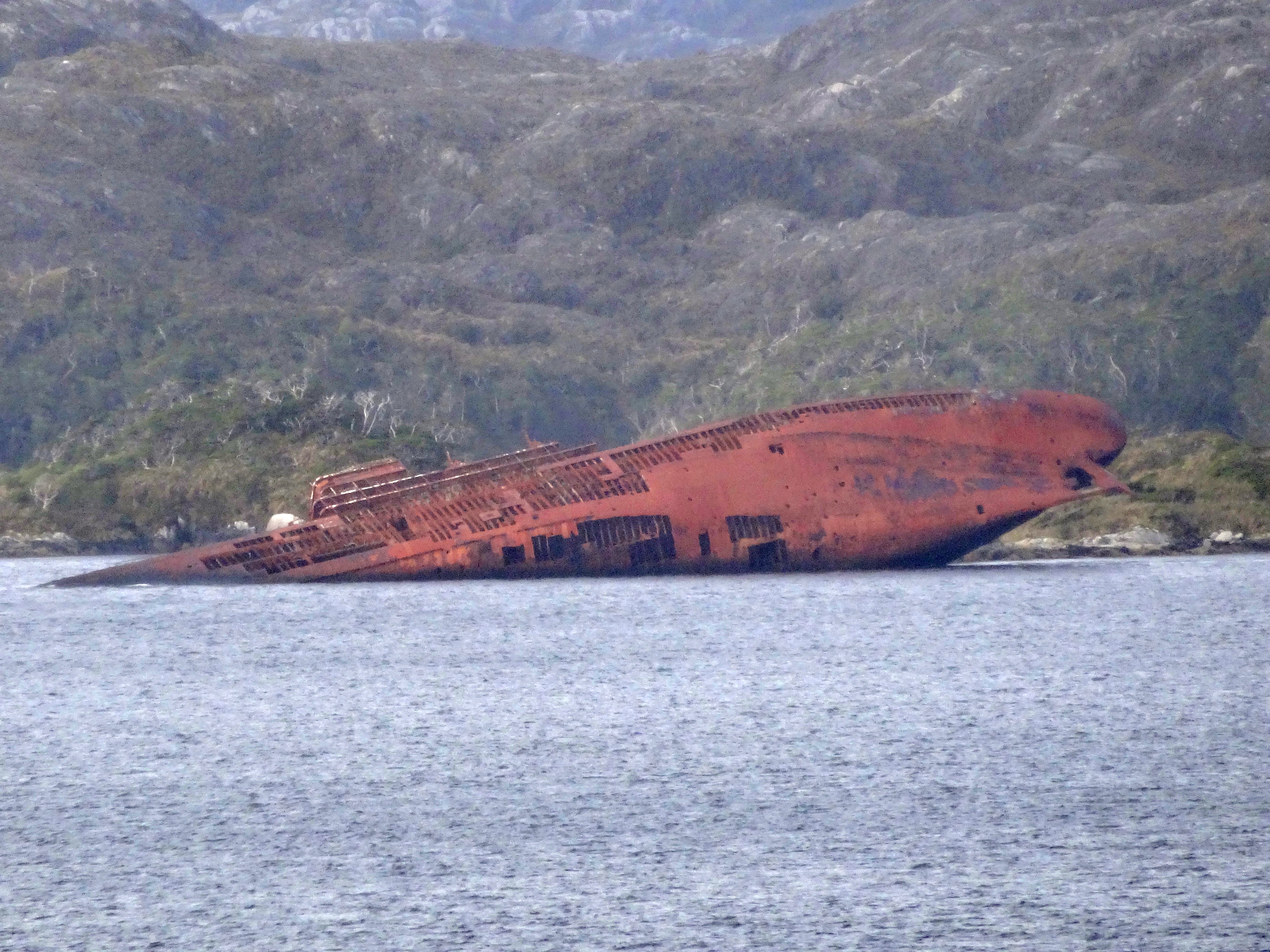
In 1961 this merchant vessel ran into some bad luck, not to mention an underwater rock formation. Thirty-five souls went down or drowned in this unfortunate event. If you look closely you are able to see its hull gradually being taken back to the sea. There have many such incidents in the fjords over the years. Just thought it was interesting.
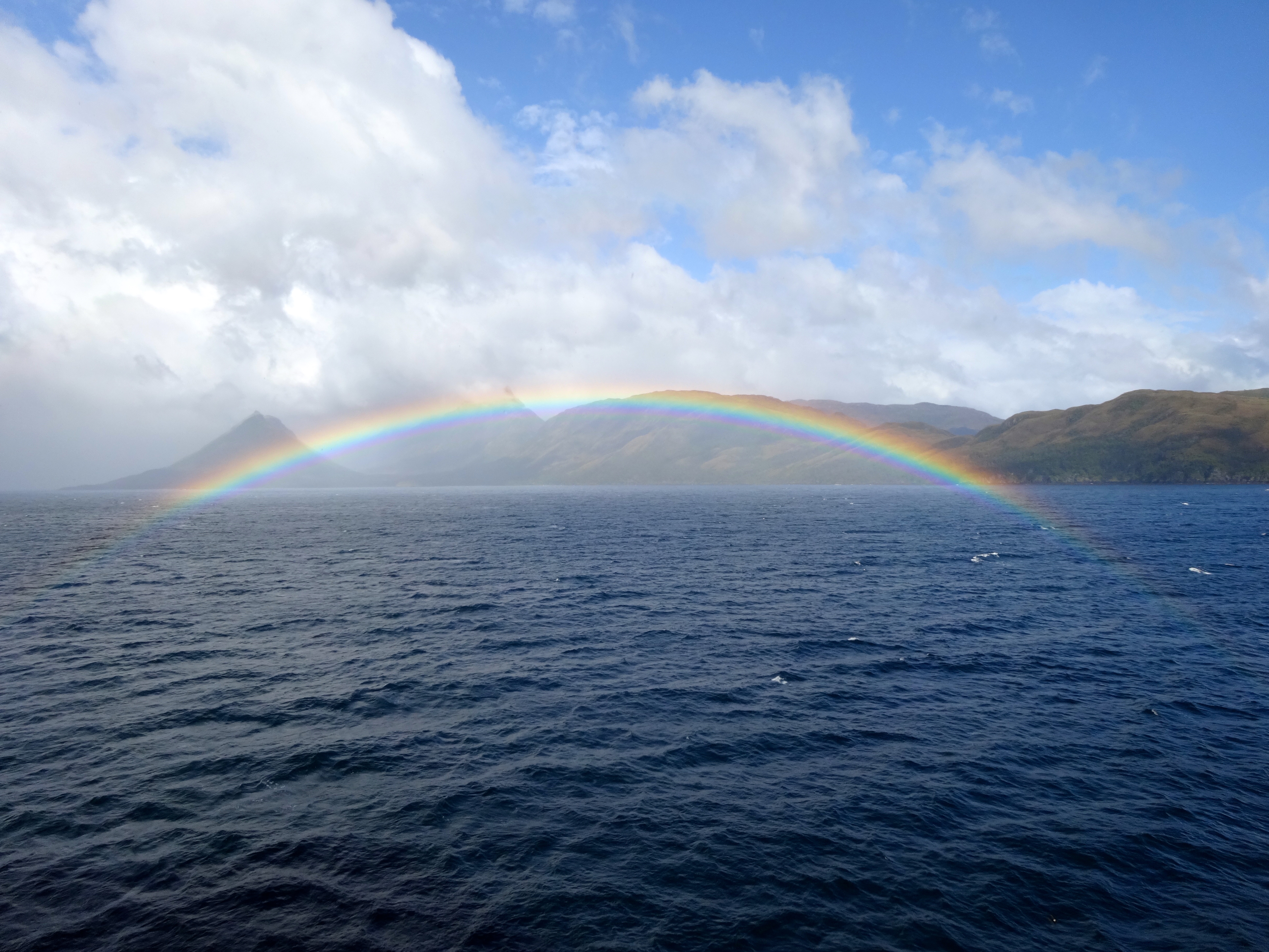
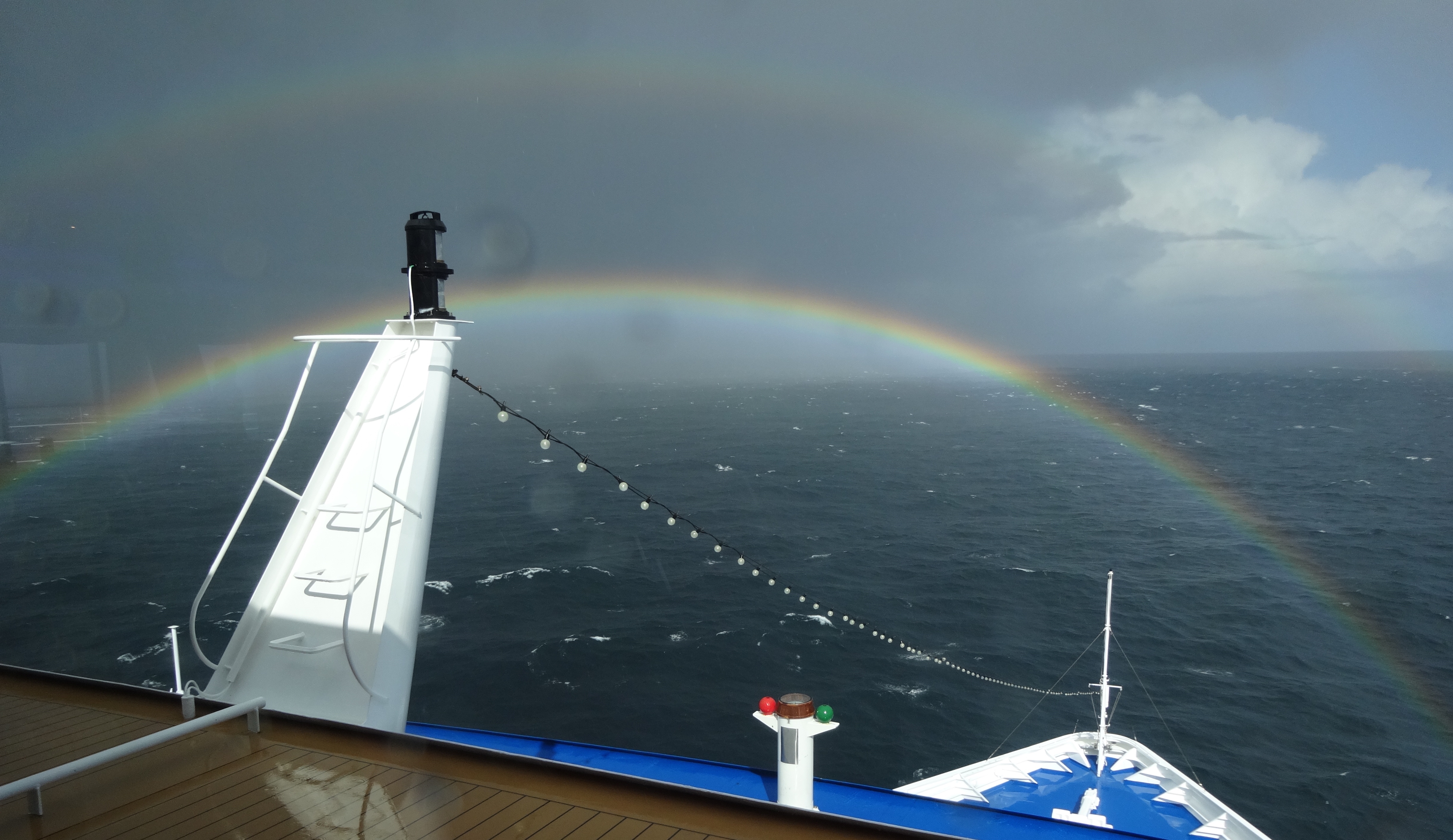
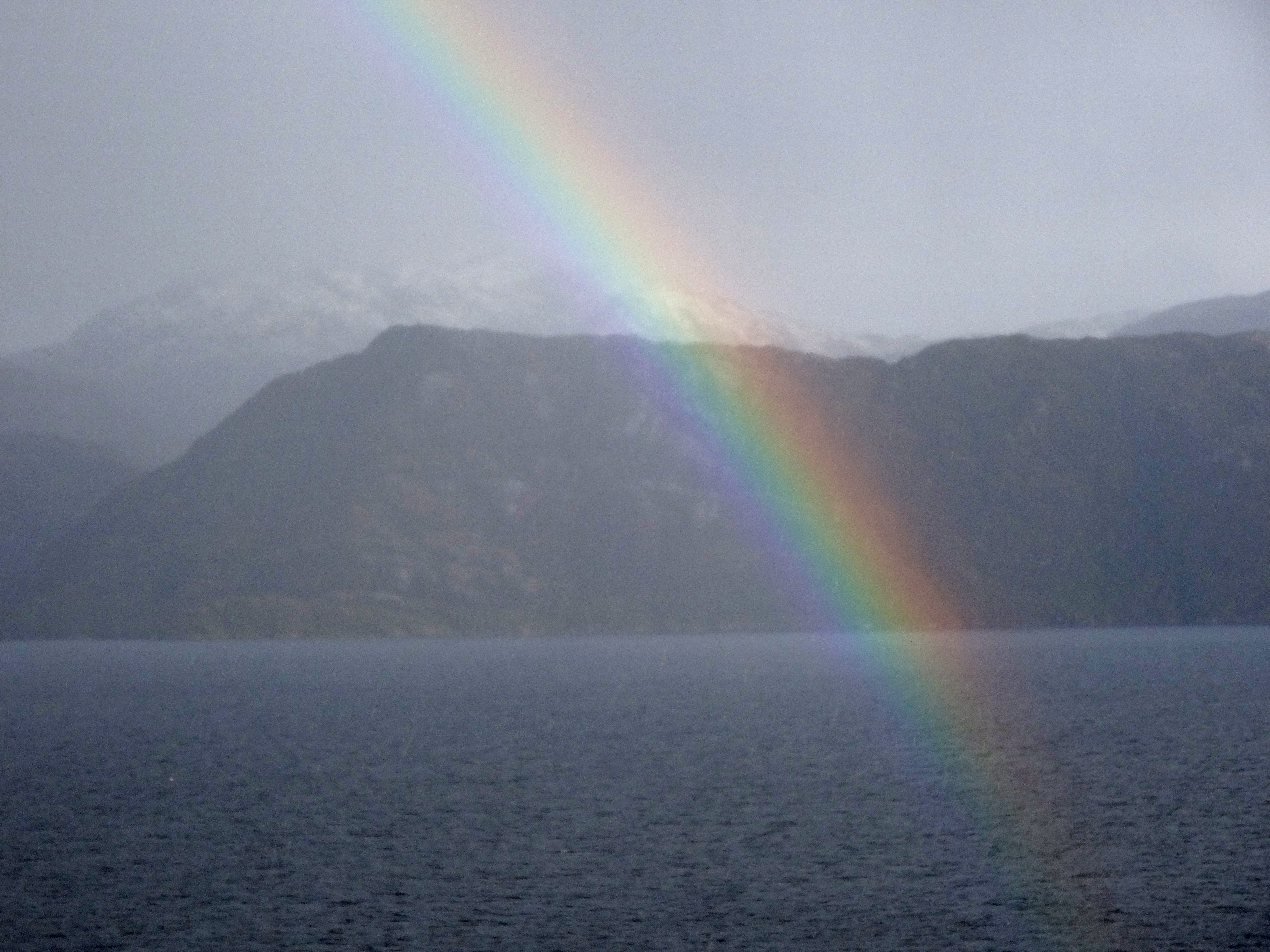
The hull of the ill fated vessel.A closer shotLots of rainbow encounters along the way.Another view.A different rainbow encounter.Off my bow, these things seem to be everywhere.
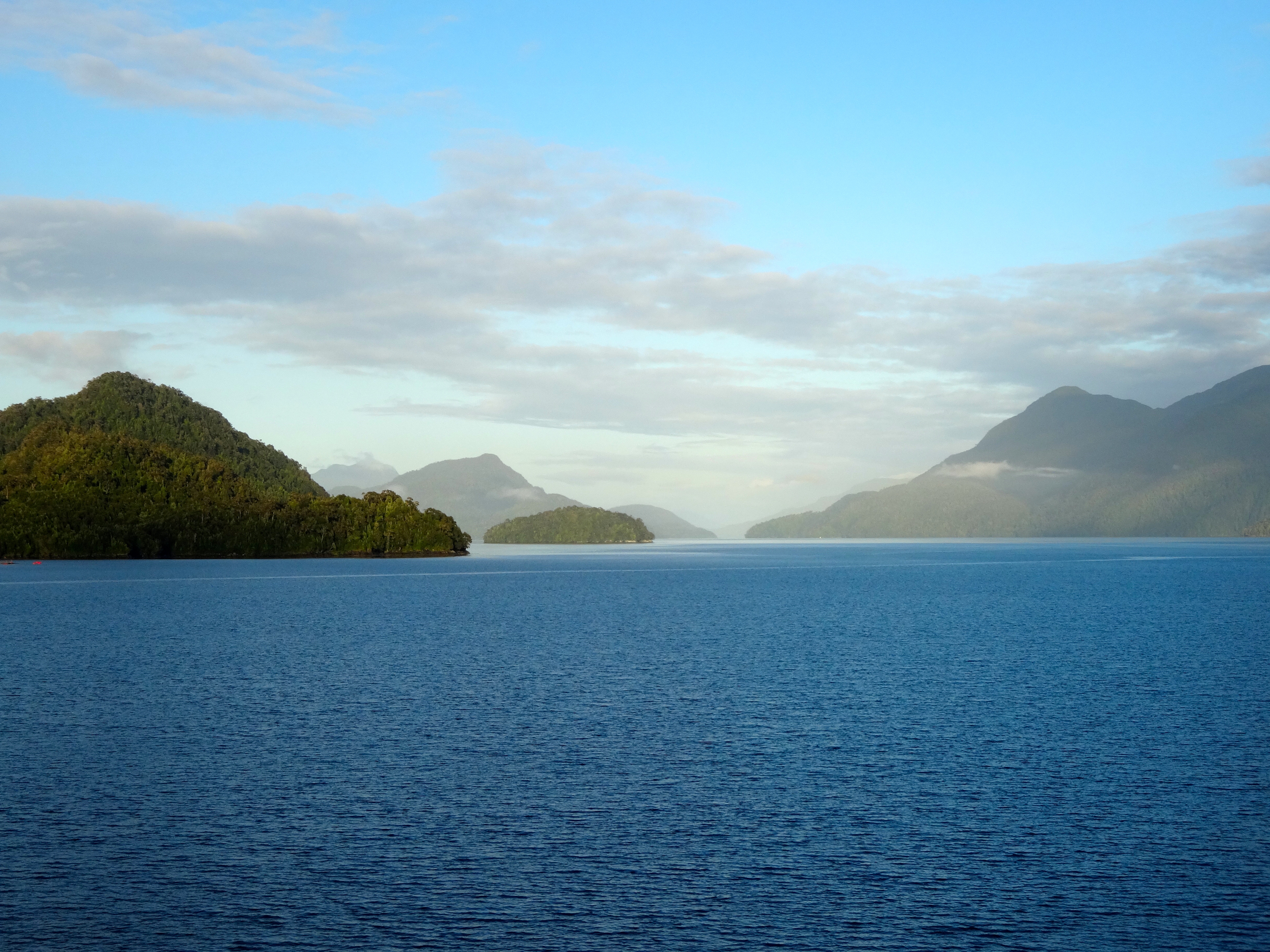
This morning I find myself in the Chilean Fjords and will be for several more days. These places are only accessible from the sea. There are no airports, nor any roadways connecting to the mainland. Only a very few of the fjords are inhabited. Moreover, there is very little wildlife. The only wildlife found here either swims or flies.
The tiny port village is called Chacabuco and is ringed by snowcapped mountains. Being this at an extreme southern latitude on the planet, snow falls almost all year long. You’ll notice the fresh snow in many of the pics attached.
Patagonian ice sheets plunge to the sea and that area provided me the opportunity to see the Giant Condor (although not lucky enough to get a pic). This bird is endangered.
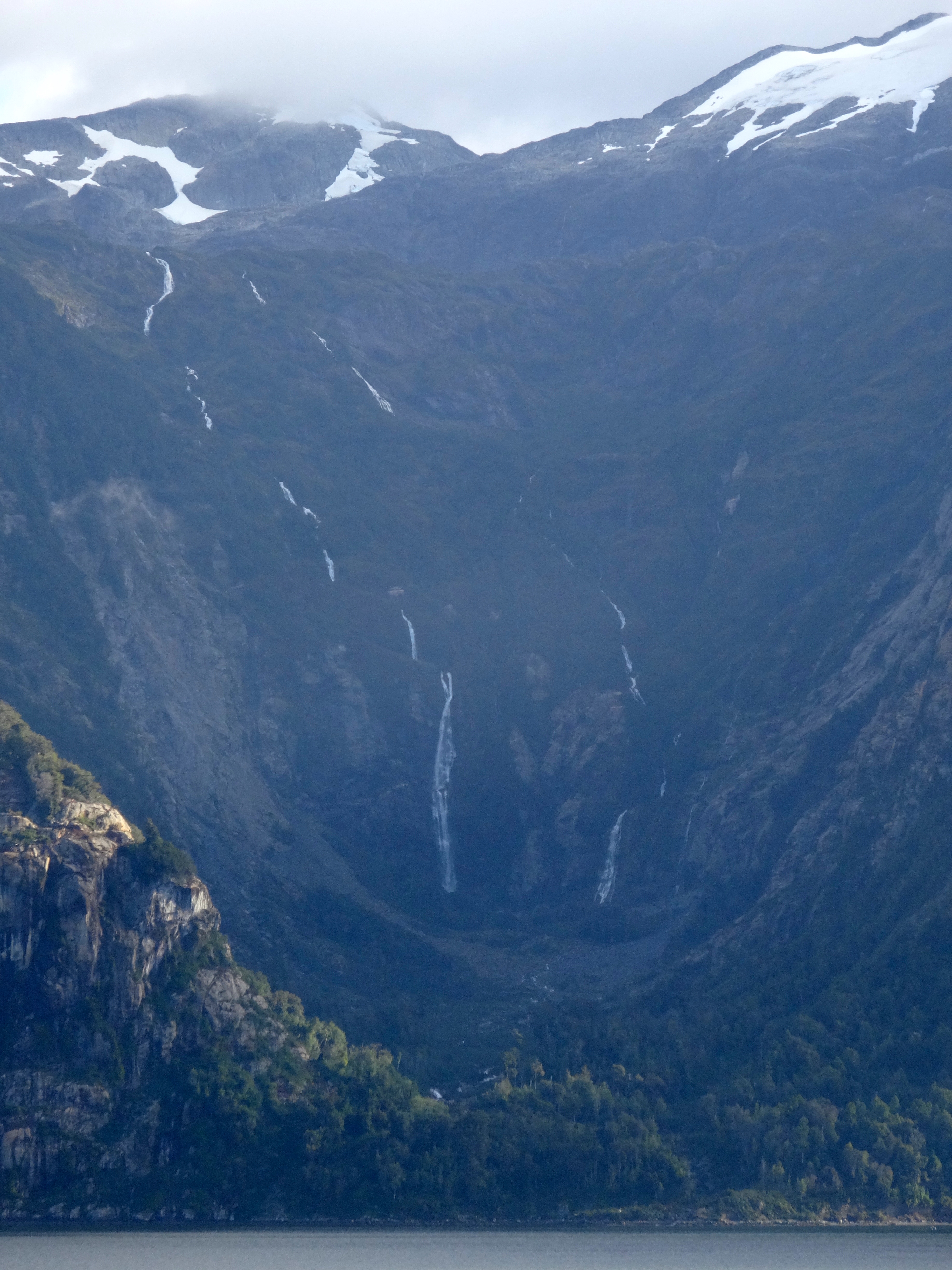
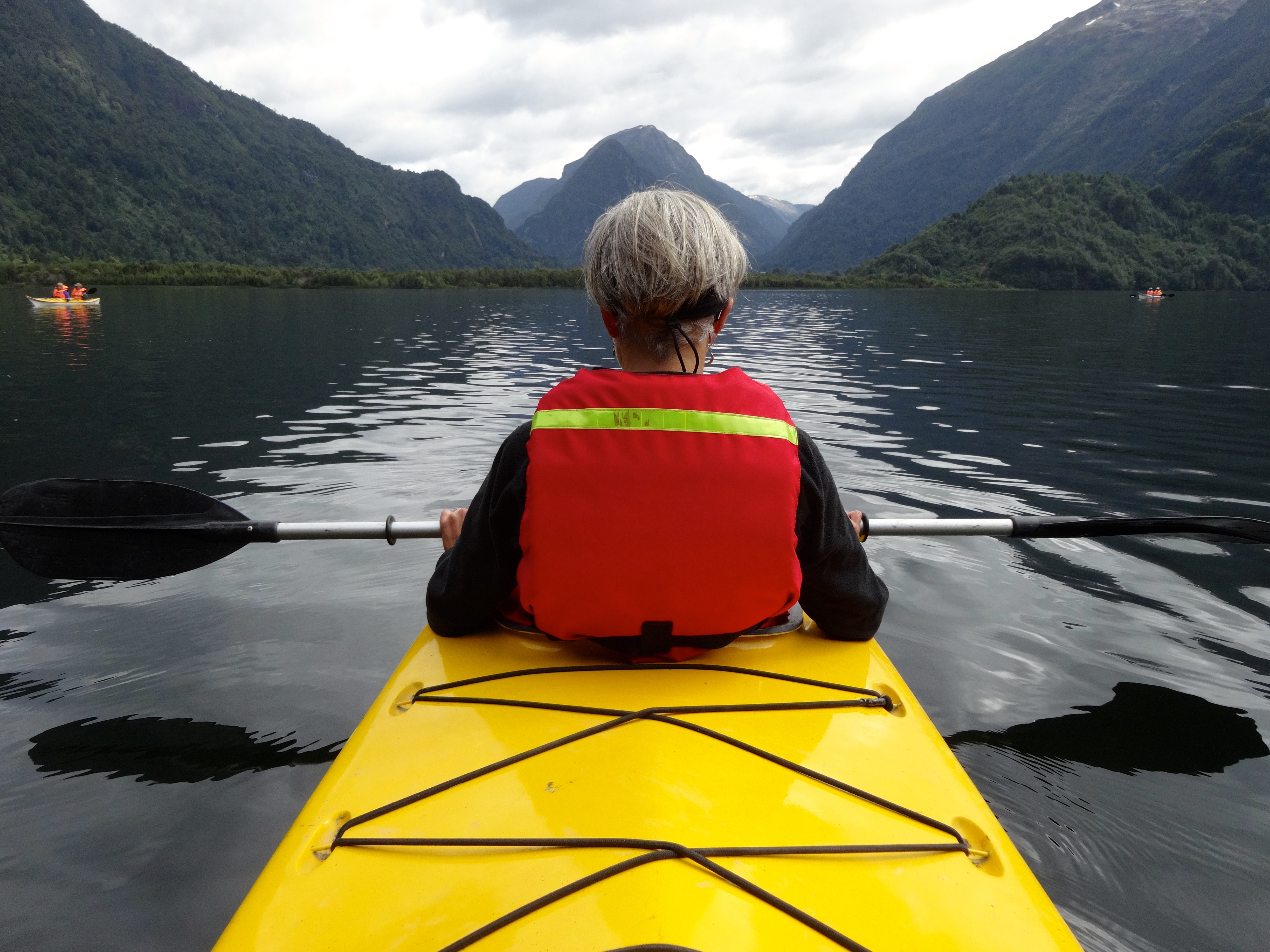
Early morning light and low hanging clouds cling to this fjord.This waterfall is at least 4000-5000 feet. It begins at the snow on top and reaches all the way to the sea.Another early morning view.Midday clouds provide for some muted lighting.Taking a bread on the riverbank while kayaking.Another shot from my kayak and one of the riverbanks.In my kayak with a view to the lake I crossed to enter the river. The kayaker pictured here shall remain unnamed at their request.Evening light in the fjords.Near sunset in the fjords. Notice the calm of these waters here.
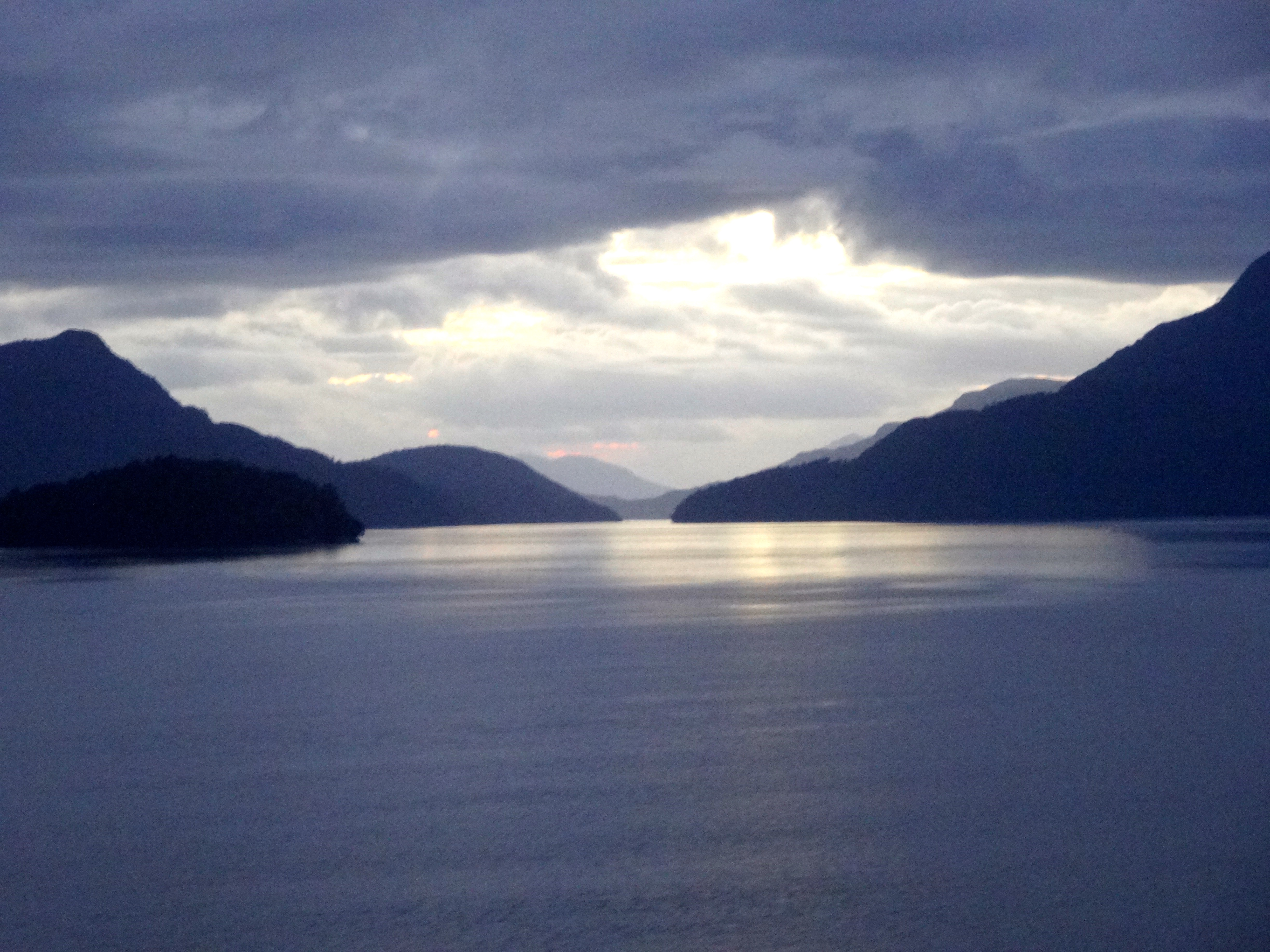
Gathering swells as I am nearing my entry to the open sea. Only 4 hours of high swells until I am able to again seek the protection of the fjords. The swells reached 18 -20 feet that night.
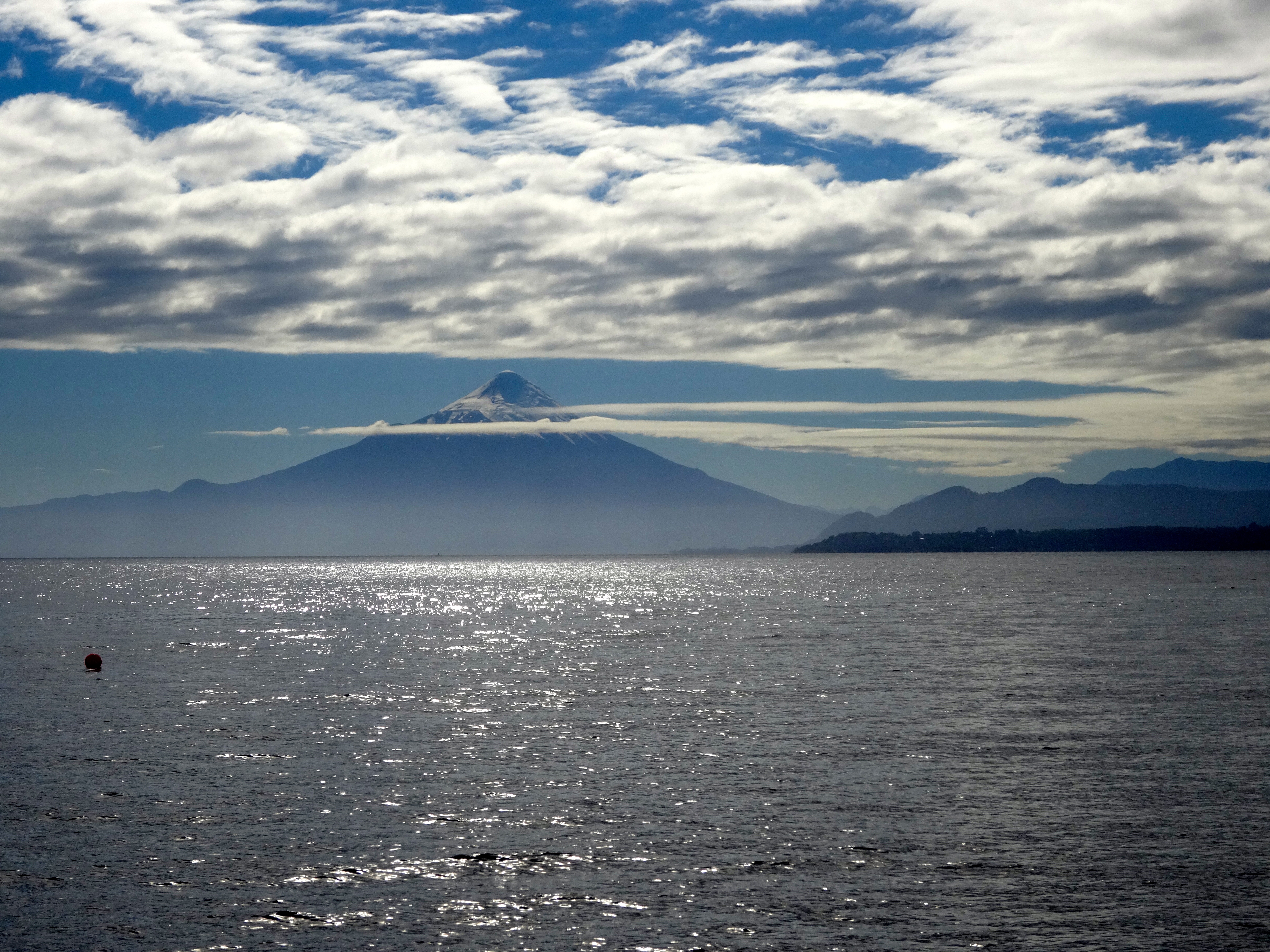
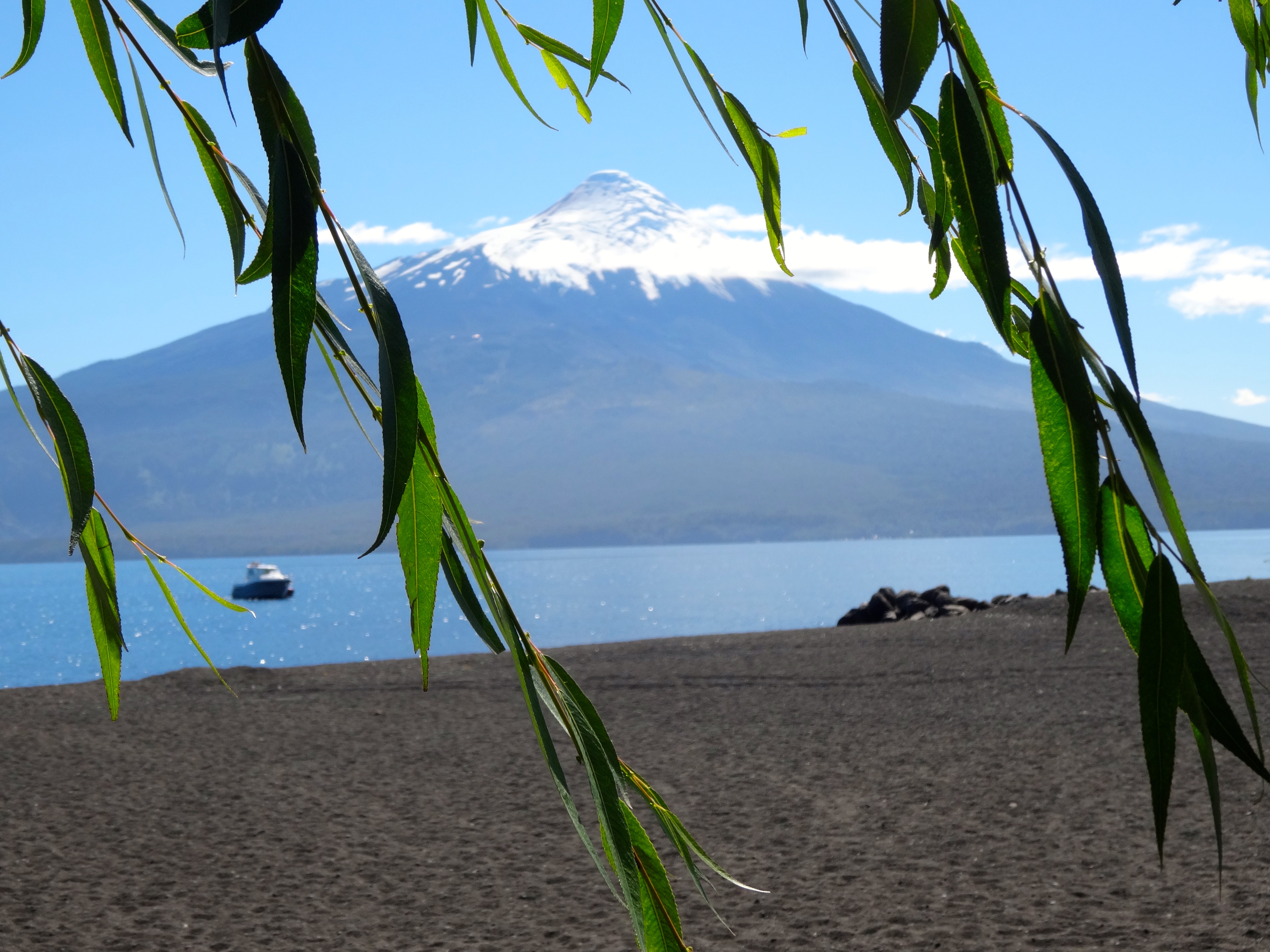
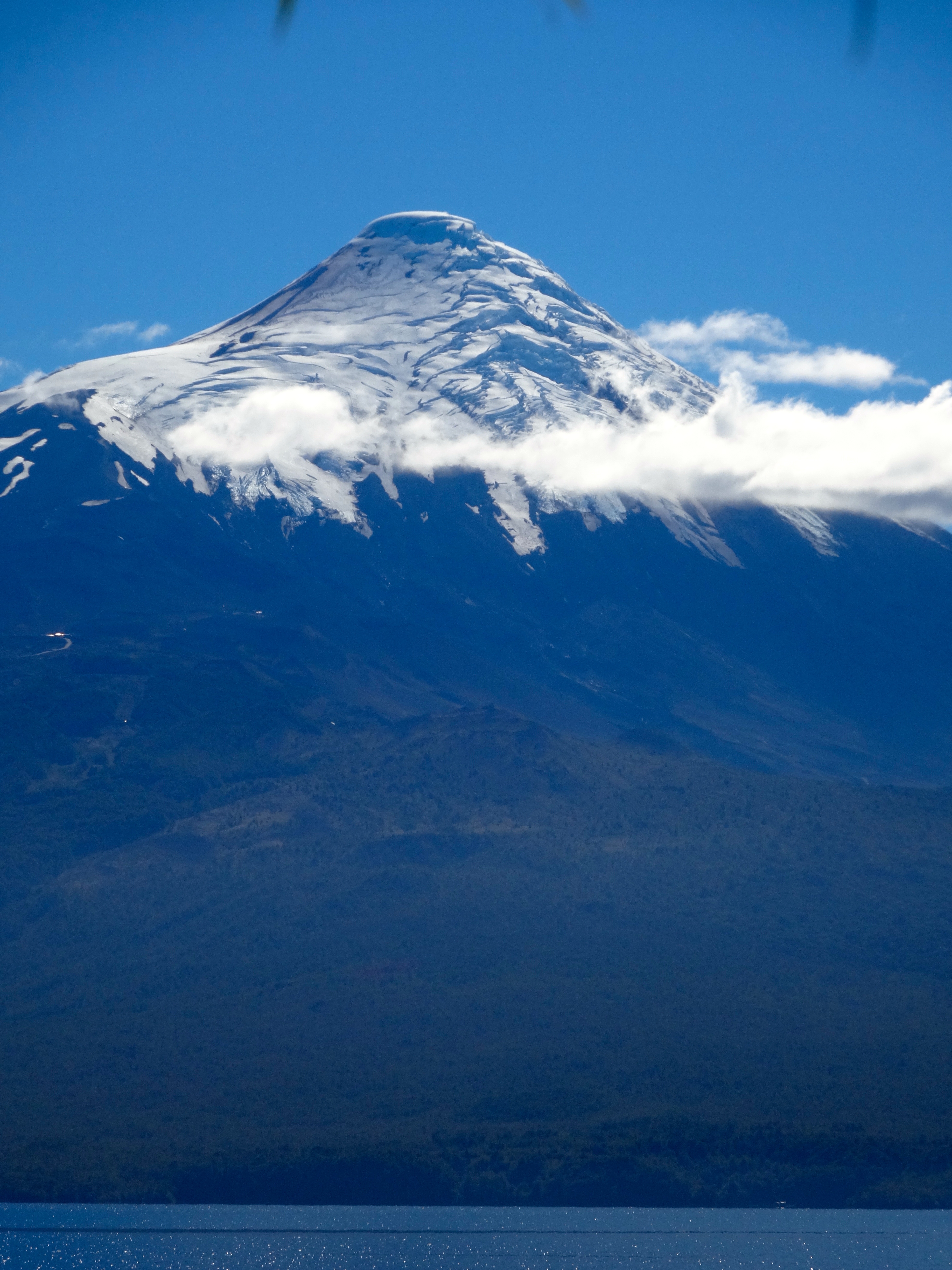
I took the day off here in order to enjoy some white water river rafting. Just an outstandingly clear day to raft. From this area, otherwise known as the gateway to the Andes you could see three volcanos; one of which is active with periodic lava flows. The one pictured below happens to be dormant at this moment. Its name is Villerica and rises over 9,000 feet. Only 60 miles to the east is the Argentinian border and the Agentinian Andes.
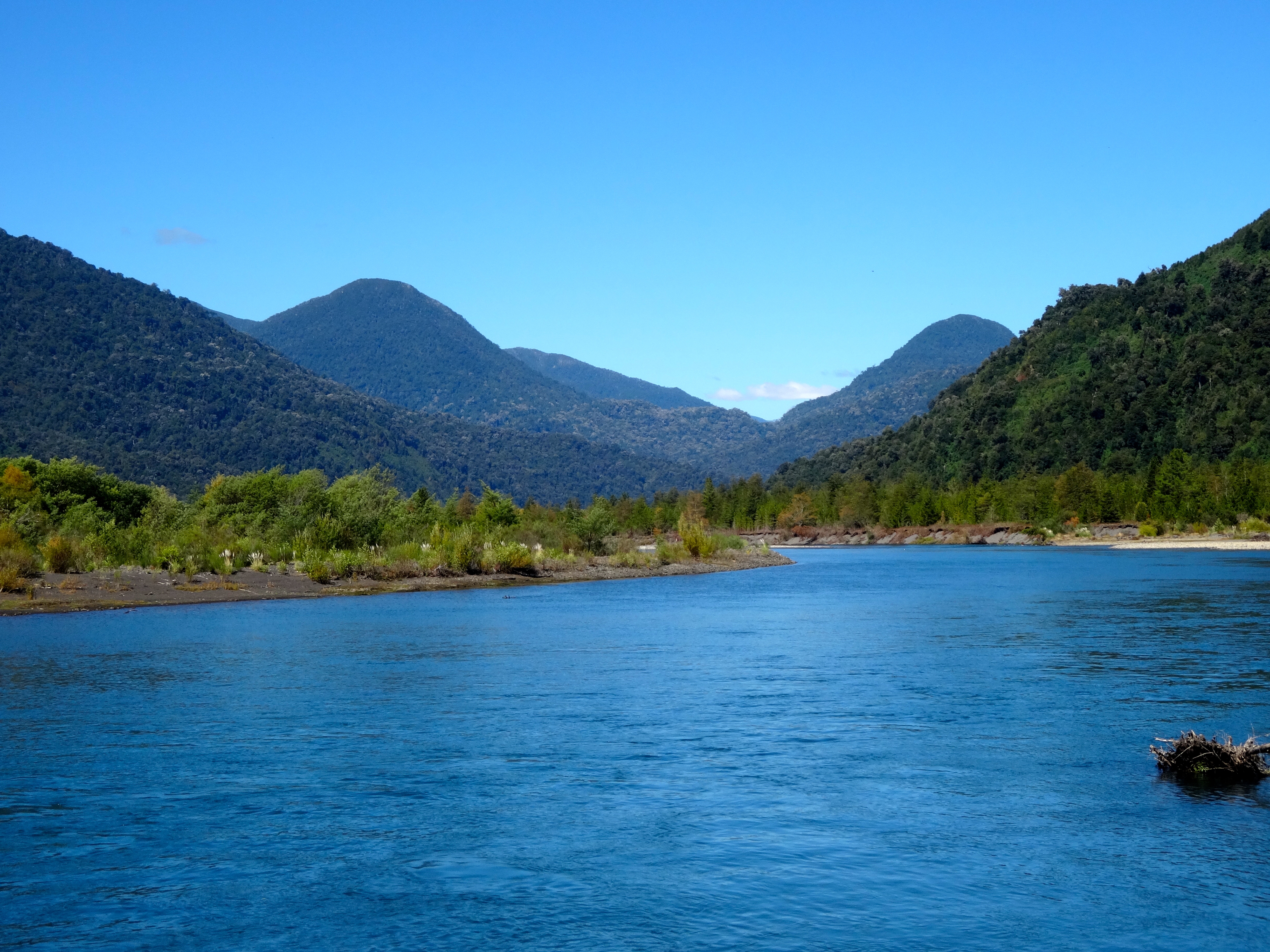
The Lake District has many rivers as well. The one we were rafting on is called the Petrohue. Since it is now the end of summer here the river was running low. Consequently, the rapids were in the 3-4 category. Earlier in the beginning of summer they range in the 4-5 category. The 3-4 were perfect. Only one dude in our raft was ejected and had to be pulled back in.
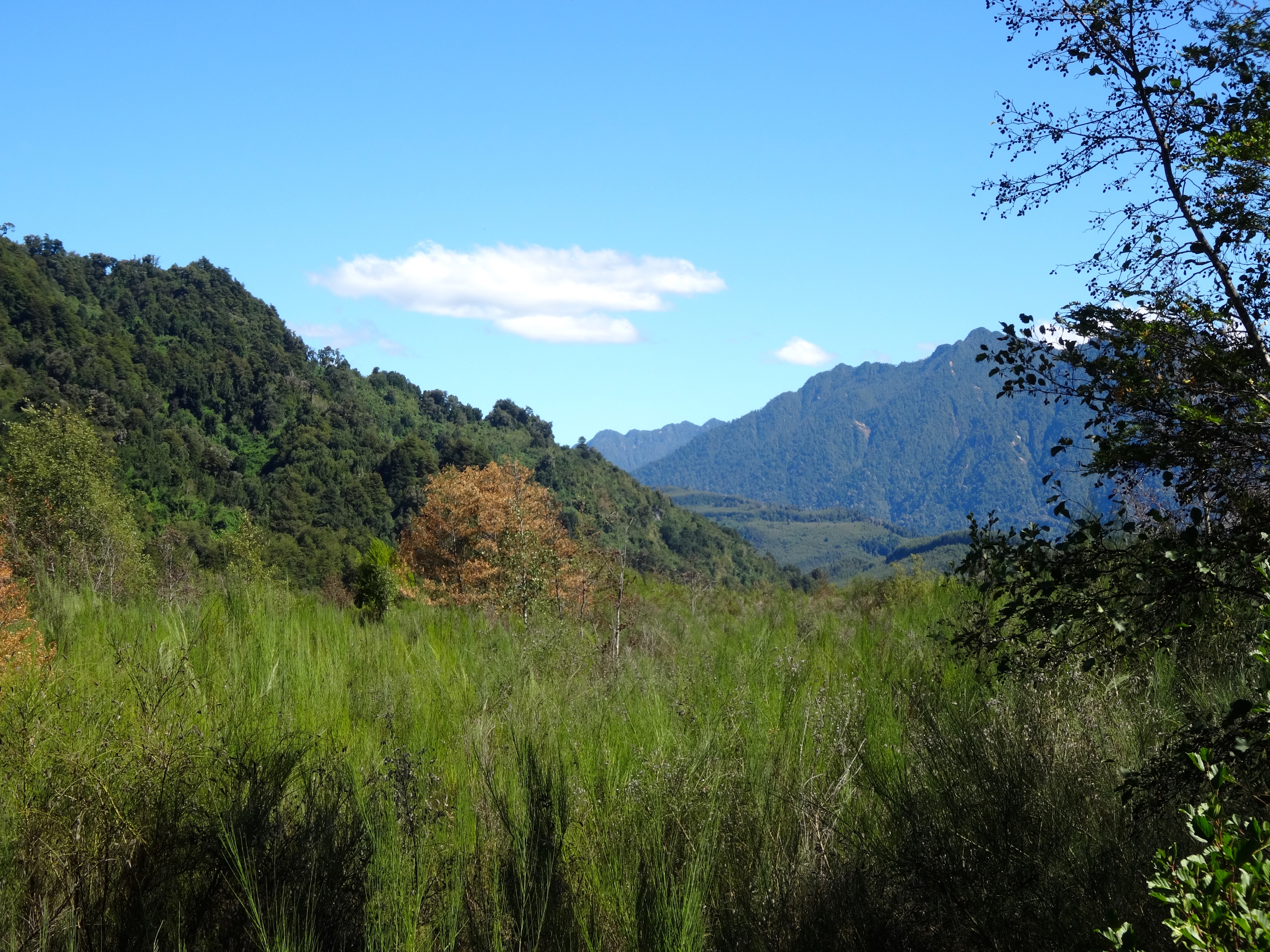
This region is named for its 12 biggest glacially carve lakes. There are dozens of smaller ones as well. Stream fishing is awesome here.
Since I was unable to have my camera in my hands while rafting (because of the paddle) I missed some very amazing photo opportunities. That was the only bummer of this incredible experience.
Woodcarving on the street.A closer shot of his work.Rising more than 9,000 feet is Villarica.Couldn’t help it. Just One more. The scene was quite breathtaking.Close up of Villarica.Valley through which I rafted the Petrohue.
This is the Petrohue photographed at my point of exit.
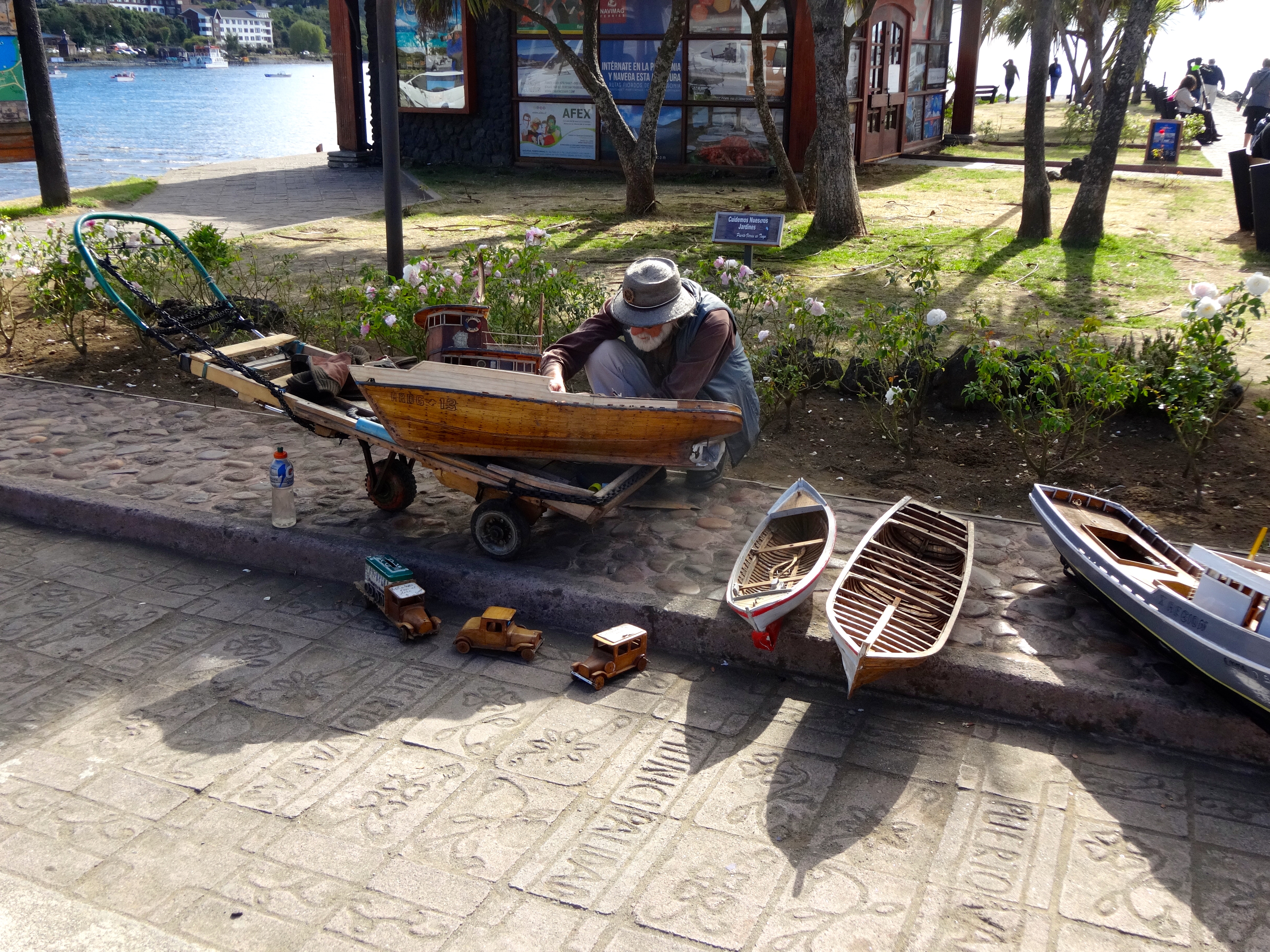
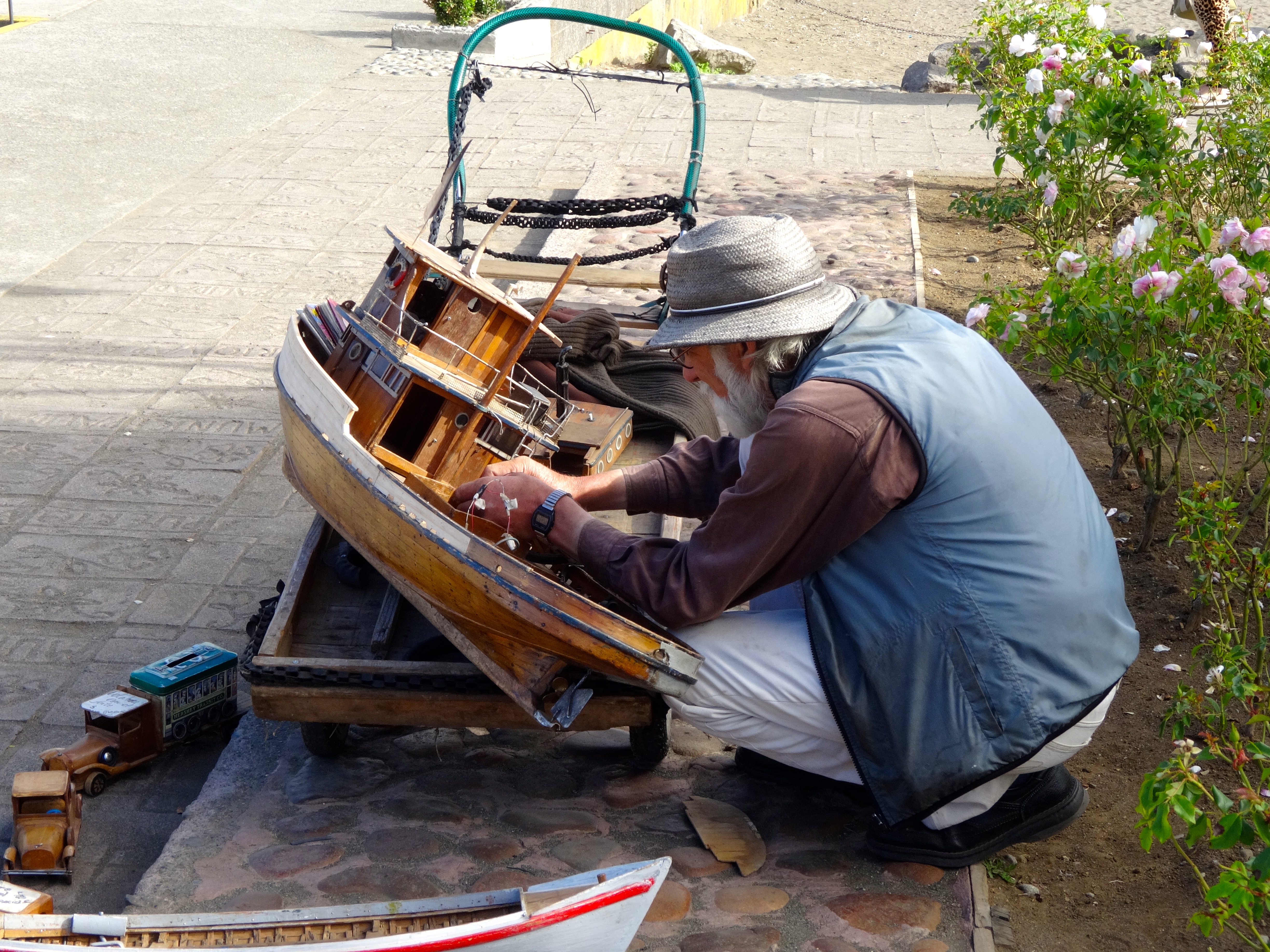
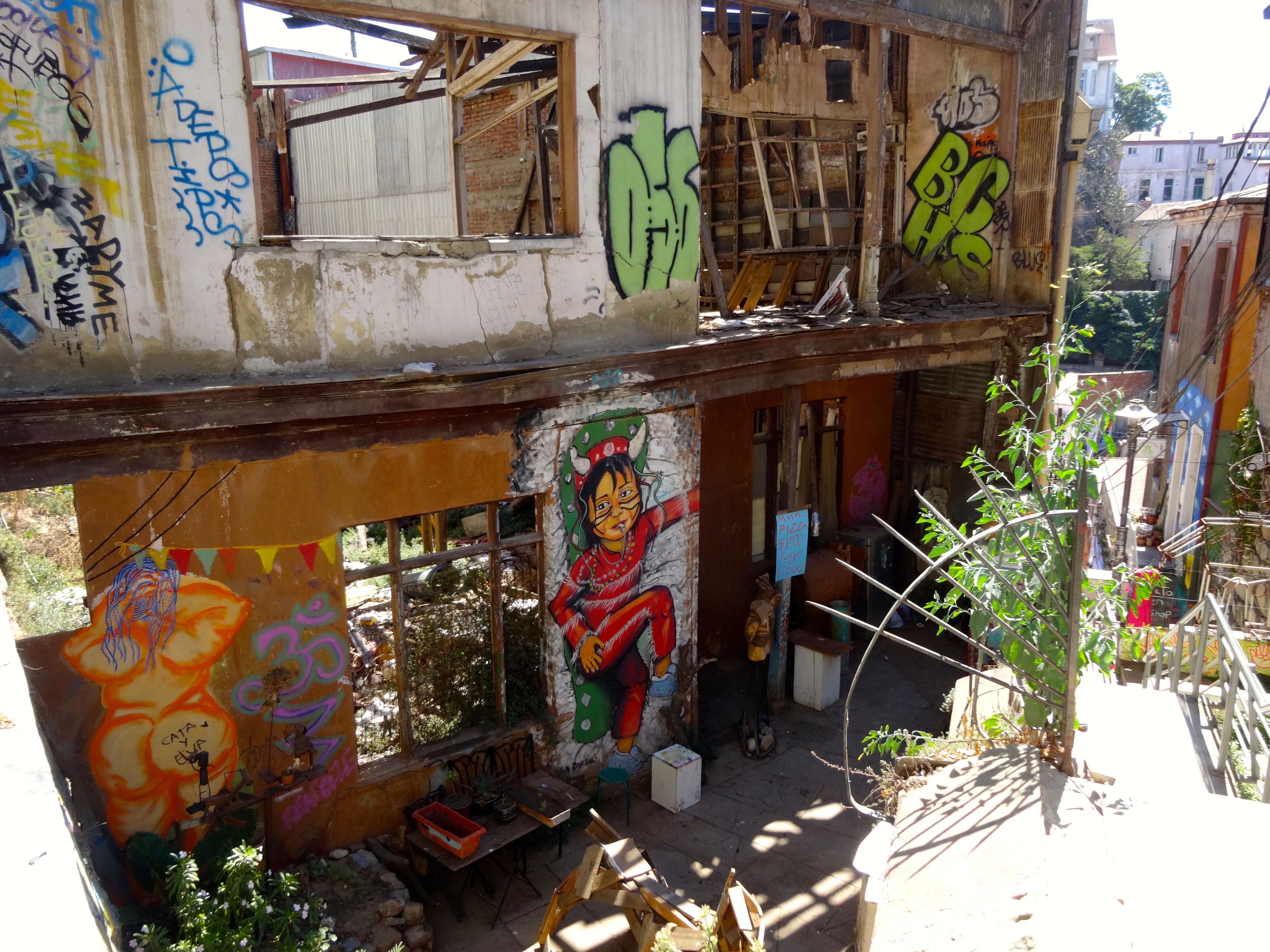
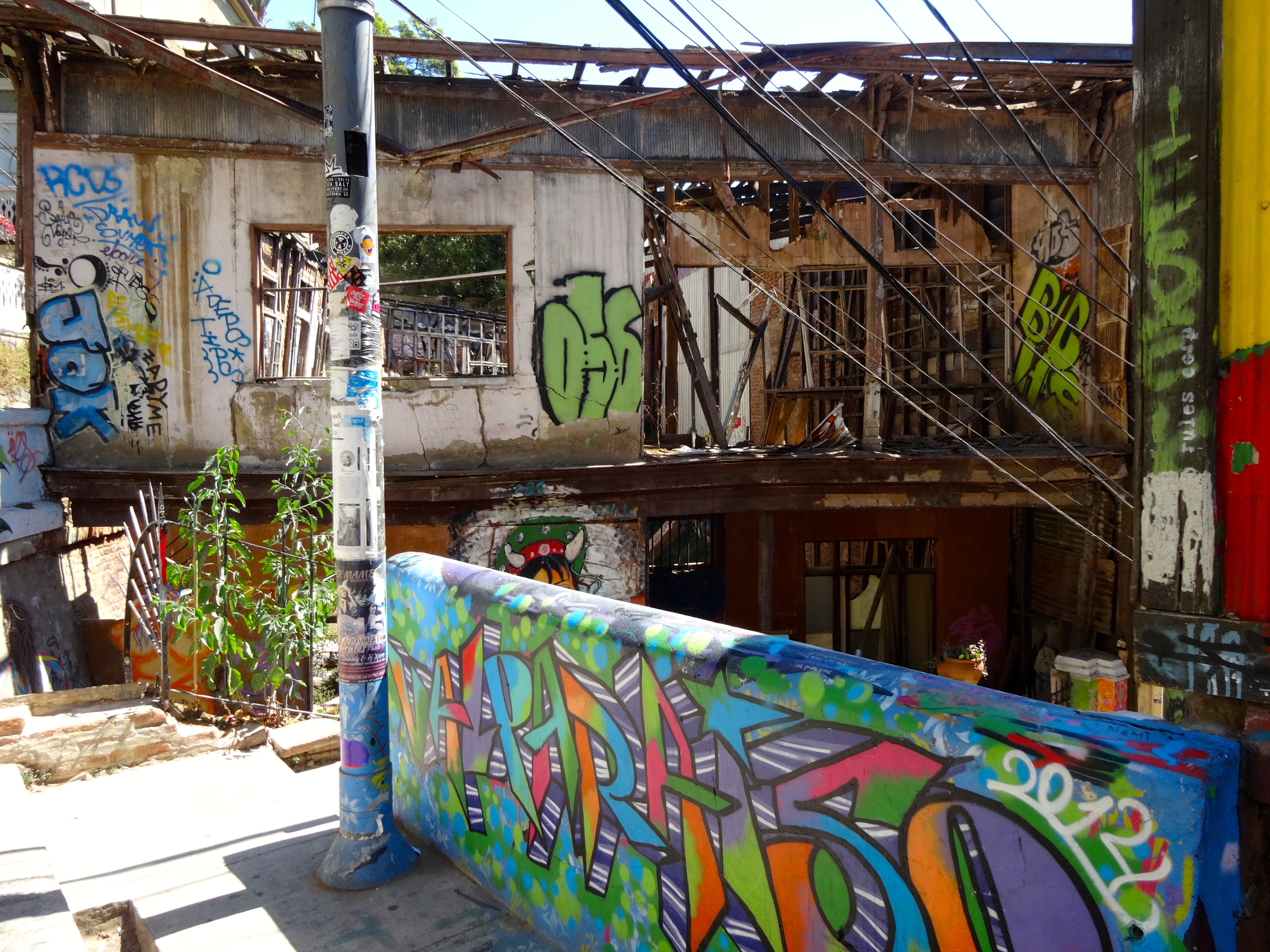
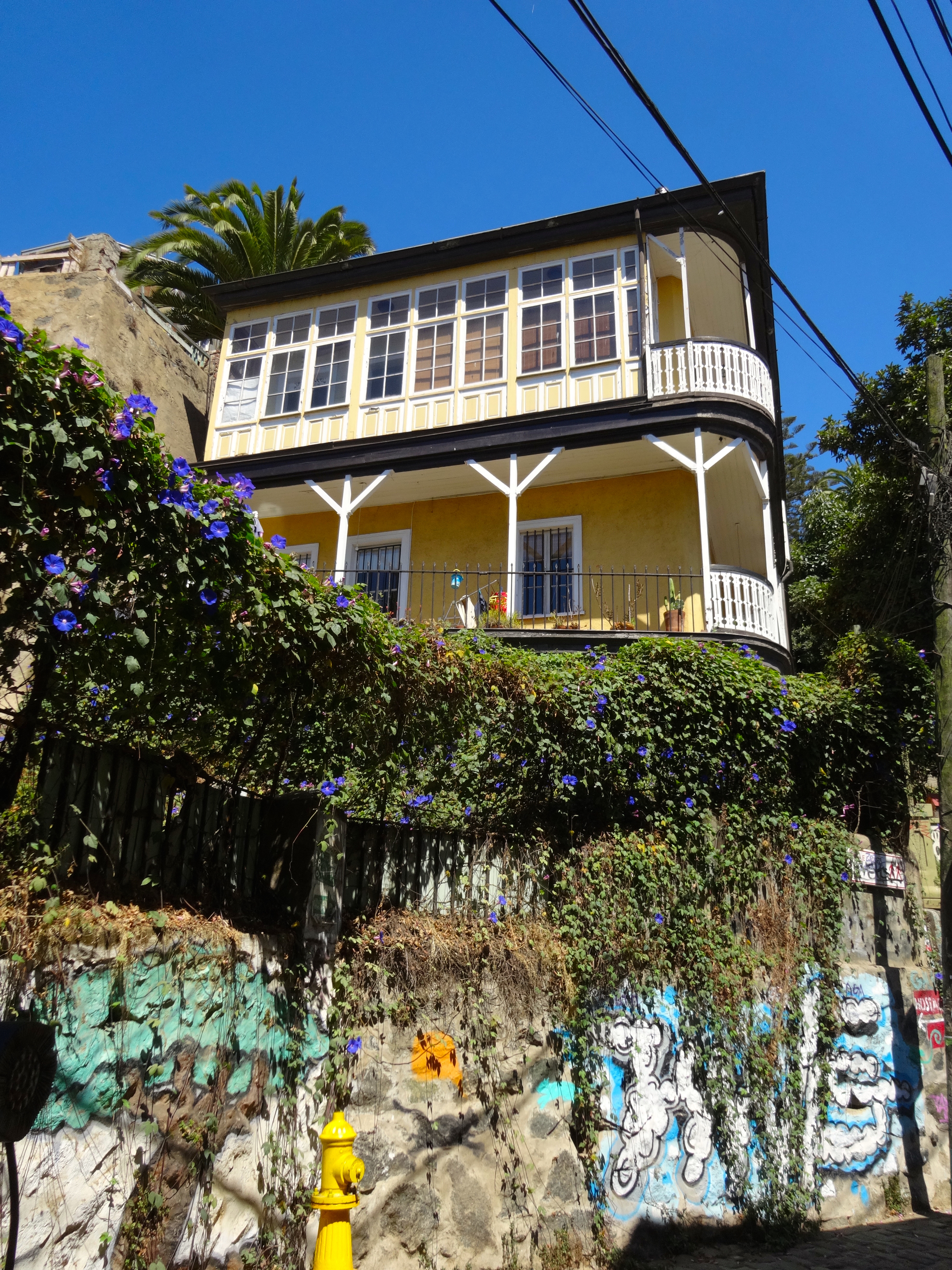
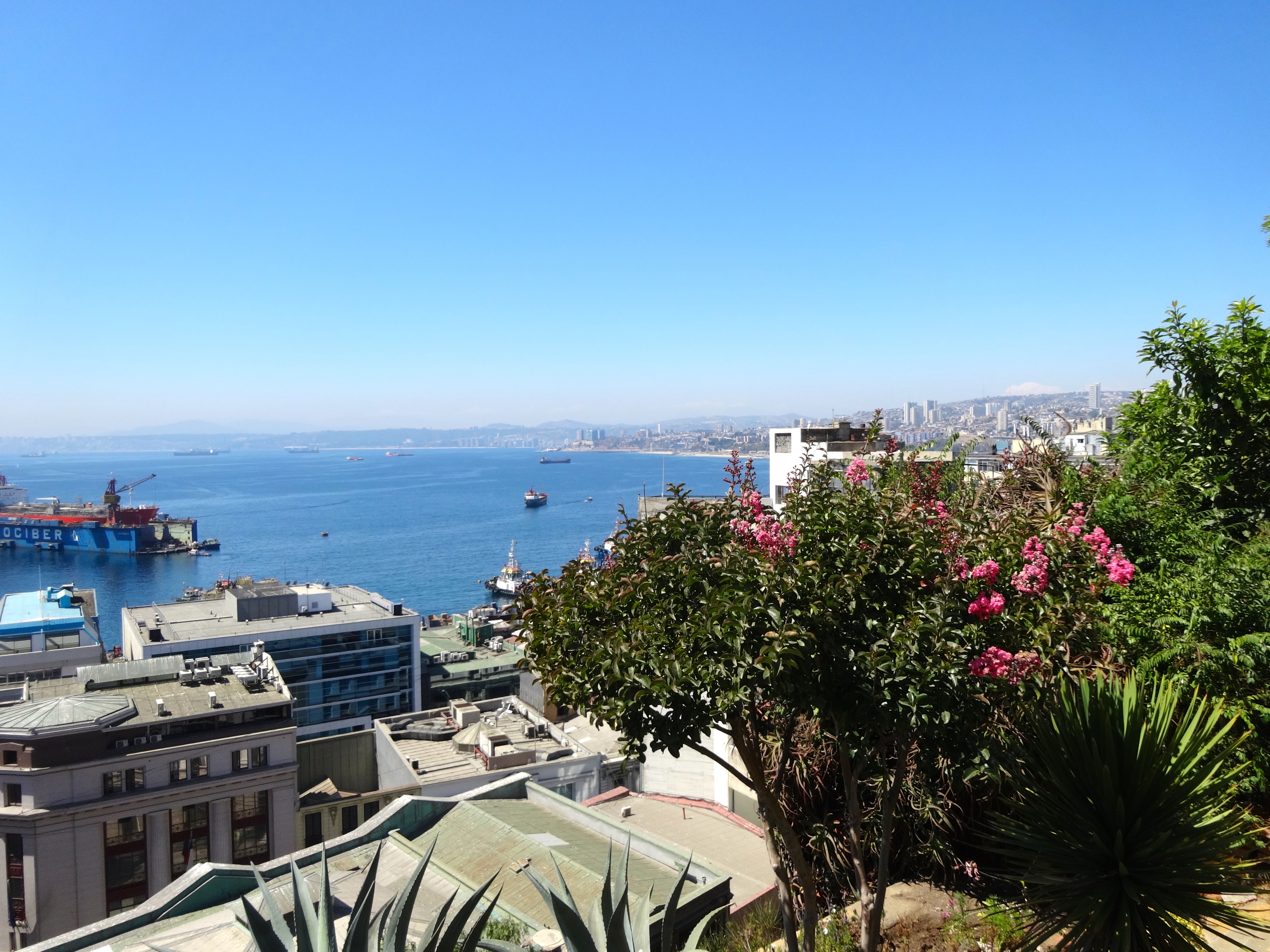
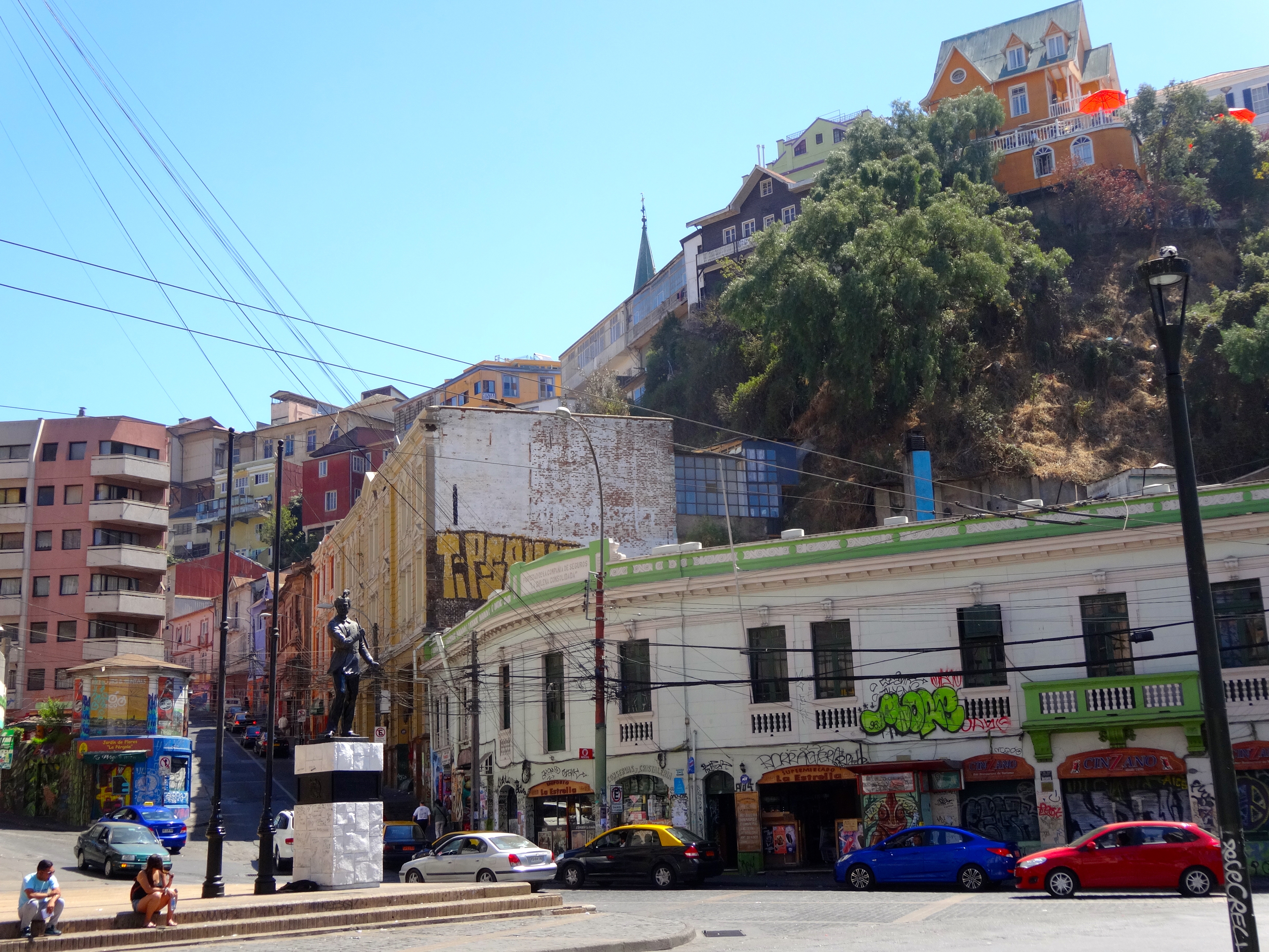
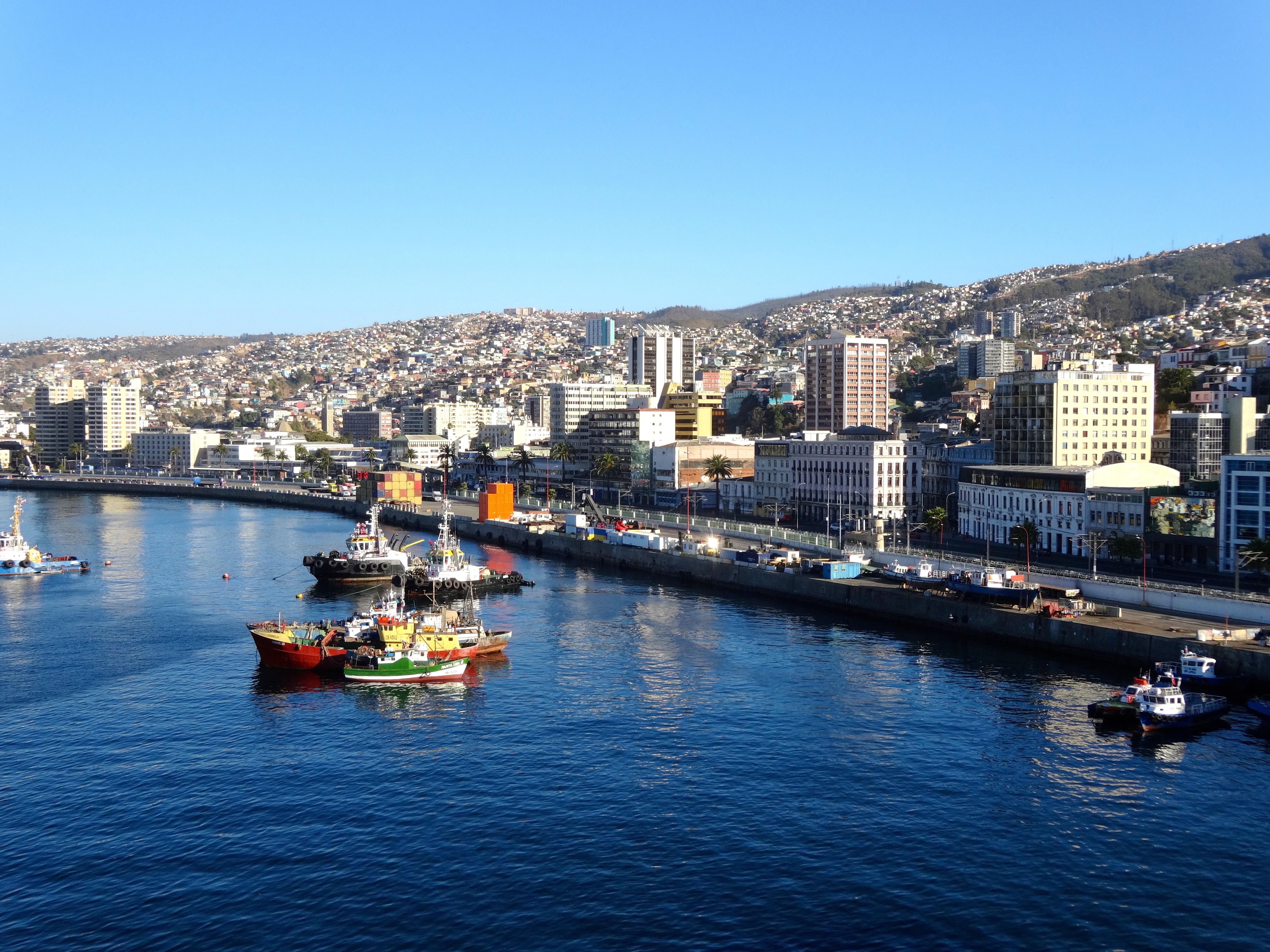
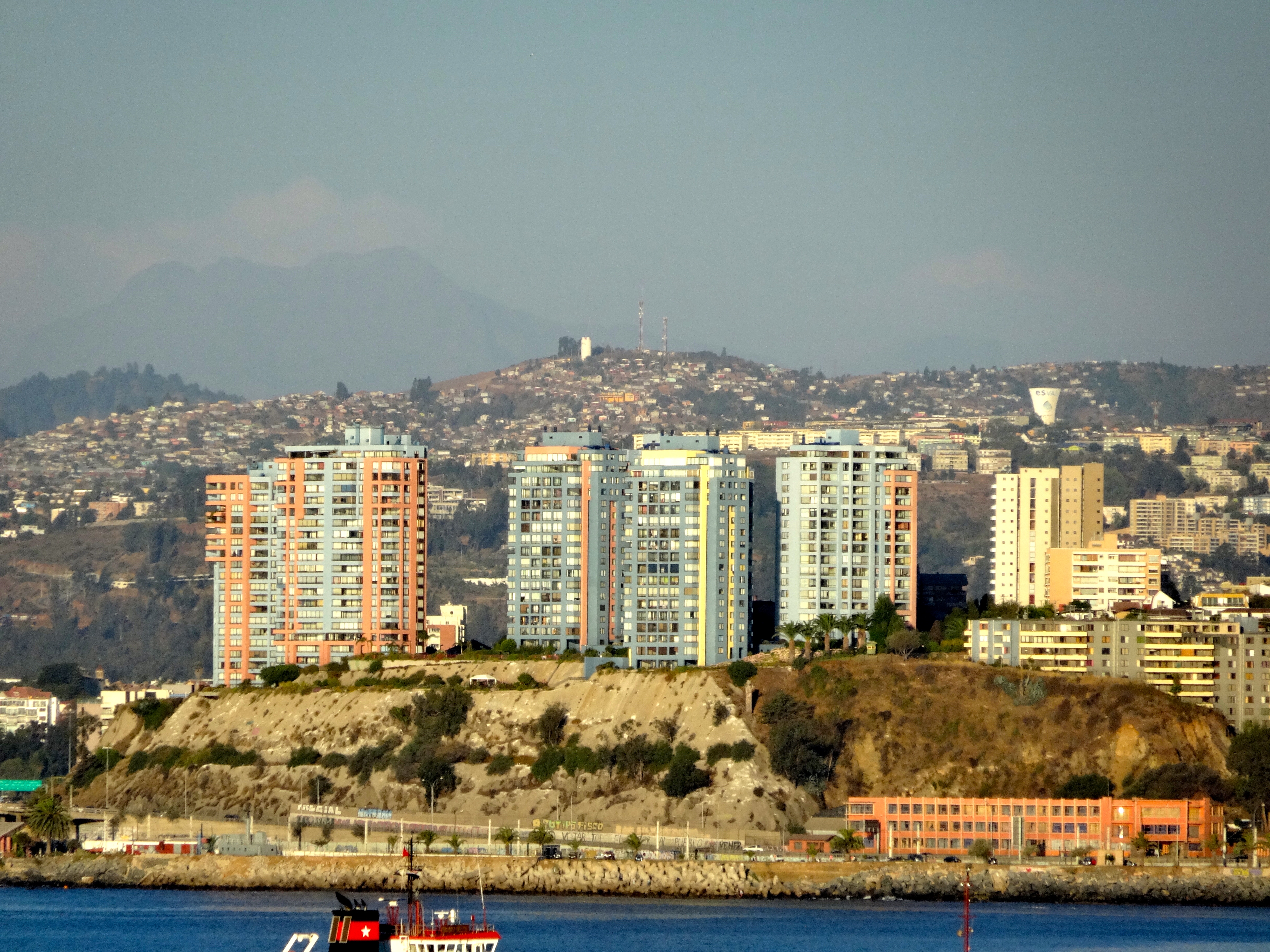
Not much room between the high cliffs and the sea, but Valparaiso does qualify as Chile’s third largest city with a population of 200,000 people. The only two larger metropolitan areas are Santiago and Concepcion. There are two very different and distinct sections to this city. The first is the modern coastal stretch that skirts the bay, and the other is much larger. This area is much older and comprises most of the neighborhoods and residences. This area is known as Valpo. Valpo and these neighborhoods cling delicately to the cliffs and hills, which rise abruptly just a few hundred yards from the shoreline. This is where I spent most of my time. Each hill is like an individual neighborhood laced with beguiling twisted streets and loads of commissioned and non-commissioned graffiti. (see pics)
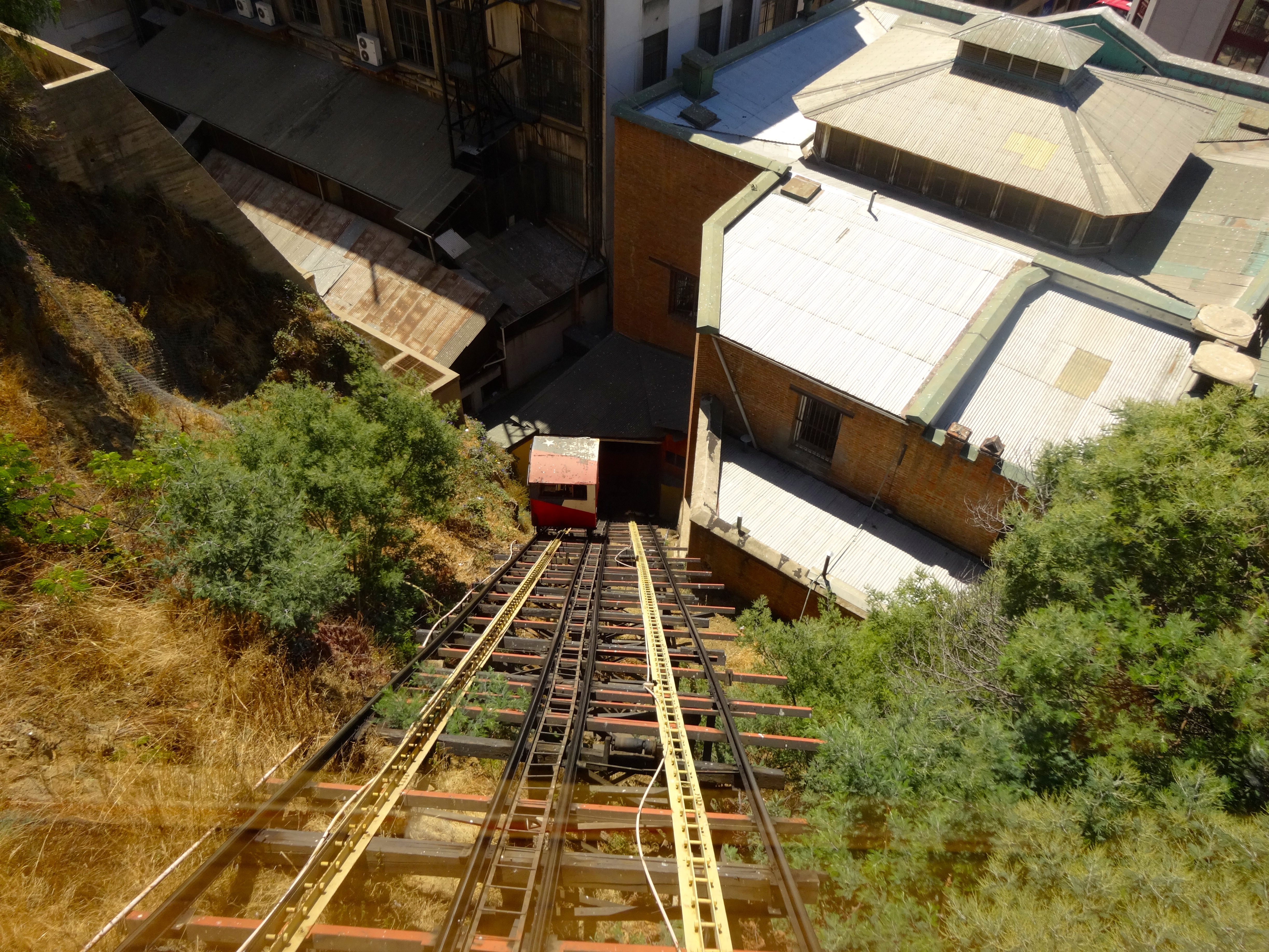
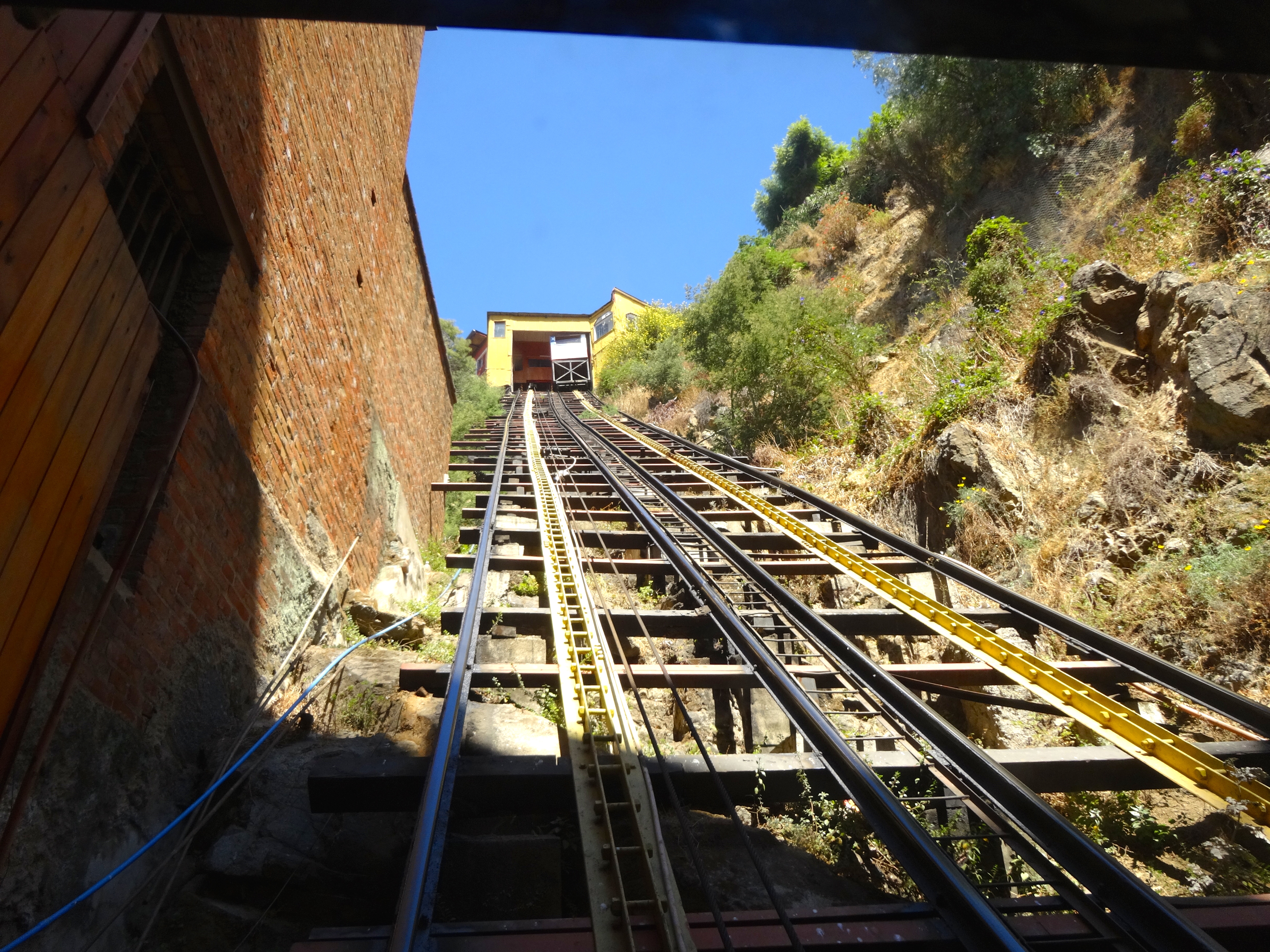
There are 16 operating funiculars. A funicular is a very steep cable car. These take people from the seaside almost straight up the mountainside to the neighborhoods. Some are at such a steep incline that they are more like elevators. (See pics) Up in these charming neighborhoods I found great little restaurants and cafes. The graffiti is also quite remarkable. (See pics) Once at the top there are commanding views of the coastline.
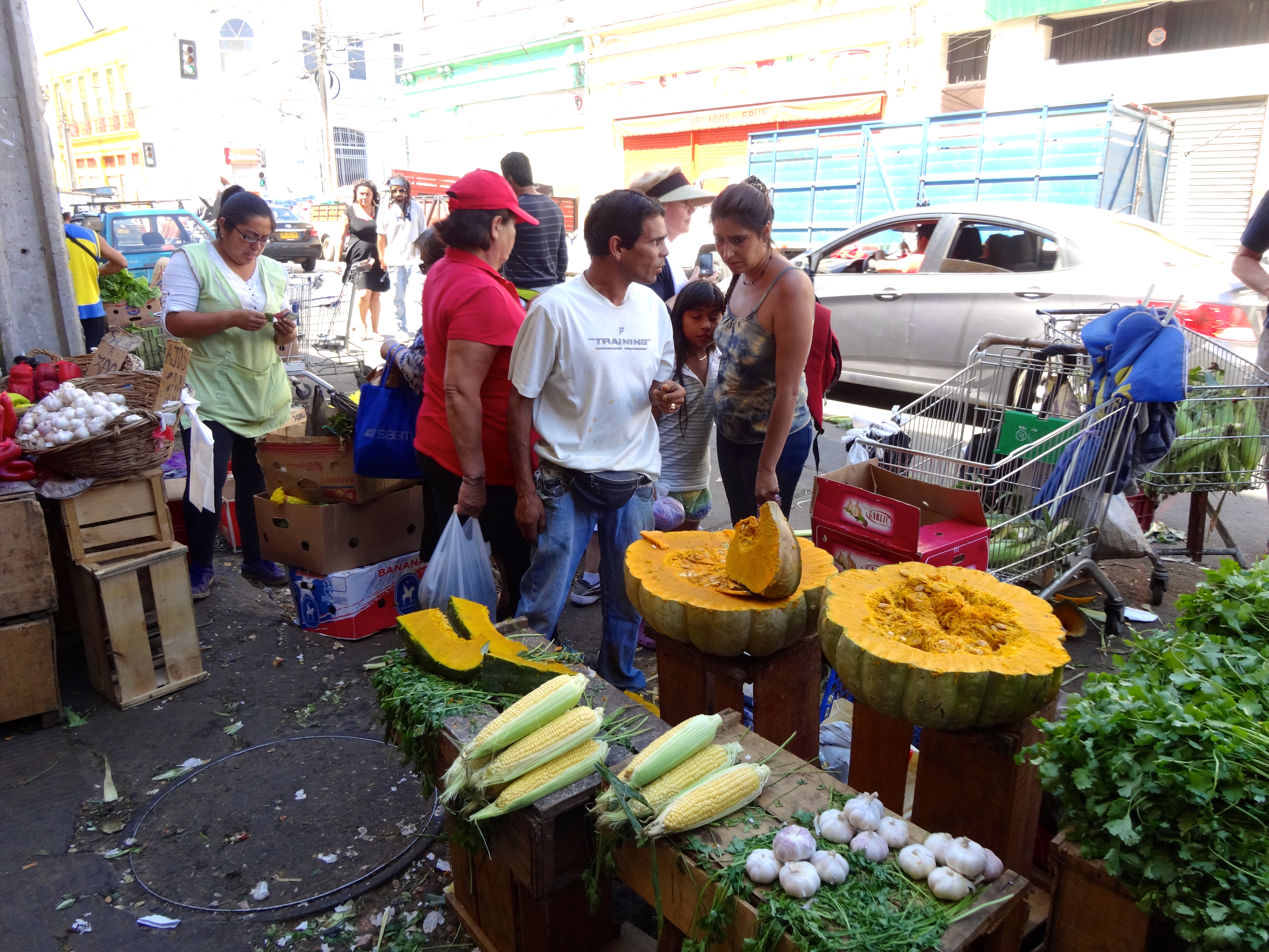
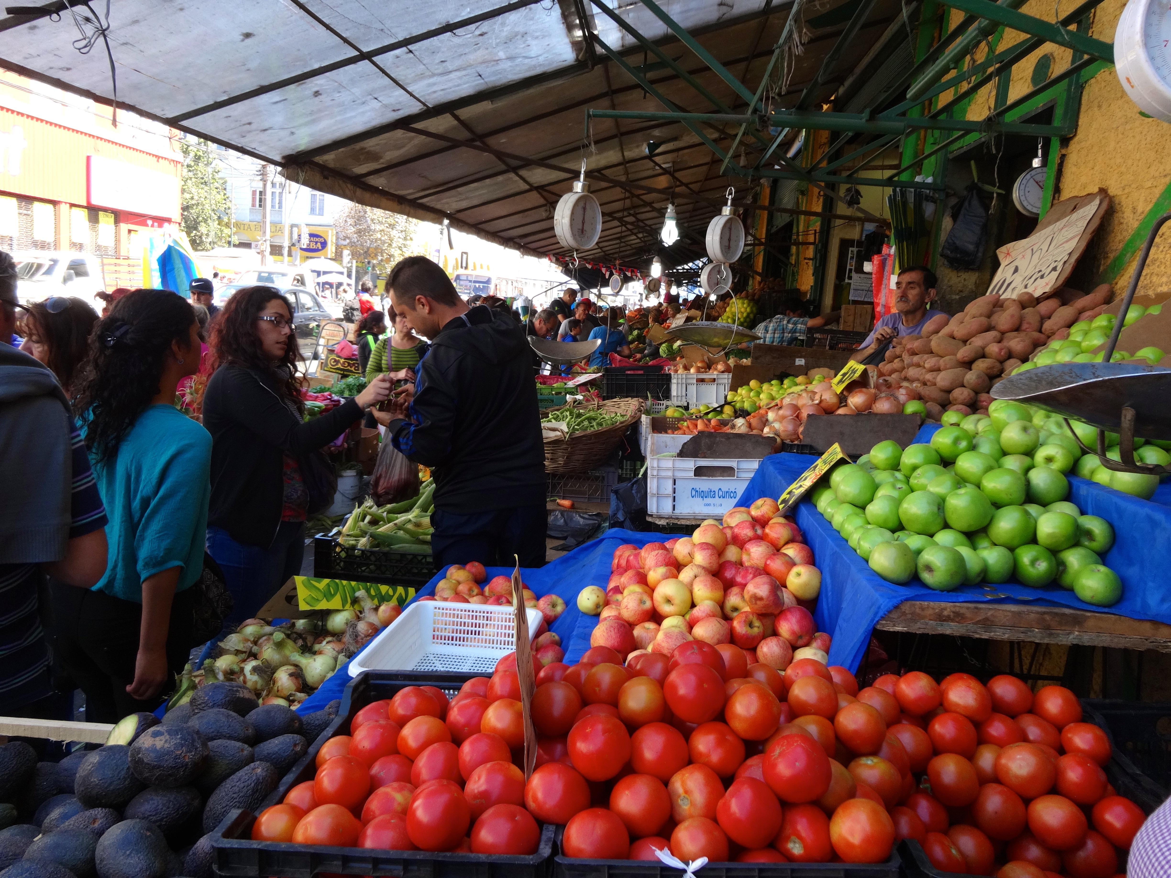
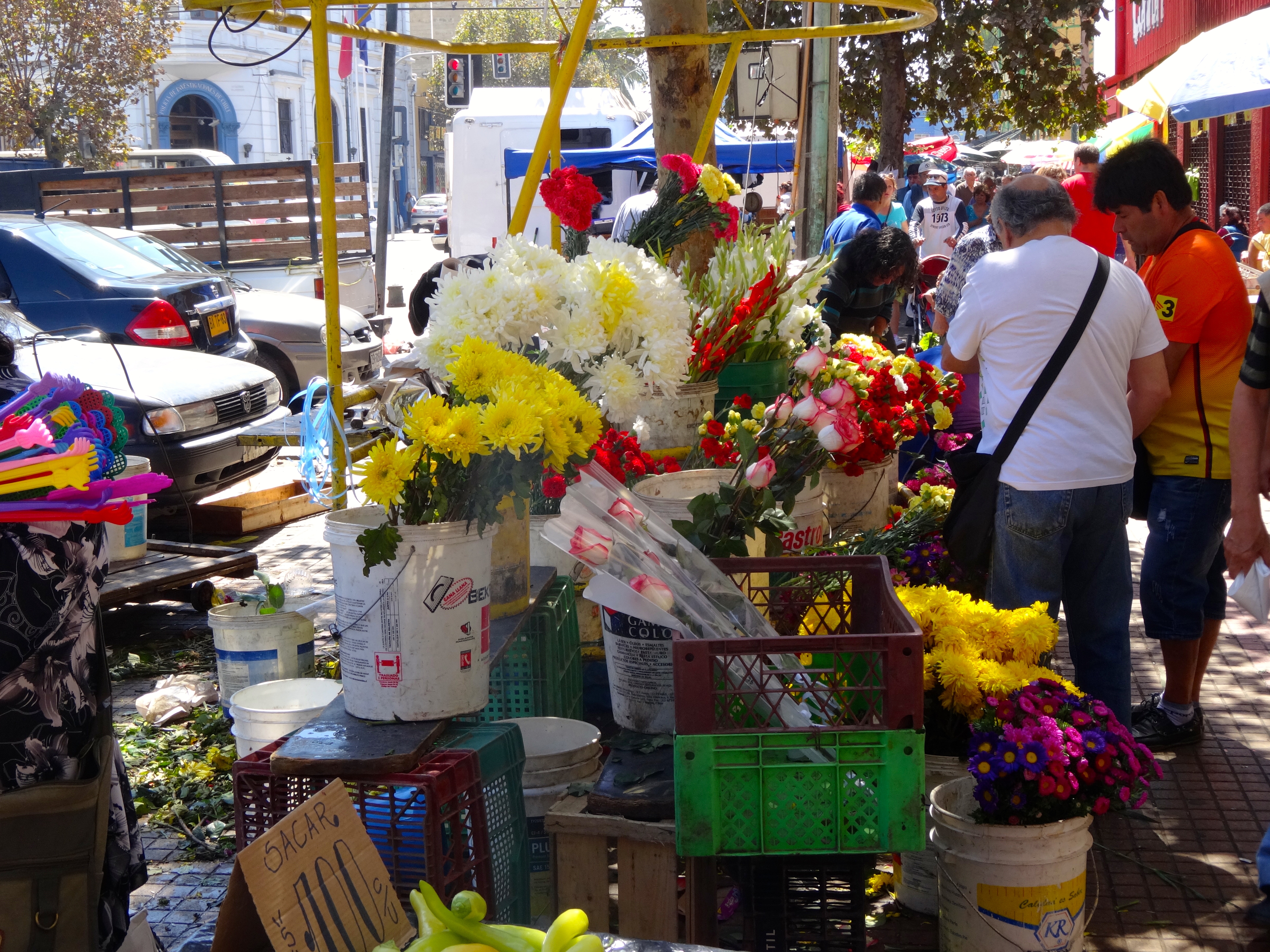
Since much of the land around this city is very fertile, the fruits and vegetables are plentiful. The open air market is evidence of the bountiful land surrounding this area. (See pics)
Santiago, Chile’s capital city is approximately 2 hours east by automobile.
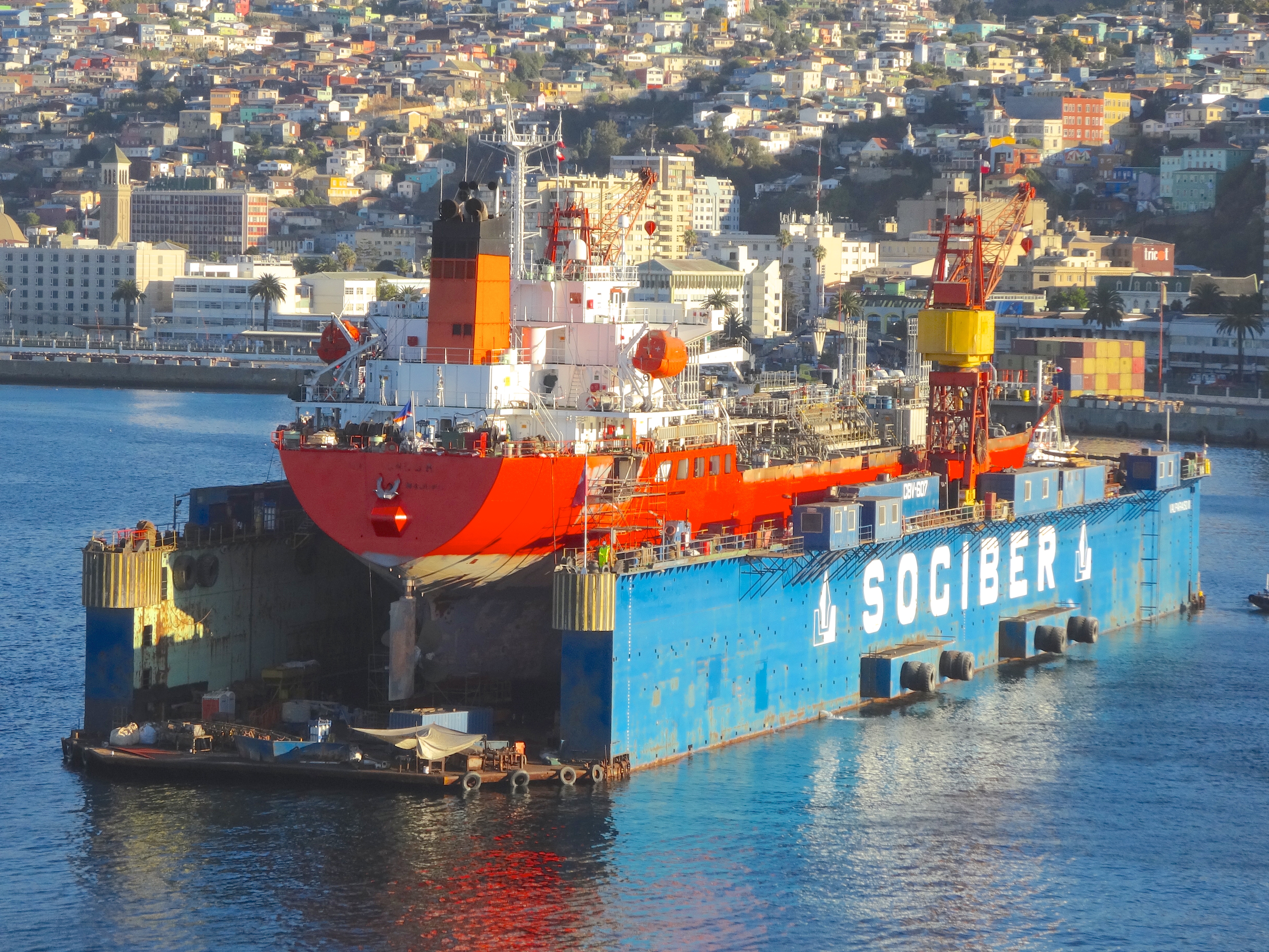
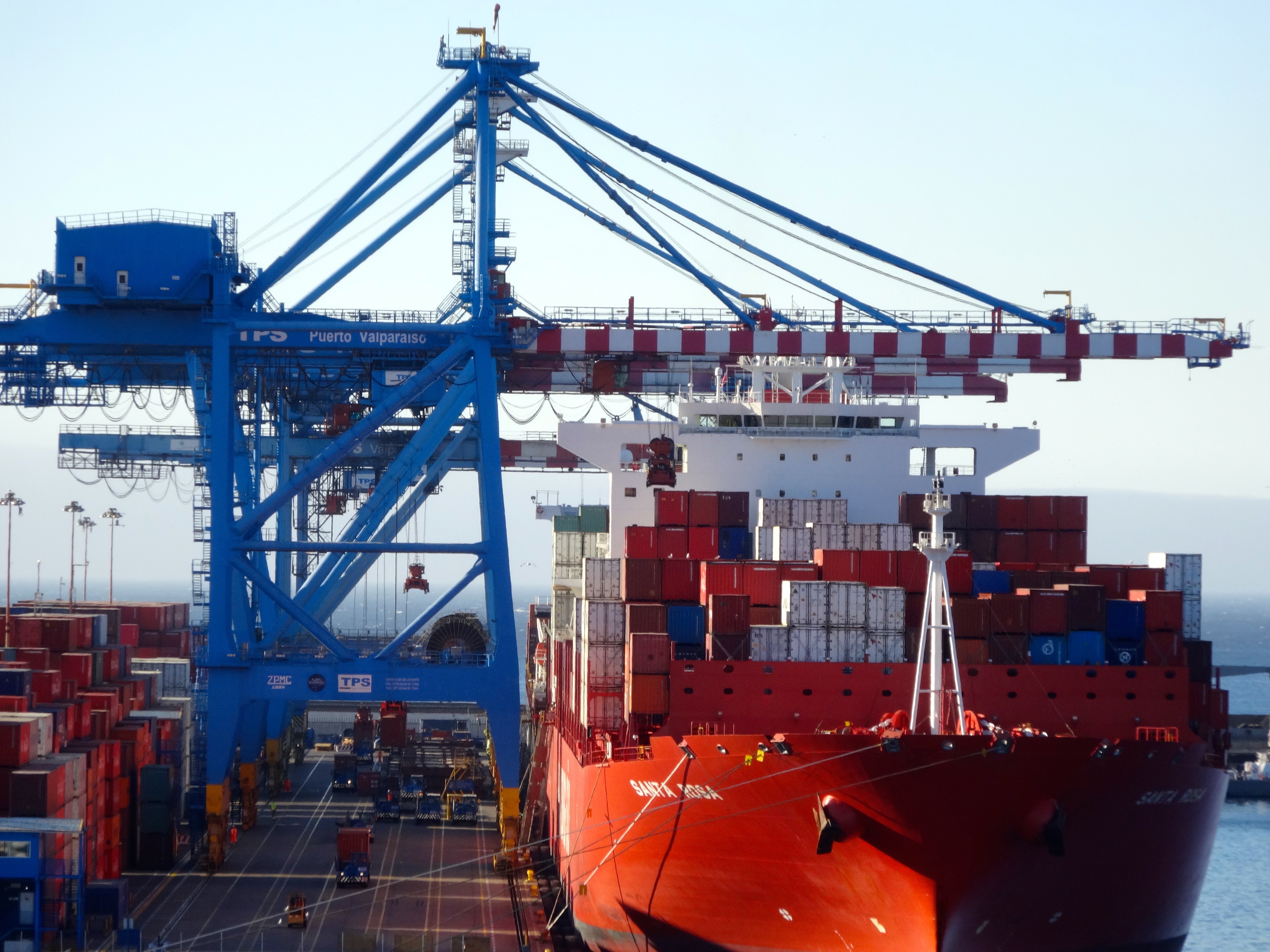
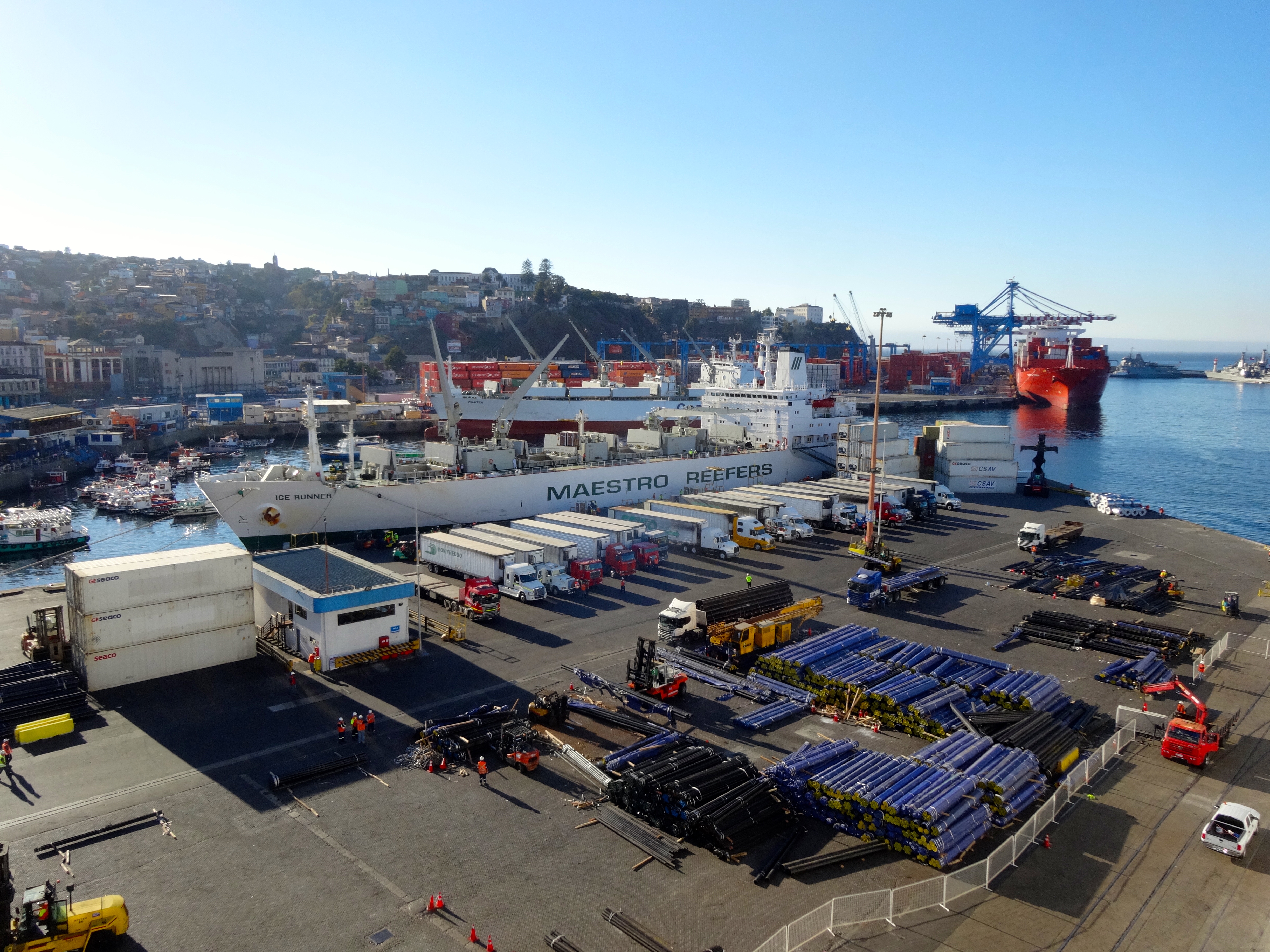
Look at the size of these pumpkin squash.Nice bounty of fruit.Produce at the market on Sunday.Here’s a shot of the funicular tracks. Just look at the pitch. If it lets go from the top it is only about 3 seconds before you are smashed like a bug on a windshield.Here’s the view from the bottom before my assent.Example of non-commissioned graffiti.Both commissioned and non-commissioned graffiti.House on a cliff. Note the graffiti at the bottom.View from the top of one of the funiculars.View from the modern more commercial area up to one of the neighborhoods.Coastline scene and in the background, the residential neighborhoods.This ship looks like it needs more than just an oil change.Modern area of town. Note the Andes mountains in the distance.Major shipping port and look at all those containers.
Check out the name on this ship. I don’t believe this is Spanish for Reefer Madness.
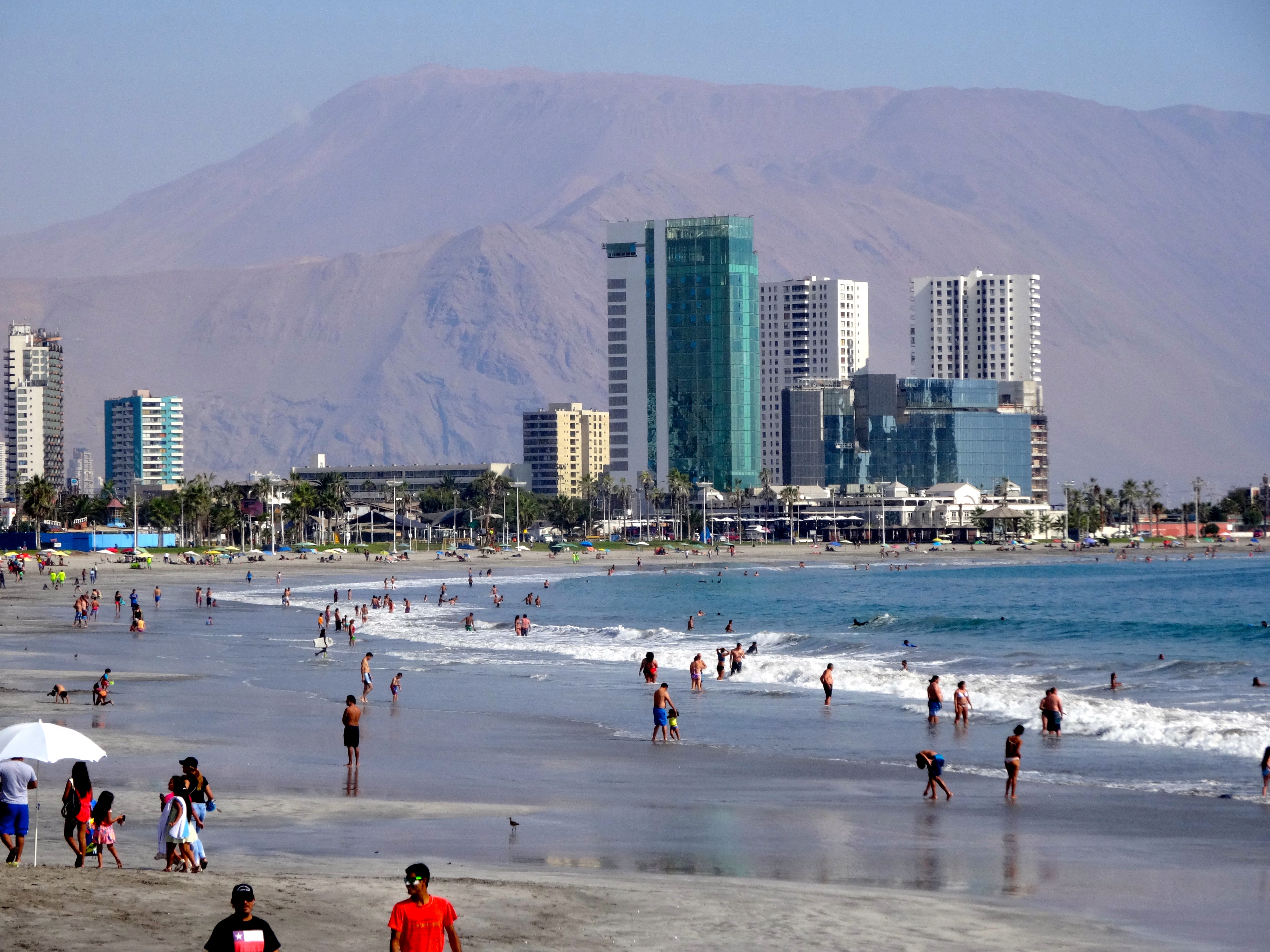
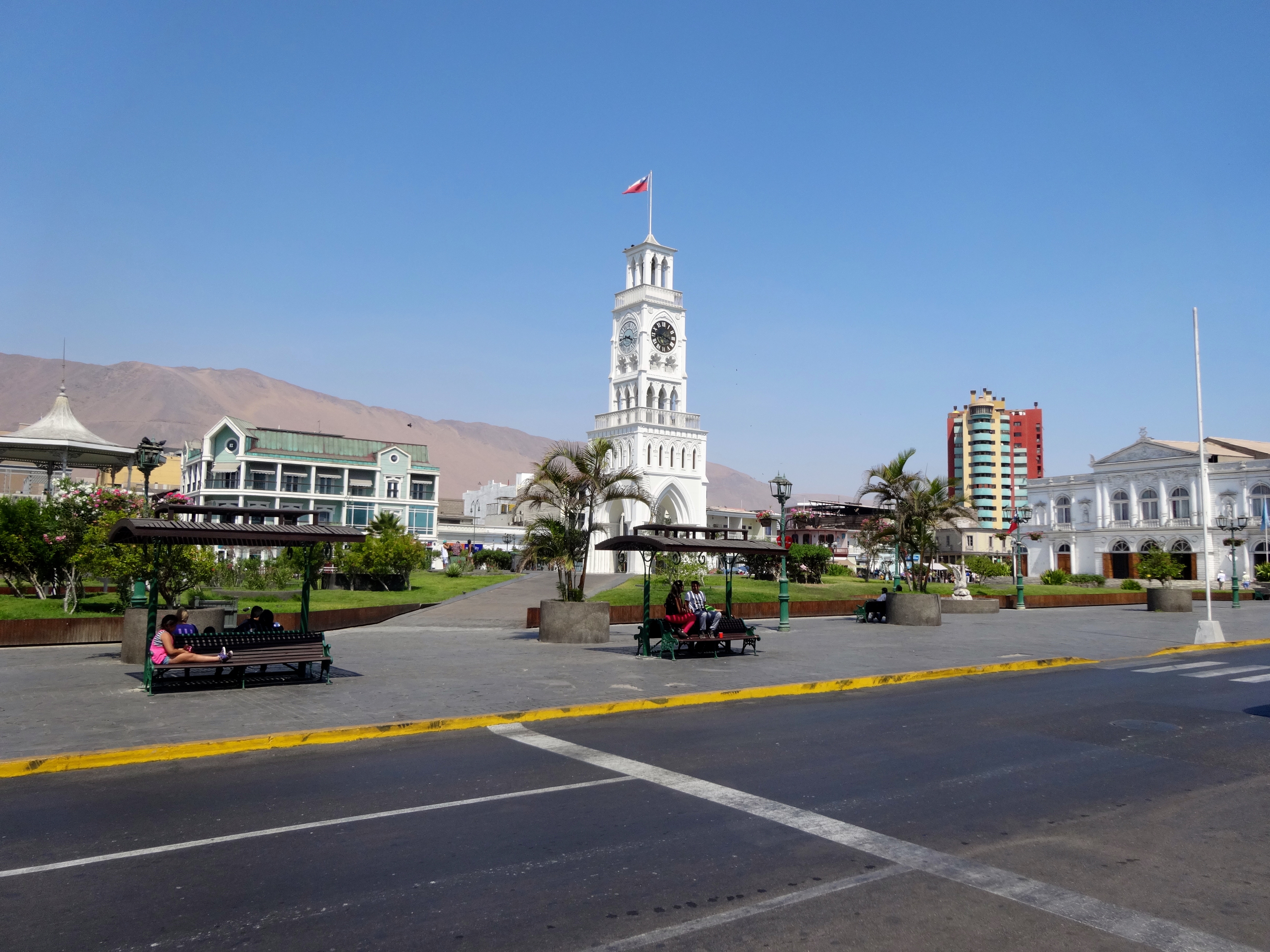
Iquique (pronounced ee-KEE-kay) is a port city in northern Chile. It lies on the Pacific coast and is part of the Atacama Desert. This area receives less than 2 inches of annual rainfall. The city developed in the heyday of the saltpeter mining in the Atacama desert in the 19th century. Interesting enough, it was a Peruvian city with a large Chilean population. It was ceded to Chile as a result of the War of the Pacific in 1879.
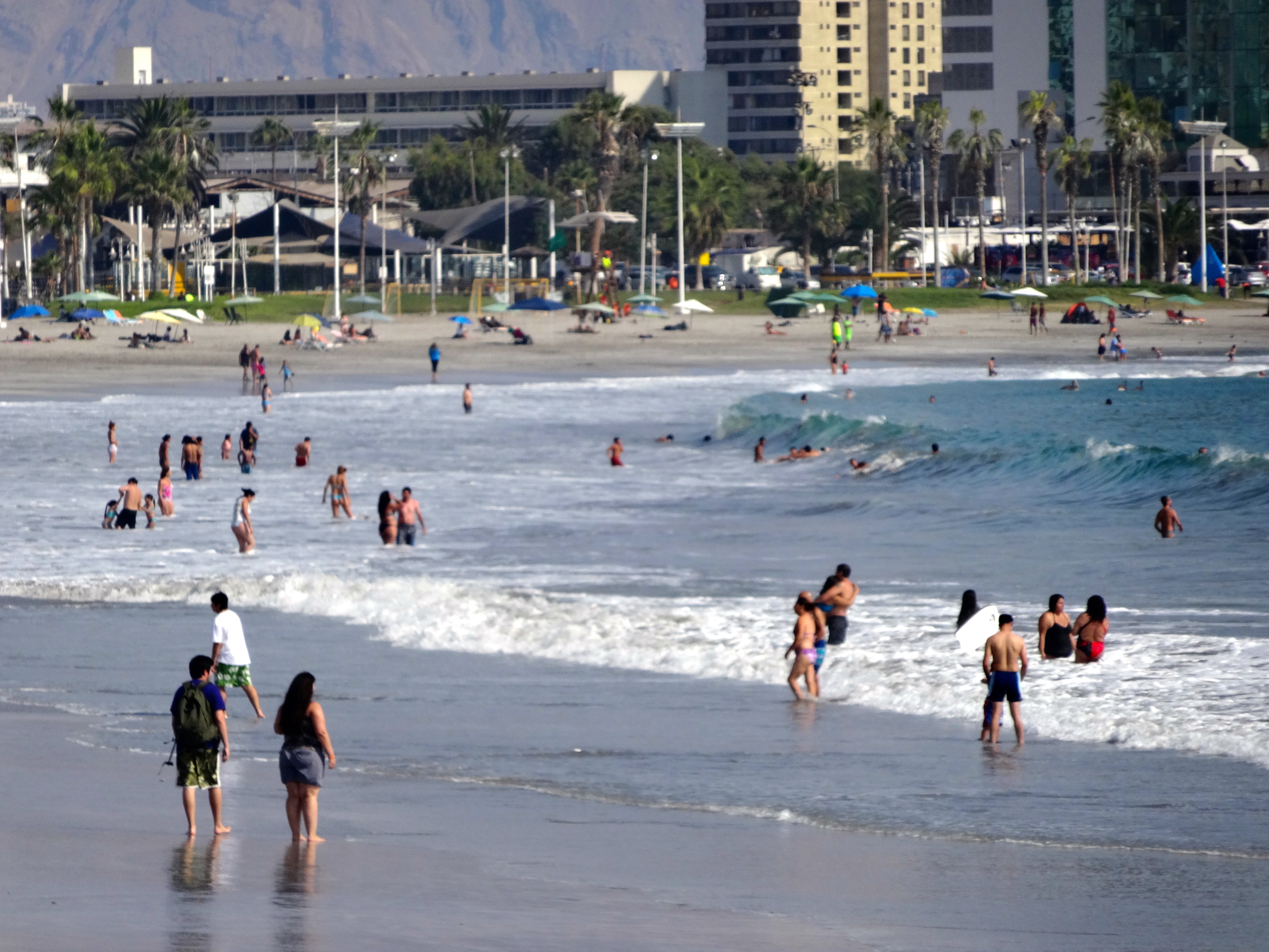
Today it plays home to surfers, hotels, resorts and casinos. Located in a golden crescent of coastline, it is among the best beach resorts in Chile. The big draw is the surfing. Consistently large swells are enjoyed be many surfers year round.
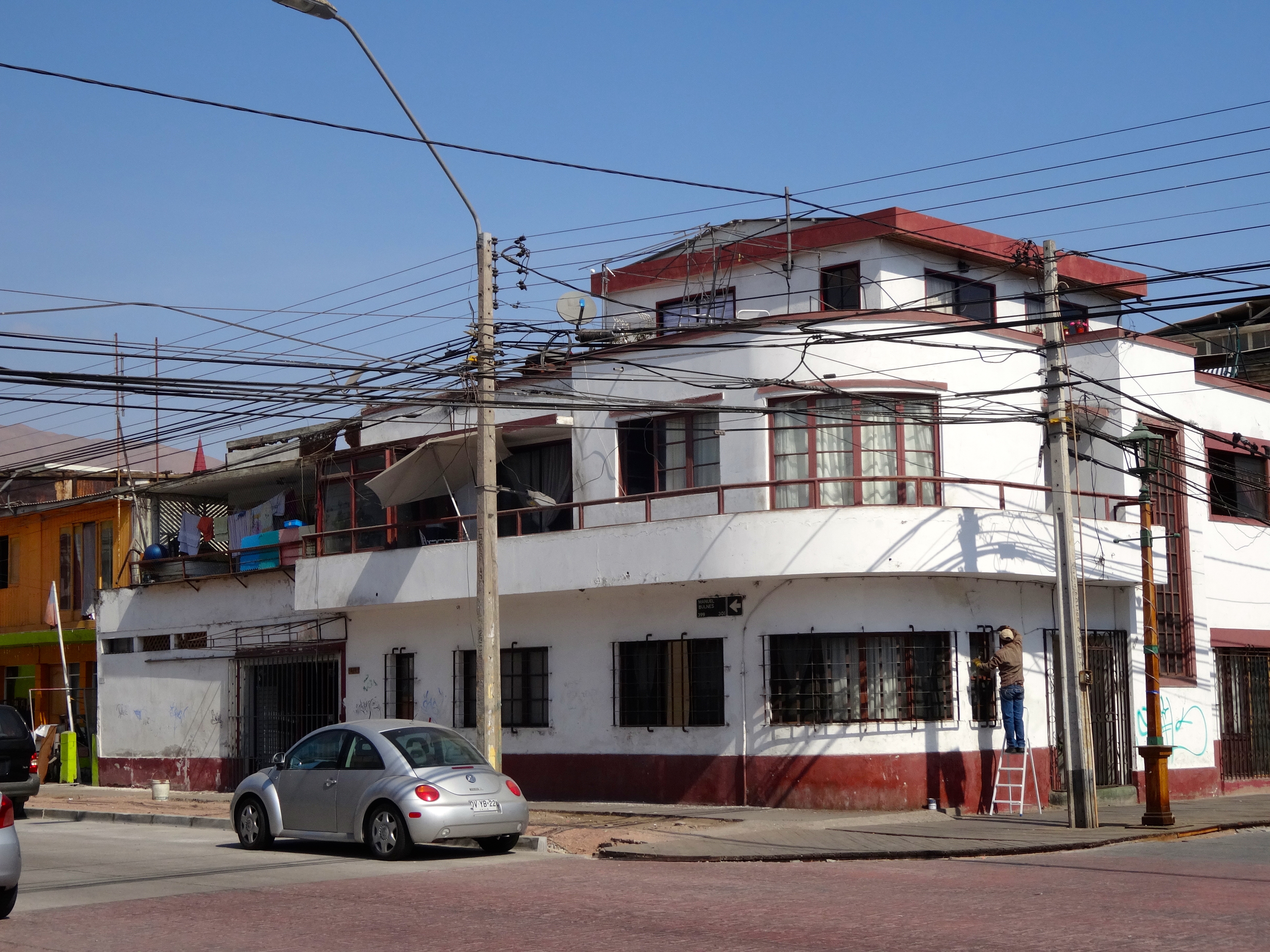
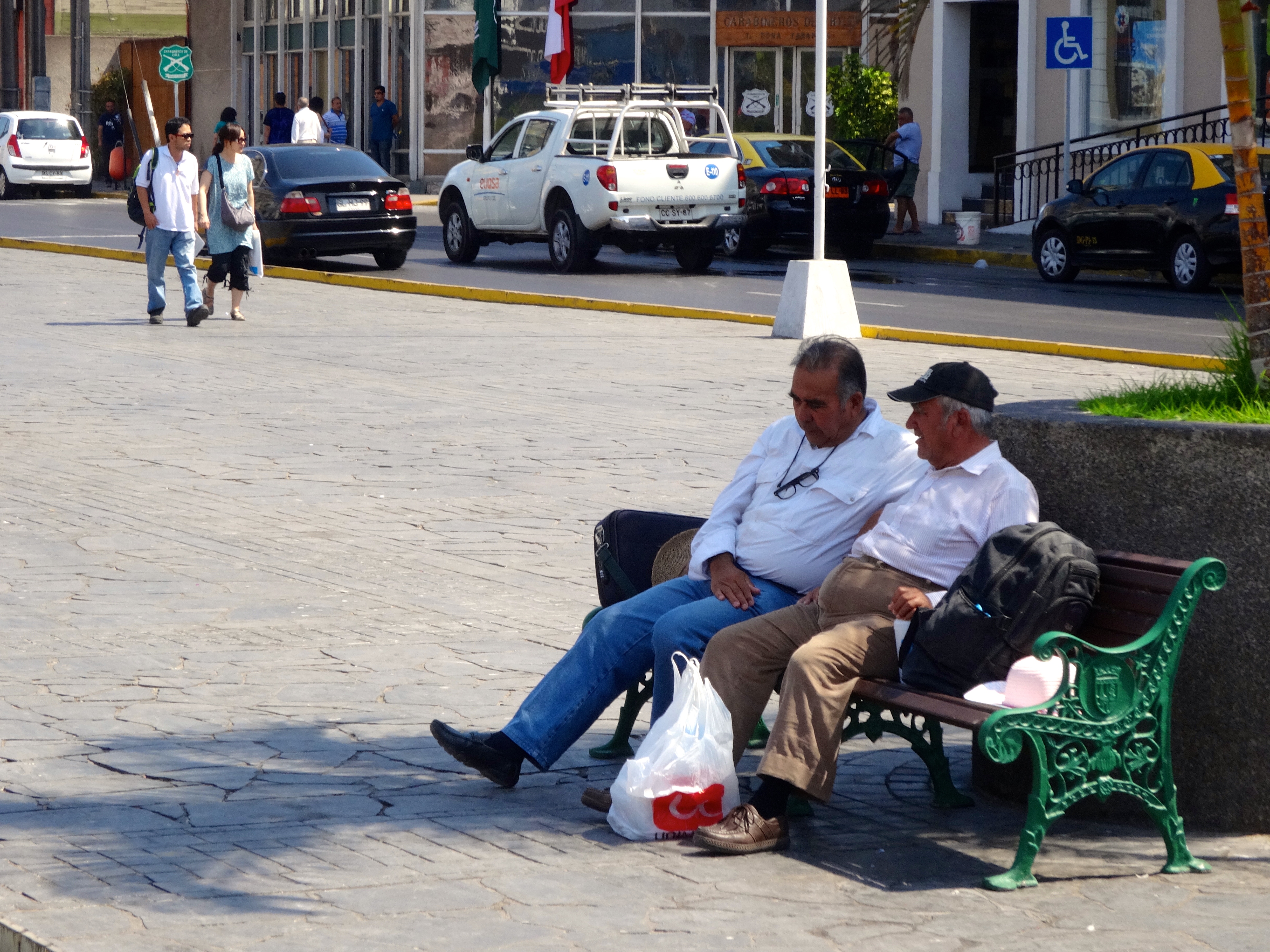
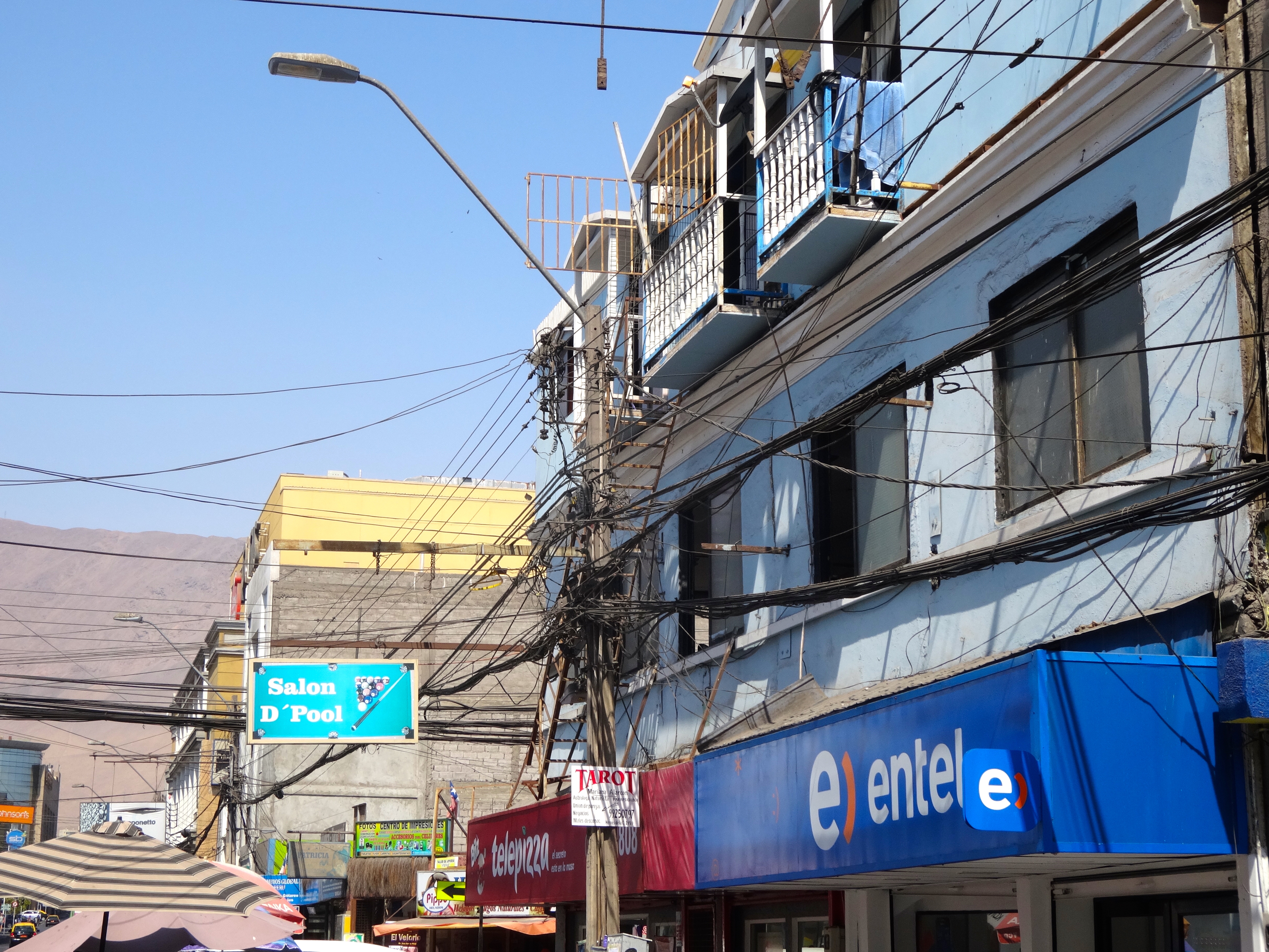
Beach scene.Another shot of the popular beach area. Notice the mountains in the background and how dry they are. Zero vegetation there. Not sure is any life is able to be supported there.Check out the wiring here. I wonder if it is up to code? Wait till you see the last pic of some local power lines. Crazy!Pastel colored high rises are common here.Two chileans having a chat in the shade.Georgian-style architecture from the 19th-century is found all around. Some has been well preserved and restored.
“Hey my power is out.” Look at these power lines. Almost creates a convoluted work of art. I’d hate to be the guys that have to work on this.
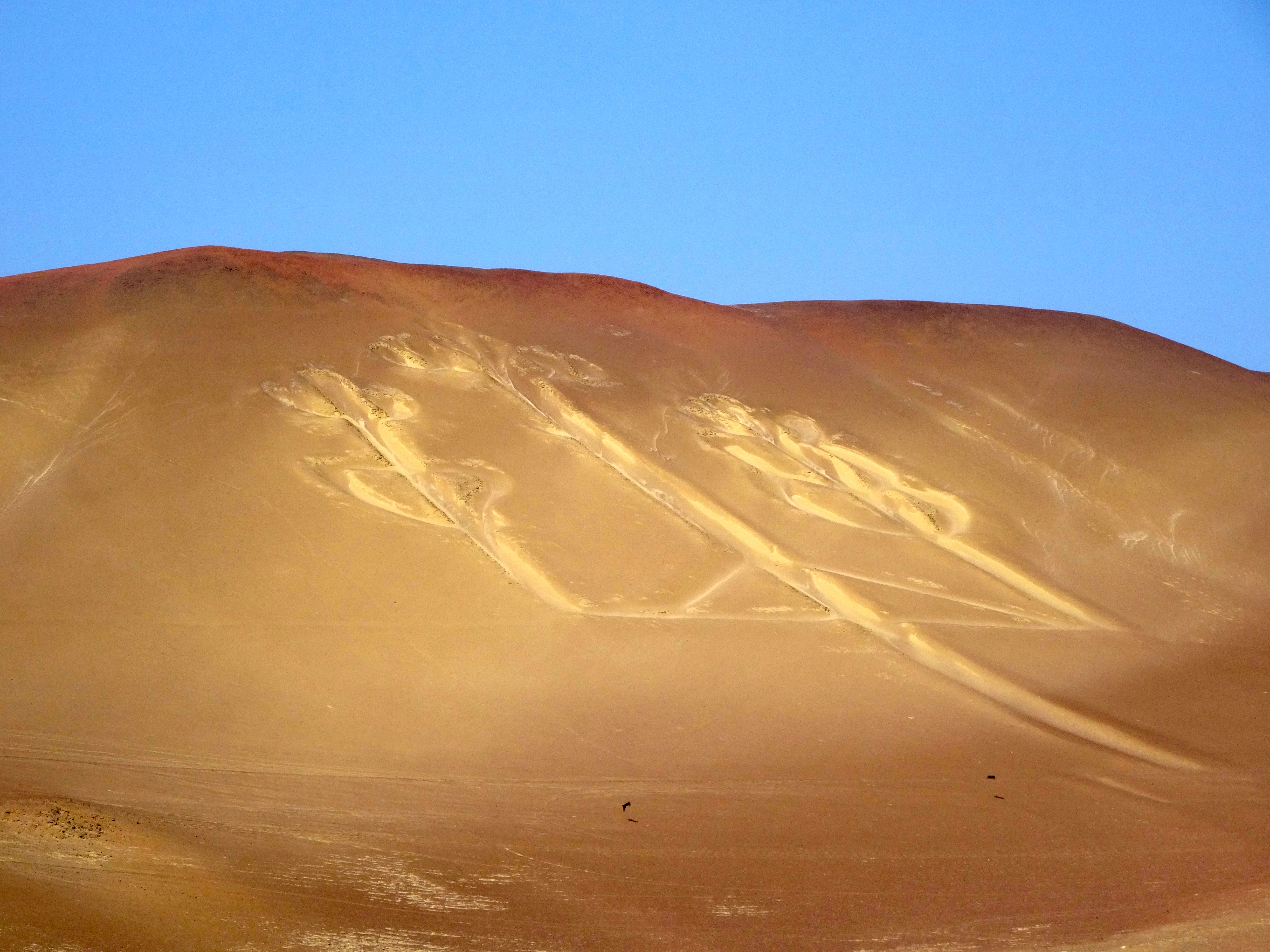
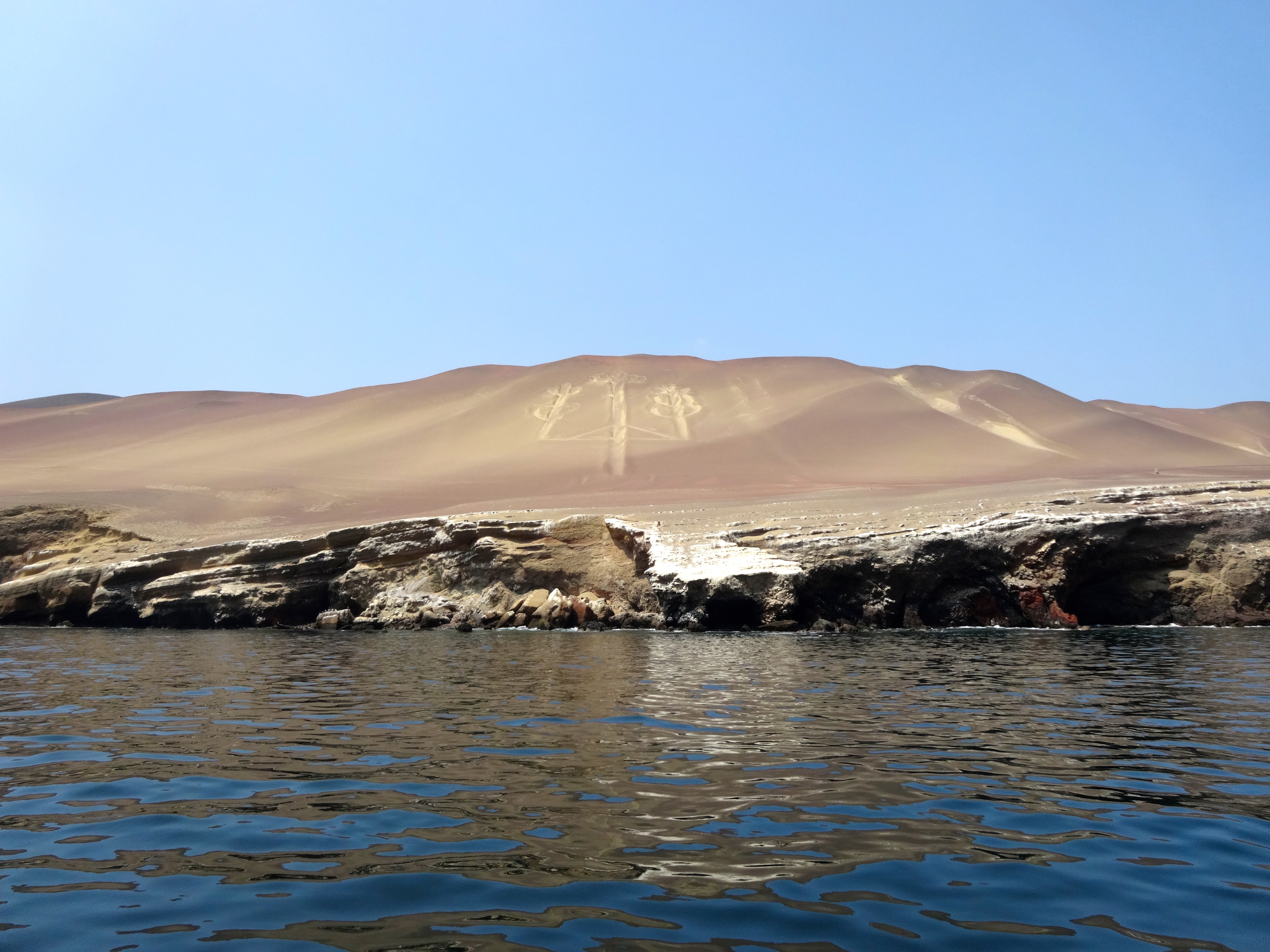
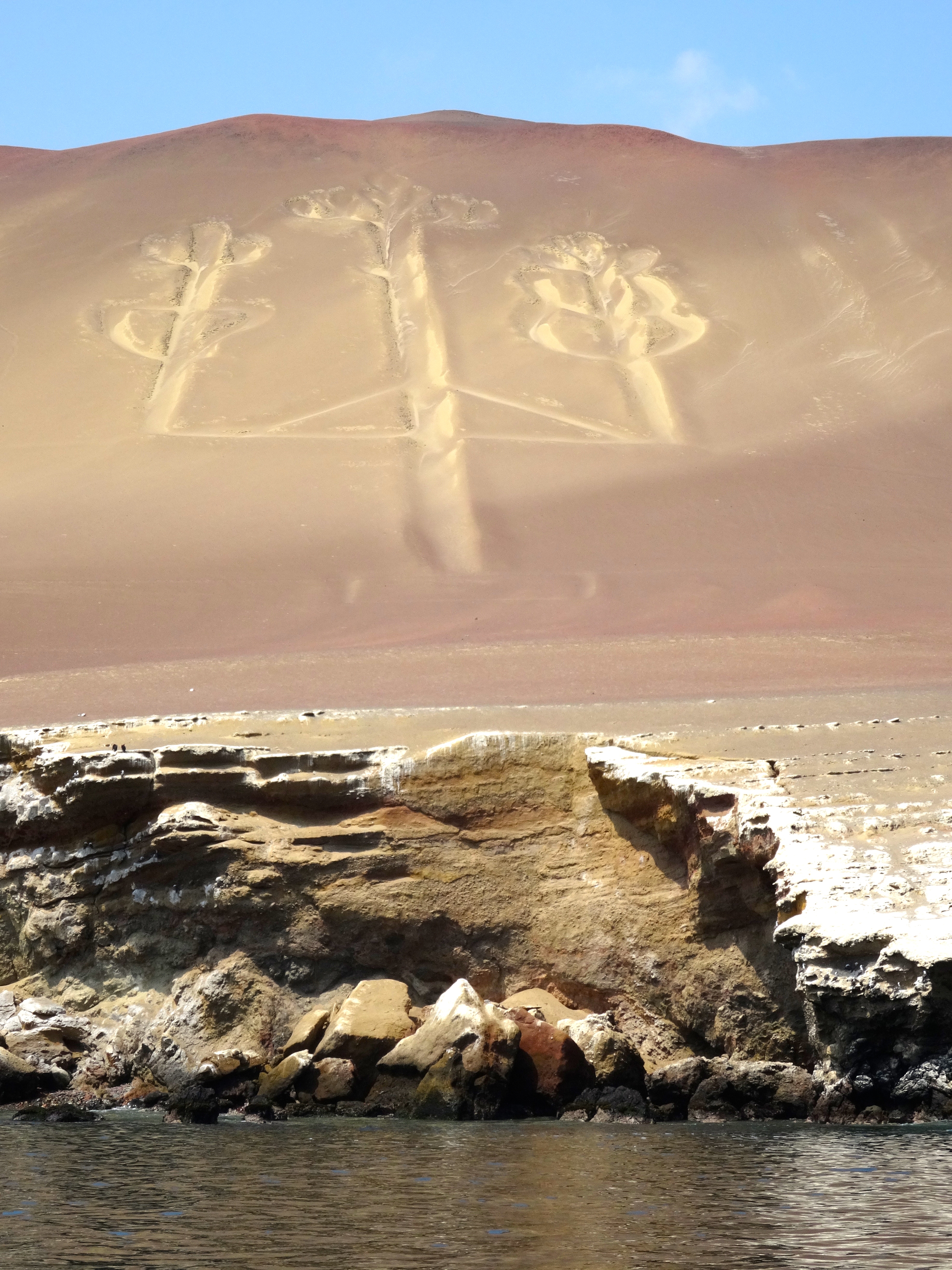
This is the most enigmatic giant ground drawings (geoglyphs) in South America. It is best seen from a several miles out at sea. I saw it fairly close (about a few miles to a few hundred yards.) It is etched into a sloping mountainside at Pisco Bay on the Peruvian coast. The figure resembles a candlestick; thus its name “The Candelabra of the Andes.” It is about 600 feet long and is visible from 12 miles out at sea. It also is located in a place that receives less then one-half and inch (or 1 cm) of rain annually. The prevailing winds come from behind (the south). Thus it is protected from wind and rain. It remains today pretty much the way it was over 2 millenia ago.
Archeologists have found pottery nearby which has been carbon dated to 200 BC and part of the Paracas Culture. Its purpose and symbology are in doubt, however one theory is that is was dug as a marker of some sort. Some archeologists say it is merely a trident. It was discovered in 1860. There is also a theory that it is related to a similar symbol found in California’s Cleveland National Forest. The archeologist associates the two candelabras in this way: The ancient inhabitants of Peru voyaged to California to collect Jimson Weed and other hallucinatory drugs. The archeologist believes the symbol resembles the Jimson Weed itself and served as a navigational aid. Hallucinatory drugs were widely used by these peoples in ceremonies and rituals. Please note that the hallucinagens were not used as navigational aids, just the symbol of course.
Closer pic taken near the shoreline.The “Candelabra of the Andes” closer up. Obviously my approach was from the sea.From a distance of 2 miles.Another perspective.
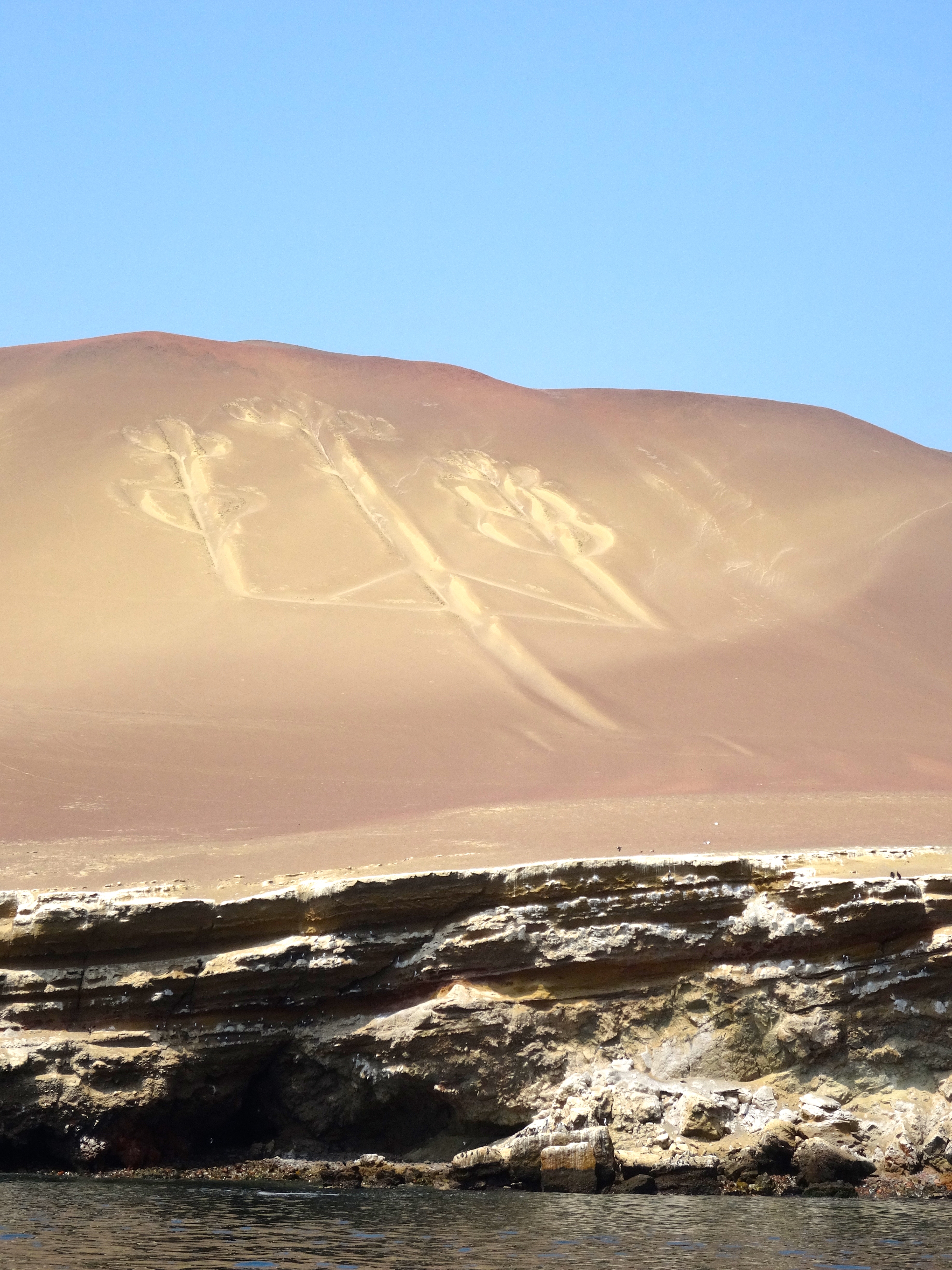
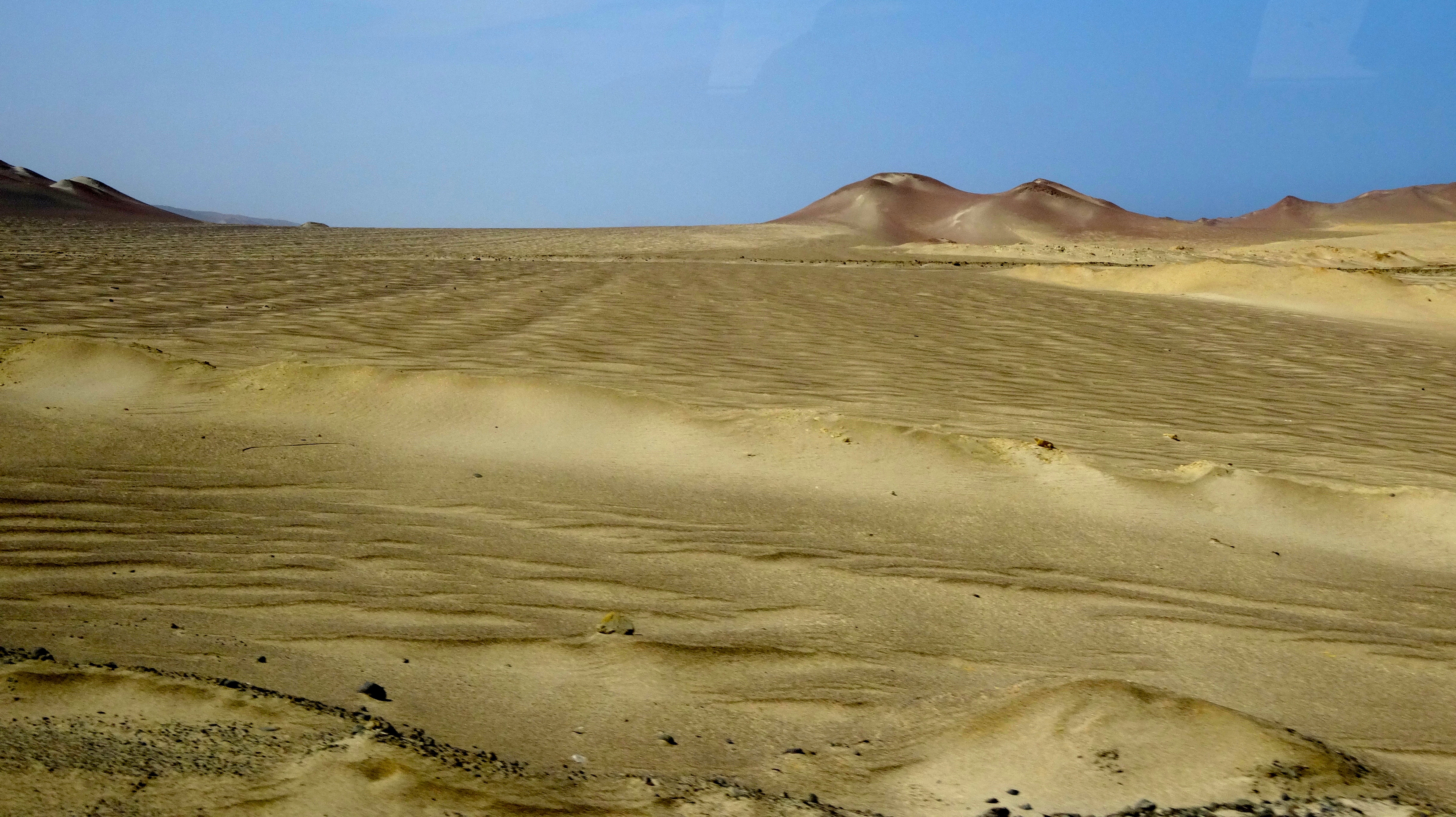
This is the surrounding desert. Not a living thing (plant, insect, lizard) for many many miles. This desert is several miles from the Candelabra. The annual rainfall is less the 1 cm (about 1/2 inch). I get thirsty just looking at this place.