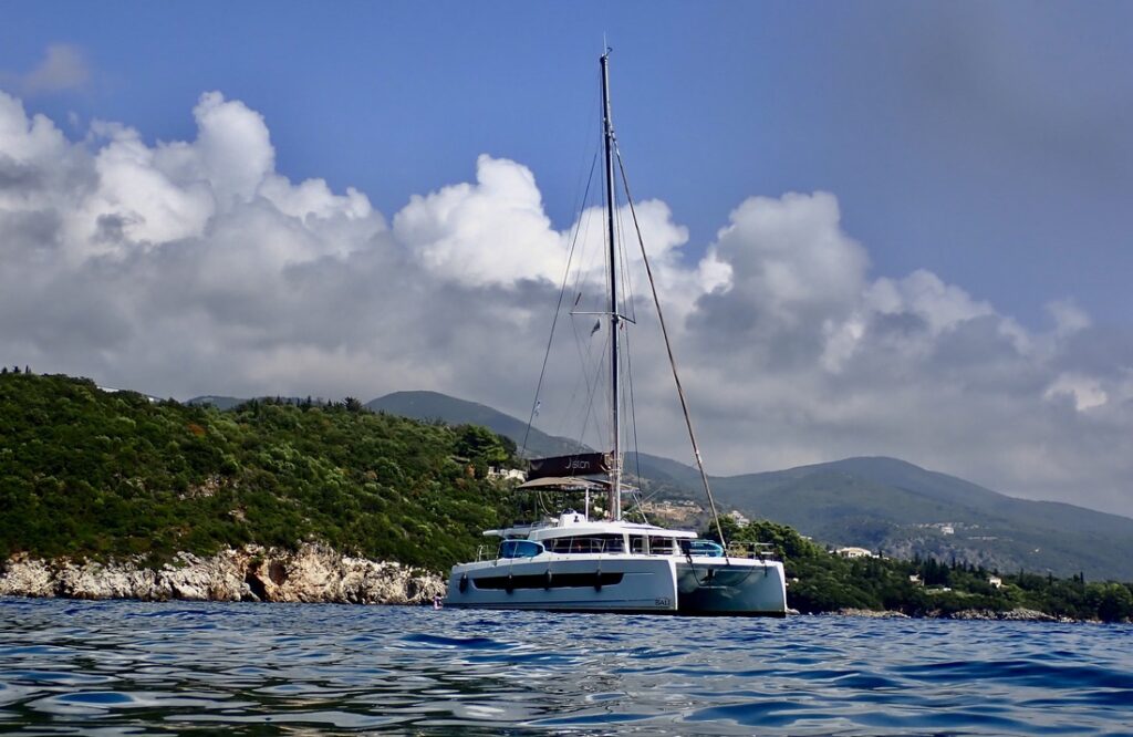
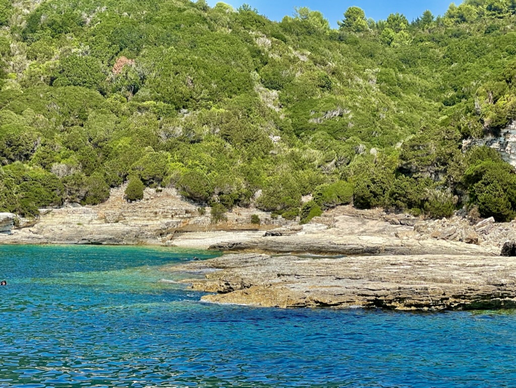
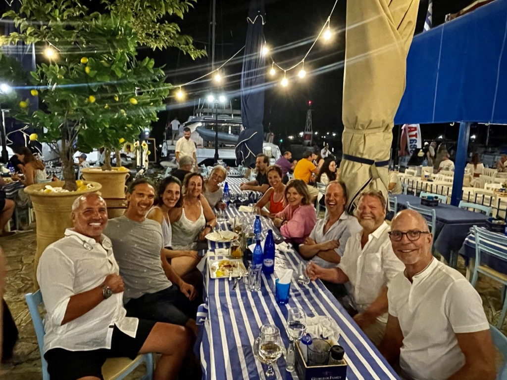
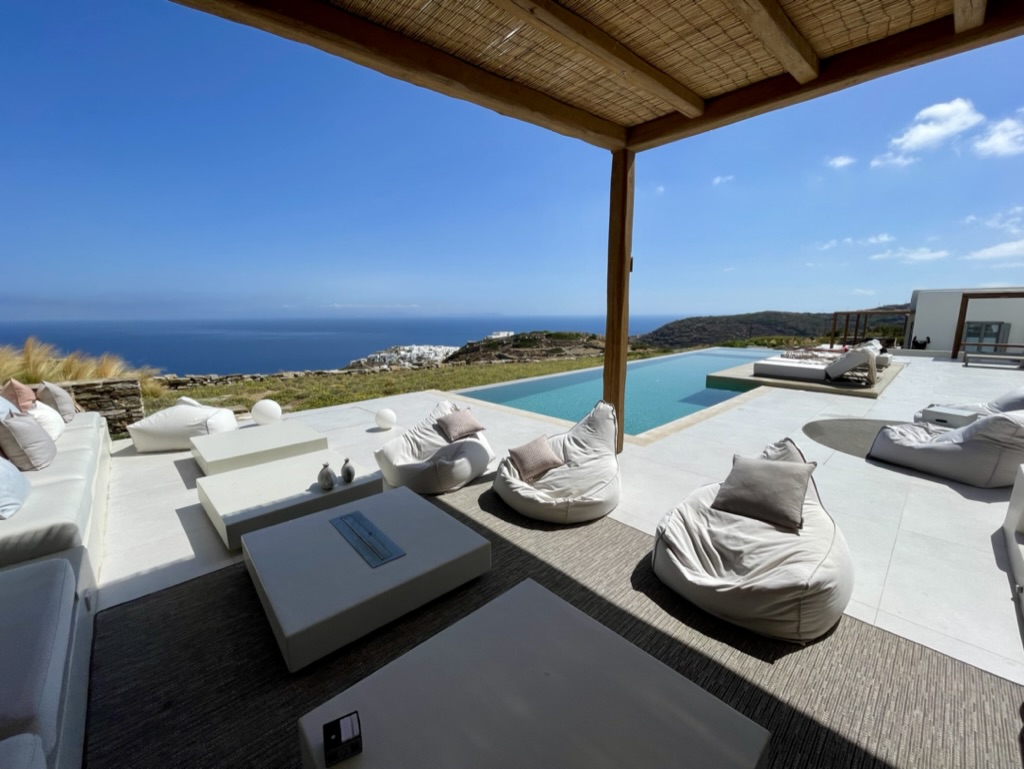
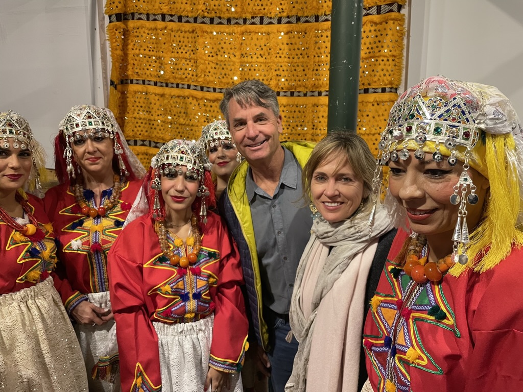
I chartered a catamaran in September in order to explore some of the Ionian Islands. Since I wasn’t entirely confident in my level of sailing expertise, I also enjoyed the company of a Greek captain and his lovely Turkish wife. She was acting as our hostess. She did some light cooking too. They, and the few friends who were joining me for this charter, made for a pretty magical time together. It was the perfect vessel for sailing from island to island and otherwise enjoying this scenically beautiful area. The Ionian Islands are just off the western coast of the Greek mainland. Daytime temperatures were in the mid 80s (or 30 degrees celsius). Nightime temperatures range from 72-78 degrees. The sea is a refreshing 80 degrees. We were in the water several time a day. The places we chose to visit are largely frequented by Greek tourists, rather than drawing a more international crowd. Consequently, these places are much less touristic and this results in a more intimate experience at every point.
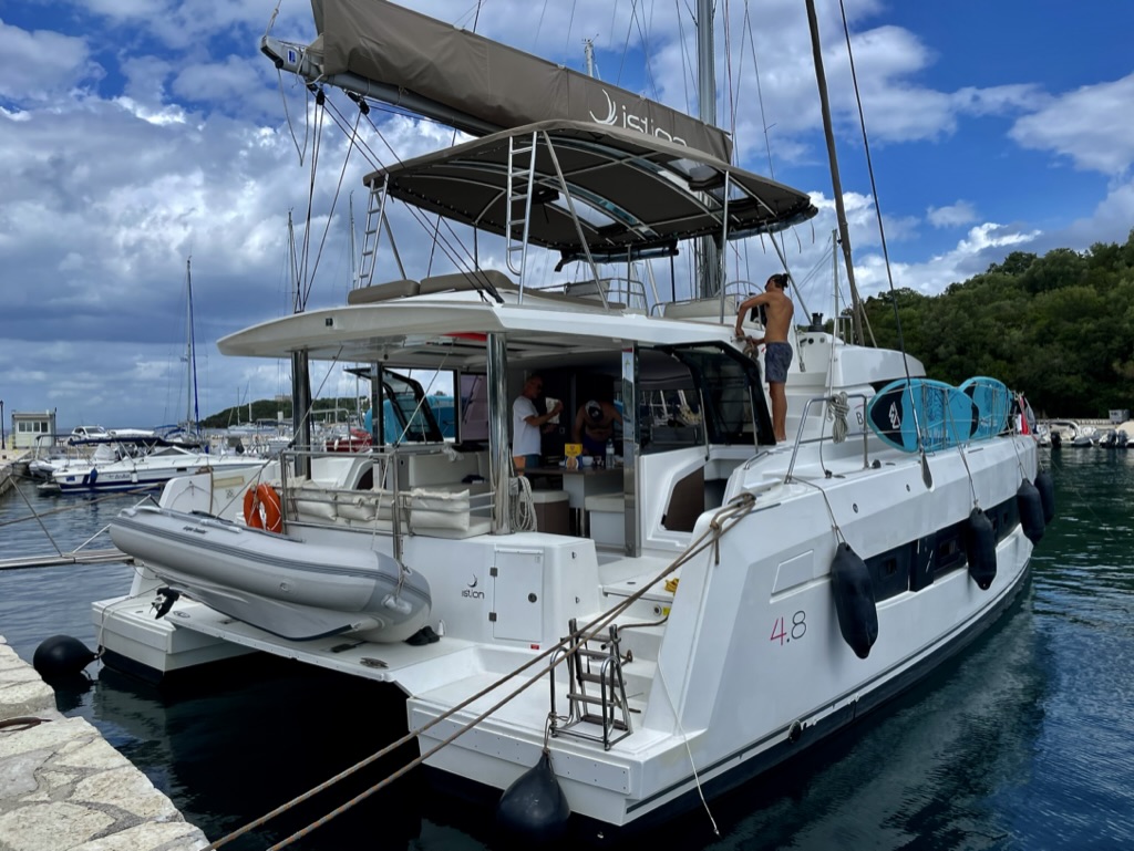
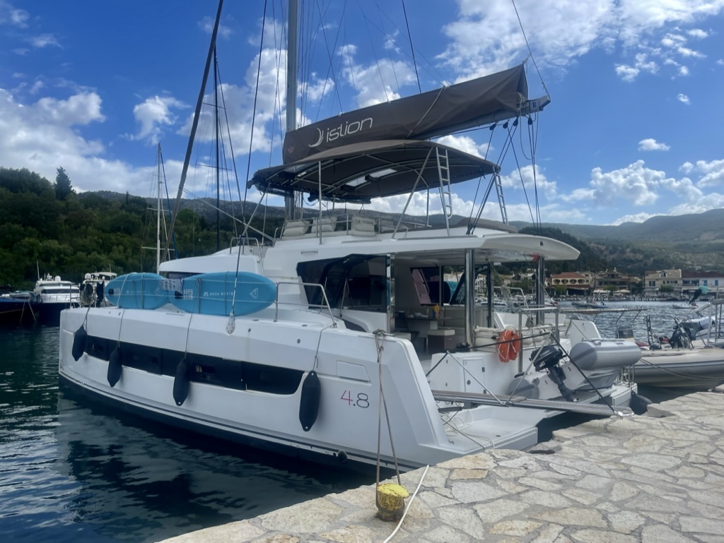
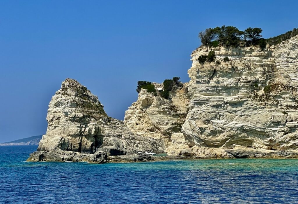
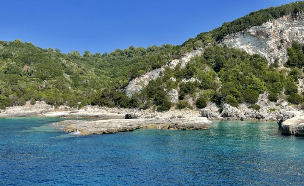
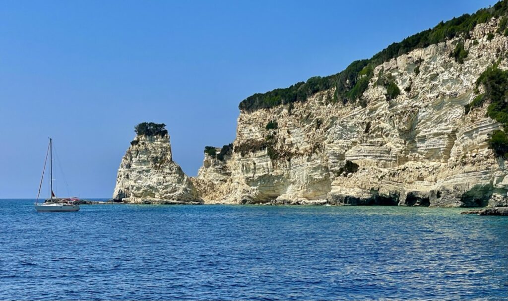
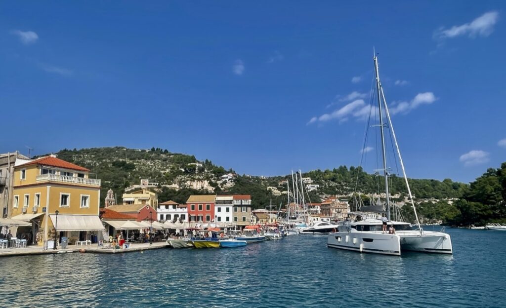
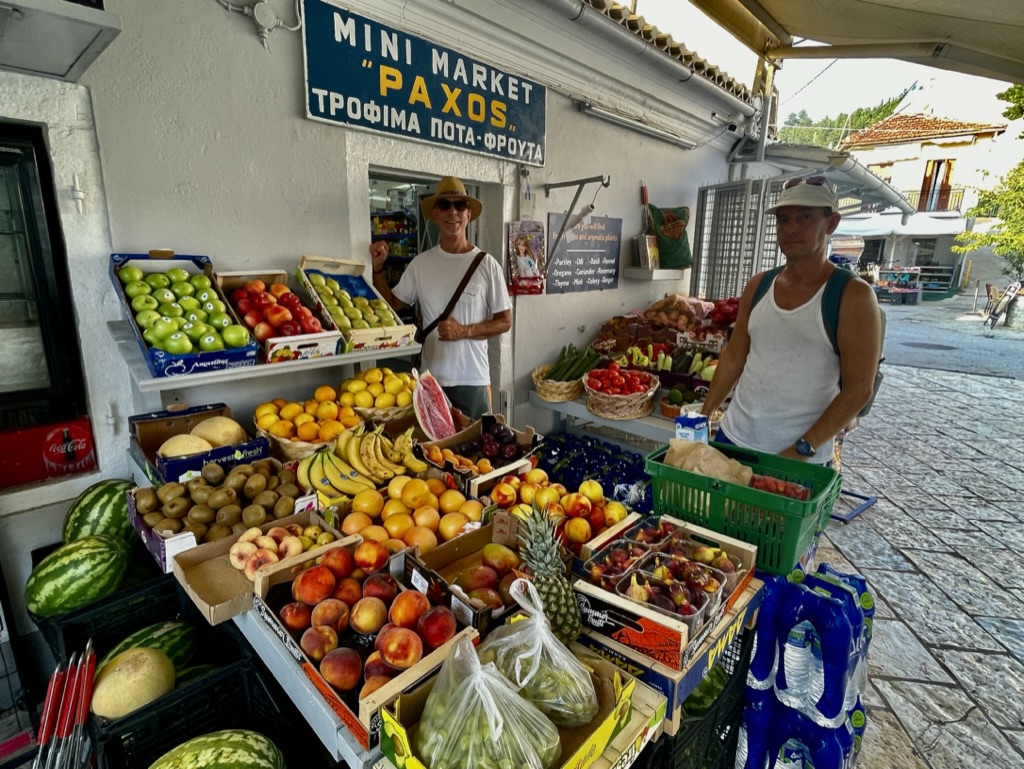
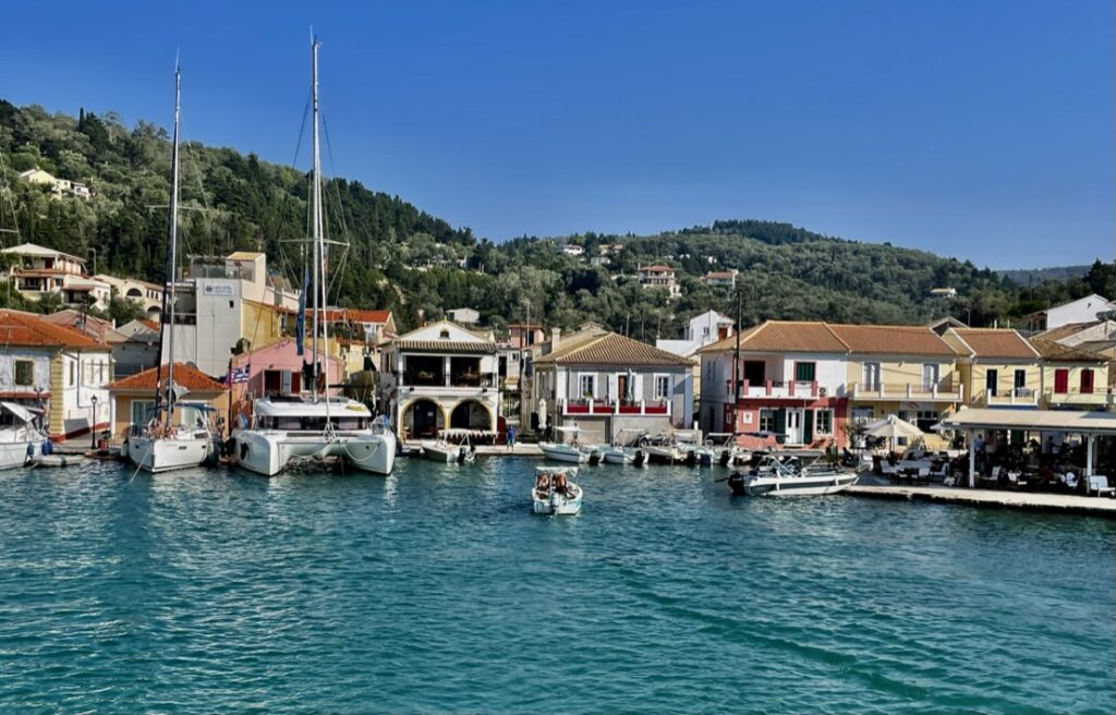
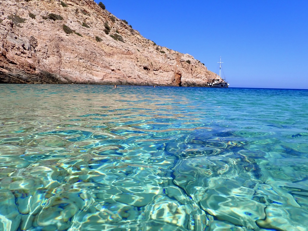
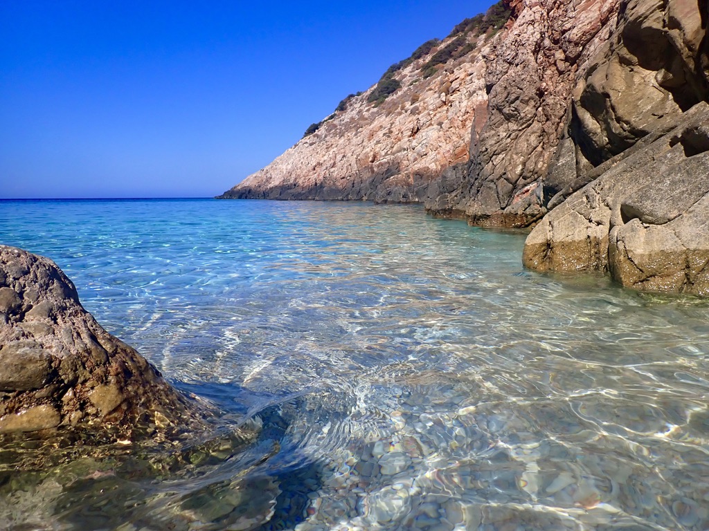
View from the water of the Bali 4.8 Catamaran. The catamaran is very stable because of its 25 foot width. We were able to sail unassisted by its motors about half of the time we were on the water. Here we took a break to swim and paddle-board to a nearby beach. Rear view of the vessel. Besides its 6 cabins and 6 bathrooms this vessel has great common areas. The view shown here illustrates the openness of the main deck area. The entire rear wall with its sliding doors recesses up into the ceiling, thus disappearing for the entire time we spent. It allows the outside and inside to become one very large and comfortable area with seating for 12-14 people.While almost all of our dinners were enjoyed in little restaurants and tavernas in the little villages we visited, breakfasts and some lunches were enjoyed on-board. This image was taken in the morning after filling the water tanks and getting some important provisions like more tequila and ice. Otherwise the Bali was well provisioned with everything we needed.The first of many snorkeling sites. Great water temperatures and clarity allowed for some incredible snorkeling. As can be seen there is no development. This spot was as quiet and pristine as it gets. Another image of the snorkeling coastline. In the distance on the left the sandy beach can be seen.The limestone features make for an interesting contrast.Antipaxos, this was our home for the night. This image was taken as we were sailing away in the morning. Some of the nights we had to moor instead of a marina tie-up. This night we had a tie up. The Bali had a small dingy for shuttling people from the boat to the shore when marina tie-up was not possible. These little villages are fantastic. Lots of bars, restaurants, little boutiques, and some dancing.Shopping for fruits and vegetables. Another afternoon and another little harbor for the evening. This place is known as the island of Paxos.Post sunset from the boat.A different evening and another beautiful stop for the overnight.The village at dusk is shot from above after a short hike up. On this particular night we moored the Bali in the harbor below. Then a 10 minute dingy transfer to the shore. Dinner by the little harbor. Eat, drink, and be merry then walk back to our home away from home. This group looks pretty merry indeed. Oddly enough, and it may be hard to see, but the woman seated on the far-back left bears a strong resemblance to that housekeeper I had in Sicily back in 2013. What’s crazier is that she doesn’t seem to get any older. Bella luna and some great cloud formations when I returned to the catamaran after dinner in the village. Perfect moment to enjoy a small glass of mastic and savor the view.
When the time on the catamaran is done we all part company. I will be headed to spend some time in the islands to the south of the Greek mainland known as the Cyclades. Until then, keep exploring.
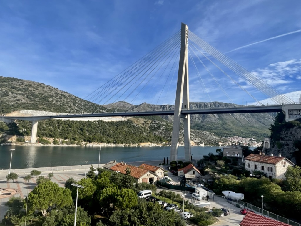
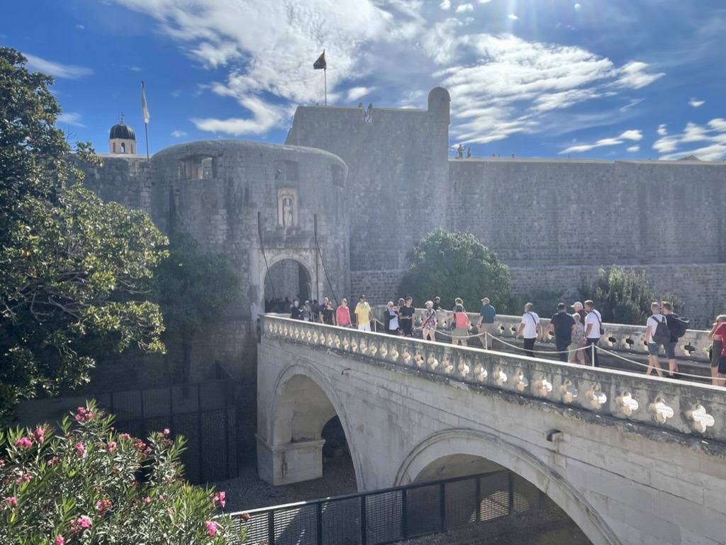
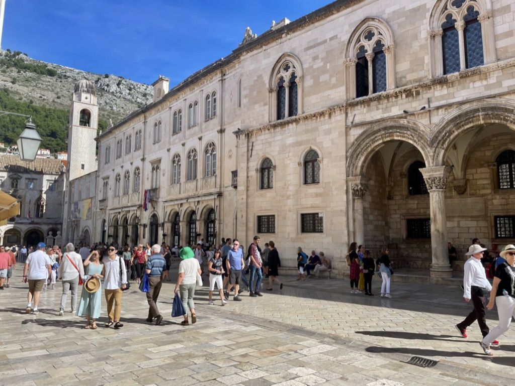
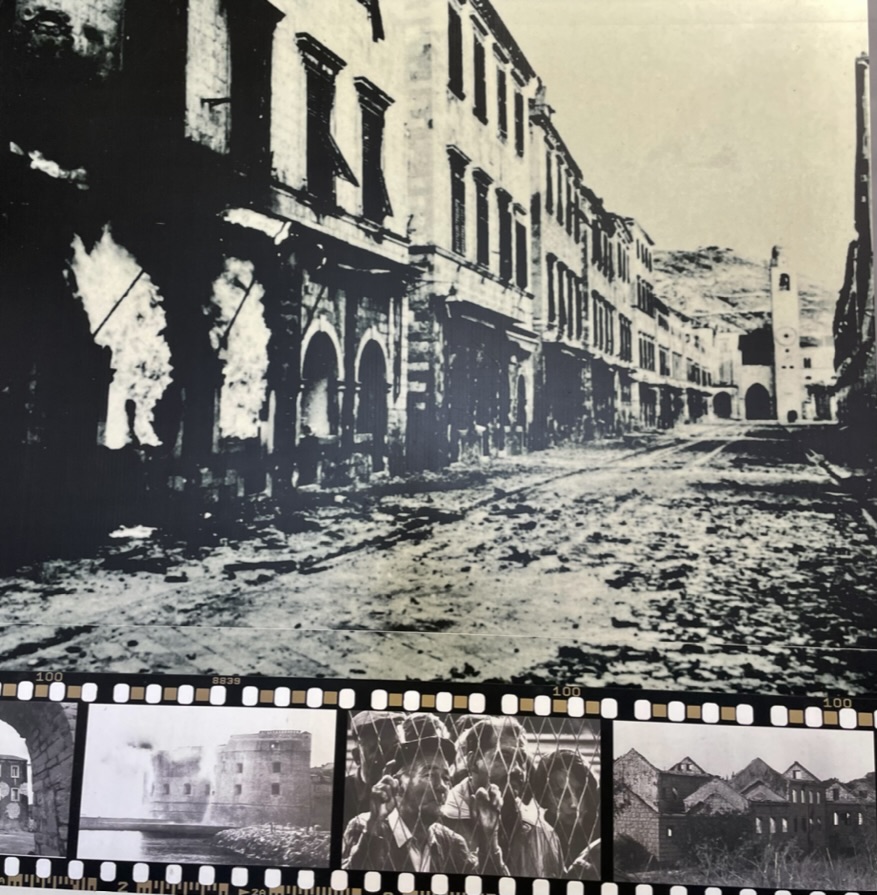
This was a great choice to visit. It’s on the Dalmatian Coast in the Adriatic Sea. The city was added to the UNESCO list of World Heritage Sites in 1979 in recognition of its outstanding medieval architecture and fortified old town. The city dates back to the 7th century. In 1991 it was besieged by the Yugoslav People’s Army for 7 months and suffered significant damage from bombings and shellings (See image below).
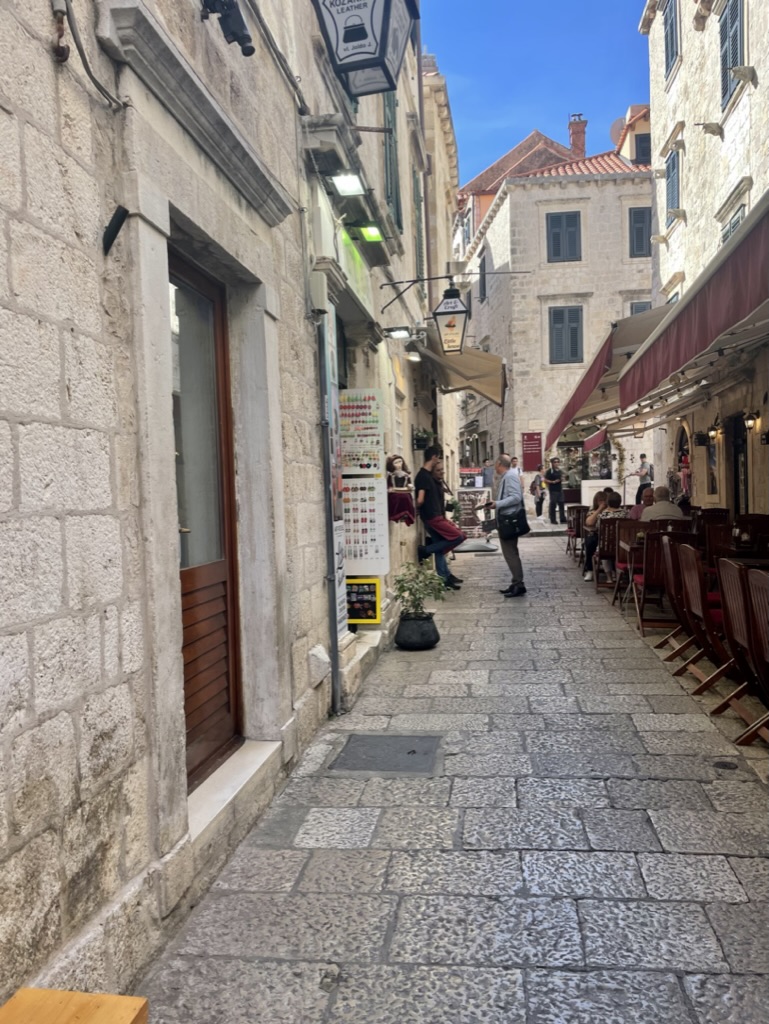
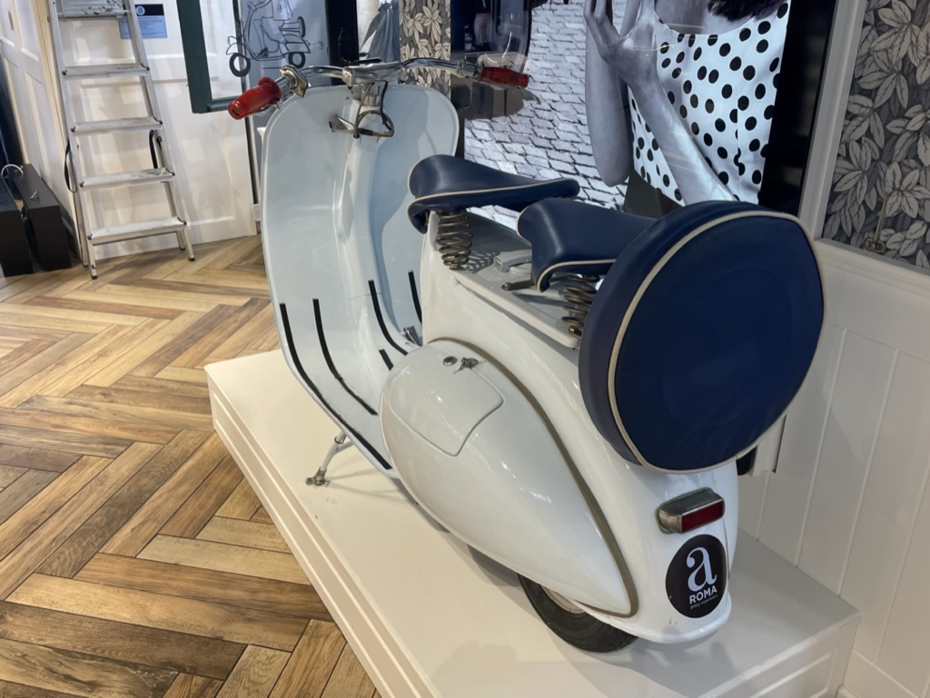
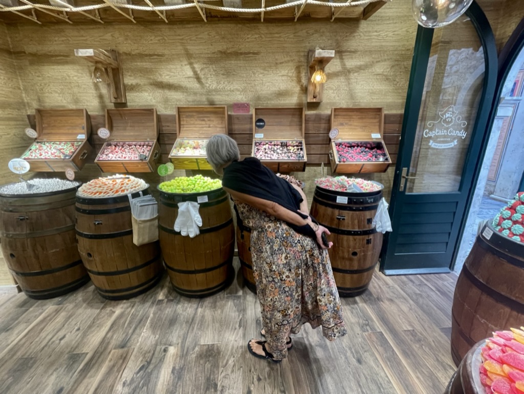
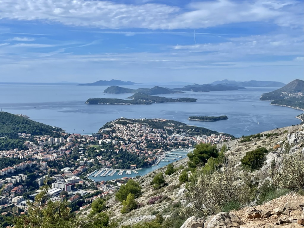
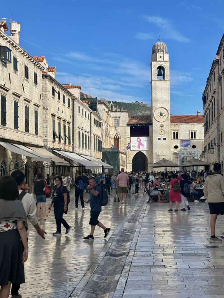
Sunrise along the Dalmatian Coast just outside Dubrovnik.One unique bridge. Gotta love the physics at play here. Visitors entering the walled city. There was a lot filming done here for the HBO series The Game of Thrones. It’s easy to see why. Typical street inside the city. There are numerous taverns, restaurants, and shops.Love seeing stuff like this Vespa displayed in stores. This is the plaza area within the city. A curious candy lover for sure. Not just another “looky lu.” She was not leaving without sampling and buying a variety of these tasty treats.A view toward the marina and harbor. 1991. The walled city after being bombed and shelled by the Federal Republic of Yugoslavia. 2022. Same perspective as the image just above, but 31 years later. The clock tower still stands. The restoration of this site is nothing short of incredible.
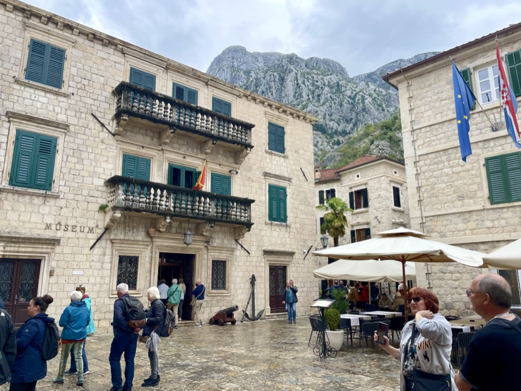
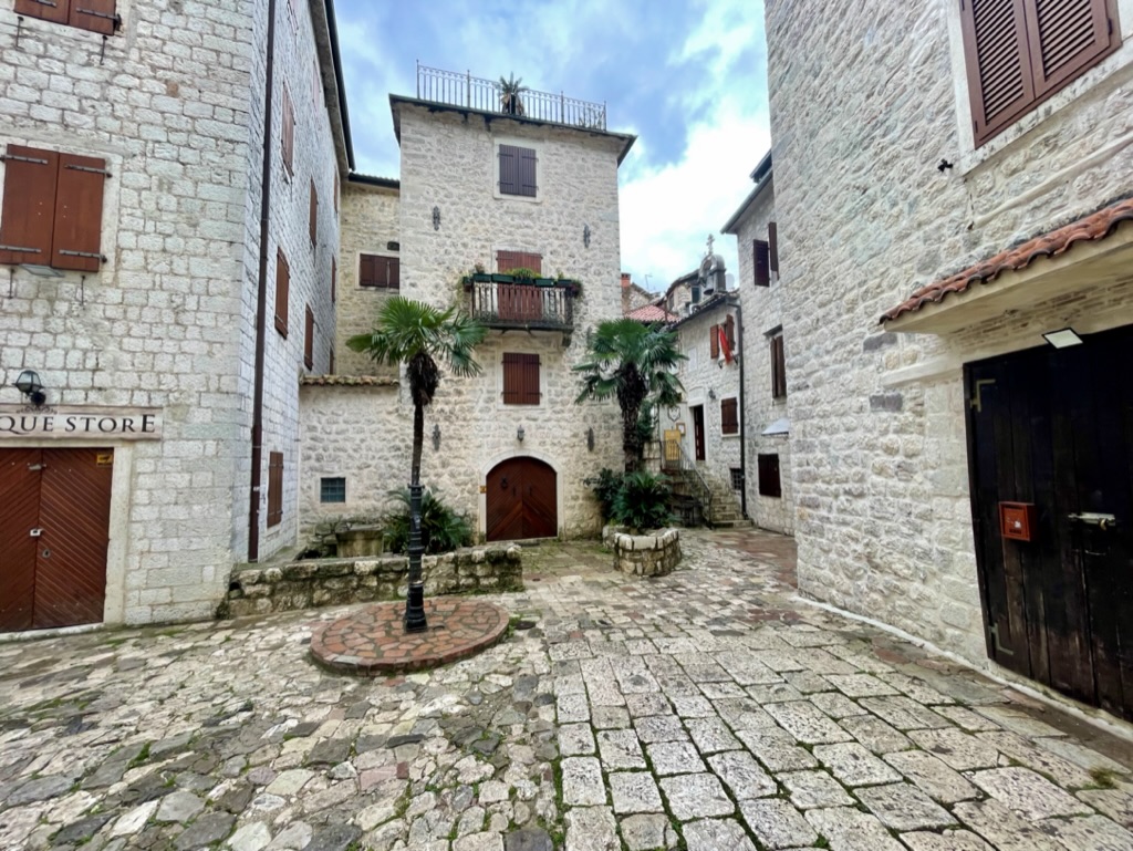
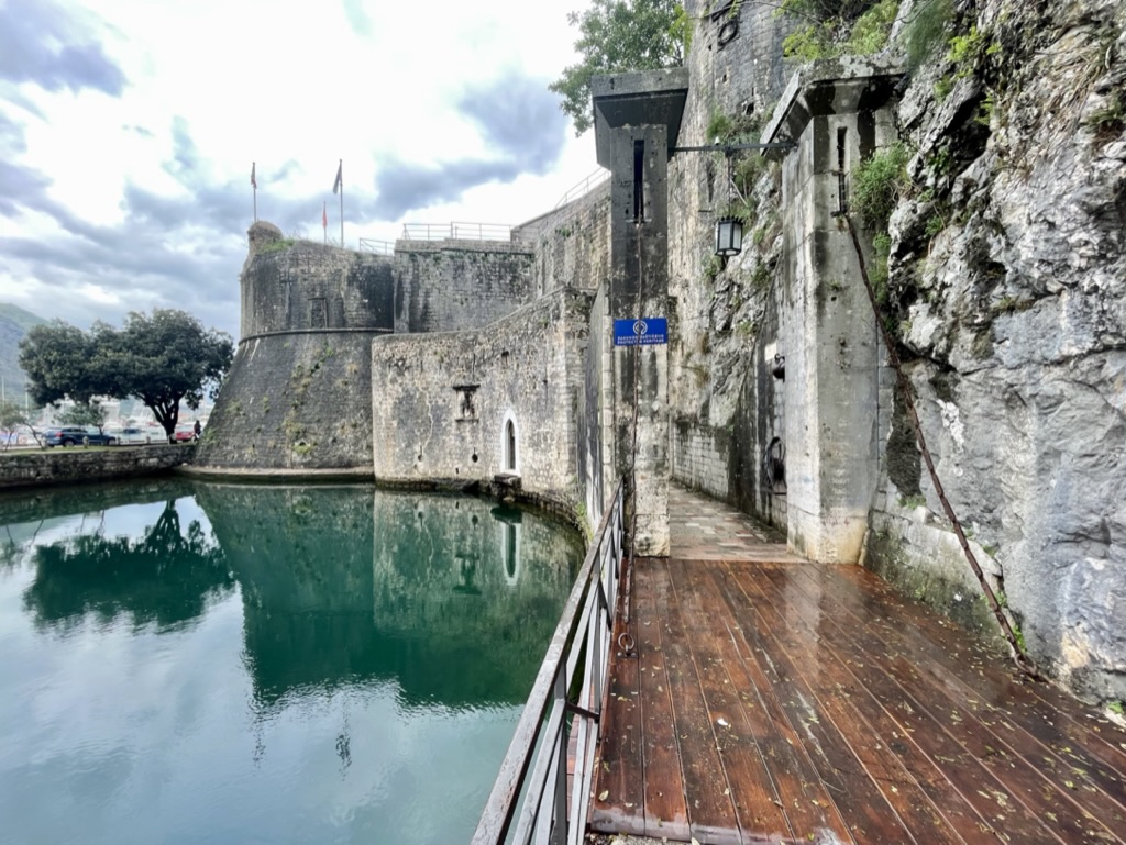
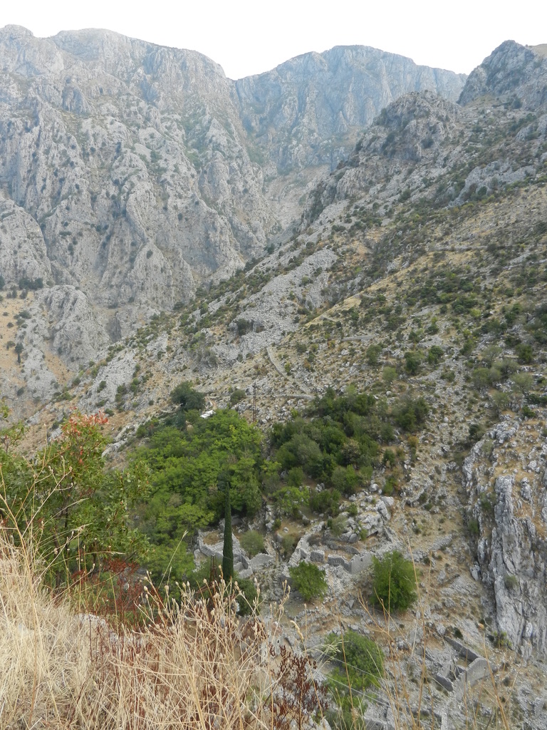
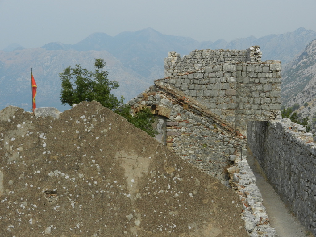
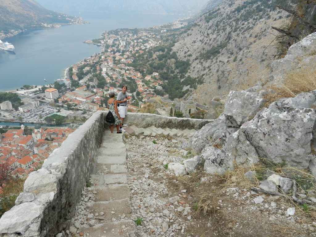
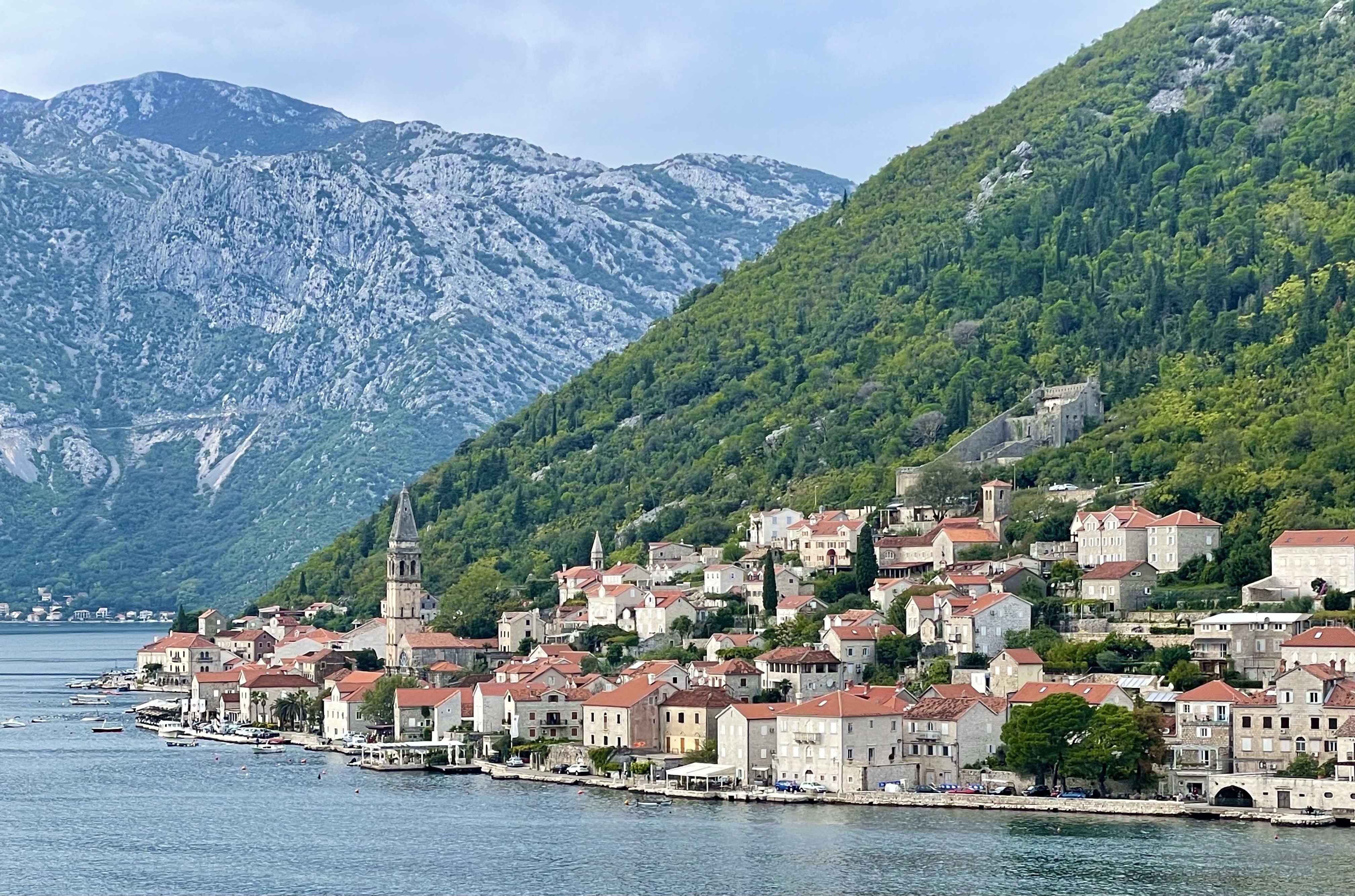
This is one stunningly beautiful place in the Balkans. It’s bordered by Serbia and Bosnia, and Kosovo to the east. Kotor was founded in the 5th century. The old city was built in 12th to m14th centuries. The protected walls lead up the the fortress of Saint Ivan. Kotor is on the World Heritage list.
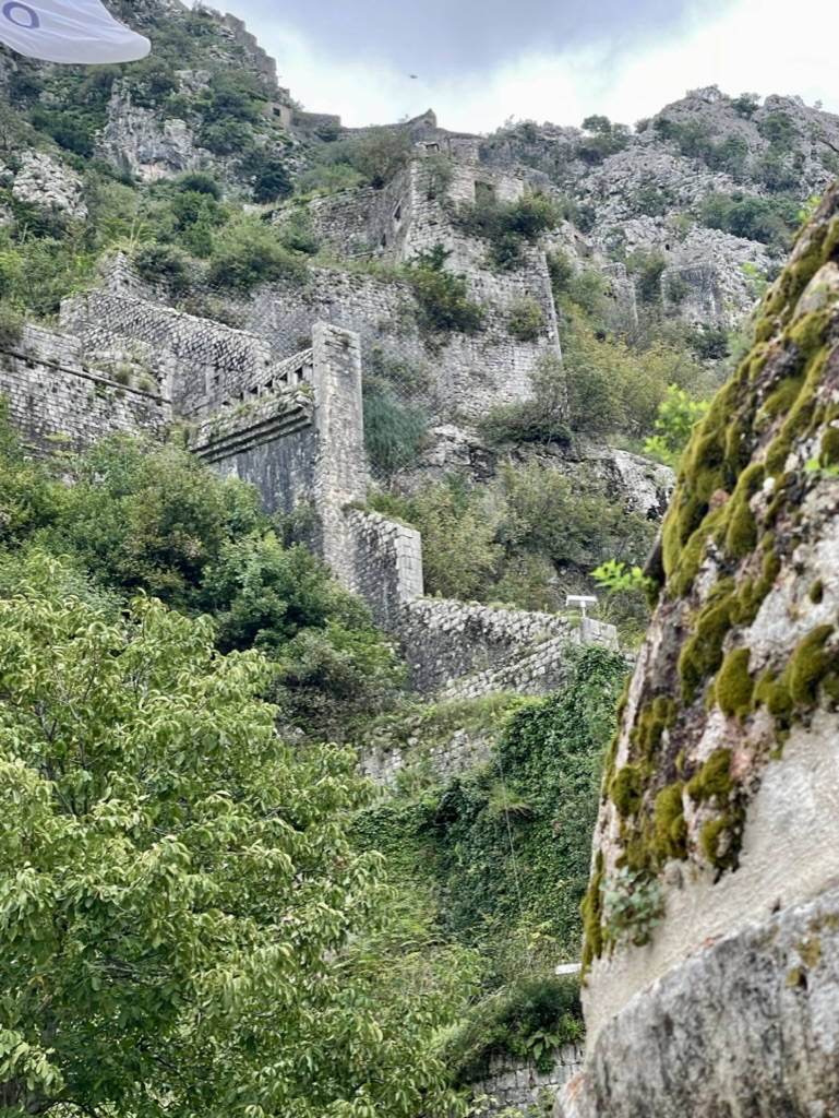
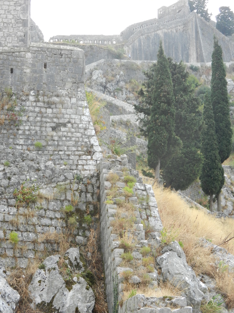
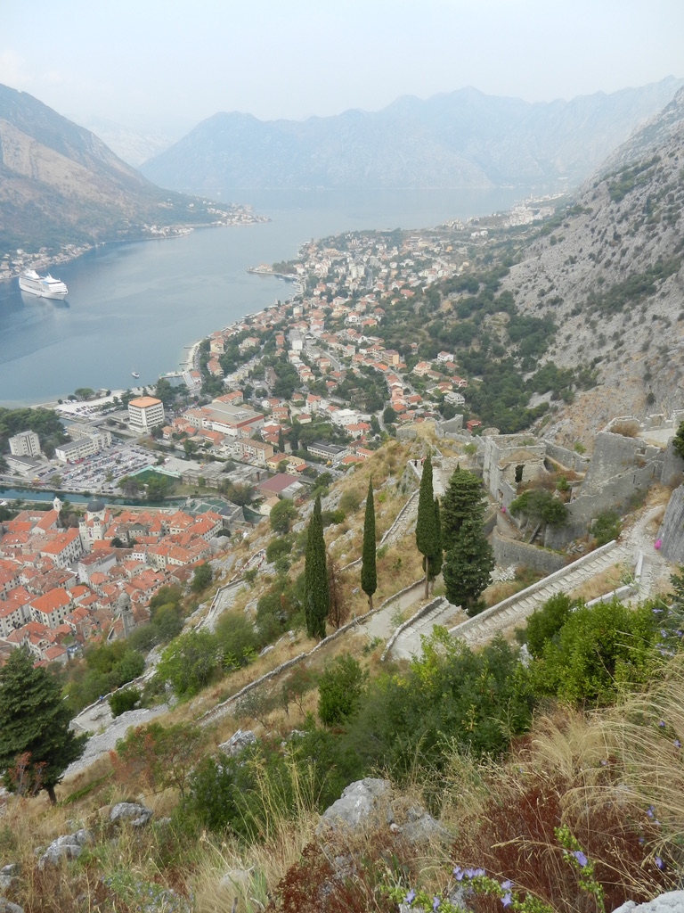
Within the walled city people enjoy taverns, restaurants, museums, and old churches.Just another quiet street where some businesses are closed for the season.Just outside the gate you can see what was once a functioning draw-bridge. Scarf man was happy I was in his shop. The pending hike up to the old fortress. Assuming you can, this is something you must do when visiting Kotor.Steps, steps, and more steps on the way up to the top. The view from above. It had to be at least 1,800 steps to the fortress at the top. I’m glad I wasn’t part of the construction crew who built it. The mountain range behind the old fortress does not look like it’s easily crossable. Thus, no sizable attacks could be mustered from this direction.Part of the old fortress. All the materials were transported up from the city below.Descending from the fortress back down to Kotor.
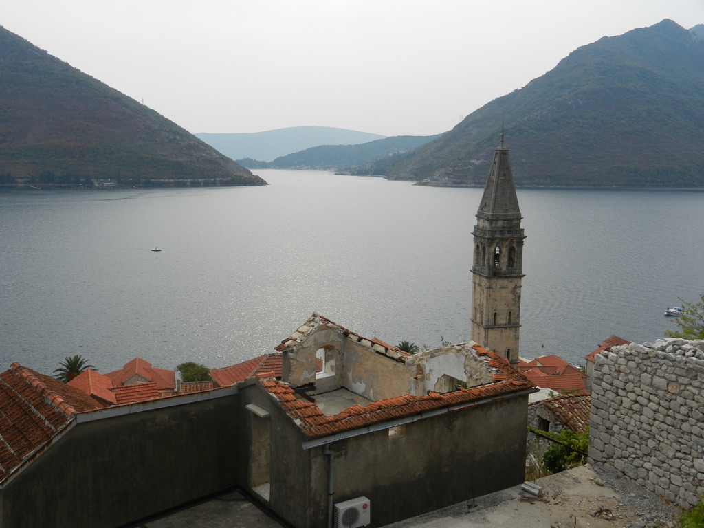
Perast
Perast is a tiny village about a 30 minute ride from Kotor. It’s right on the water and a great place to grab lunch. There is some fishing here, but not a lot more to do.
Perast from the street above. Not much to look at from this perspective except the beautiful Adriatic Sea.Perast from the water. This little town is absolutely charming and so picturesque.
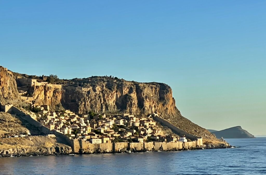
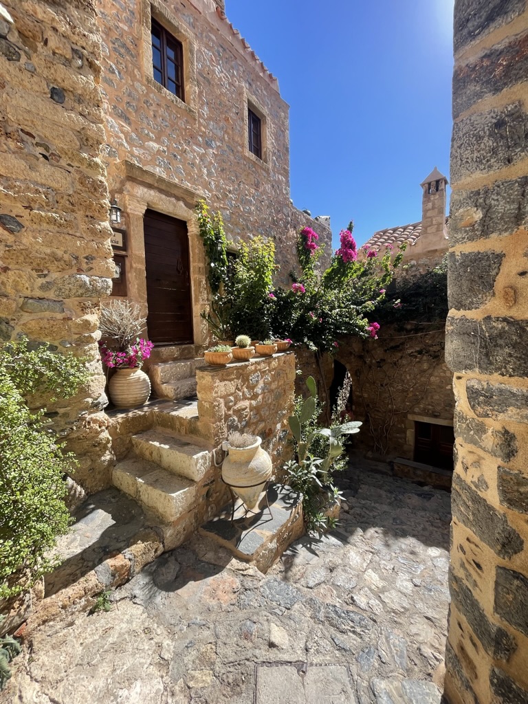
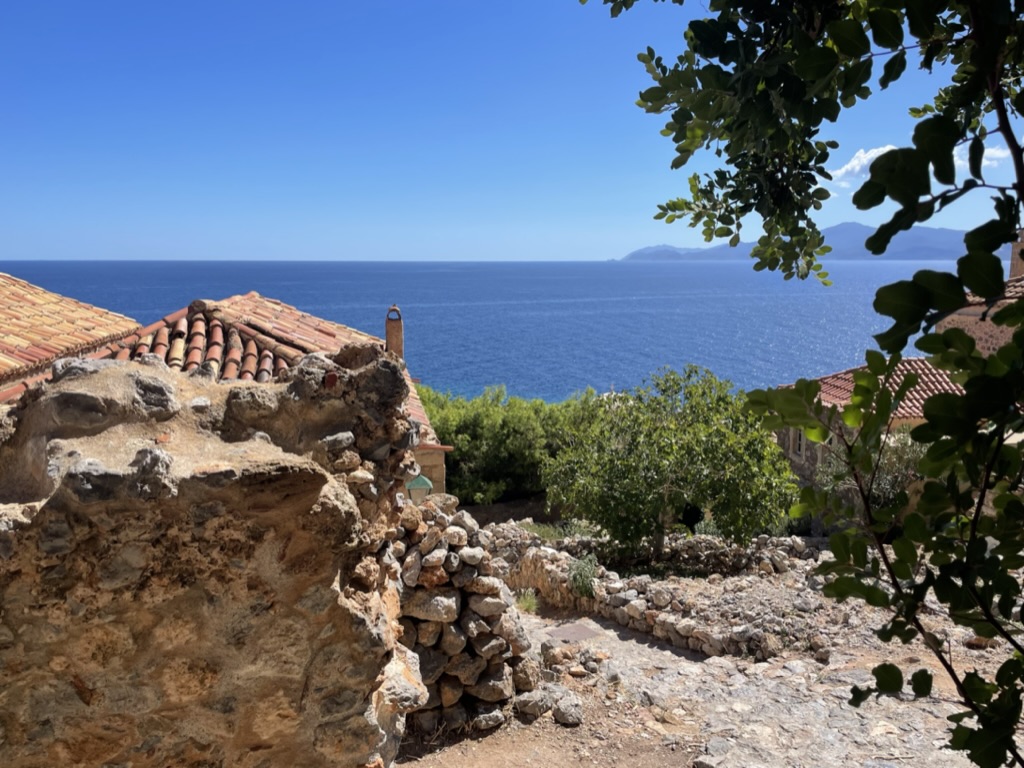
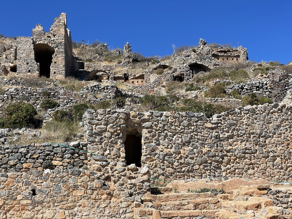
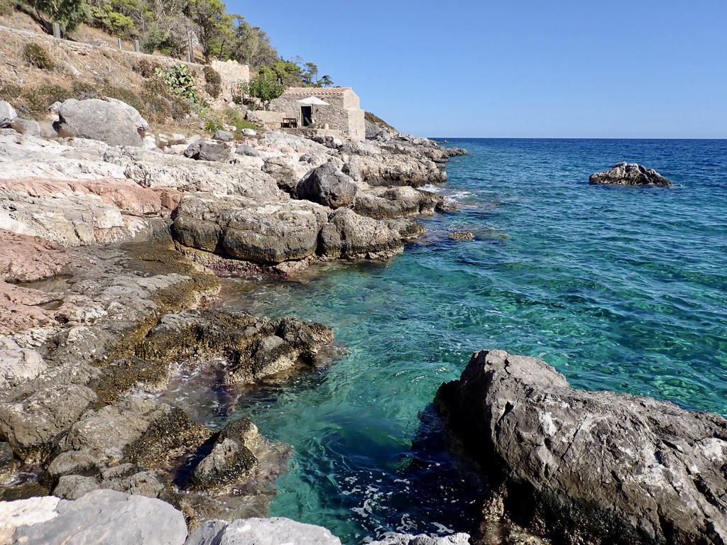
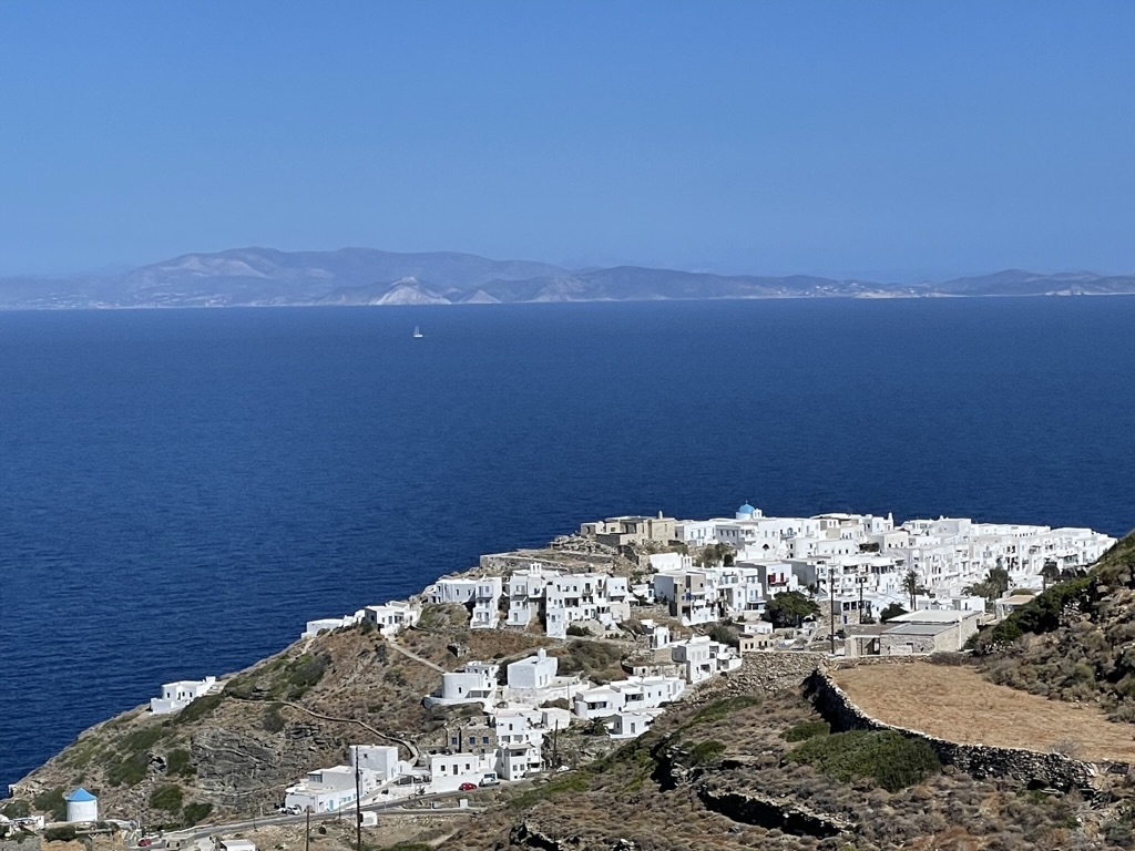
Monemvasia is a beautiful medieval walled city. Its ancient documented history dates back the 8th century. However, it had some settlements above it that date to a much earlier time. These are evidenced by the ruins atop the cliffs above the walled city. Monemvasia is home to only 1,300 people. Its absolutely charming and while it is almost an island, it is not, as it is connected to the mainland by a narrow 200 meter causeway.
The walled city image captured from the water. I hiked up above to the ancient ruins which are pictured below.Within the city flowers abound. Virtually all the construction is of stone and tile. And while it’s as solid as it gets, it does make hanging pictures or mounting a flat-screen bracket a real challenge.Crashing waves at seaside. There are some ladders from the rocks into the water for access. It was very hot so I took a plunge to cool off for a bit.The view from the hike up to ancient ruins above the medieval city.These ruins pre-date the walled city by possibly 800 years. You are able to see that these people really honed their masonry skills in the centuries between. These older ruins appear Flintstonesque when compared to the walled city.An Airbnb outside the walled city. This little dwelling had no windows, only a door. It’s a solid little structure. Could probably survive a direct tsunami hit. Not sure how much demand there is for a place with no windows.
Olympia
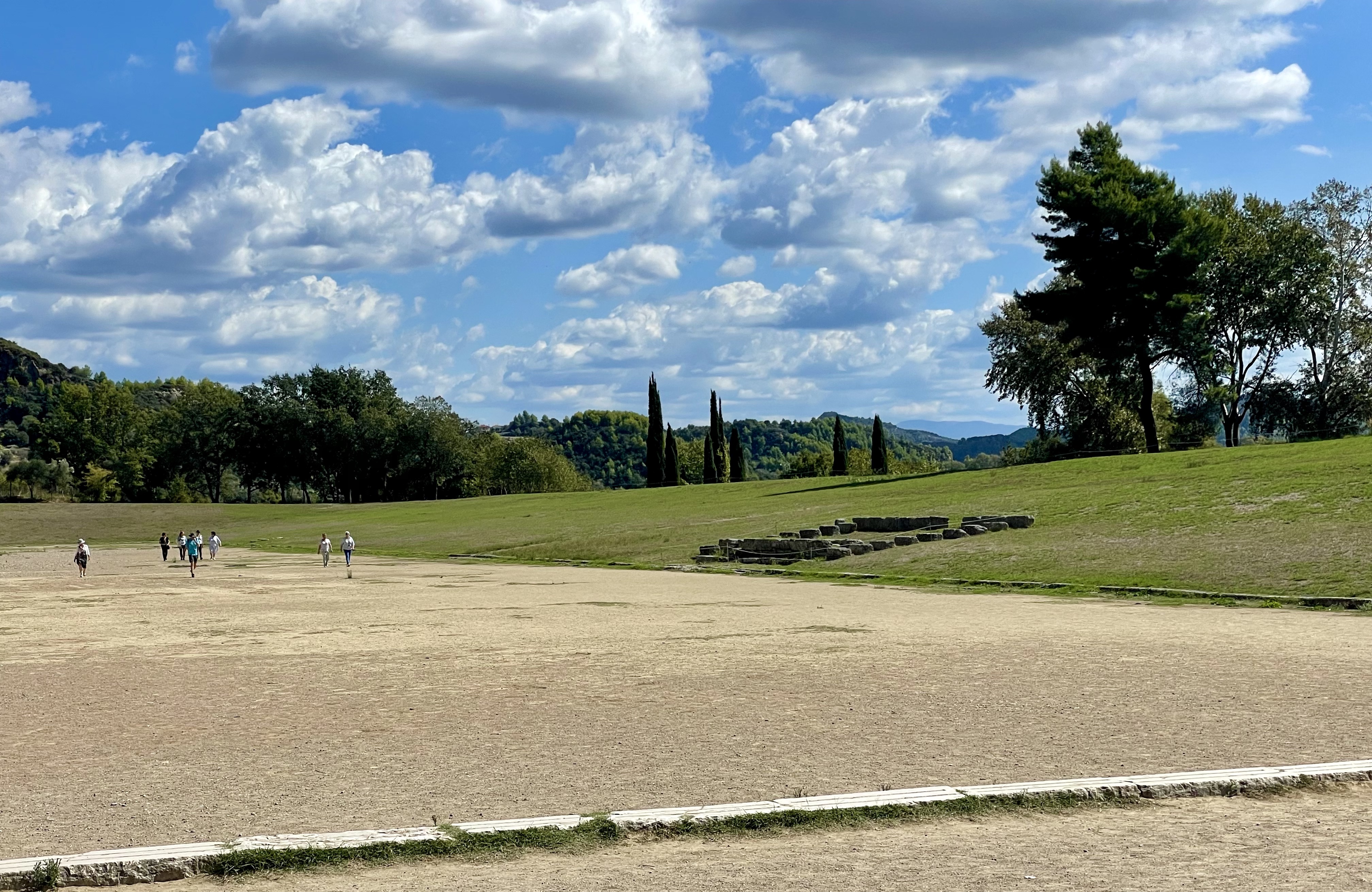
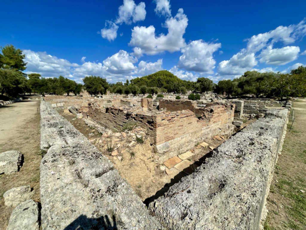
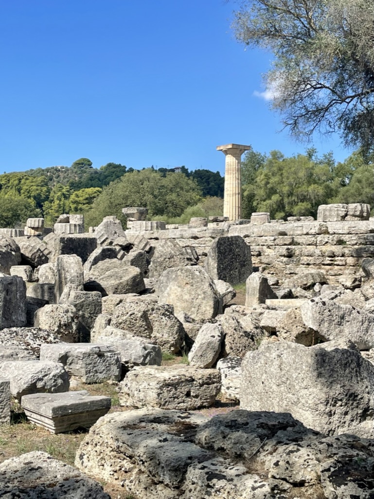
Olympia is the birthplace of the Olympics. There are several acres of excavated artifacts and ruins in the park to be explored. It is an active dig from an archaeological perspective.
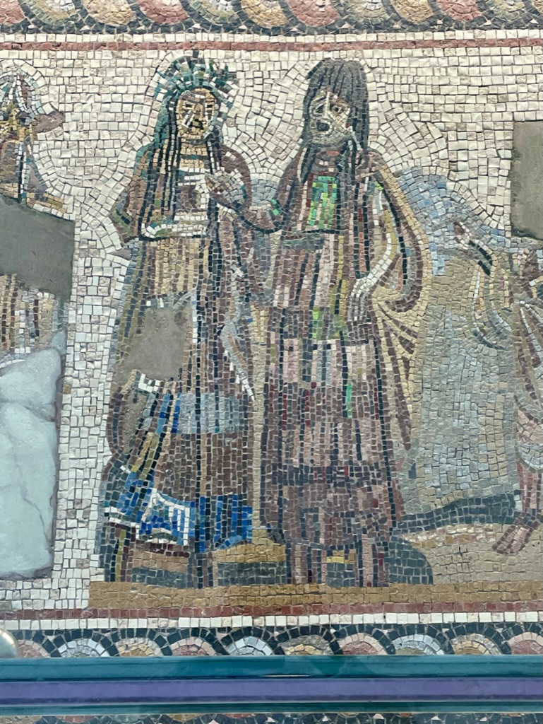
The field of the original Olympic Games. The games ran for 4 centuries (800BC-400BC) until the Romans banned them because they believed the games to be pagan, and thus contrary to their religious beliefs. What a buzz-kill these Romans must have been, on so many levels.Building ruins at Olympia. Most of this site consists of the old city ruins.Here is one fully erect doric column. The ruins are like a giant puzzle, only these pieces need small cranes and forklifts to move them into place. It appears as though they have given up trying to place them in most of the park. Just put the “DO NOT CROSS” ropes around them, charge the public to view them, and call it a day.This area cleaned up nicely. Ionic columns in the park.Mosaic in the adjacent museum. While the original games were BC, this mosaic only dates back to 700AD. It is more than 3 meters high. That’s a lot of tiles.
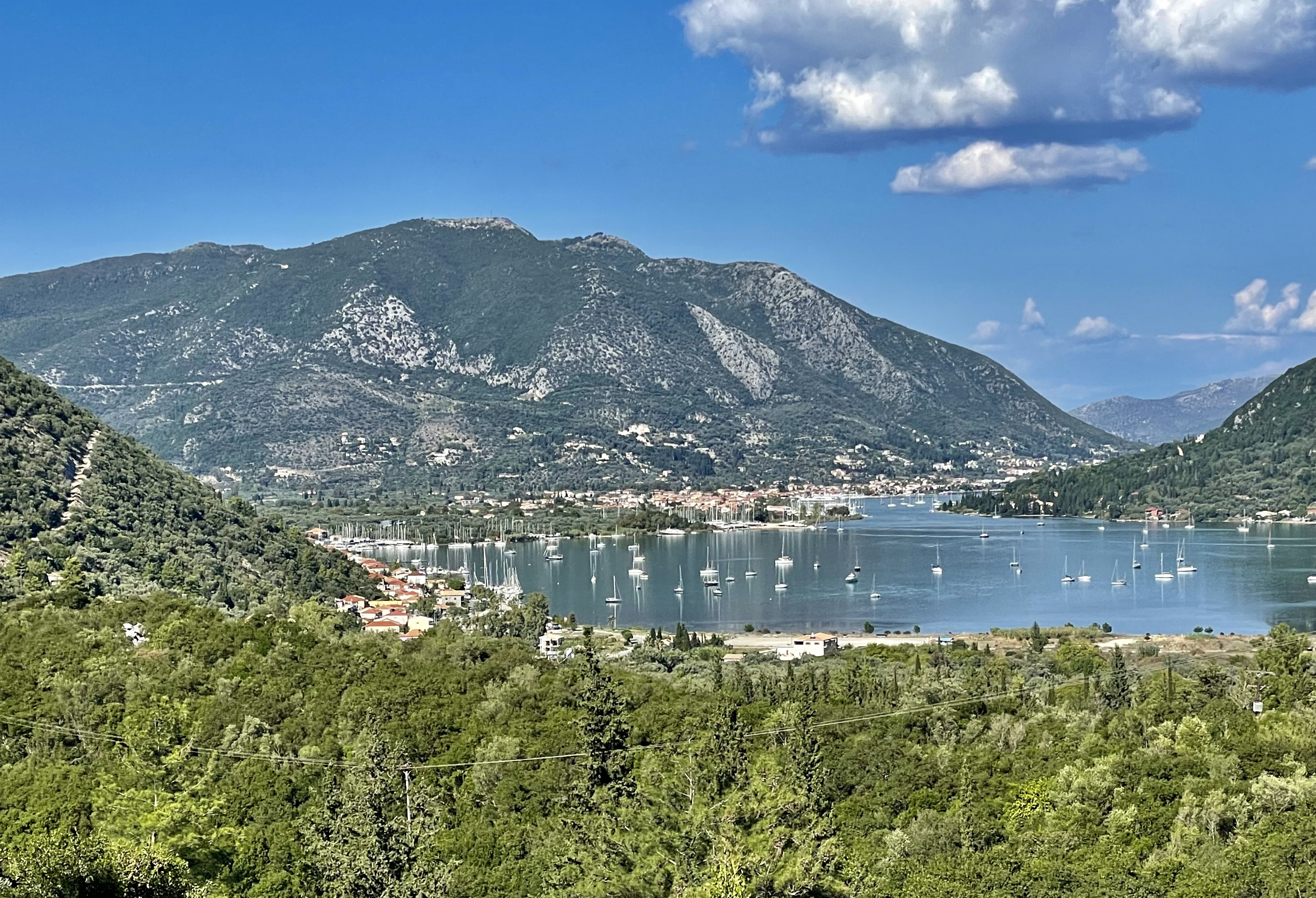
Ionian Islands
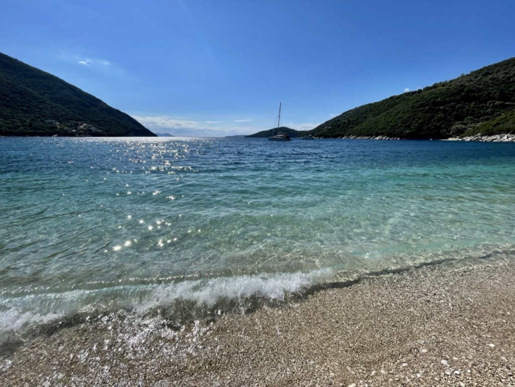
The Ionian islands are much more lush when compared to the Cyclades. They are considerably more mountainous. The people here are as friendly and welcoming as everywhere else in Greece. It’s a great place for a 2 week sailing charter. It has beautiful beaches, fabulous waters, delicious food, awesome wine, and great sunsets. It has just about everything one requires for a magical time.
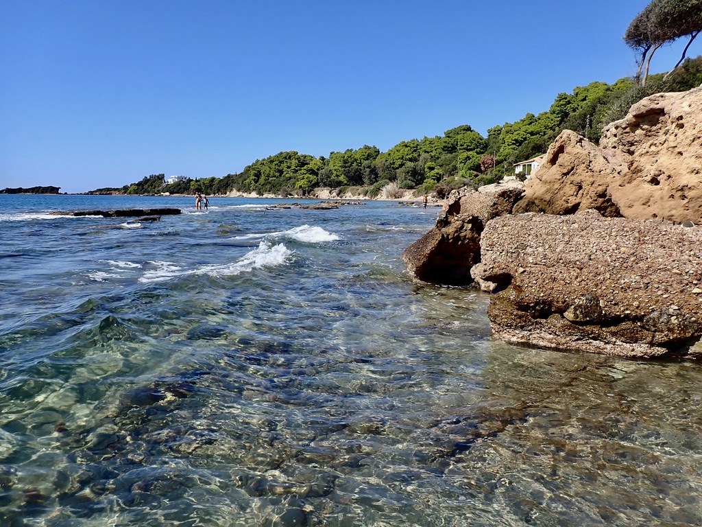
One Ionian beach with really good lunch options. Harbor in Nydri on the Island of Lefkas. It resembles the Lake District in northern Italy.Another beautiful beach albeit a bit rocky. One more parting beach image.
And that’s it from here. Not sure where I am headed next but I hope to file an entry from there, possibly Montenegro or Croatia. Thanks for viewing and checking in.
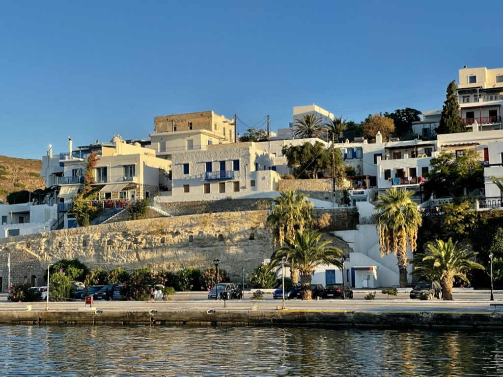
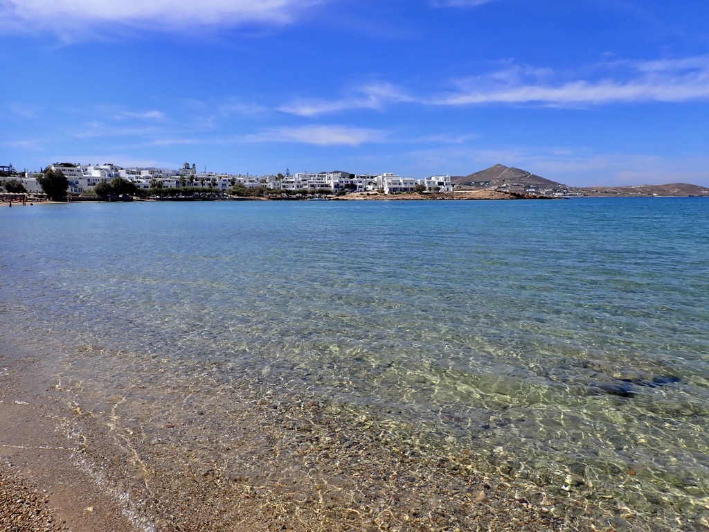
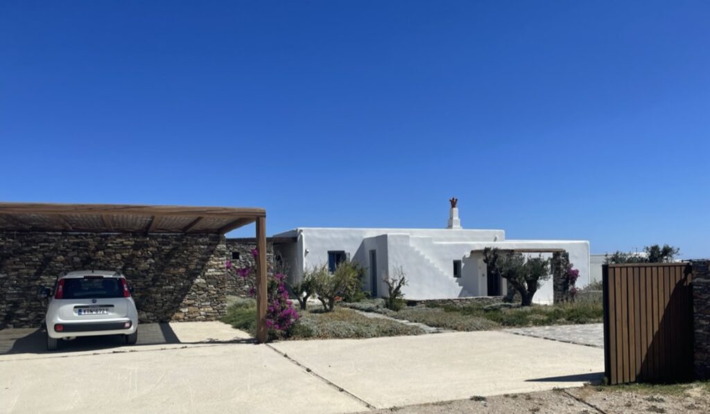
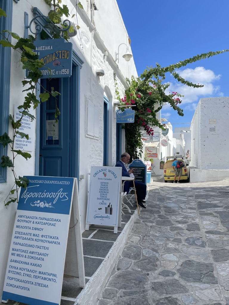
Paros is located in the Cyclades in the Aegean Sea. It’s a bit larger than Milos or Sifnos. It is home to some 14,000 residents. It’s about 150 km south of Athens and mainland Greece. The two main towns are Parika and Naoussa. They are both full of traditional taverns, great restaurants, sophisticated bars, and lots of shopping. They both enjoy a vibrant night-life. Cars are critical to mobility and rentals are prevalent.
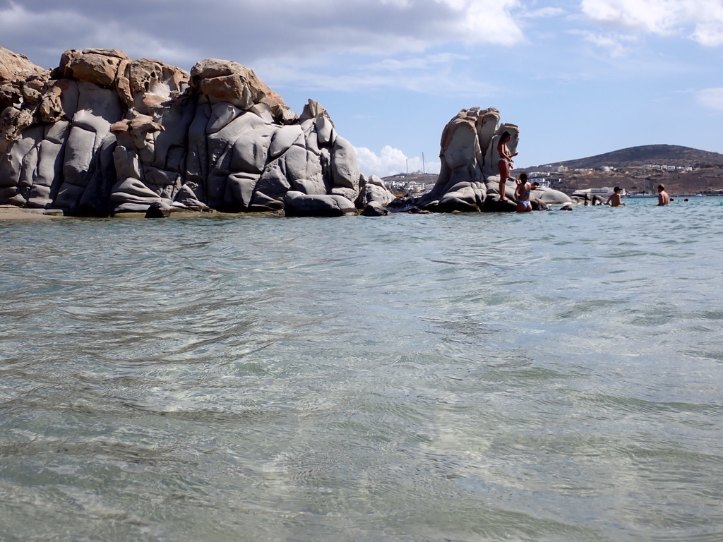
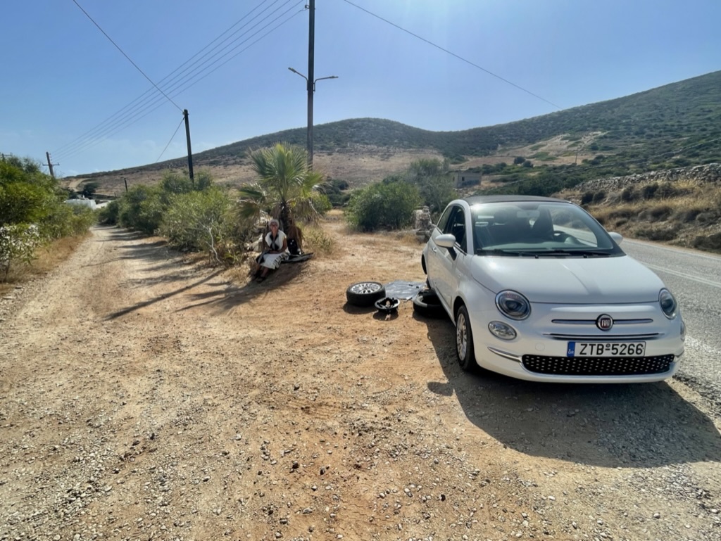
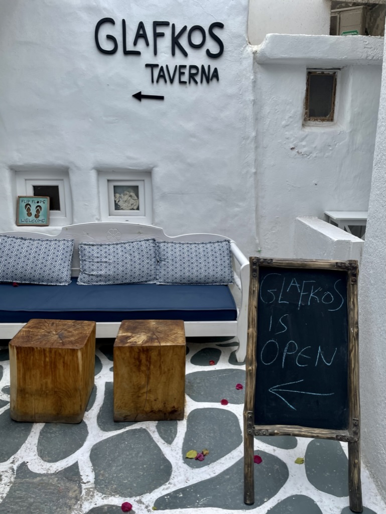
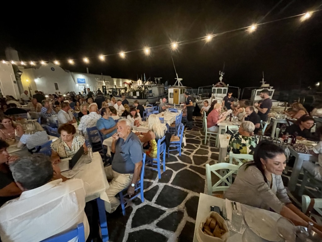
The view coming into the harbor on the ferry from Sifnos. Naoussa is in the background. This is where I chose to stay. The hotel was The Cosme. While it just opened only a few months ago, they still have a few wrinkles to iron out, and I am confident that they will.This rocky beach has both nude and clothed bathing. All of the islands are swimsuit optional. Beach on Antiparos. It’s much more quiet on this island than on Paros. The resident population is only about 1,200 people. It’s rumored that Tom Hanks has a place here. A blowout after the beach and on the way to lunch. Although the shoulder was almost flat, a closer look reveals that the Fiat Panda still tipped and fell over on the jack. I will omit all the expletives spewing from my mouth in the moment.The woman in the shade, although a complete stranger, pulled over to see if I needed help. I responded “not unless you can lift the car.” These Greeks are really nice people. I asked her if she wanted to wait, I would buy her lunch once the car was repaired, and she agreed… And that’s how to make chicken salad out of chicken shit.Great bar and restaurant, and as the signs say, it’s open and flip flops are welcome. If you ever visit this island, make this a stop for lunch or dinner. Great seafood and it’s right on the water.Alfresco dining in Naoussa. It’s a great scene. Fabulous food, awesome wine, killer vibe, and some after dinner smoking. In this perfect climate, how can this be topped? Reservations are imperative and dining is late as one would imagine.
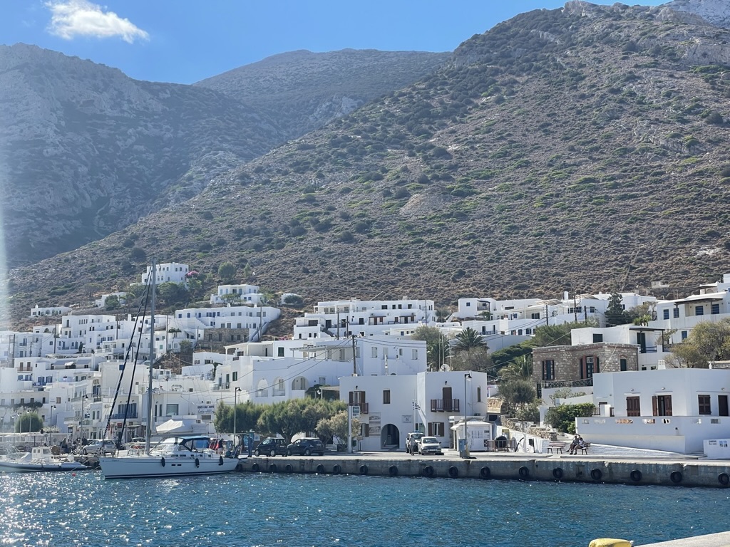
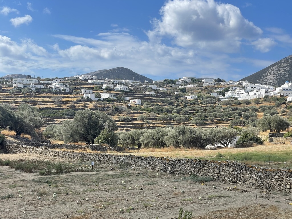
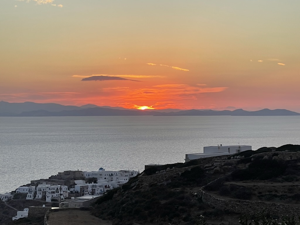
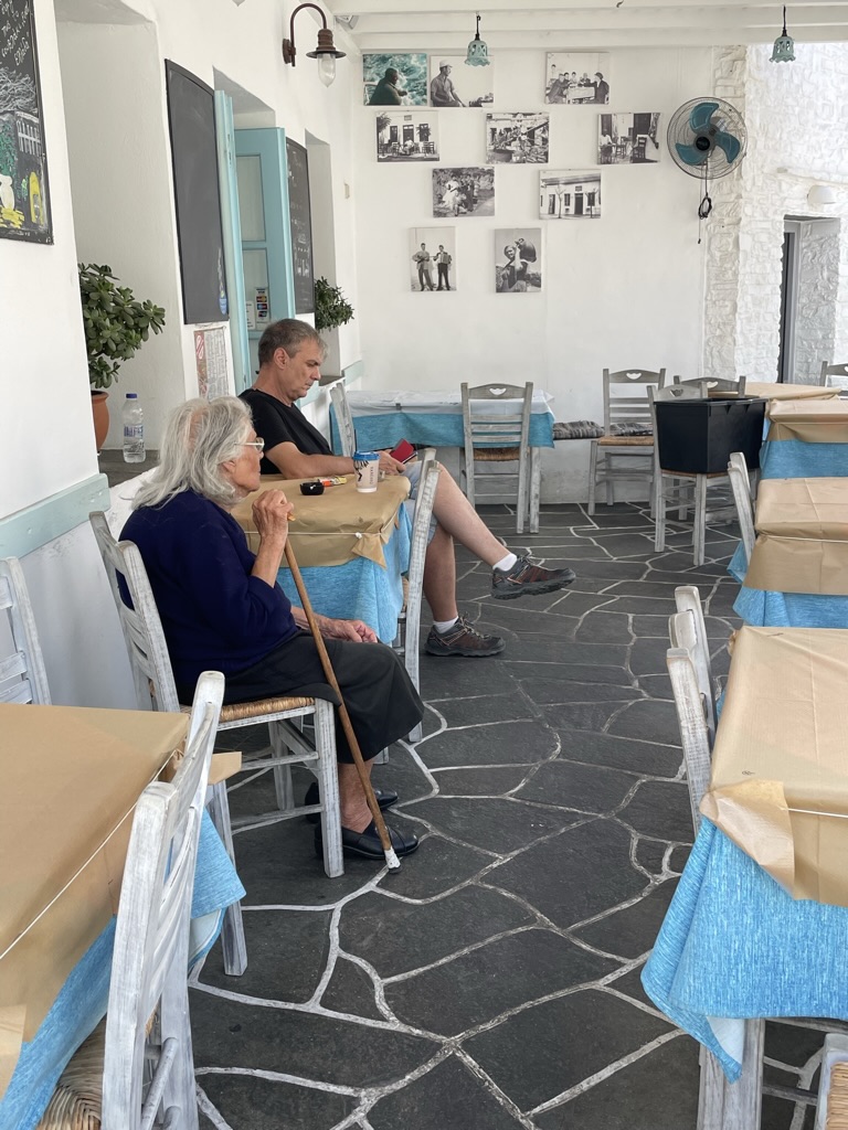
Sifnos is known mostly for its gastronomy. I decided to visit my old friend Marko who lives here. He was gracious enough to allow me to stay in his villa here. It’s nice to have some wealthy friends who live in nice places. I arrived here via ferry from Milos. The little harbor is known as Kamares. Although the island is home to only 2,250 residents, it boasts more than 300 churches. That’s like one church for every 7.5 people. Who needs that many churches? Highly recommend a visit if you are ever in the area. Not just amazing food here, but great beaches and nightlife.
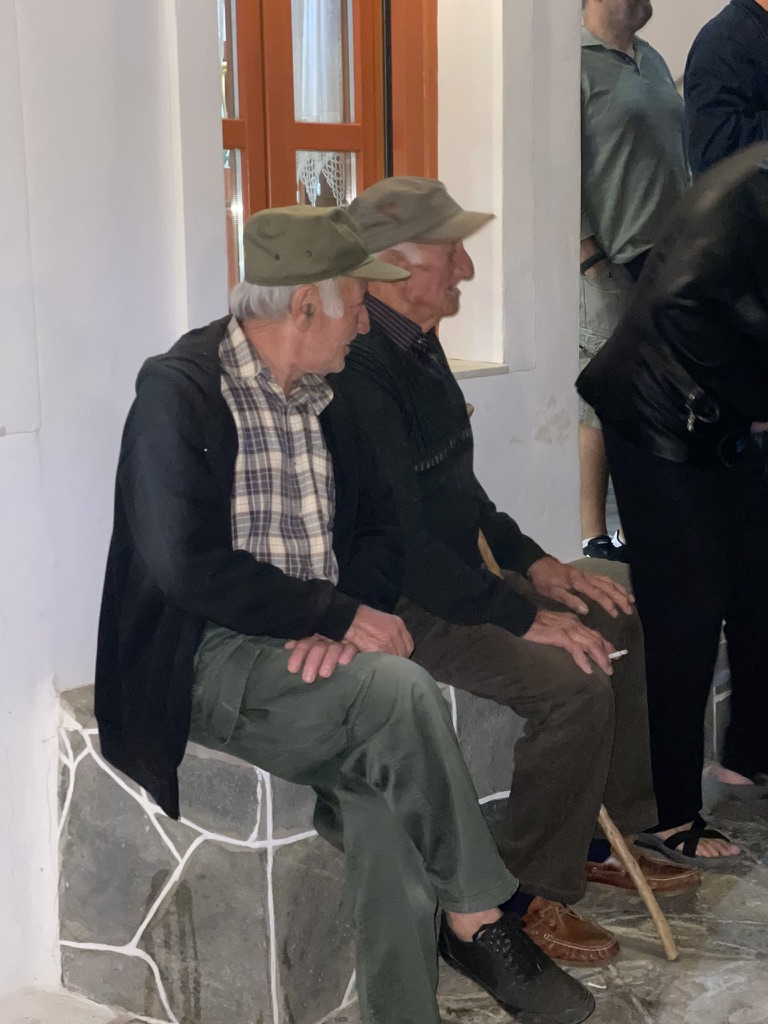
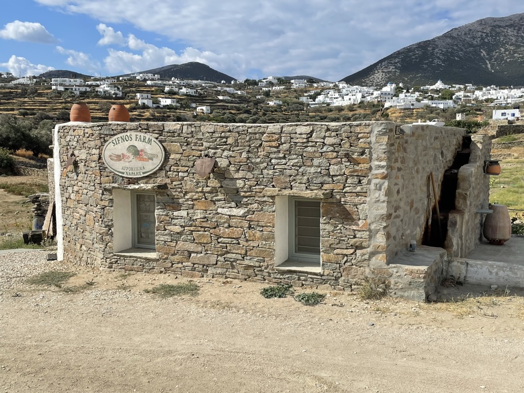
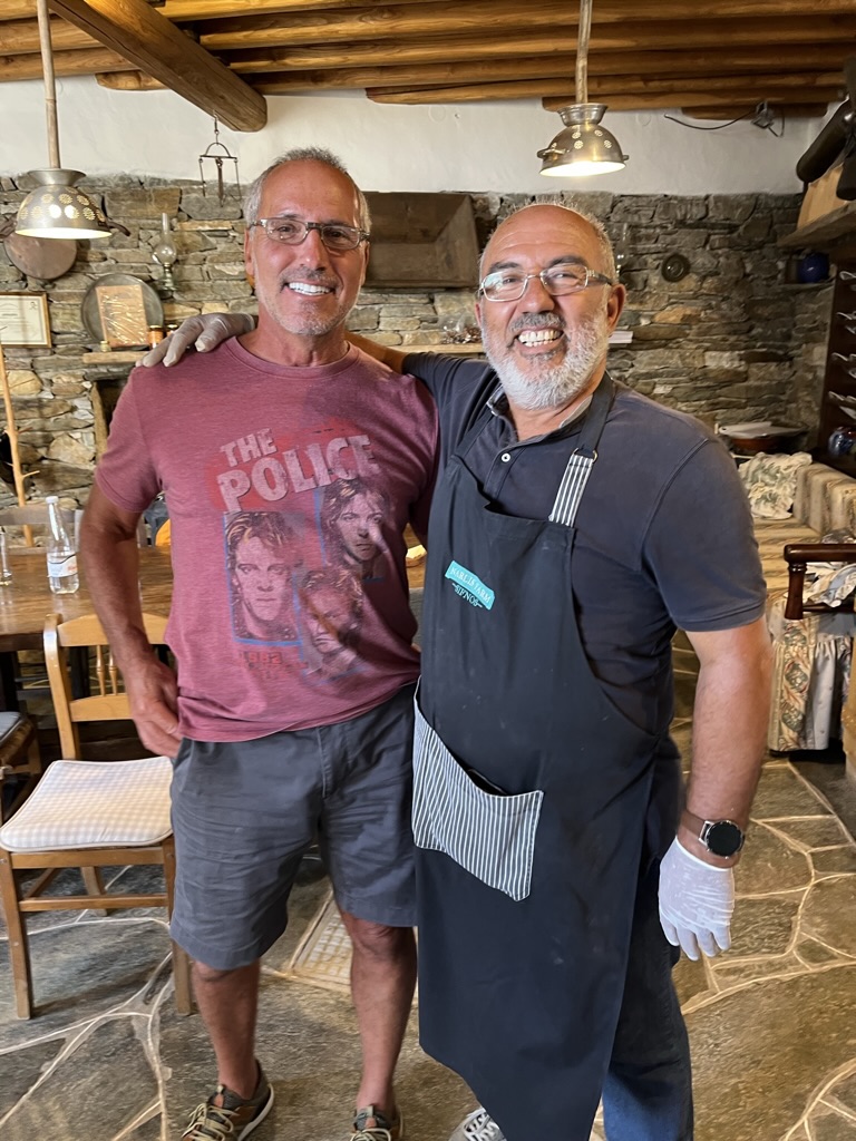
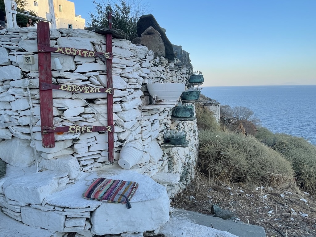
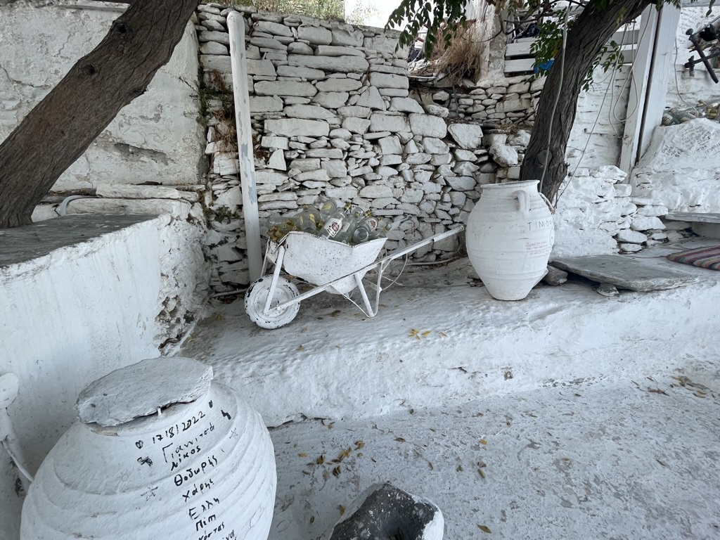
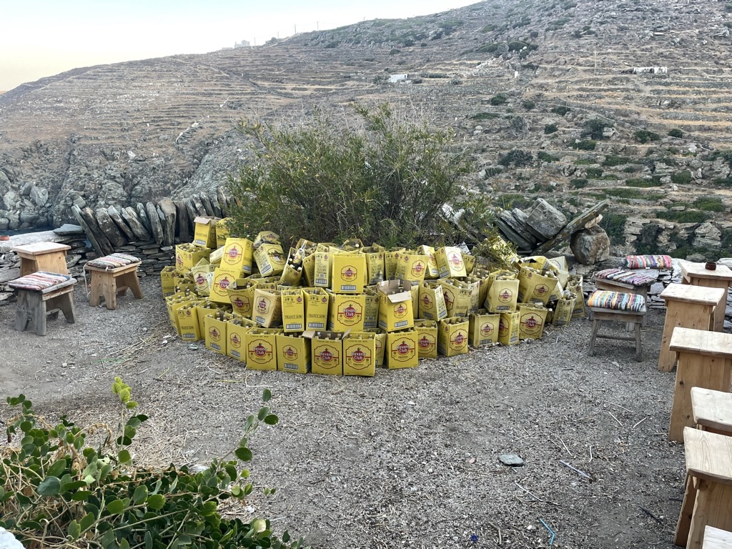
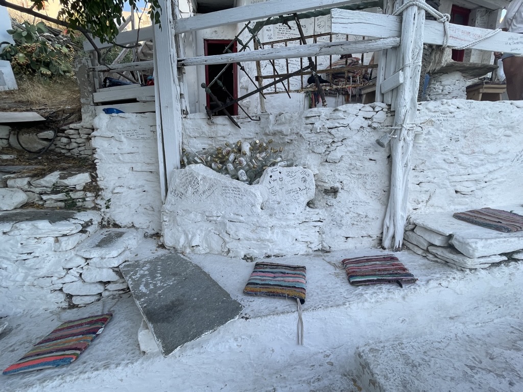
Kamares harbor as I arrive by ferry. It’s a fairly quiet harbor as far as harbors go. There are some nice harbor- side bars and restaurants. After a 25 minute drive from the harbor I arrive. Driveway view of Marko’s villa, my home while on Sifnos. Not much to look at from this perspective. Very unassuming property from the gravel road.However, the rear of the his villa more than compensates for the ordinary view from the road. This place is killer. It has very comfortable accommodations for 16 people with 8 bedrooms and bathrooms. The little town of Ka’stro below the villa. This is where I found the mojito bar which is featured in some pictures below. In the distance are the islands of Paros and Antiparos.One of the many churches which dot the island. This one is known as the Church of the Seven Martyrs. With so many churches any new ones must make sure the prospective name isn’t already taken. Like the old Simon and Garfunkel song “Bookends.” The Papapoulos Brothers are enjoying an evening smoke while people watching. Their hats were a promotional gift at the nearby Gyros bar.Farms in the area. These crops are cultivated with little if any irrigation. Here are watermelons growing. Doesn’t look as though it will be a bumper crop this season. Above are the ancient walls which are evidence of the terrace farming that took place here centuries ago.I visited this farm during my stay. The family Narlis lives almost entirely from the land. The cooking lesson and food were Meditarranean and amazing. After searching my entire life I finally found my long lost Greek brother Georgios. He is the patriarch and chief farmer of the family Narlis Farm. Quite an impressive chef as well. It’s a simple but fulfilling lifestyle. Their perspective is local and not global. Must be nice.This place struck me. It’s a bar that sells only mojitos and beer. It was odd that almost all of the bar’s decor consisted of their empty rum bottles. They must be proud of these. Here you can see them piled on the shelves.More bottles adorn the wheelbarrow. They definately saved on decorating this place. Just spray paint everything white, pile the empty rum bottles in whatever will hold them, and done.Why discard even the boxes the rum comes in. As you can see here, they might be fashioned into decorations as well. This could possibly be the centerpiece attraction, it certainly wasn’t the mojitos this place serves. Those sucked.Don’t these cushions look comfy? And don’t miss the empties in the rocks just behind those awesome cushions. And again more white spray paint on everything.Accidentally woke up early enough to catch this.A very old local enjoying a morning smoke. Some people are built to smoke. Smoking seems to be a very popular pastime here. These folks make it look so relaxing. Almost made me want to engage in an after dinner smoke myself.Side street in Apollonia.Street flowers are found almost everywhere. It just speaks volumes about these awesome people. They understand beauty and are friendly, generous, and warm, not to mention really good looking too.Turkish style. Guess who isn’t Turkish. These two, apparently happy tourists seem to not fit in at all.I was able to snorkel in these beautiful waters which were also the perfect temperature. One more glimpse of these beautiful temperate waters. One doesn’t even need any recreational drugs to enjoy these amazing colors.
Soon I am off to Paros and Antiparos. I hope to make another entry then. Thanks for taking some time to look at these. Hope you enjoyed.
The North Shore of Maui is vastly different from the major tourist destinations of Wailea or Kaanapali. There are no major hotels, only a few very small ones. There are several great restaurants in the area. What the North Shore is best known for are giant waves. The largest waves in the world are often recorded as happening here, and Peahi (better known as Jaws) is it. The largest of these monsters arise only in the winter months. The genesis of these waves is the severe Pacific winter storms in the northern hemisphere. These storms which may be a few thousand miles away create giant swells. This area of Maui is also a nice part to spend time on if you are looking for a more local experience. There are some nice little towns on this side of the island, Kula, Makawao, and Pukalani to name a few. There is a lot of agriculture upcountry too. I also visited Haleakala National Park during sunrise at Maui’s highest point atop of the extinct volcano.
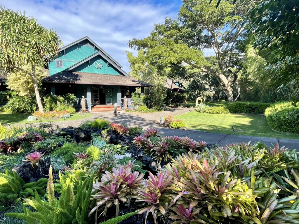
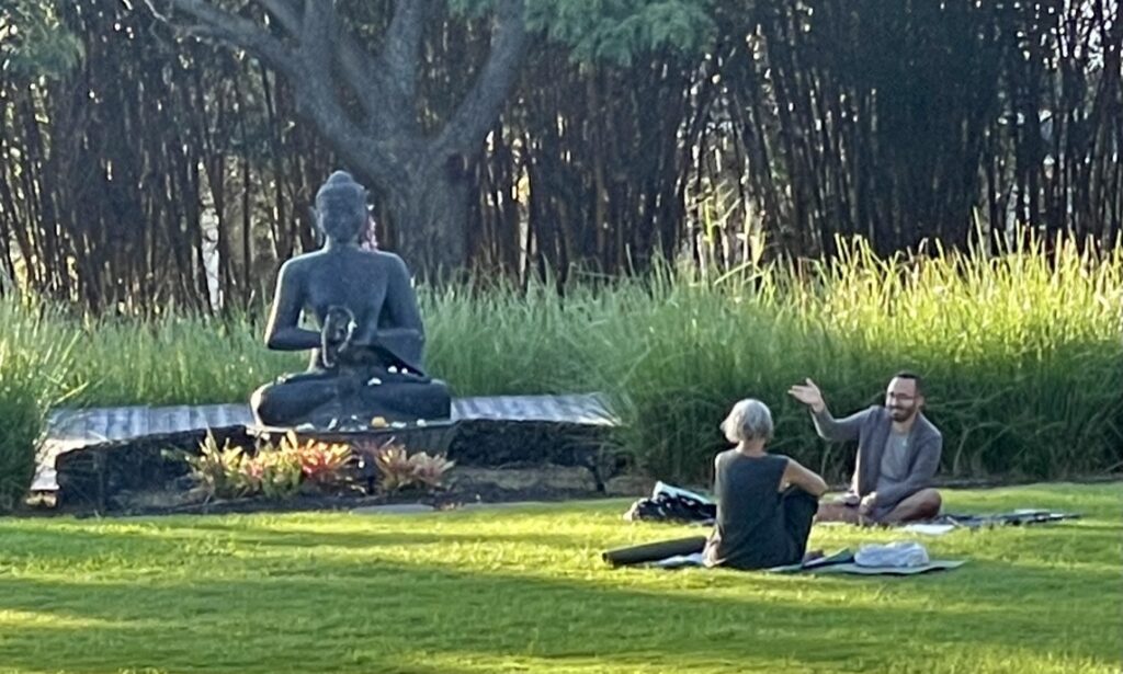
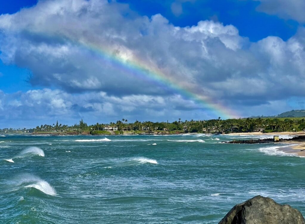
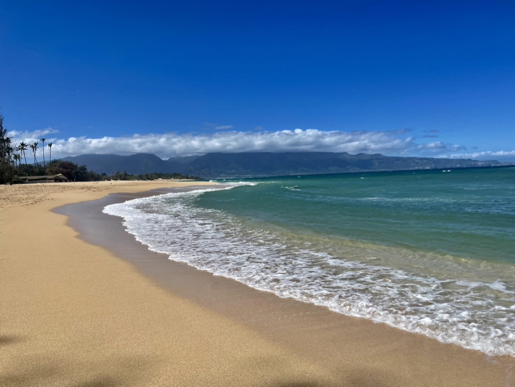
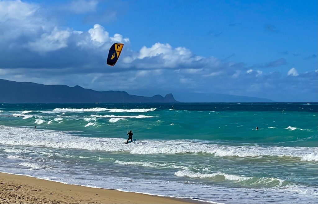
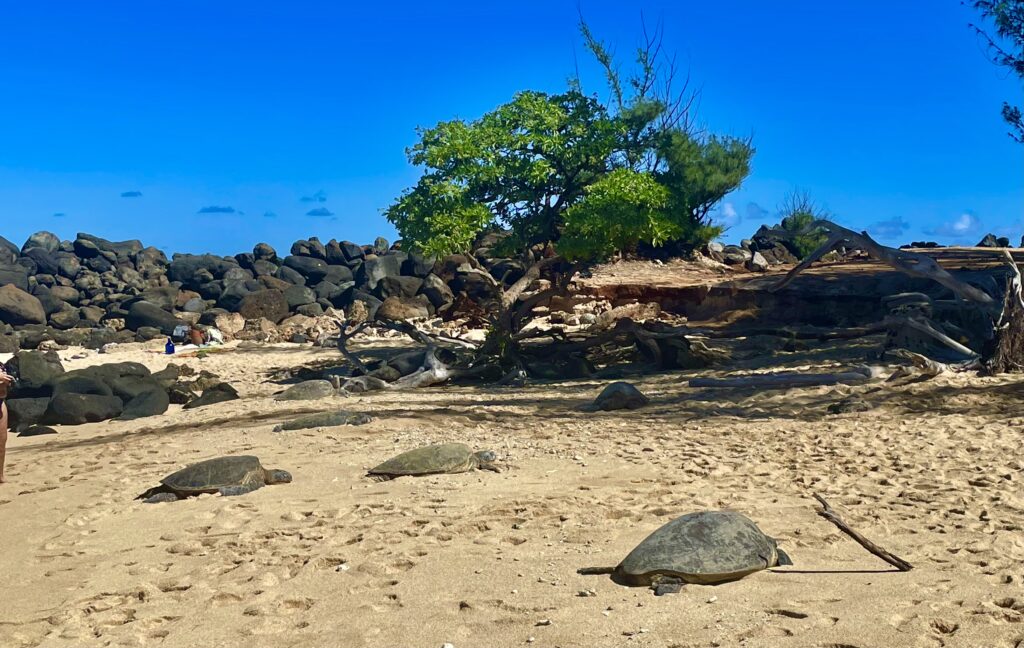
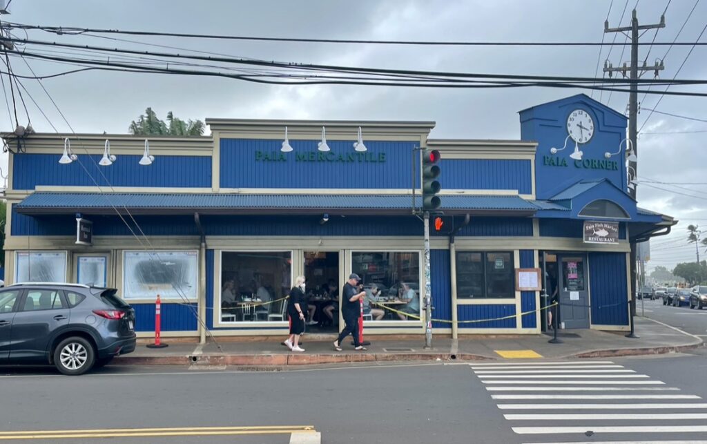
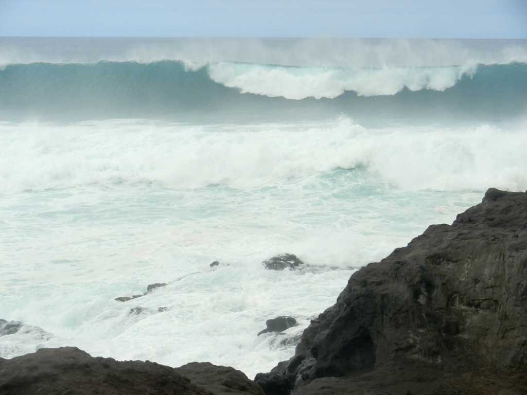
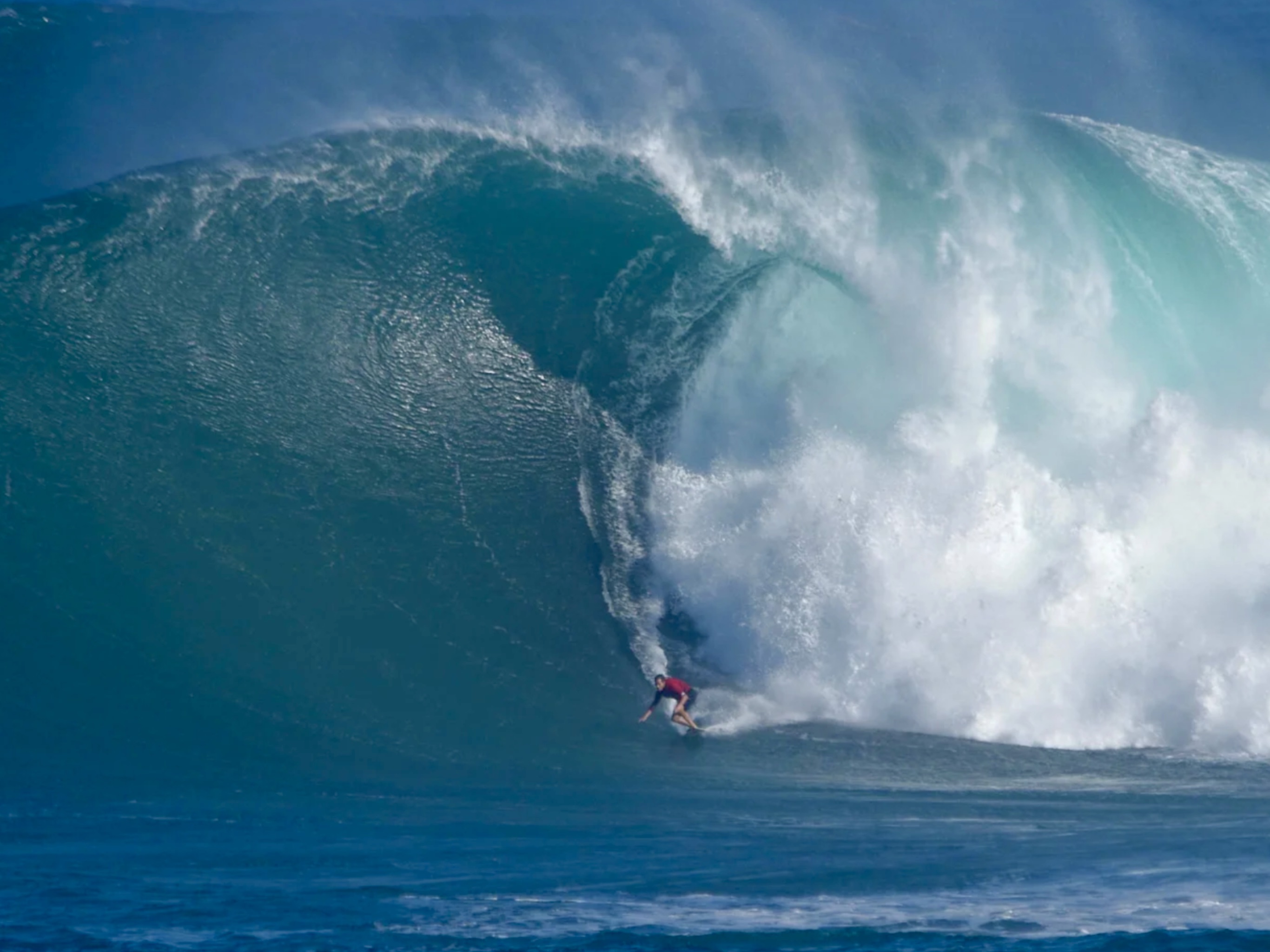
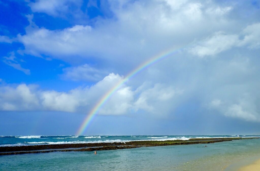
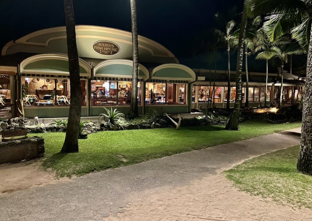
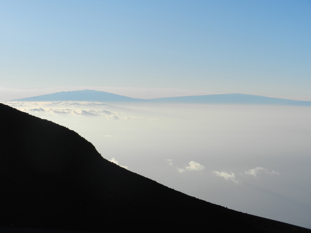
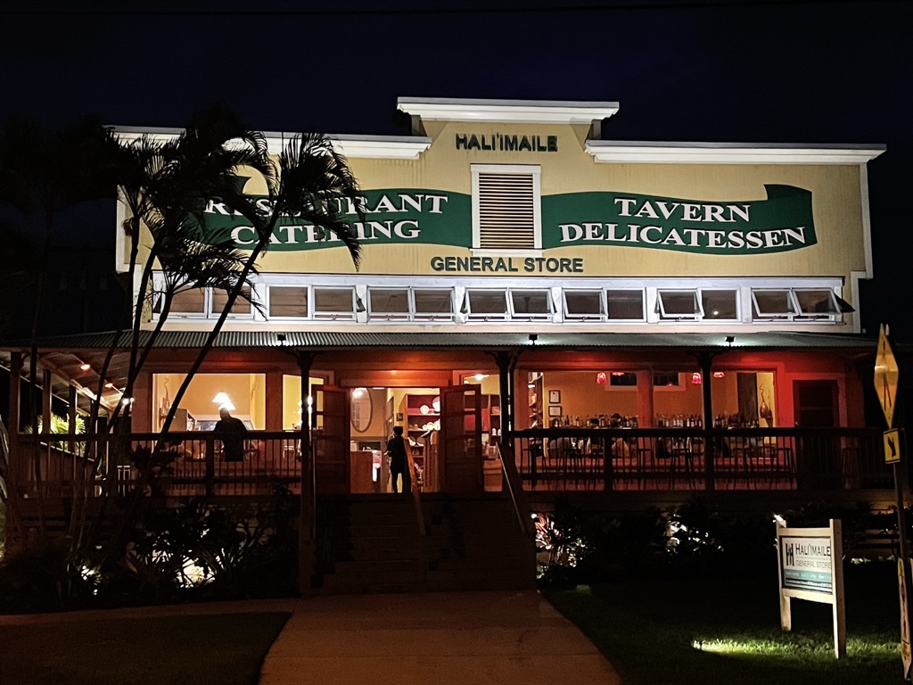
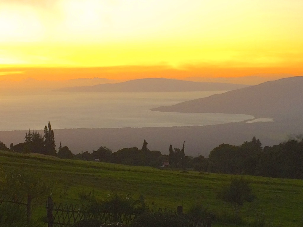
The Lumeria Retreat was a very low-key and chill place to stay. Plus many yoga offerings. The drive to the beaches was only about 15 minutes. There were limited amenities here, but the gardens, birds, and trees were beautiful. I think this woman is practicing as I walked by. Or maybe something else is going on. It was hard to tell.One of many rainbows over the little coastal town of Paia on the North Shore.Baldwin beach is just a few minutes from Paia. The West Maui mountains are in the background. Because of the natural breakwater in a couple of spots, even very little kids can safely enjoy the water without too much risk of being carried away. Of course, drowning is always a possibility.As a result of the prevalent winds here, kite surfing is happening almost every day. This guy is just going out. Their kites dancing in the air can be seen as far out as 1-2 miles.Usually, a few sea turtles scatter the beach where the waters are a bit more tranquil.Paia fish market on the corner is a great, yet reasonable option for lunch or dinner. Get the blackened ahi.People at Jaws viewing the impressive surf. It was hard to tell how big these swells were because there were no surfers the morning I was here.Another image of these giant crashing waves. Quite sizable.Impressive doesn’t even begin to describe this surfer. I was not the one who captured this image last year at Jaws. Judging from relative proportions, this wave appears to be a least 45-50 feet high.Another rainbow at Baldwin’s “Baby Beach.”Mama’s Fish House at night. Great fare but a bit touristy. Also, a nice lunch option since its location is a primo beachfront. The entire place is open-air, so it feels great. Steven Tyler of Aerosmith fame was here the night I dined. He still looks pretty good at 74.The crater atop of Haleakala at sunrise. The elevation here is 10,023 feet and the temperature was only 25 degrees Fahrenheit. Bring a blanket if you don’t have any winter clothing. It was difficult waking up at 4AM but, worth it once on top here. The drive from the North Shore takes about 90 minutes.View toward the Big Island. The two peaks seen are the two volcanos Mauna Kea and Kilauea. Kilauea is currently active with lava flows.View from the top of Haleakala looking down at a small portion of the North Shore. Dotting the area between my vantage point and the coast are the towns of Kula, Makawao, and Pukalani.Best upcountry restaurant, The Hali’imaile General Store. If you are spending time on this part of the island it’s pretty convenient to get to. If you are in one of the resorts on the West Coast, make sure you have a “DD” because it will take over an hour in the car and these guys make great cocktails.
So that’s going to be it from Maui this time. Until I write and publish again, stay safe and enjoy some time away somewhere.
I decided after several weeks on Maui that I needed to decompress a bit. A beautiful, logical, and logistically easy option was Lana’i. Although this place is cost prohibitive to many, my sponsor was very generous with me, so off I went, bound for the Four Seasons Hotel at Manele Bay. I spent the night before at the Lahaina Hotel, which was located only 3 blocks from the ferry to Lana’i. The next morning I had an early breakfast and then walked to the ferry. The ferry is usually a very pleasant 45 minute cruise, and this time it didn’t disappoint. Because it is winter I was able to spot whales along the way to Lana’i. Hard to say how many because how do you know if it’s the same whale breaching, or another one? I was greeted at the Lana’i harbor by a representative from the hotel and she transported me to reception (Only a 5 minute drive).
The Island is home to only about 3,000 people. 98 percent of the entire island was acquired from Castle & Cooke in 2012 by Larry Ellison, the then CEO of Oracle Corporation (not to mention the fifth wealthiest human on the planet). Ellison’s vision is to create a sustainable and carbon neutral island. He is well on the way, with much of the energy being from solar and wind. As part of this effort to sustainability, Ellison has created two 20,000 square-foot computer monitored hydroponic farms/greenhouses, with plans for four more.
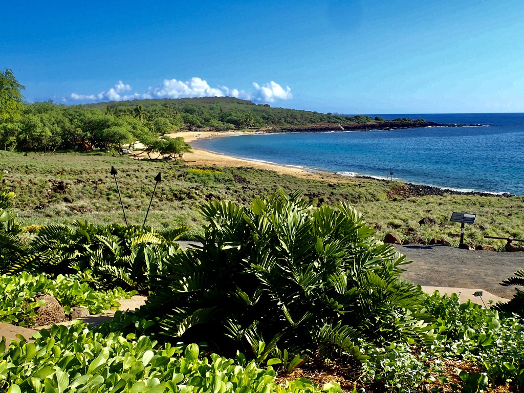
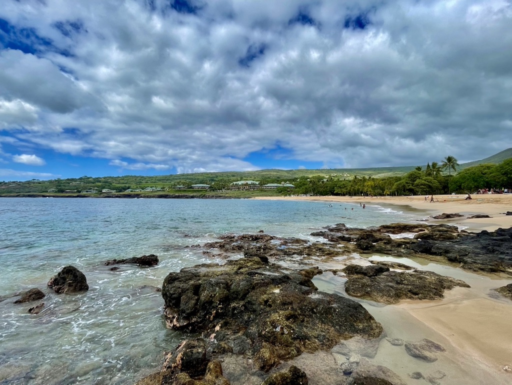
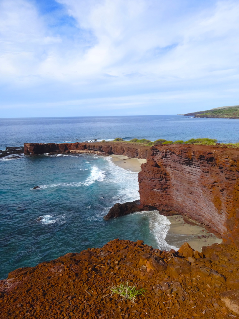
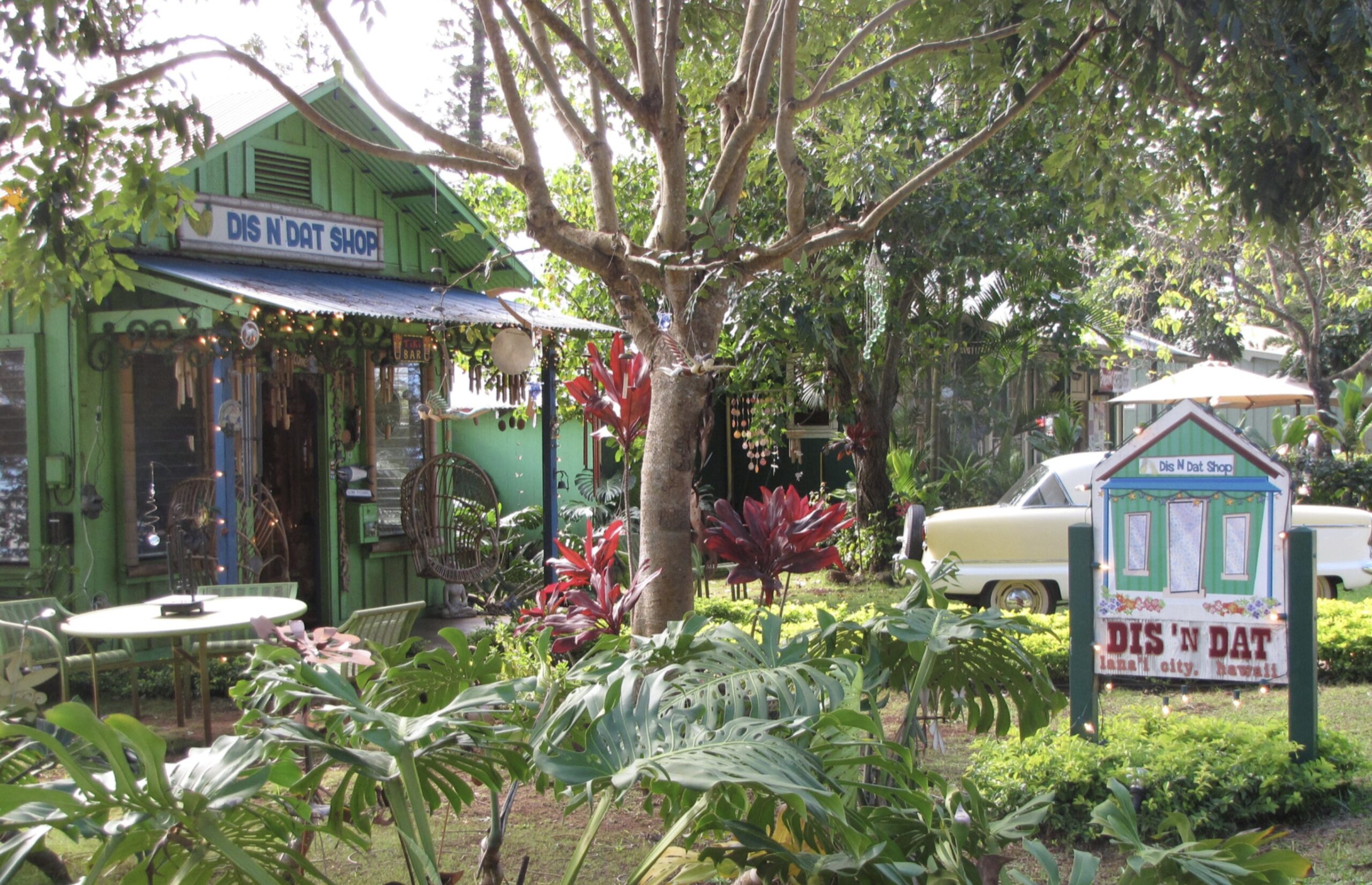
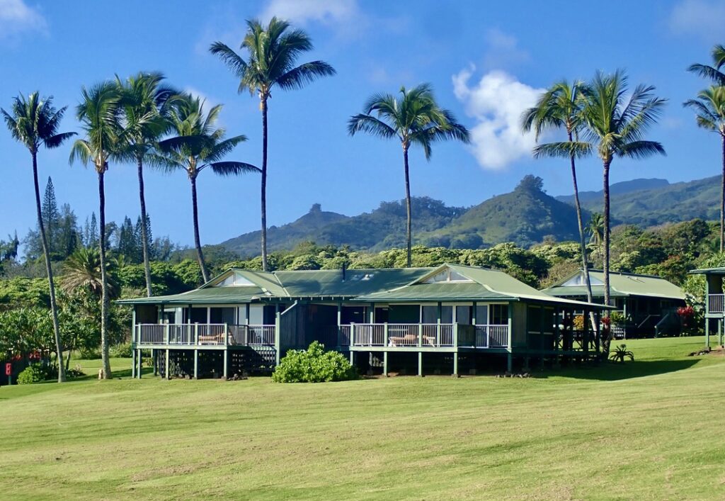
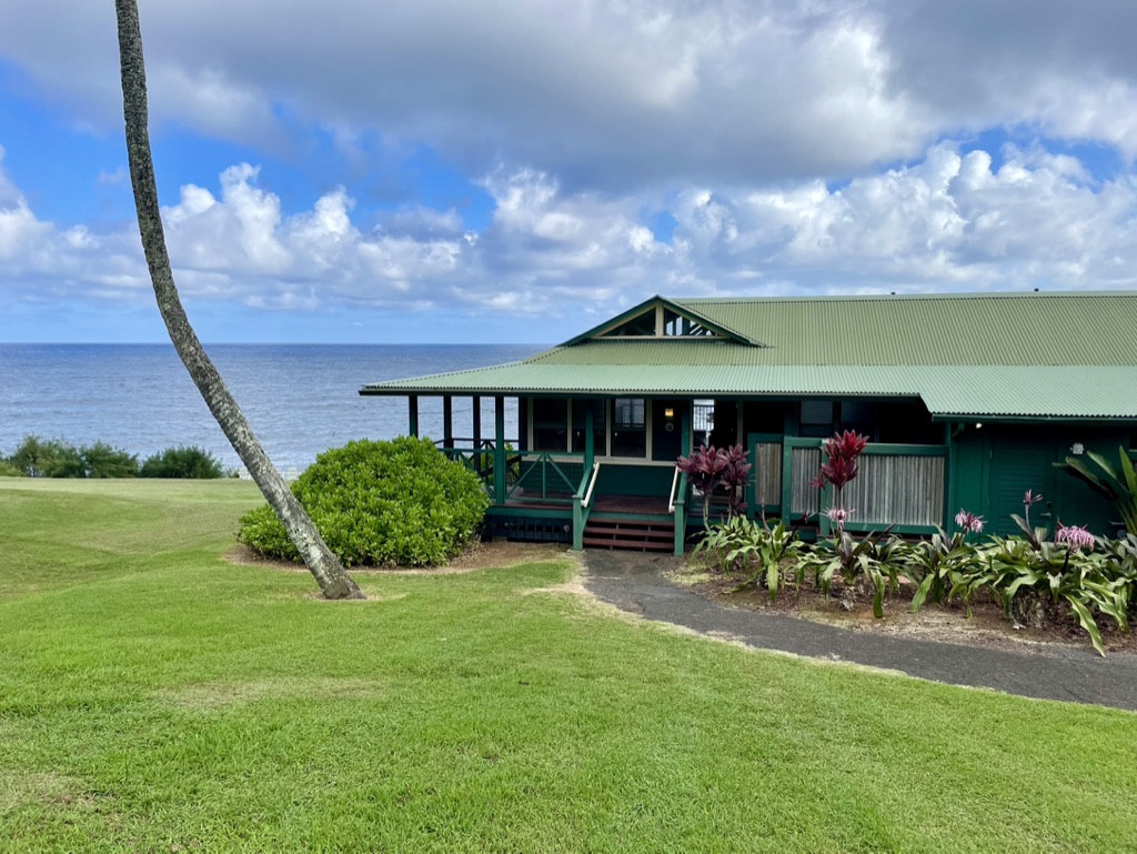
While the tempo here is much dialed down from Maui, there are enough things to do so as to preclude any moments of boredom. Beach stuff, golf, hiking, snorkeling, biking, and tide pooling, just to name a few. There also is the little town of Lana’i City where most of the residents live. This town is located about 20-25 minutes by car up the hill to the middle of the island at an elevation of 1,650 feet. It has some shopping, but is otherwise pretty quiet. Other than the Four Seasons Resort at Manele Bay and the Sensei Resort up near Lana’i City (also managed by Four Seasons), no other hotels exist on Lana’i. These are both relatively small properties in terms of guest accommodations. Between the two properties there are less than 300 rooms and suites.
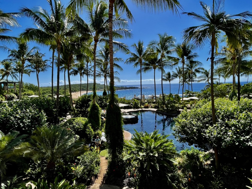
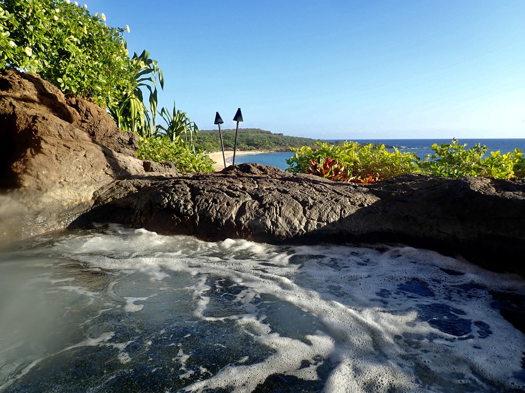
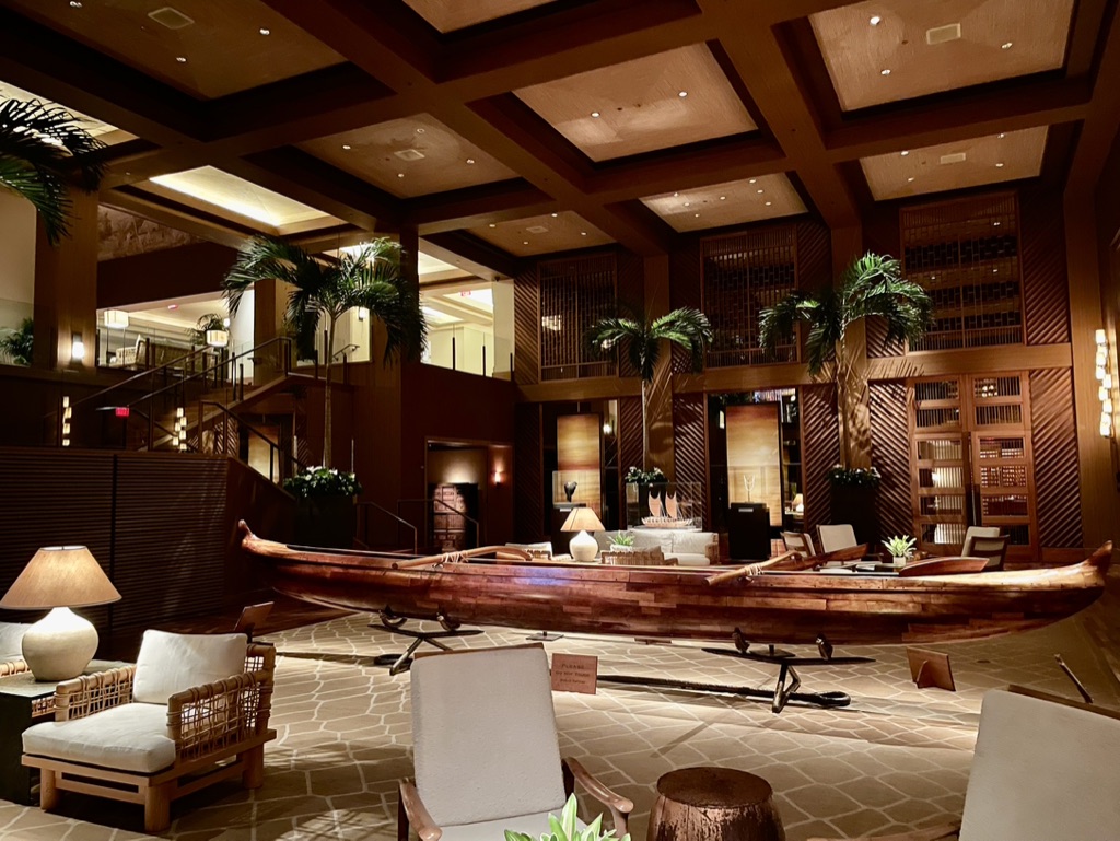
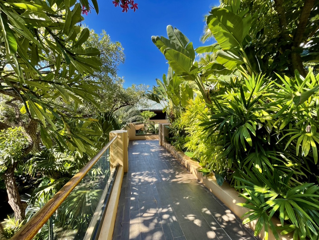
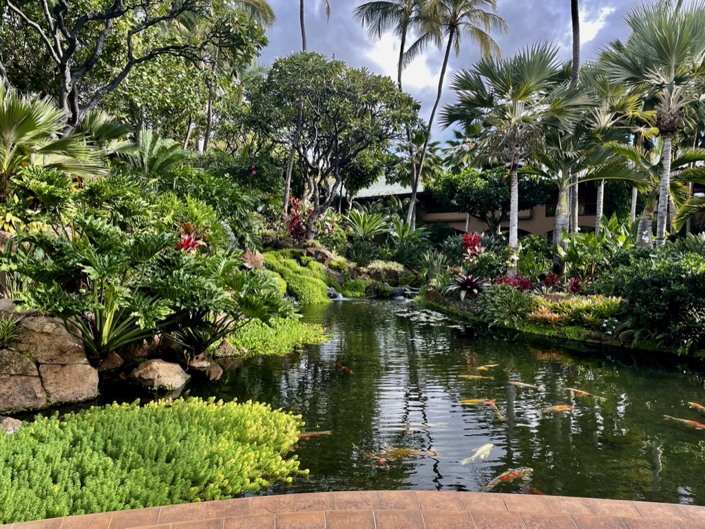
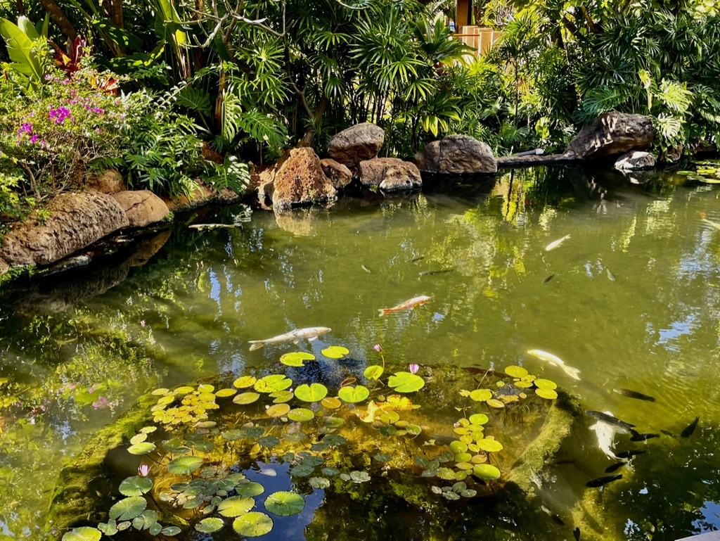
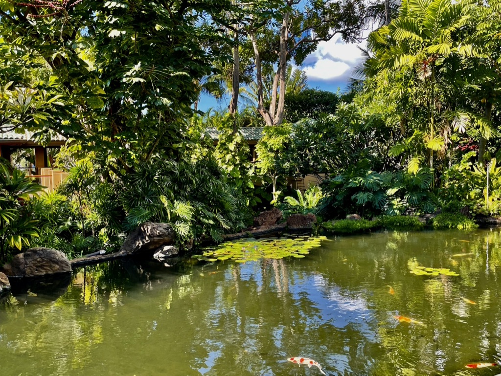
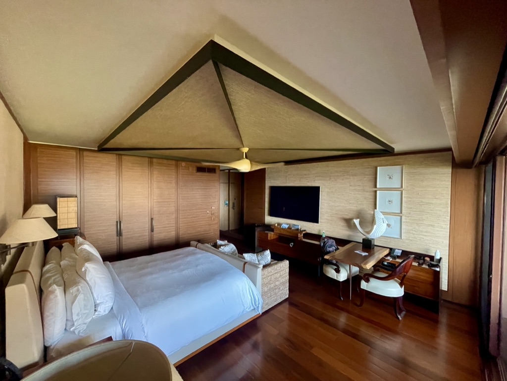
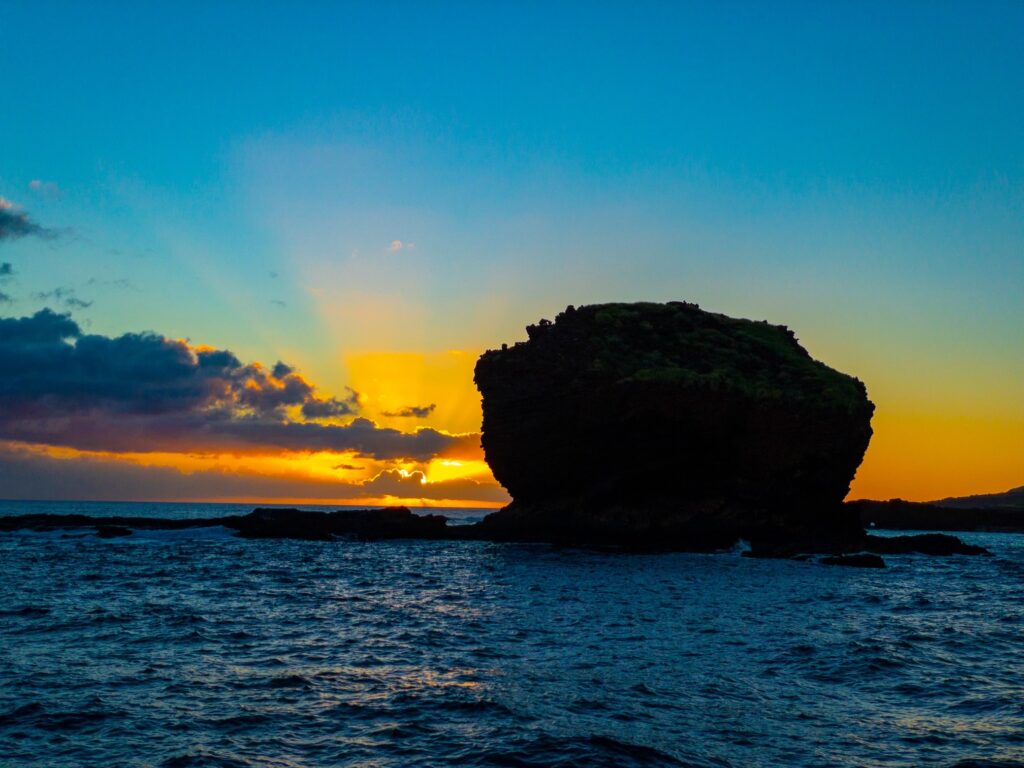
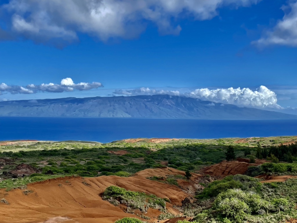
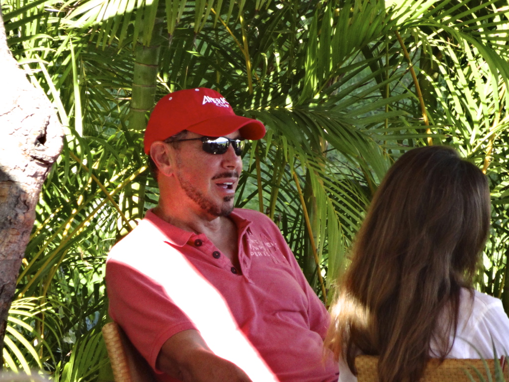
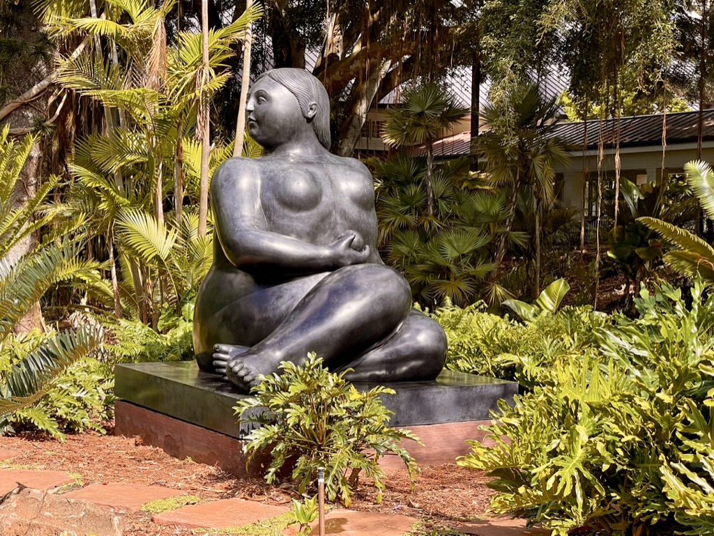
Lana’i in the distance. I captured this image from Upcountry Maui the day before departing for Lana’i.Manele Bay as seen from the hotel. The walk down to the beach takes about 12 minutes. The Four Seasons in the distance, as seen from Manele Bay.Morning view overlooking the pool and ocean.View to Manele Bay from one of the spas. The tiki torches at frame center are all around the property. Several are lit each evening at sunset in a traditional Hawaiian lighting, while the vast majority are set on auto-lite. The main lobby at the Four Seasons.The walkway to my accommodations. With all of the dense foliage it’s difficult to actually see much in the way of buildings.Koi ponds along the walk to my room.Closer look at these koi that resemble small submarines. More water elements, streams, and waterfalls abound.My humble abode while I am here.Hike to Sweetheart Rock.Sunset over Sweetheart Rock. Compliments of my friend and photography mentor, EdB (A/K/A Edward Baldwin).A view to the island of Molokai from the far side of Lana’i. Molokai is not known for being tourist friendly, and I get that.Typical shop up in Lana’i City.Larry Ellison taking a lunch meeting. He looks great for a guy in his 70s’. Notice the America’s Cup hat.The very zen feeling at Sensei is only enhanced by views as these.Large sculpture at Sensei.
I’m hanging here as long as my expense account last. At that point I will ferry back to Maui. Be well until then.
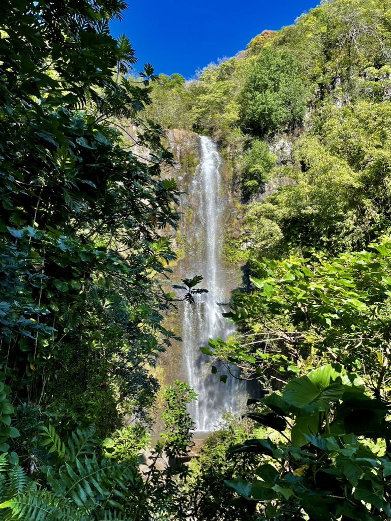
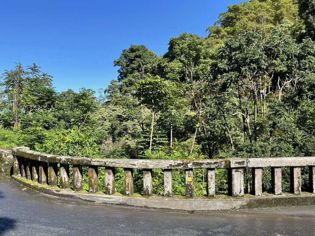
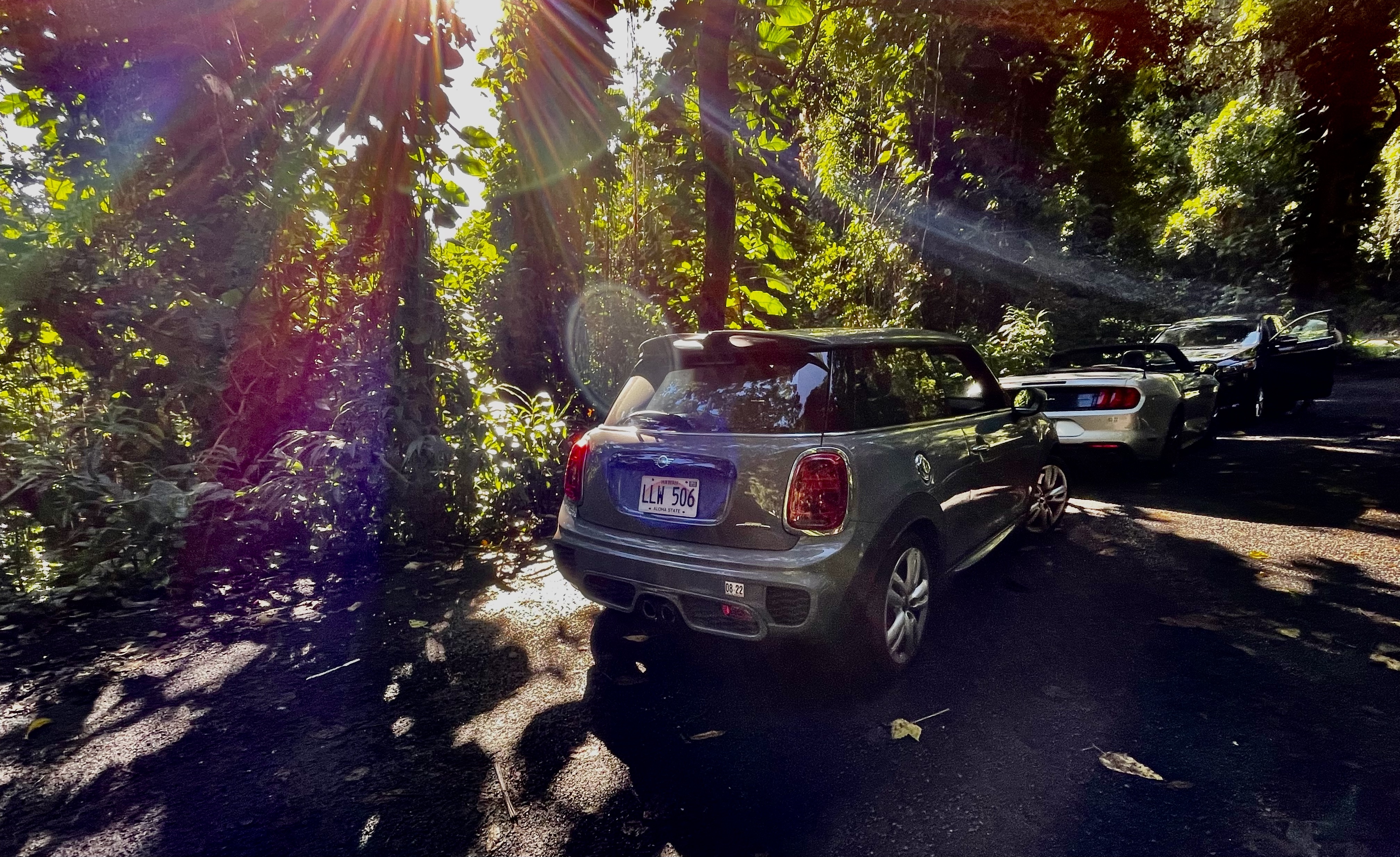
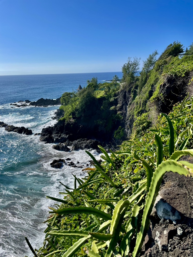
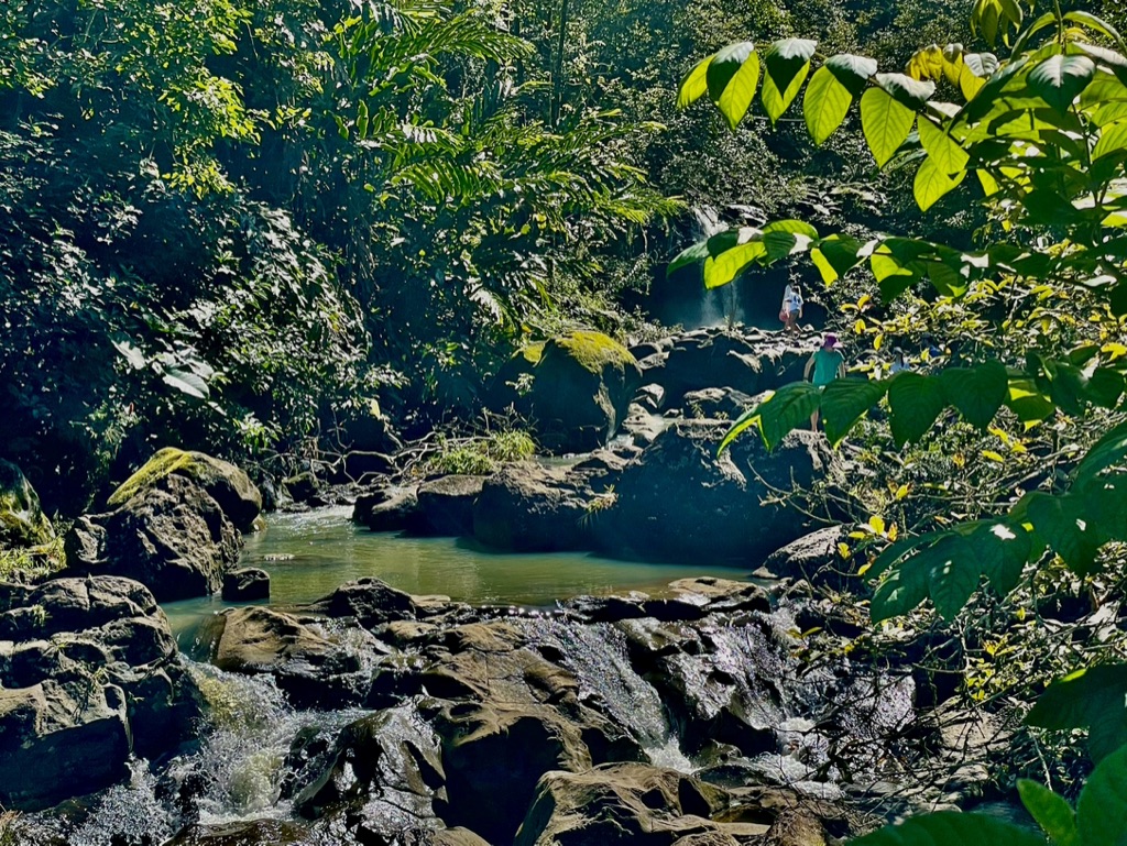
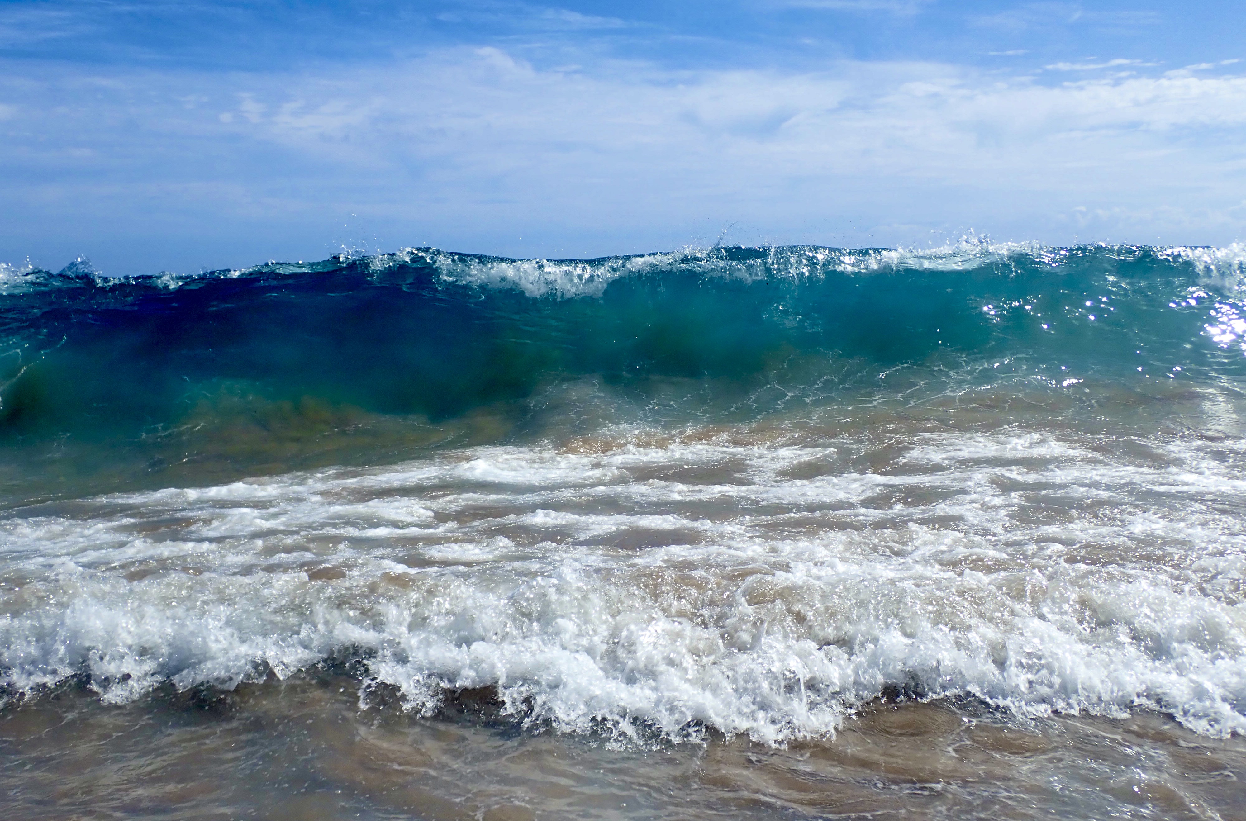
It’s been a while, but I am back out there. Started back with a pretty easy trip to Hawaii. Thought it would be a good place to spend time until this Covid thing finally blows over. I purchased a one-way ticket so I had a lot of flexibility. Because of all the unknowns posed by Covid, I decided to book only my first hotel. That way if the trip was scuttled I wouldn’t lose too much in the way of reservation deposits. There was availability all over the islands I chose to visit. I witnessed lots and rainbows, but never any rain. The temperatures at the beach was about 80 degrees fahrenheit. From the little beach town of Paia on the north shore, I drive my Mini Cooper rental to Hana. Although the trip is only 39 miles, it takes between 2.5 and 3 hours (with no stopping for views or problems). Due to the many one lane bridges, cars must stop many times and yield to oncoming traffic. It’s also I good idea to check for road closures before you depart. If the road to Hana closes you must turn around, no other options. One other important recommendation I would make is to stay in Hana at least 2 or 3 nights. The drive is so beautiful one feels compelled to stop many times along the way. A leisurely drive with just 4 or 5 stops can easily take upwards of 5 hours one way. Close to and in Hana are white, black, and red sand beaches. There are some great hikes and plenty of scenic opportunities.
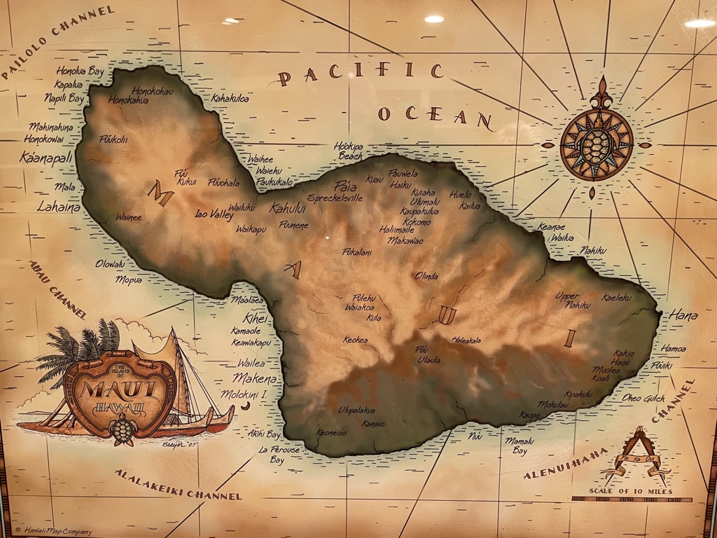
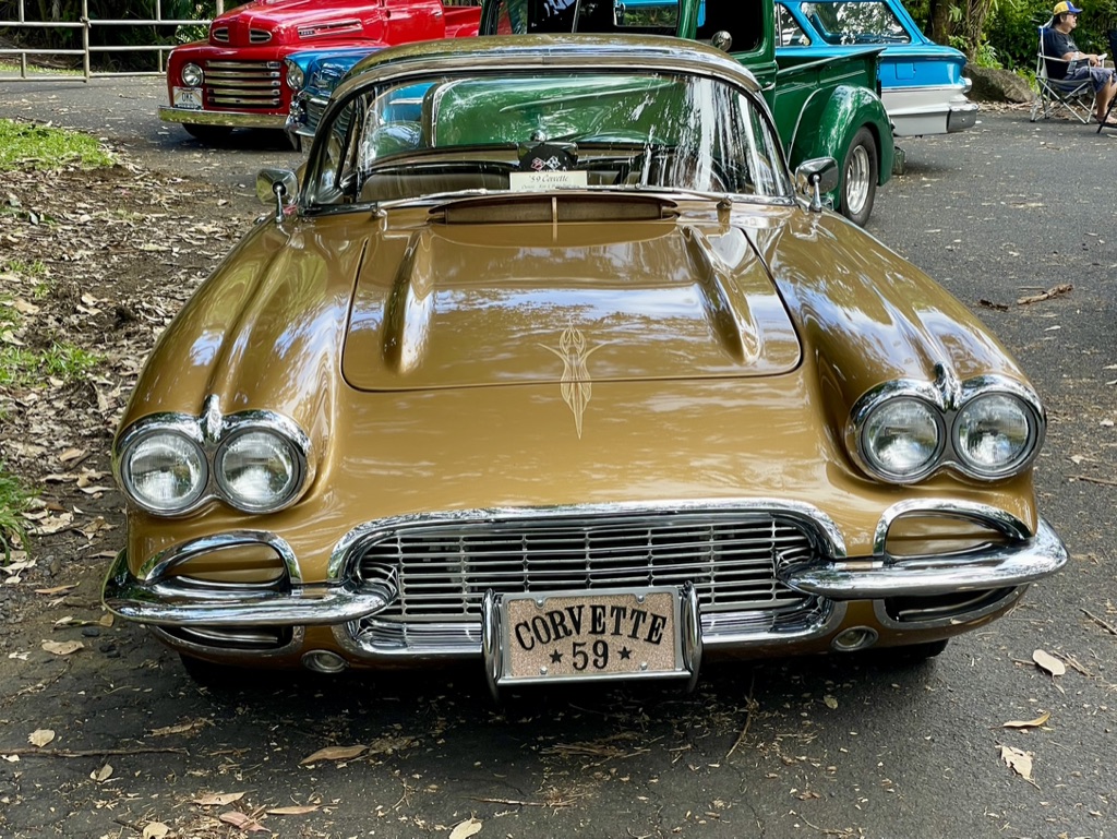
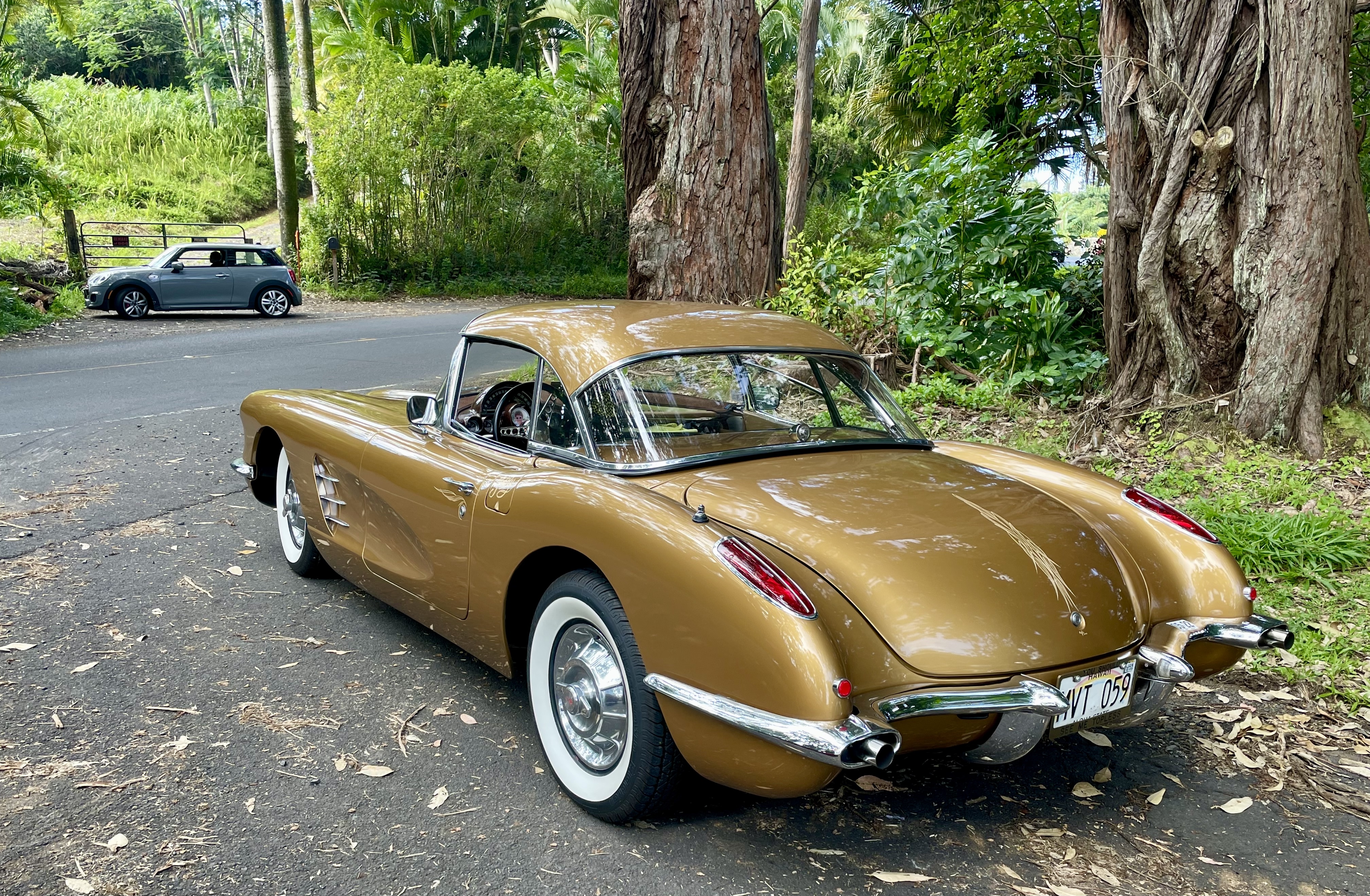
Map of Maui. Hana is located at the extreme eastern tip.One of the many waterfalls which can be seen along the way to Hana.One of the 50 or so old one-lane bridges along the way.I encountered a small group of old car collectors and their prized vehicles along the way.Another shot of this very awesome creation.My Mini which was a great choice for this experience.Along the way to Hana, a view to yet another beach.One of the many places to take a dip along the way. Fed by fresh rainfall from a much higher part of the island this pool was very refreshing.
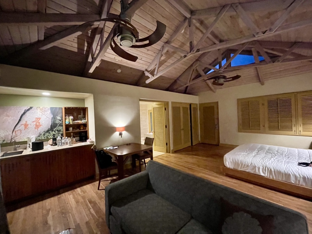
Once in Hana I checked into my hotel in Hana. The population of Hana is only 1,526 people as of 2020 census. There is only one hotel. Formerly known as Travasa, and before that the Hana Hotel, it is now owned and operated by Hyatt. As you can imagine the hotel is quite small. However, it has a good restaurant and spa. There are other nice amenities to enjoy as well. So, not only is it “the” place to stay, it’s the only place to stay.
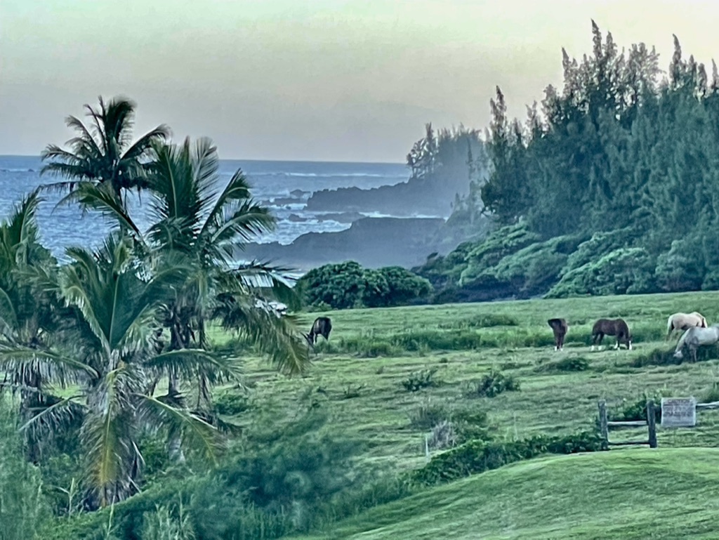
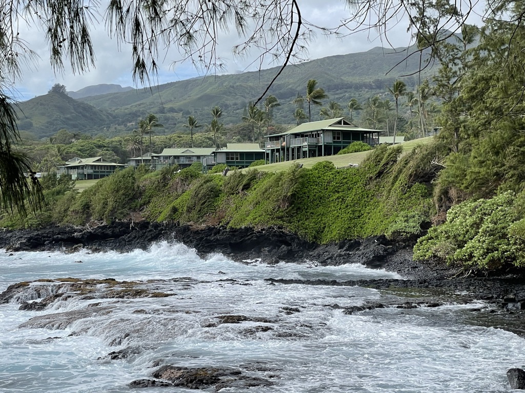
Welcome home to the Oceanfront bungalow. Super comfortable, and as a result of its close proximity to the ocean, you rarely if ever need air-conditioning. Image of my oceanfront bungalow.Front view with the crashing ocean behind.Odd juxtaposition with the horses and ocean. This is a view front my bungalow deck.View of the oceanfront bungalows from my hike to the Red Sand Beach. With only screen doors in the bungalow, you hear the waves crashing all day and all night.
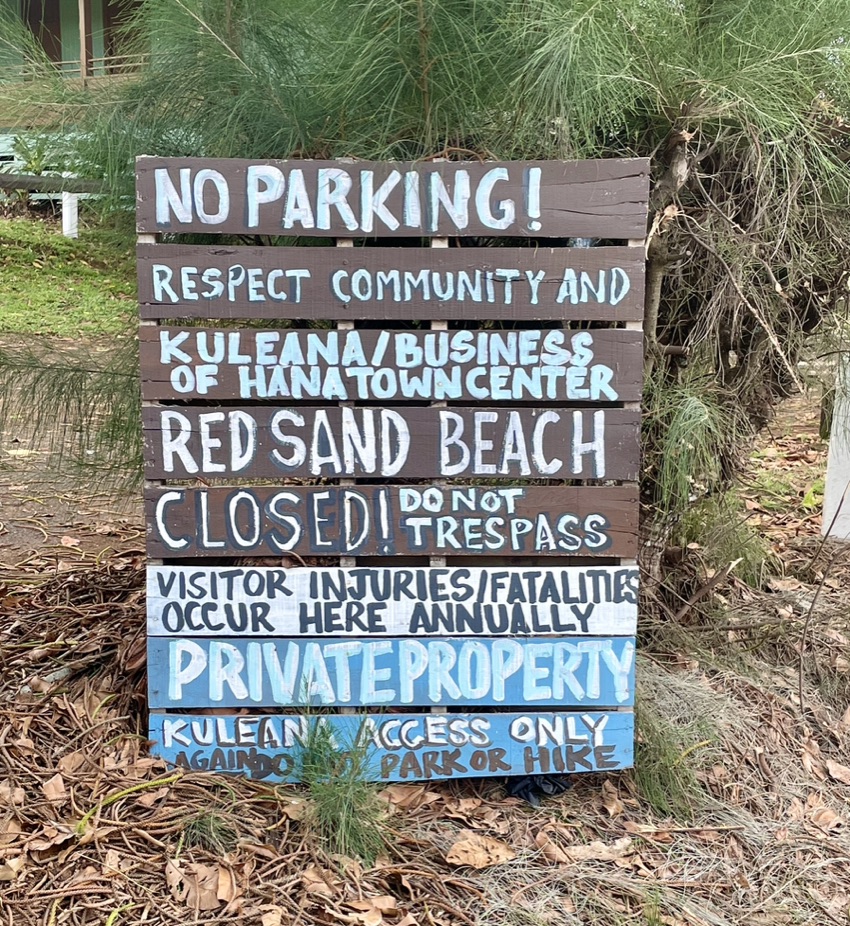
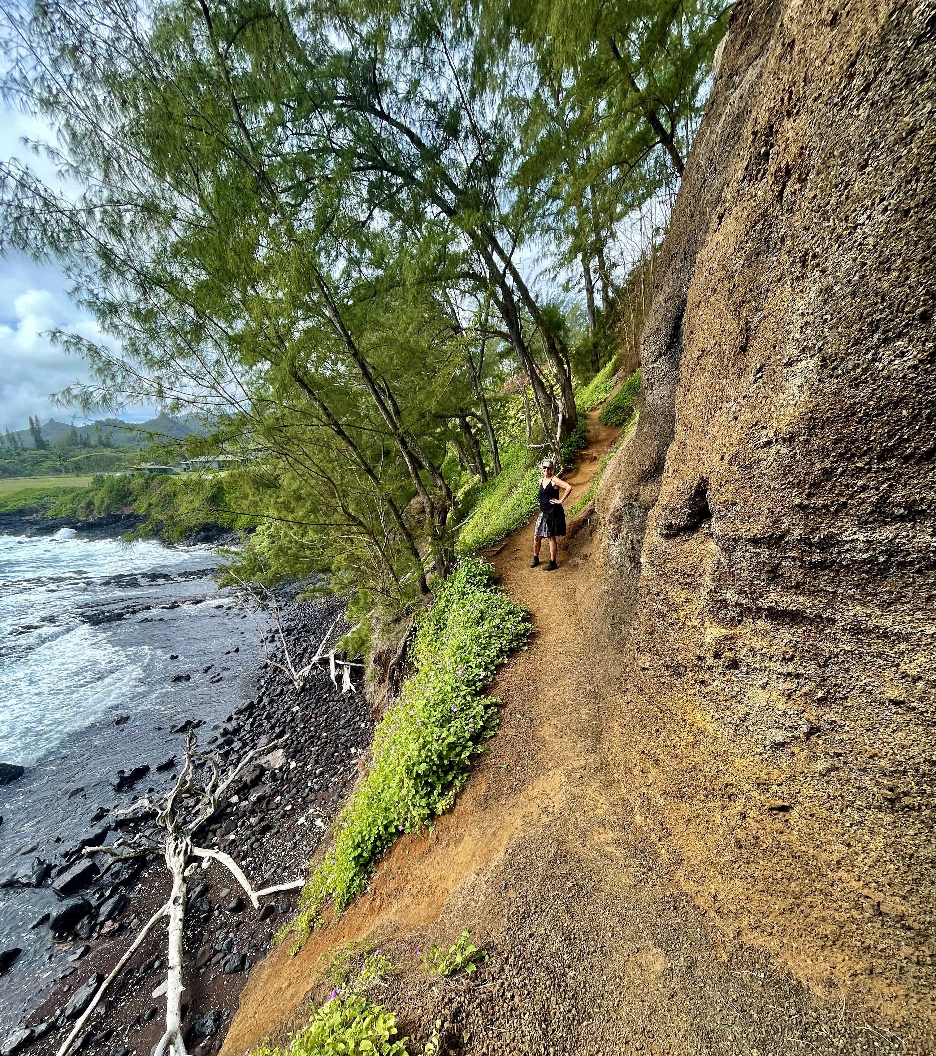
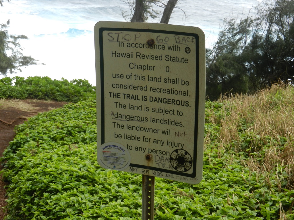
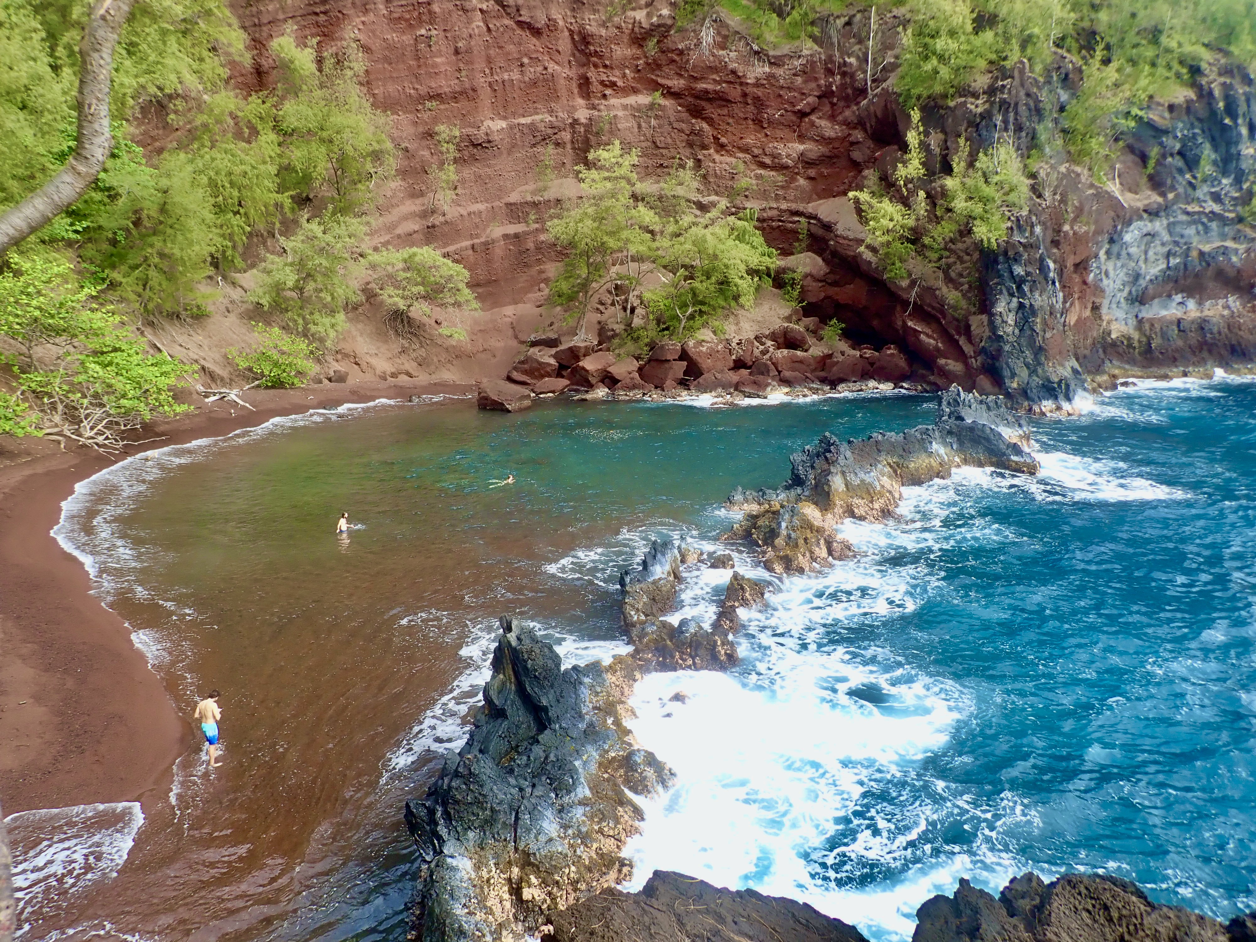
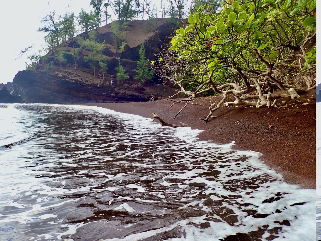
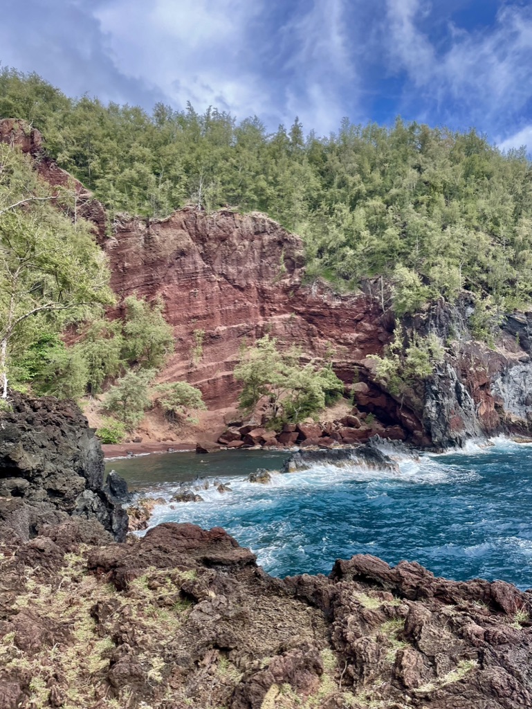
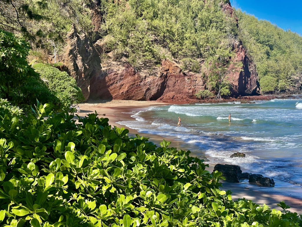
Take a short but dangerous hike from the hotel property to the Red Sand Beach. The bay is also known as Kaihalulu Bay. This is only one of a few red sand beaches in the world. The bay is shielded by the otherwise very rough ocean by a reef.
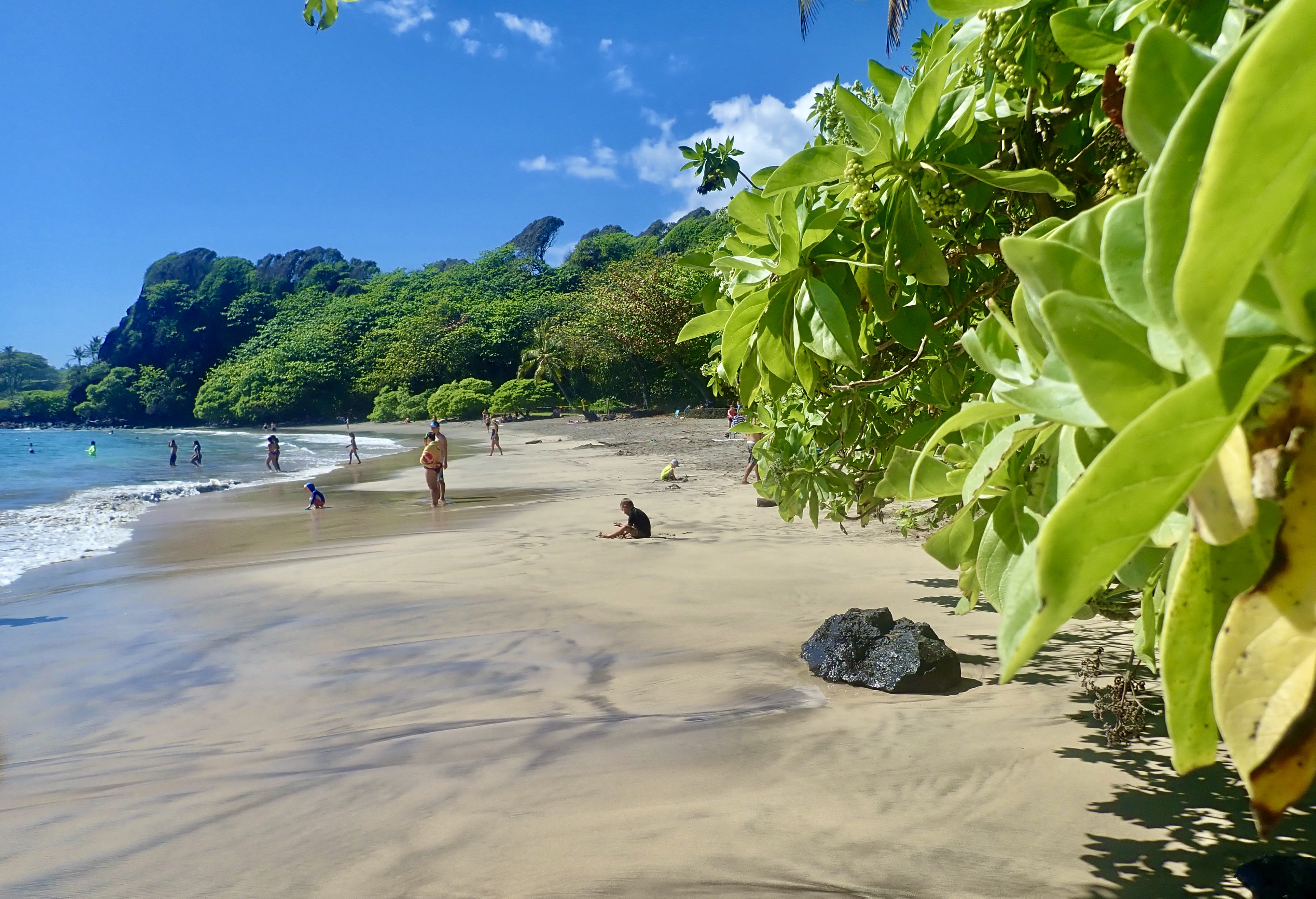
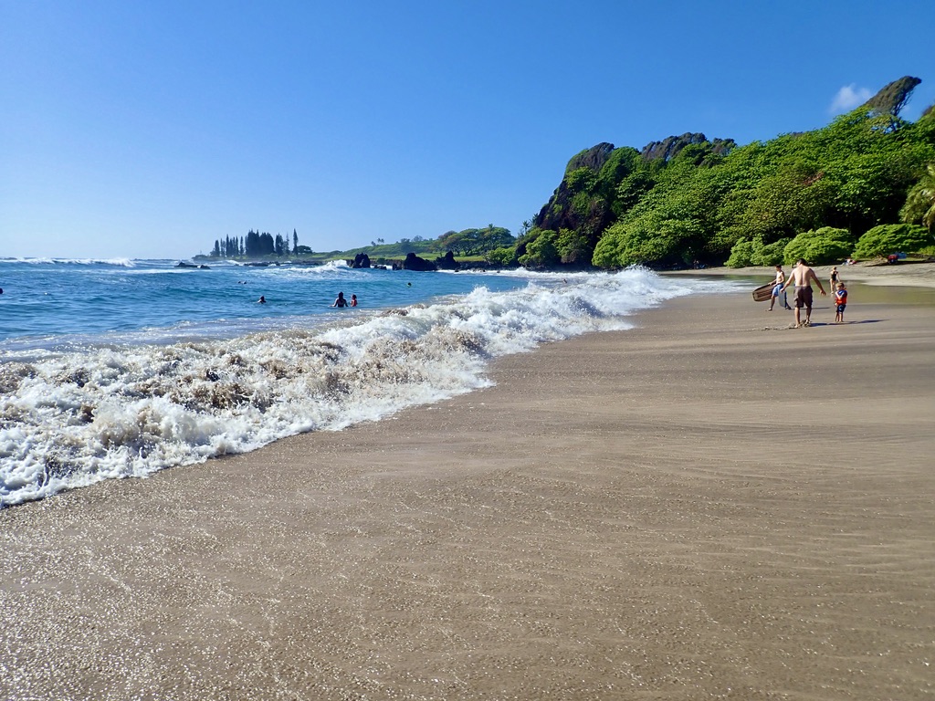
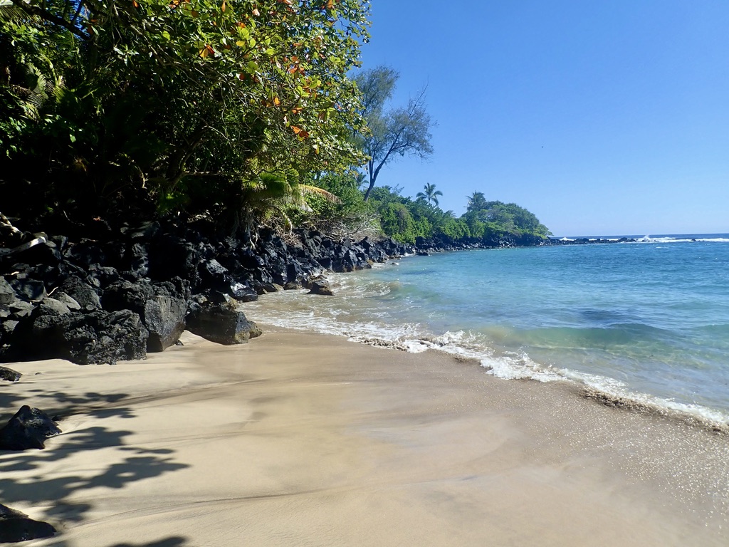
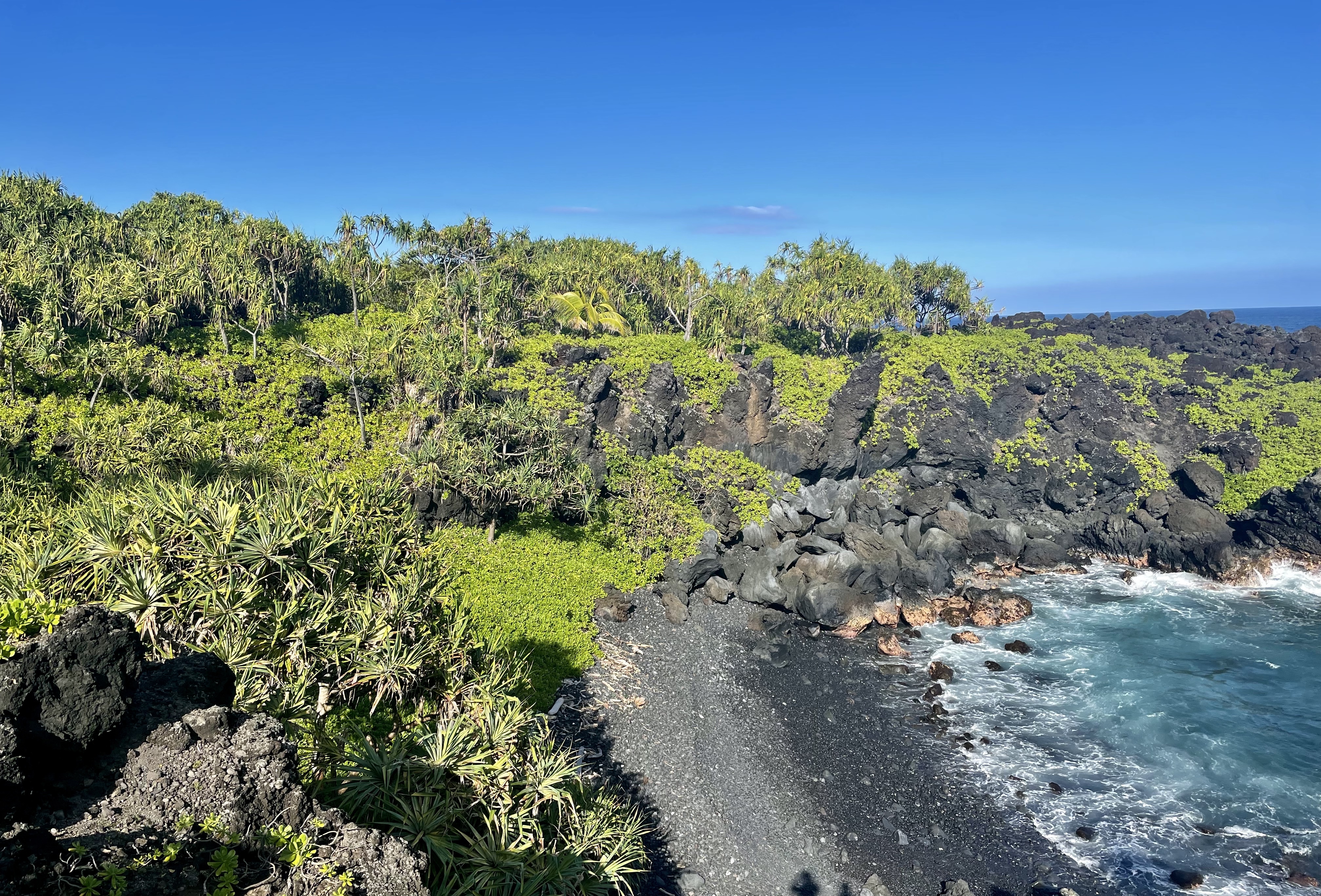
The warning sign to be taken seriously. The most common and sometimes fatal injury occurs from slipping on the unstable cinder-like soil or abundant pine needles. The drop can be as little as 15 feet or as much as 80-90 feet, depending upon what you hit on the way down, and if you are able to grab a hold of something in order to stop. Either way it spoils part, or all of your day.If this young lady slips and falls, the accident may not be fatal, but it would surely ruin the balance of her vacation. She bears a striking resemblence to my housekeeper from Sicily several years ago, but that’s not her.Another warning, not to be taken lightly.Red Sand Beach and the protective reef.On the beach perspective.View from above.Red Sand Beach.Hamoa Beach is only a few minute drive from Hana.Another image of Hamoa Beach.Waves at Hamoa Beach. These are way more fun than they look.One more image of Hamoa.The Black Sand Beach. There is a portion where the sand is very black and very fine.Image near the black sand beach.Just another simply beautiful beach.
As I travel around this island and possibly others, I will keep on posting. So stay tuned.
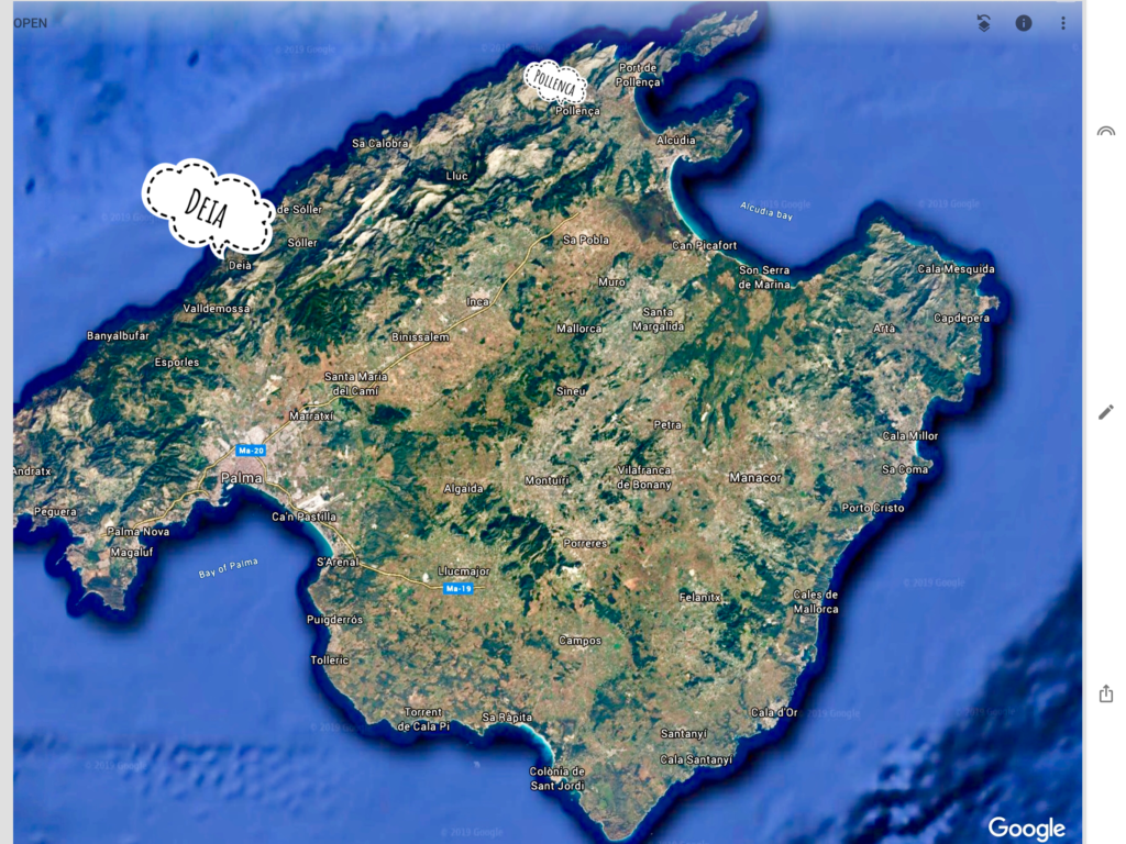
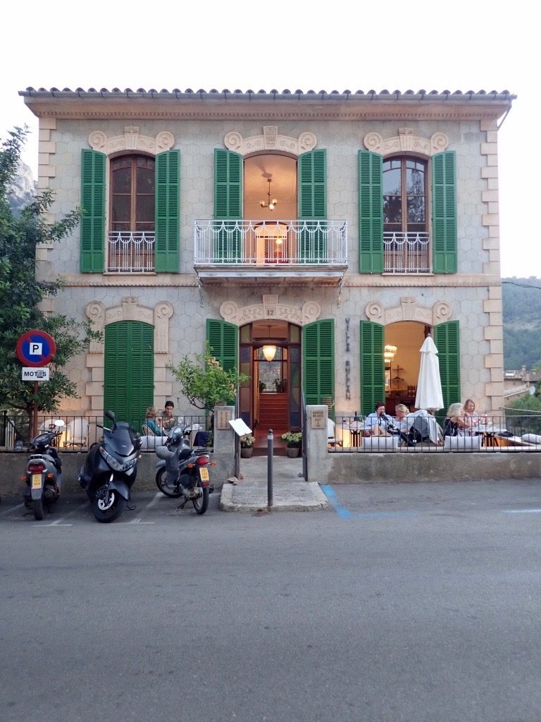
This is my final spot to spend a few days. The tiny municipality and small coastal village is known for its natural beauty and its literary and musical residents. Among its more well known residents is Richard Branson, the Virgin Records mogul, and Mark Knopfler of Dire Straits fame. With its tiny population of 620 it is quiet and very manageable. It’s easy to see the appeal because of the stunning topography, foliage, and stone structures. The only negative that is easily identified is the roads. They are so narrow and winding that if you miss your turn, it won’t be easy to turn around. It could take several miles to make the correction. That’s a small price to pay to be able to spend some time here.
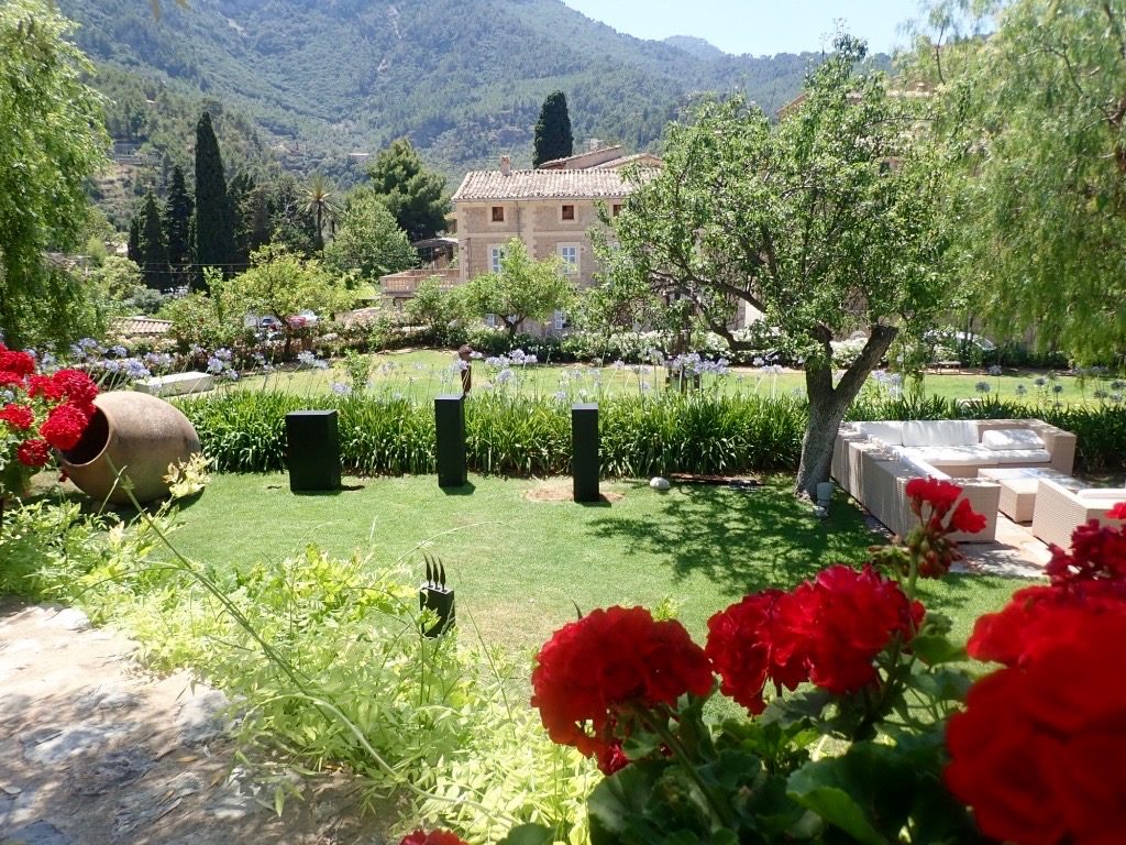
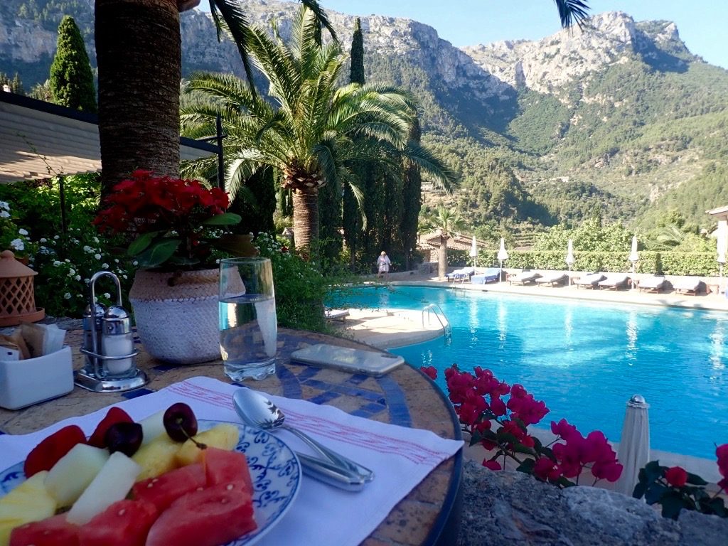
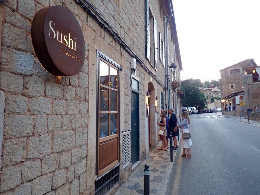
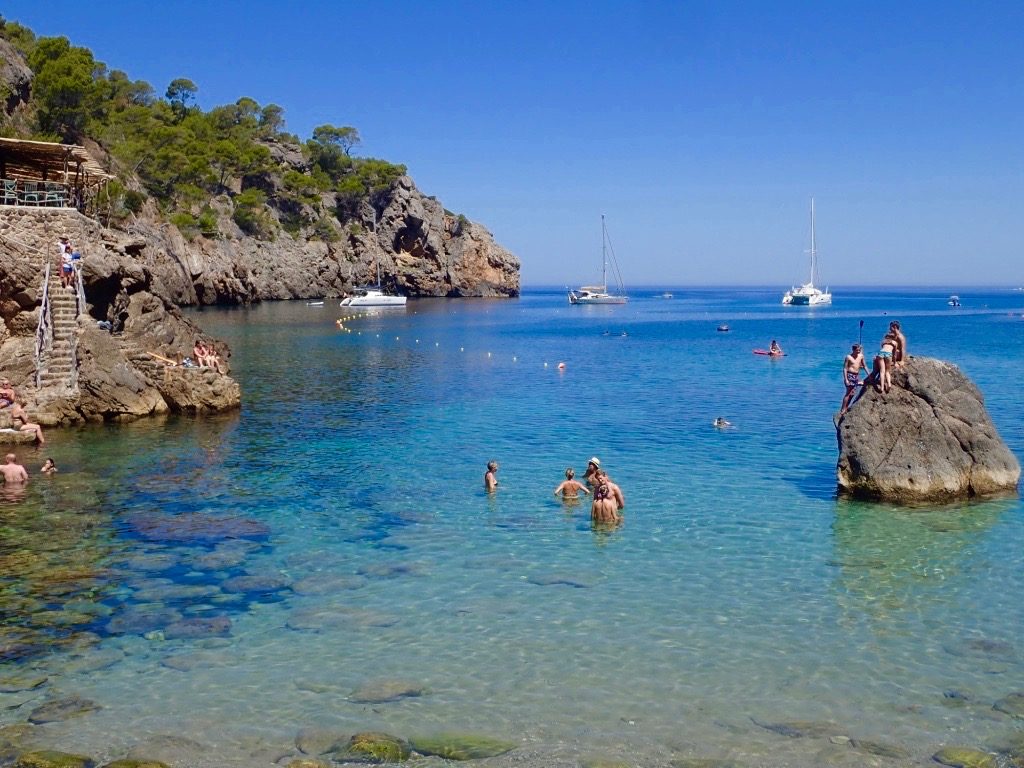
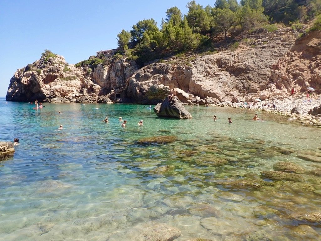
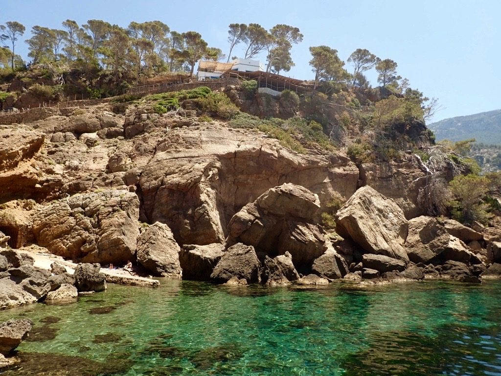
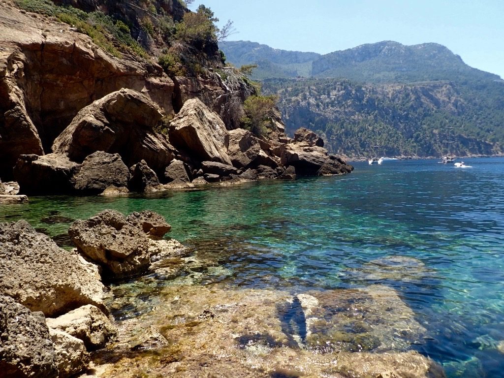
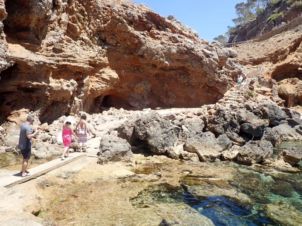
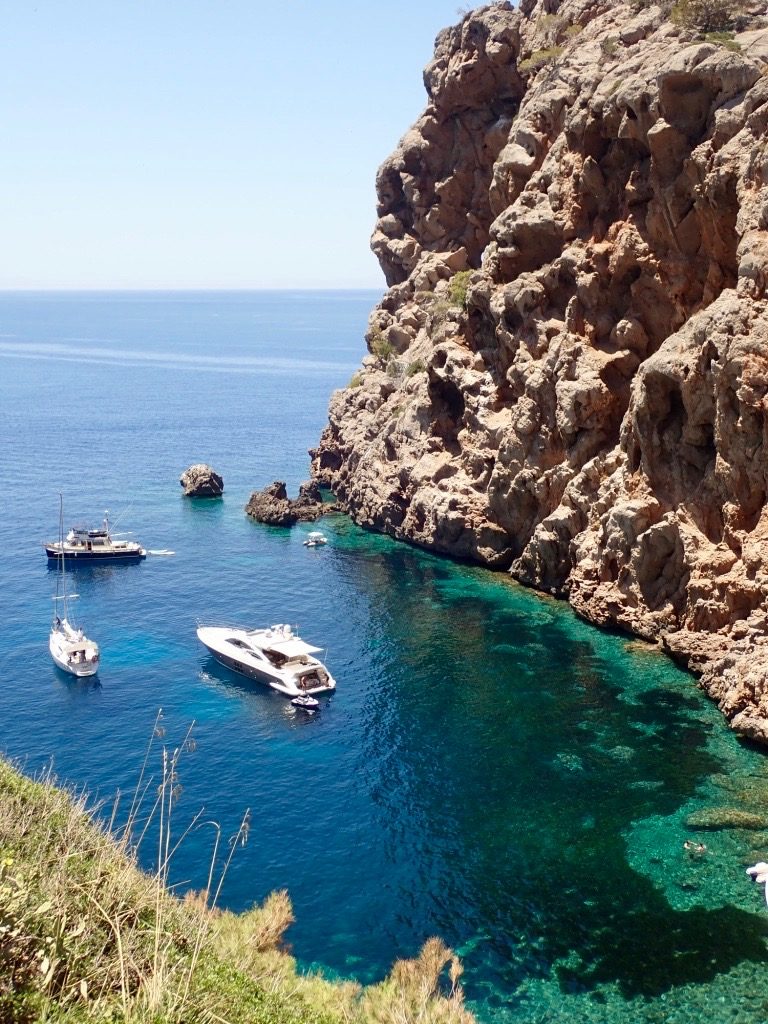
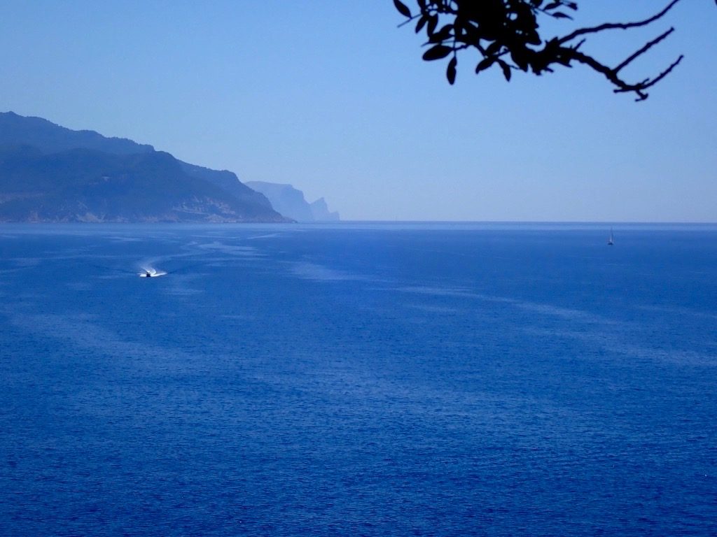
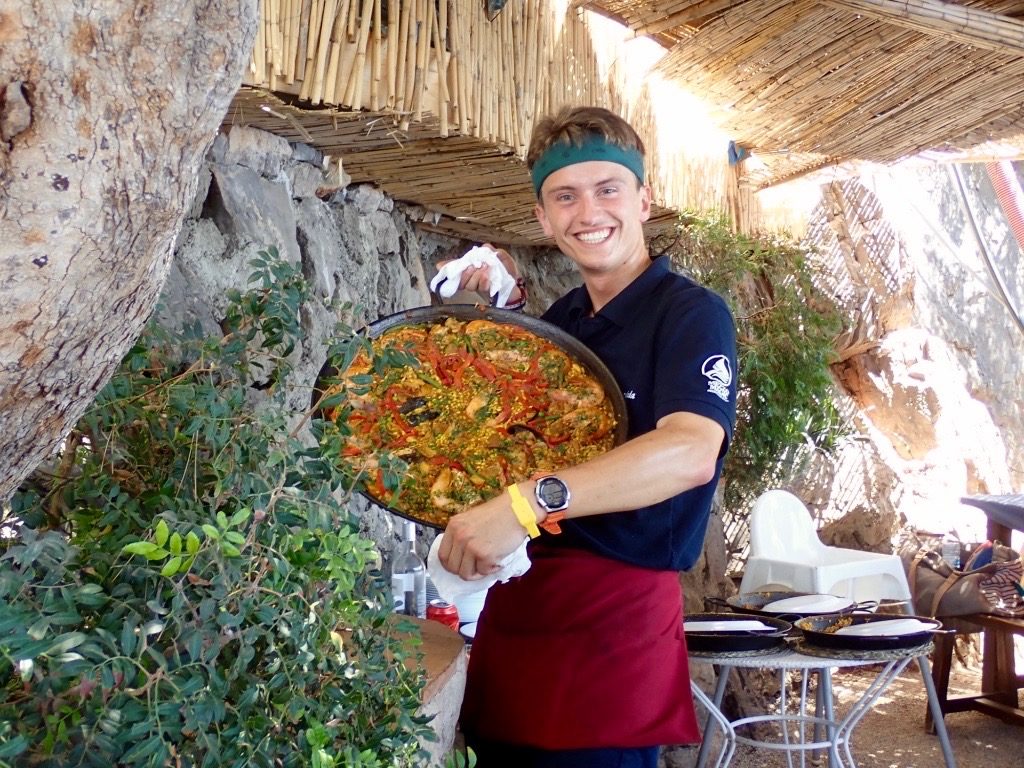
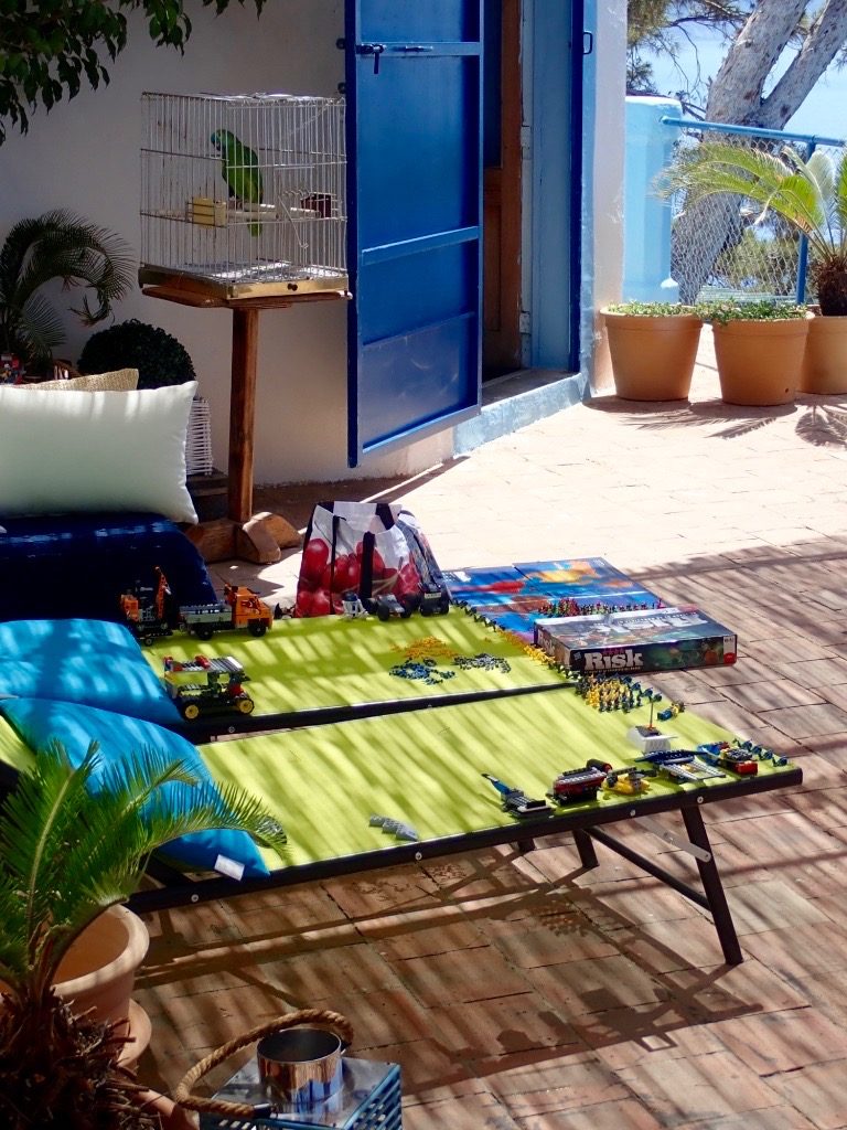
Map showing the Deia area and location on the north coast..The walk up to my temporary home in Deia, La Residencia.Some of the gardens on the property which are peppered with art sculptures.View of the the main pool area at La Residencia with the small town of Deia in the background.Breakfast by the pool.Street scene in Deia.Great little Spanish restaurant just across the street from La Residencia.Local beach scene where I was to pick up a catamaran for the afternoon. It is the vessel on the right.Another angle of the same beach.Mallorca northern coastline as seen from the boat.The restaurant on the top of the cliff is the lunch destination. It is almost exclusively accessed from the water.Water level view of the cove where we moored the catamaran.The hike up to some of the best paella on the planet.The view in the opposite direction and the only road in. Primarily the narrow road is used by the family who lives here and owns and operates this establishment.Arial view of the same cove. Not quite at the restaurant yet.View from my table. Even if the food was marginal, it would have been great dining here. Take a look at this. Here it is very proudly exhibited. He almost needed a third arm to hold it. His smile is akin to a proud new papa with his child. Loaded with a crazy amount of very fresh seafood, this thing killed.The family that owns the establishment lives here. Remember if you are old enough, playing with actual toys and games, not video games. And that Amazon Green in the cage completes the scene.“She’s a man baby.” Austin Powers in The Spy who Shagged me. This beauty was hanging in the lobby of a sushi restaurant I was dining in. Quite an eye catcher, wouldn’t you agree?